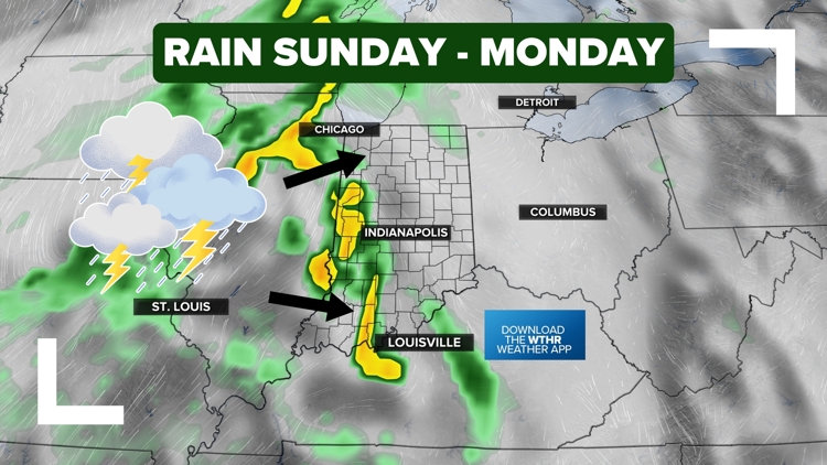
INDIANA, USA — After weeks of dry, hot weather with expanding drought and county burn bans, a welcomed change is coming to Indiana's forecast: rain and storms.
Tap HERE to track scattered showers and storms moving in from the west.
A blocking pattern has kept the weather very quiet and warm across Indiana. Now it's breaking down as two cold fronts are moving in with rain chances.
Front #1: Isolated showers and storms possible across Indiana (generally north of I-70) for the afternoon and evening
Front #2: Scattered rain and downpours across all of Indiana Sunday and Monday
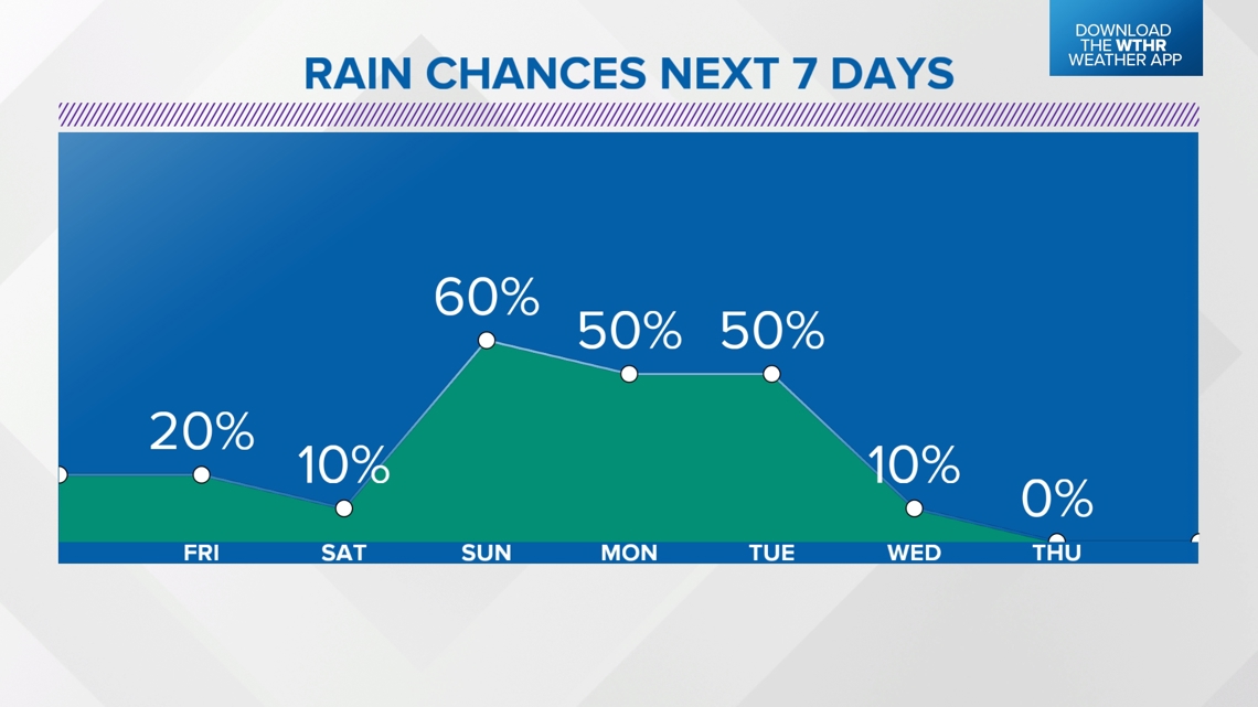
Multiple days of rain chances are coming. That doesn't mean you will get rain every single day, but there's a decent chance you get at least some drops of rain the next 4-5 days.
How much rain we need
We generally need a good 2 to 4 inches of rain across Indiana. Not only has it not rained recently, it's also been hot and sunny. This heat leads to more evaporation, drying out our soil even faster.

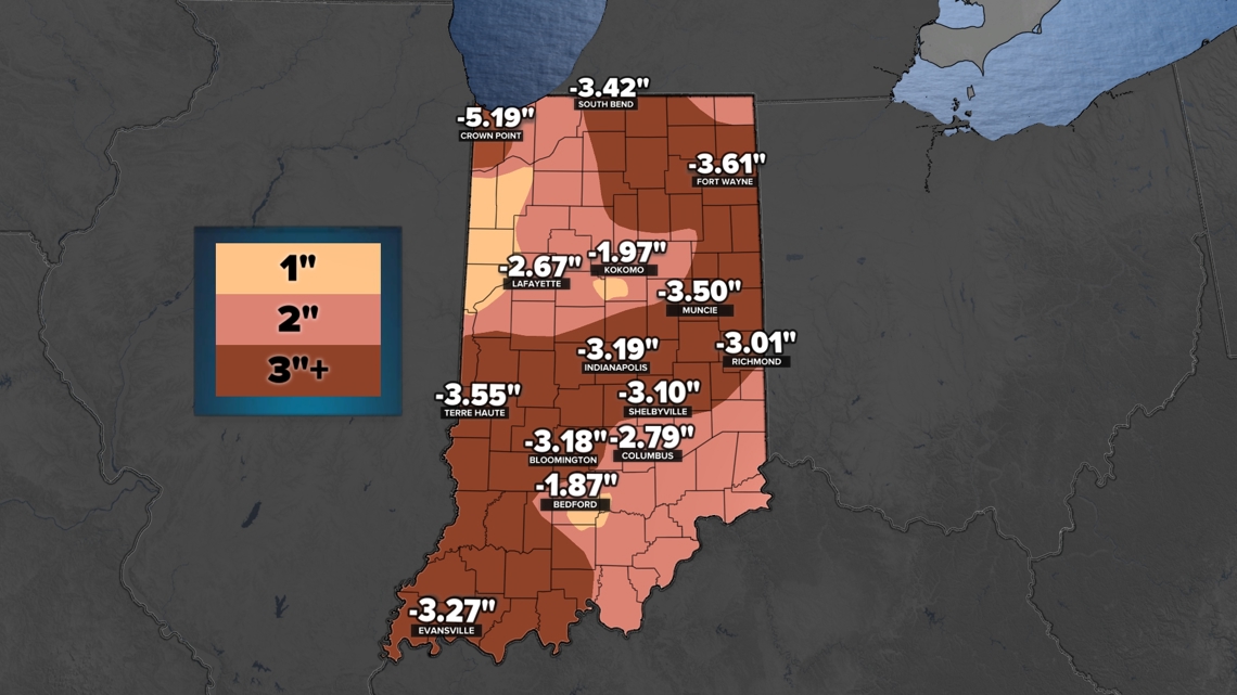
The dark brown areas show where we have the biggest rainfall deficits from just the past 45 days. Many places have been running dry for much longer than that.
Burn bans
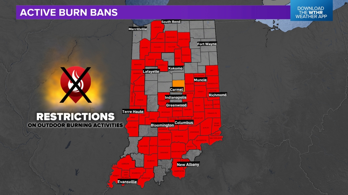
(As of Sept. 19th at 7 p.m.) More than 60% of Indiana counties have now activated a burn ban due to dry conditions and fears of fires/sparks spreading.
Red: County-wide burn ban
Orange: Local burn bans being activated, but not county-wide

How much rain we are forecasting
(Expect zones to be slightly nudged around) This is a start! Expect some changes, but generally a half inch to over an inch of rainfall is expected from Friday (Sept. 20) through Tuesday (Sept. 24).
There is a trend for more rainfall for the northern half of Indiana. Higher pressure to the southeast may break up some of the rain as is moves in.

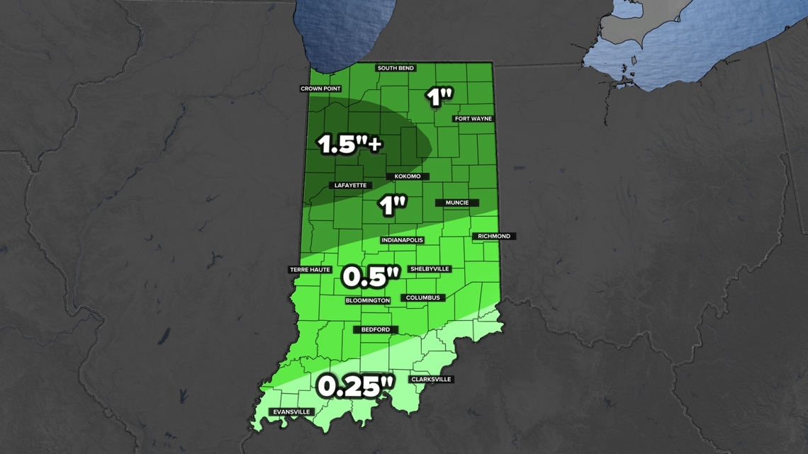
The rainfall map will likely not be as neat as this map. Scattered showers and storms will bring widely ranging totals, sometimes within a single county. But generally we are expecting 0.5" to 1.5".
Tracking rain: Friday chances
Friday's rain chances are weak. A stray shower is possible west of Indianapolis in the late morning.

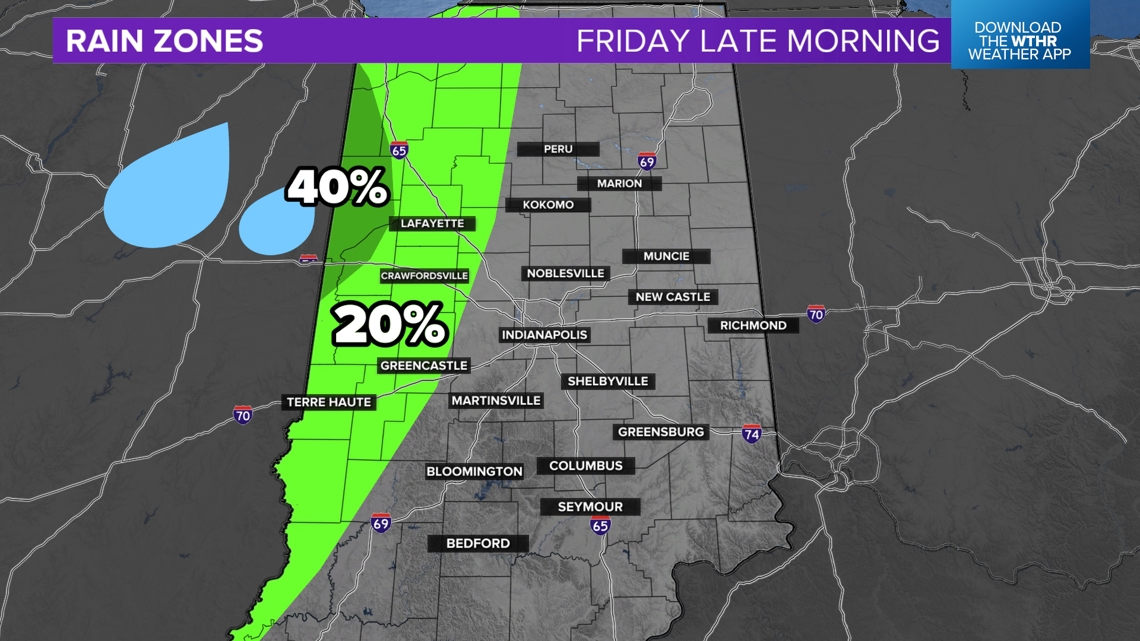
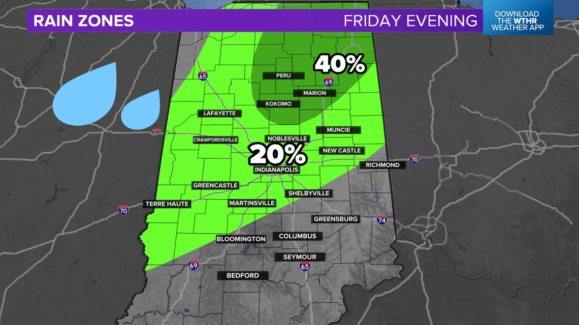
A few more pop-up showers and storms are possible later in the evening, especially north of I-70. These will be hit-or-miss. Expect an isolated rain chance from 5 p.m. to 11 p.m. on Friday. There may be a few football games that get impacted by brief showers and storms.

Tracking rain: Sunday - Monday chances
The rain coming up Sunday and into next week looks more widespread and heavier. The radar will likely be messy as this system pushes up against the high pressure that has protected us for several weeks.

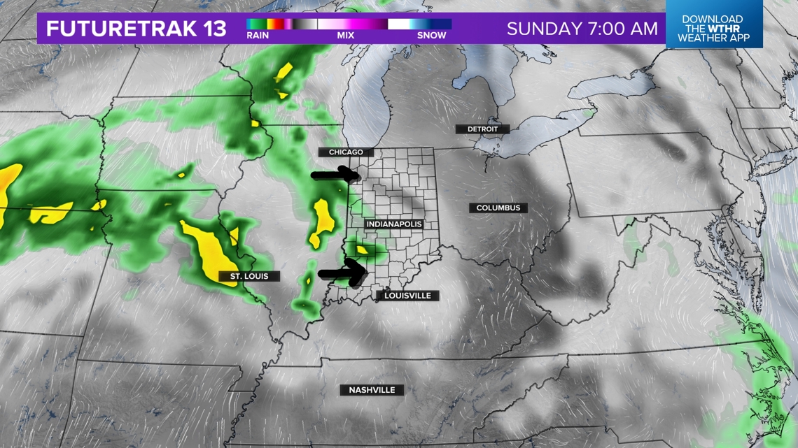
Scattered showers, storms, and heavy downpours are possible at random times Sunday through Monday. By Tuesday the rain should start to gradually exit with quieter weather returning.

— 13News Meteorologist Matt Standridge


