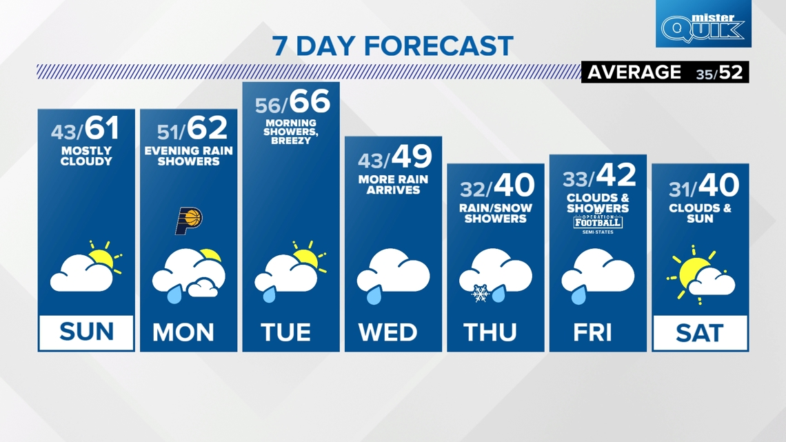
INDIANA, USA — Indiana's first chance for snow showers (mixed with rain) of the season will be possible later this week from Wednesday night through Friday morning, especially when it's dark and cooler outside. Clouds will be low and temperatures should be in the 30s and 40s. It will be snowing above us, but the question is will they survive or will they melt? We'll have to see.
Tap HERE to track the next cold front coming toward Indiana with our interactive radar and satellite.
The keyword to all this will be "chance." Snow is not guaranteed. In fact we expect a mix of reports across the state. Not all Hoosiers will get the same thing.
Let's talk about what we are seeing so far. For the latest local forecast updated by the 13News Weather Team, tap HERE.
Weather setup
- Front No. 1: Monday-Tuesday with rain showers
- Front No. 2: Wednesday Night-Thursday-Friday a.m. with scattered rain and snow showers
The chance for snow is only remotely possible thanks to a rainy cold front coming on Monday night and Tuesday. It could bring a quick quarter inch of rain, but in the meantime it will drop Indiana from the 60s down to the 40s. That's the front you see pushing to the east down below.

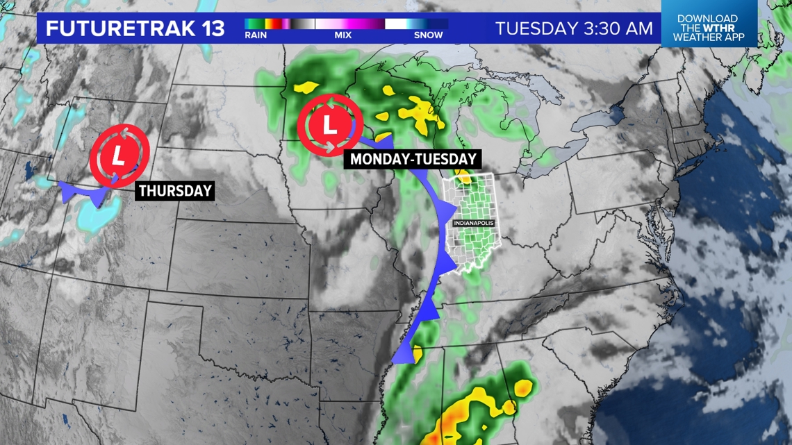
It shouldn't be too much rain, neither will the first front be that stormy. There could be some rumbles of thunder, but generally expect some rain passing by Wednesday night into Tuesday morning.
Then we get to storm system No. 2...

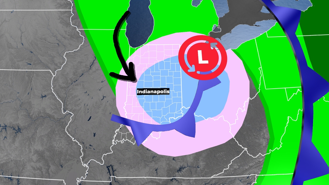
A weaker, cold-core low pressure will develop and move in behind the first cold front, which already laid the ground work for some colder air.
This second low pressure will produce lots of low clouds and scattered snow above our heads. However not all of them will survive. If we can cool to near 40 or upper 30s, expect widespread scattered snow showers. If we stay in the low and mid 40s, it may be too warm for them to survive.
Varying temperatures above us
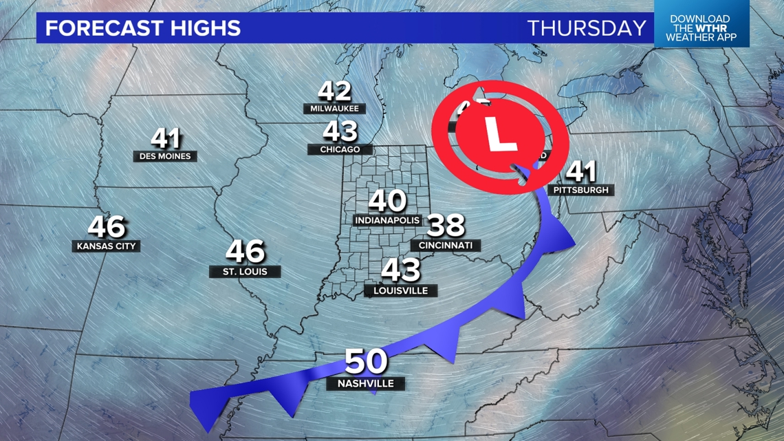
There will be a big bubble of 30s and 40s across the southern Great Lakes down at the ground, sometimes melting the snowflakes and sometimes letting them pass through. These are afternoon highs on Thursday. We expect temperatures to be a little colder in the morning and later that night. Those will be the best chances for some snow showers.

It will be snowing above our heads (blue zone below). However there will still be some 40s closer to the ground (red zone below). Will the snowflakes be able to survive the final leg of their journey down to the ground in this layer of warmer air? That's what we are working on as a weather team. We think there is at least a chance.

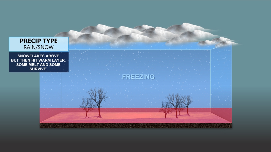
Rain north and snow south? How?
This is getting a bit too specific this far out, but we wanted to talk about the influence of Lake Michigan. The Great Lakes will help contribute to some moisture and help kick off these lake enhanced or lake effect showers.
However since this is the first lake-effect system of the season, the water temperatures of Lake Michigan are still fairly warm. Many locations are reporting water temperatures still in the 50s. It was very warm this summer and fall. Those 50s may keep northern Indiana a little warmer, so snow chances may be tougher in the typical lake-effect snow belts, at least during the middle of the day.

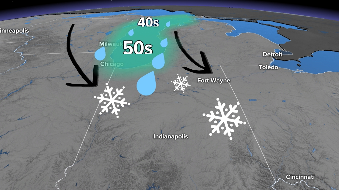
This map shows the warmer air hovering over the lake, keeping things warmer within 30-50 miles of the lakeshore.
Areas farther south, away from the lakes, may be able to get a bit colder, increasing the chance for snow showers.
So is it going to snow or not?
That's what everyone wants to know. That's what we want to know too. Right now it's still too early to say, but there is a decent shot of both rain and snow showers across Indiana. The best chance for snow may be in north-central Indiana (Lafayette to Kokomo to Muncie) and central Indiana (Terre Haute to Indianapolis to Richmond).

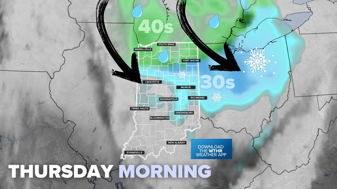
Watch for the coldest parts of the day to have the highest chance for snow showers, that includes early Thursday morning before sunrise and late Thursday night.
Will the snow stick?
That's even tougher. How the ground and roads interact with the snow can differ from town to town.
We do know that ground and road temperatures are still fairly warm. Here are the most recent ground temperatures from across the state (they're pretty warm):
- Valparaiso: 51.3°F
- Lafayette: 52.9°F
- Kokomo: 54.1°F
- Winchester: 52.9°F
- Bedford: 55.2°F
- Evansville: 55.6°F
Many times we think the snow showers will not stick, but if you get a heavier burst, it could quickly coat the ground. Mailboxes, parked cars, rooftops, and overpasses/bridges will have the highest chance to see a little snow stick in places.
— 13News Meteorologist Matt Standridge

