INDIANAPOLIS — Clouds have more bark than bite the remainder of today as the passage of the latest cool front shoved the latest round of rain out the state by noon.
A steady northwesterly wind drives colder air and low cloud cover south of Interstate 70, with just some brief peeks of sunshine sandwiched between that overcast and a departing, thinning mid/upper level cloud deck.
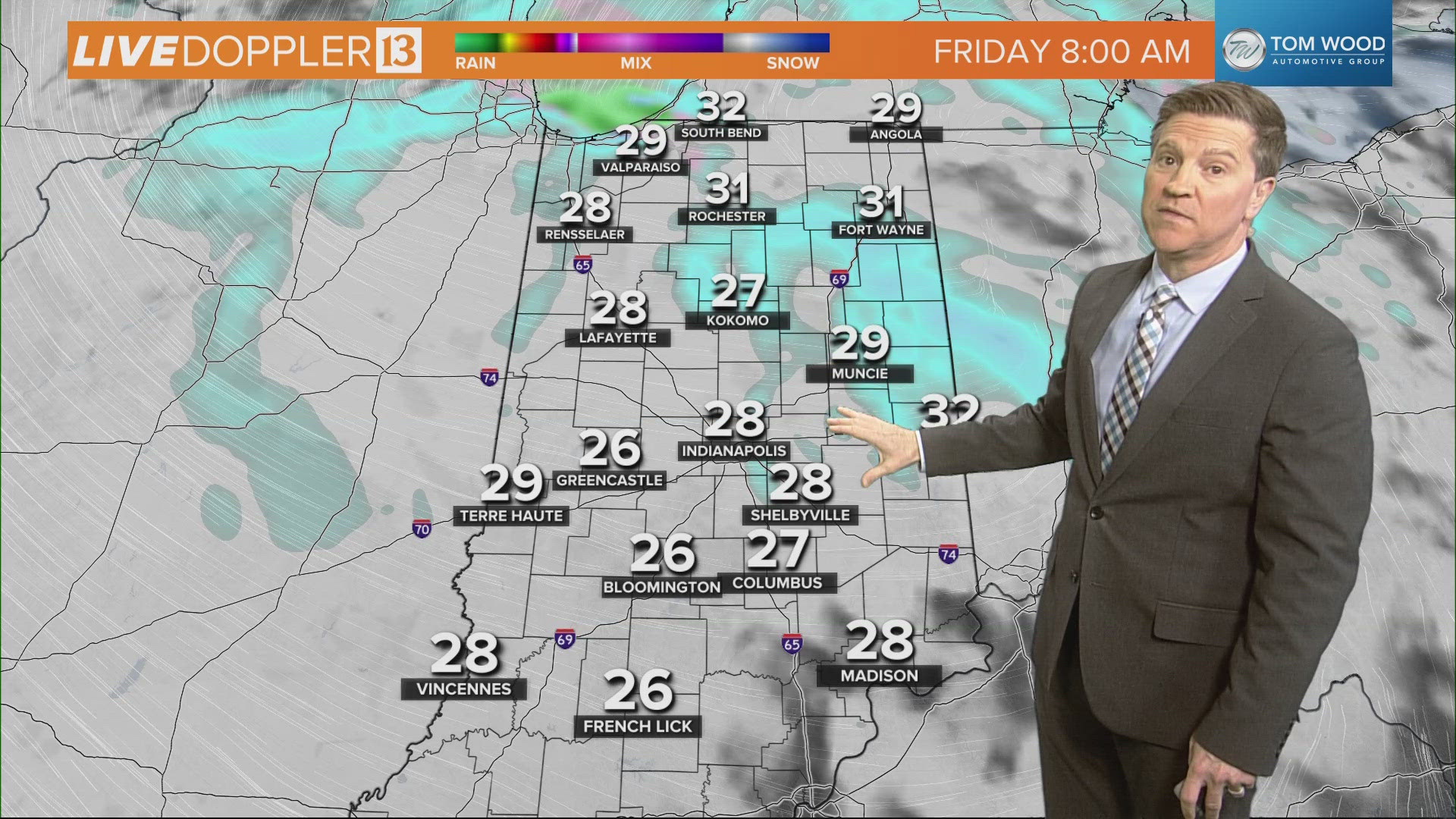
Temperatures are 5-10 degrees cooler in the wake of that boundary. The colder wind coming off of Lake Michigan will squeeze-out scattered, mainly light lake effect snow showers later this evening and overnight, primarily passing through areas well east and northeast of the Indy metro area.
They'll be more of a novelty, but certainly serve notice of the expected transition to a period of colder air heading into the weekend.
Thursday will be a relatively "quiet" weather day of seasonably chilly temperatures, clouds, and possibly some random flurries within the chillier air.
Weather Impact Friday

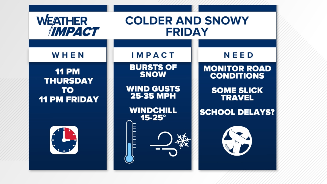
A wider-spread "minor" snowfall is ahead of us, with the arrival of the latest clipper system to impact Indiana. It brings an increasing area of snow from around midnight tomorrow night (12 a.m. Friday) into early Friday morning, preceding the core of the early day rush hour.
The combination of snow and sub-freezing temperatures will make some roadways and untreated surfaces slick. This could result in slower travel times Friday morning and possibly some school delays. The track of this system may change, but currently the higher odds of 1"-2" snowfall is north and east of Indy.

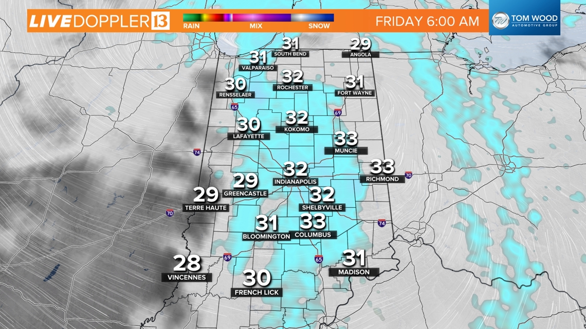

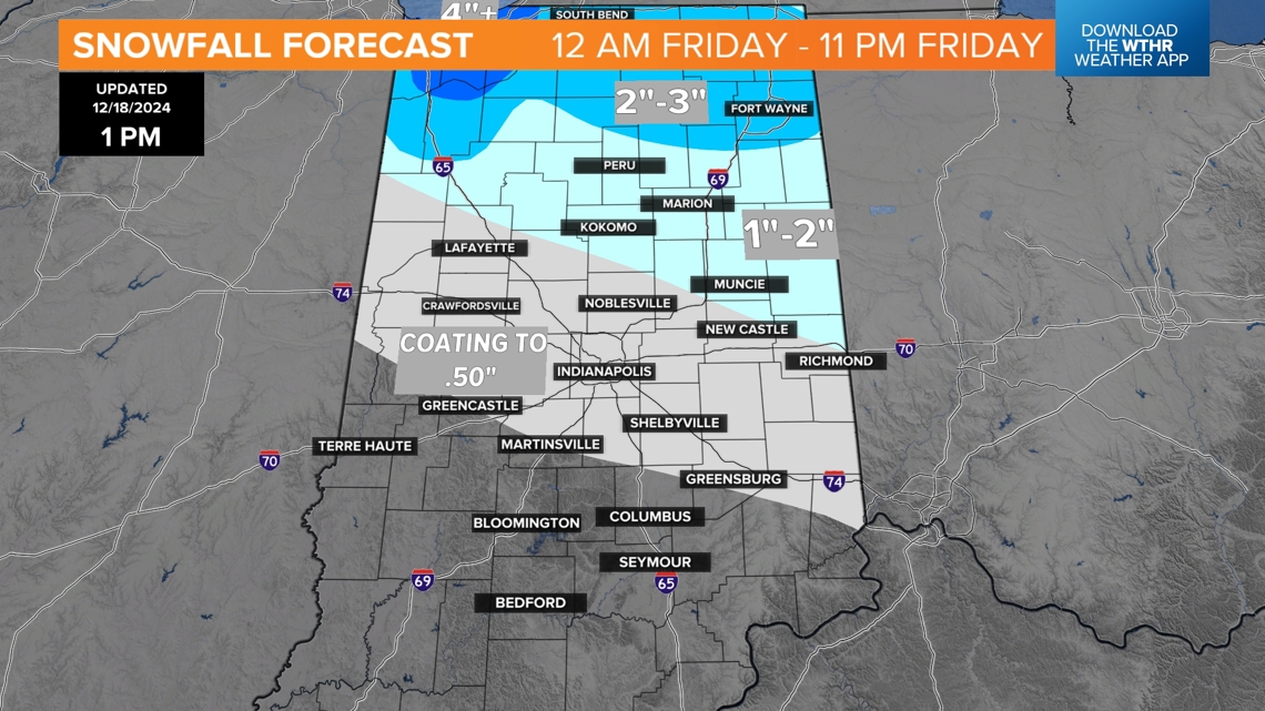
But even a coating to half-inch of snow could impact travel during the Friday morning commute. Please follow our forecast and monitor road conditions before heading out that day.
We'll transition from clipper system snow to snow showers and lake-enhanced snow bursts on the colder, breezier side of the clipper as it quickly departs by midday Friday. Snow showers will be scattered to numerous, but temperatures creeping back into the mid-30s should mitigate road issues in most areas.

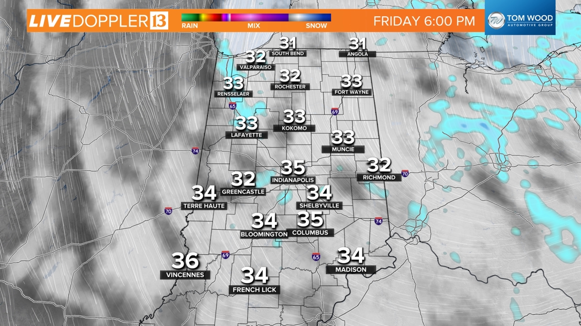

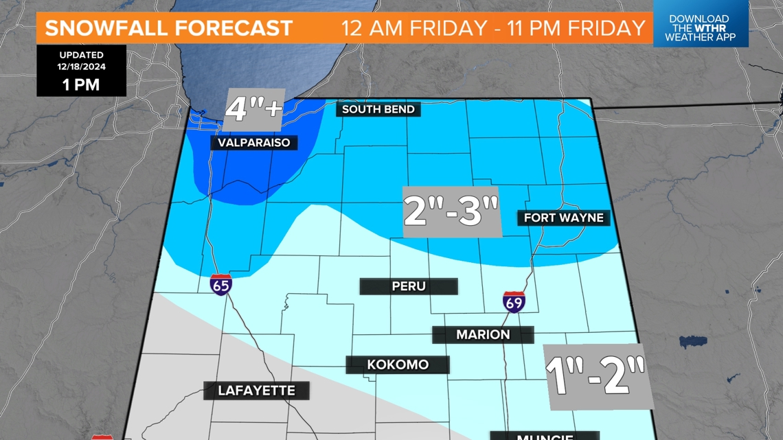
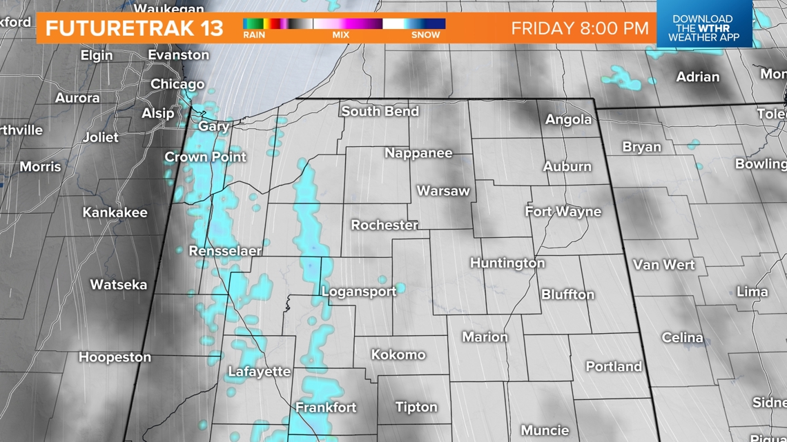
The exception will be where any persistent lake effect snow bands emerge and, at this time, that appears to be more focused on northwestern Indiana from a northerly fetch coming down Lake Michigan. However, any deviation in that vector will displace the locally heavier (4"+) snow potential farther east and/or west.
IU-Notre Dame forecast
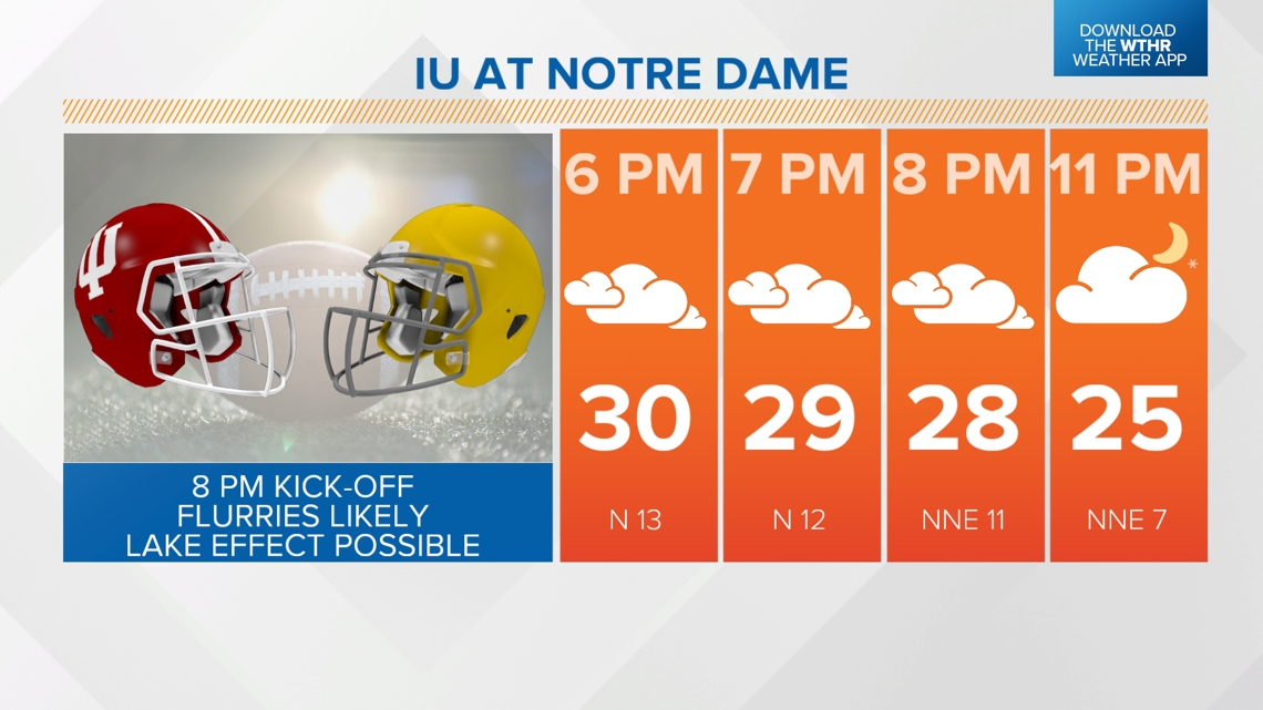
It will be a close call on how any steadier, heavier lake effect snow showers will be to Notre Dame Stadium come Friday night. The current expectation is for the heavier band(s) to avoid the IU and Irish playoff game to the west. But any deviation of the wind vector could swing it more east. Kick-off (8 p.m. Friday) temperatures will be in the 20s, with windchills in the teens and flurries and/or light snow at times during the game.


This transition to colder air lingers for the weekend that will have more flurries/snow showers around on Saturday before a brightening sky, but still seasonably chilly, come Sunday.
Wet christmas this year
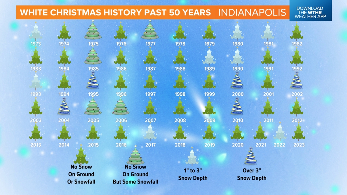
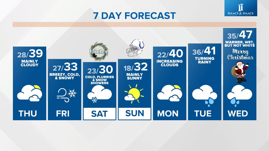
We continue to advertise a wet and not white Christmas for central Indiana with rain likely and temperatures in the 40s, nearly 10 degrees above average for Dec. 25 locally. The "balmier" air lingers the remainder of the year, with the potential of multiple days near 60 degrees and "lows" several days in the 40s. That would mean we would have many mornings when the "lows" are actually warmer than the average high for the last week of December.
There have only been three official "White Christmases" (1" snow depth at 7 a.m. Christmas morning) in Indianapolis the past 15 years. Here's a look back at the past 50 years for the capital city of Indiana.

