INDIANAPOLIS — Buckle-up, friends! Indiana is about to go an unpleasant weather ride from a well-advertised Arctic cold front that brings a variety of weather impacts to us tonight. This forecast blog will detail those impacts with latest modeling information, an update to timing and explain how long this latest cold punch will last.
What Will Be The Weather Before The Front Arrives?
From a temperature perspective, today is the "warmest" we've been since the day before Thanksgiving and the first time above freezing since last Saturday (November 30th). Unfortunately, due to the stiff breeze our highs in the lower 40s will never feel that warm.


Please know we'll have breezy conditions all day long as gusts are already near/above 30 mph and that wind will continue to strengthen leading up to the Arctic front's arrival much later this evening.
When Will The Arctic Front Arrive In Your Area?
It's still difficult to narrow-down a specific time for any given location as often times modeling is too slow on shallow cold air events. It's fair game anytime after 7 p.m. and before midnight. As of now, we're bracketing the hours between 8-9 pm and 10-11 pm for FROPA (frontal passage) around the Indianapolis metro area.


That means the front, and its impacts, clears areas quicker to the northwest (Lafayette between 7-9 p.m.) and later to the southeast (Columbus between 10 pm-midnight). Expect weather and road conditions to rapidly deteriorate as the front races across your area.
What Are The Weather Impacts From This Arctic Front?
In advance of the front early this evening temperatures will be well above freezing with a mixture and rain/snow showers developing. These showers will make roadways wet and that will be key to what happens in the post-front environment overnight.
Near and just behind the Arctic front will be a line(s) of heavy snow bursts and potentially a few "squalls" can't be ruled-out. This is very common with rapid intrusions of sharply colder air. While localized snow amounts won't be all that robust (.50"-1.5") in the briefly heavier snow bursts the combination of rapidly dropping temperatures will quickly ice-up any moisture from the evening showers and the freshly fallen snow.


This will lead to "flash freeze" conditions on roads behind the front and driving conditions will become slick in seemingly no time. We're advising everyone to check road conditions before leaving and know that road conditions could go from dry pavement to snow-covered in just the distance of less than a couple of football fields.
Slick and slow travel conditions continue overnight into the Thursday morning commute and lead to a longer commute for some and possibly some school delays and/or cancellations due to little warming on deck tomorrow.


Other notable impacts from this front with strong wind gusts of 45-50+ mph that will create brief whiteout conditions in the heavier snow bursts, possibly knock down some trees and make power outages possible. You may want to consider charging electronics and be prepared for potential outages on such a cold night.


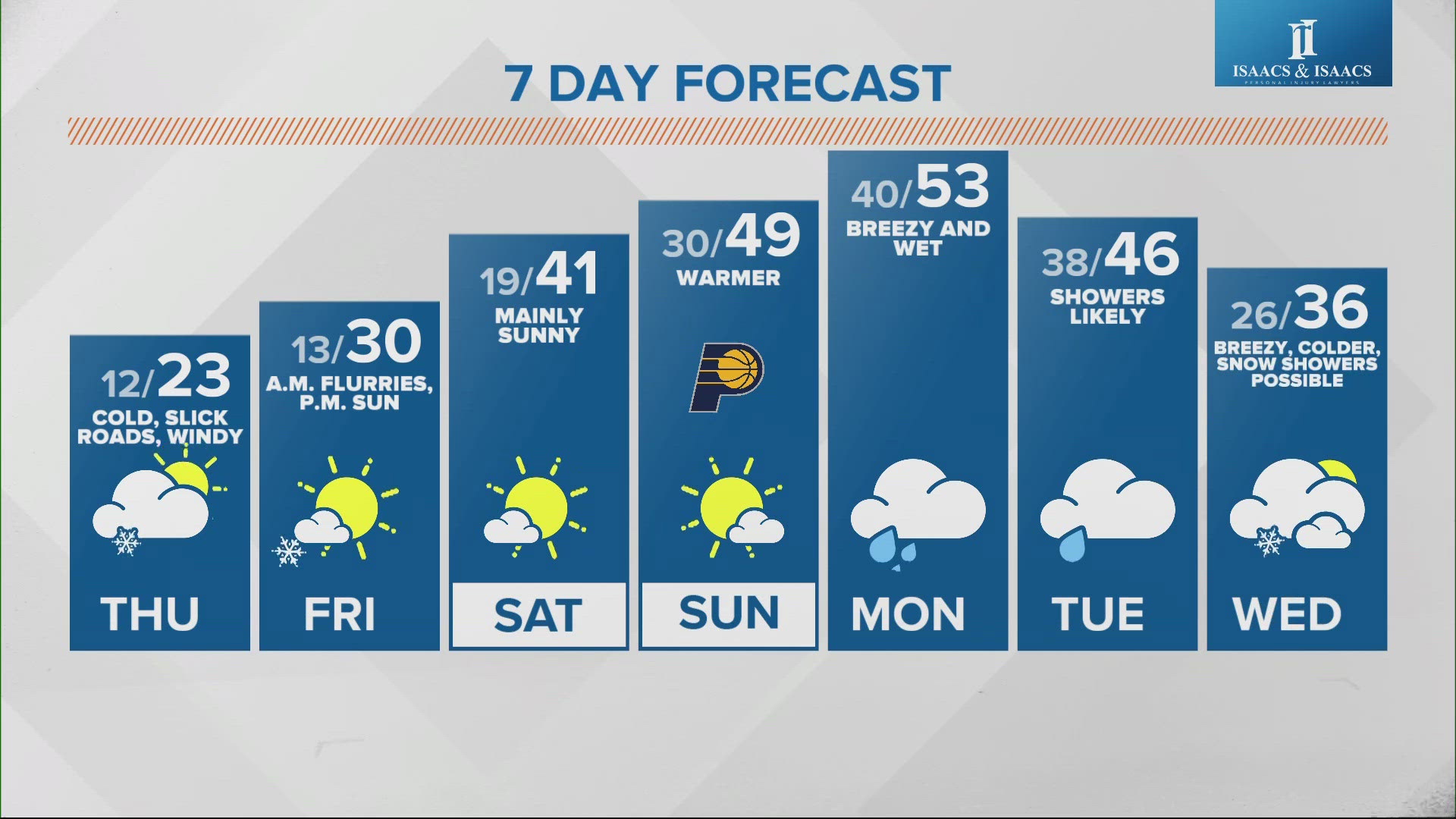
And it will be cold indeed. Temperatures drop well into the lower teens by sunrise Thursday morning with stinging windchills in the -10 to near zero range. Either layer-up properly or limit your outdoor time on Thursday until midday to later in the afternoon.
How Long Will Snow Showers And Cold Last?
The combination of cold air advection and upper air energy should keep at minimum scattered flurries and/or snow showers going into mid-morning Thursday. However, it's possible they could linger into the afternoon (similar to Black Friday and this Monday) and exacerbate road conditions for the evening commute too.


There's a bit lower confidence on that portion of the forecast, but it would not surprise us all if we're still snow globin' come Thursday afternoon.
When Will It Warm-Up?
Friday remains seasonably cold but it will be noticeably warmer this weekend with highs Saturday near 40 degrees and highs Sunday near 50 degrees. Keep in mind that coming on the heels of subzero windchills, those temperatures will make it "feel" some 50-60 degrees warmer than the needle-like cold we'll experience later tonight and Thursday morning.
We'll update this blog later today as the front approaches the state.


