INDIANAPOLIS —
Hottest day of the year
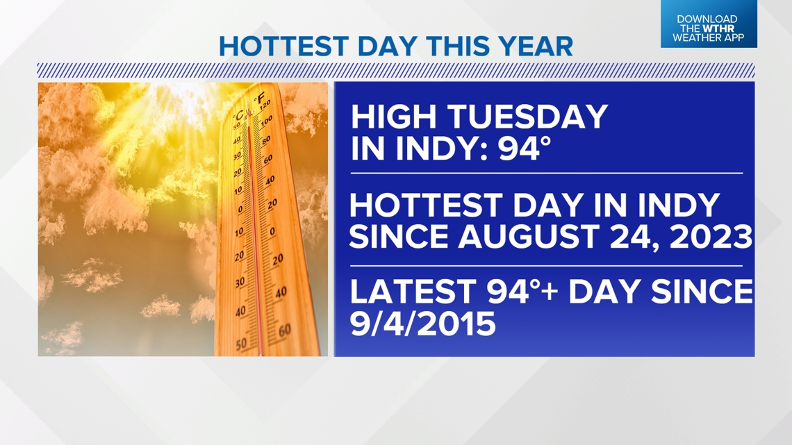
Tuesday was the fourth straight day in the 90s for central Indiana and proved to be the hottest day of the year. In fact, it was the hottest day in Indianapolis since late August of last year. 94 degrees was the official high in Indianapolis. That's shy of the daily record but also the latest 94 degree-plus high in Indy since September of 2015.

It was also noticeably more humid, and the muggy air helped deliver heat indices of 100-105 degrees-plus for most Tuesday afternoon. Even at 8 p.m., heat indices remained well in the 90s. After a days' worth of sun and intense heat, there's an extreme amount of "potential storm energy" across northern Illinois and Indiana. Such extreme values will be like high octane fuel for any storms that develop this evening and allow for "explosive" development. This has been noted already near/south of a slow-moving frontal boundary.
Storms for some tonight
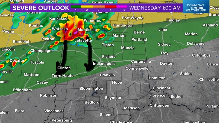
A Severe Thunderstorm Watch has been expanded to include northern until 2 a.m. The remnants of these storm clusters may drift toward Fowler, Monticello, and Lafayette toward midnight. Additionally, storm clusters are possible into Wednesday morning. We'll have to see what the radar looks like in the morning for potential of displacing the highest heat indices and lowering the duration of heat advisory conditions.


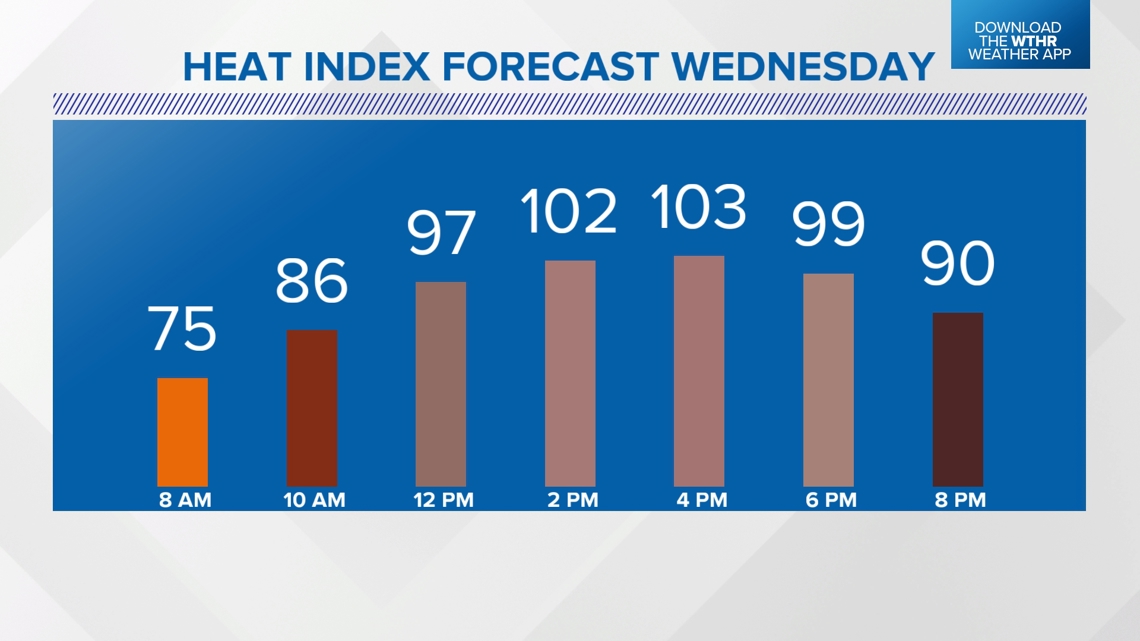
Hot Wednesday finishes with heavy storms
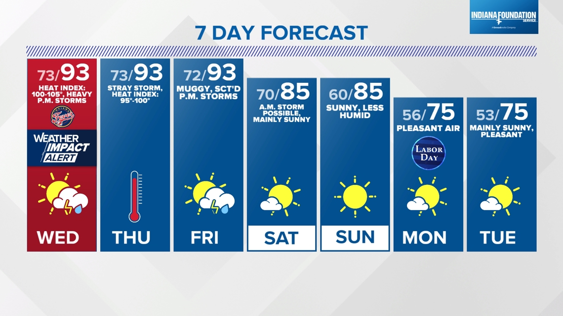
If there aren't any storms in the morning or midday, then we're staring down widespread peak heat indices of 100-105 degrees-plus between noon and 6 p.m. Less rain, clouds and storms early in the day then ups the ante of scattered-to-numerous heavy storms in the late afternoon to evening.


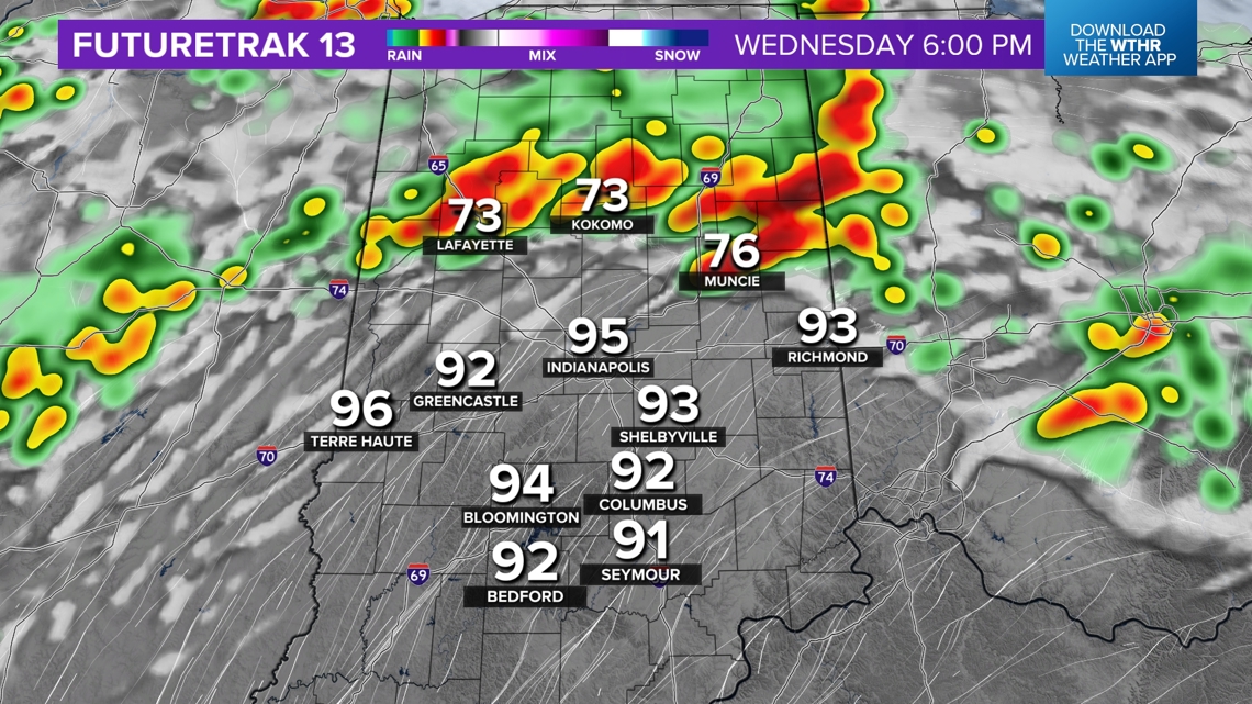

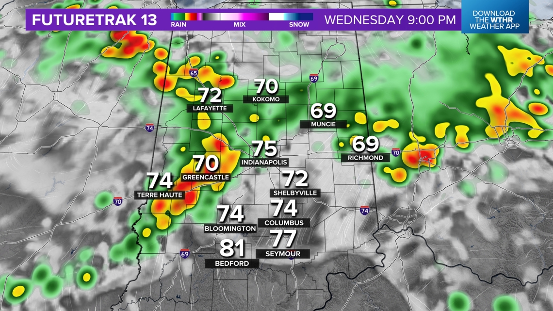
Any storms on radar Wednesday will produce very heavy rain rates and frequent lightning. Stronger cells could produce some severe gusts. Be weather aware Wednesday for heat and storms.
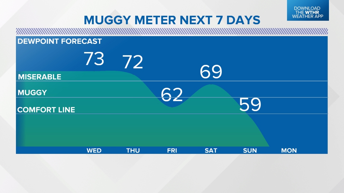
Though 100 degree-plus heat indices will be less prevalent on Thursday and Friday, please know both days will be hot (lower/mid 90s) and miserably muggy. There's only an isolated storm chance Thursday before another round of scattered to numerous storms.
The weekend begins rather humid, but drier air arrives on Sunday. With the exception of a spotty storm early Saturday, plan for a mainly sunny weekend. Comfortable air arrives just in time for Labor Day and we'll have several mornings next week in the 50s.