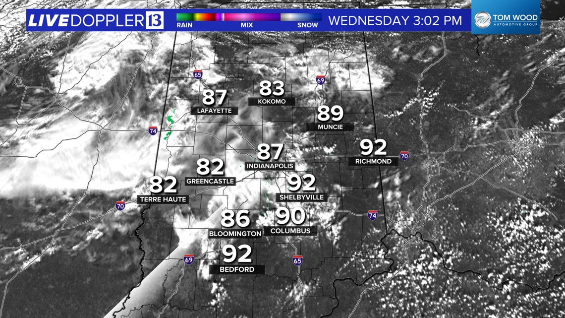
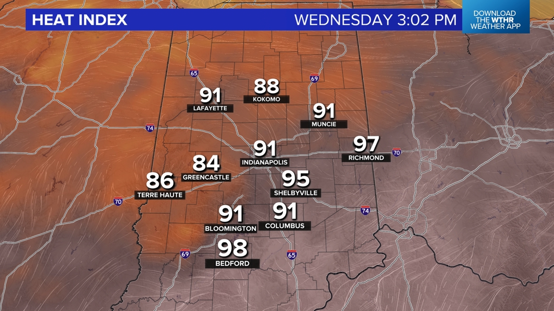
INDIANAPOLIS — The latest analysis shows the impacts of cloud debris from a decayed storm cluster that turtled over southwestern Indiana earlier this morning. That cloud cover, and lower dewpoints, has displaced the higher heat indices (near/above 100°) over eastern and southern Indiana where it's been sunnier.
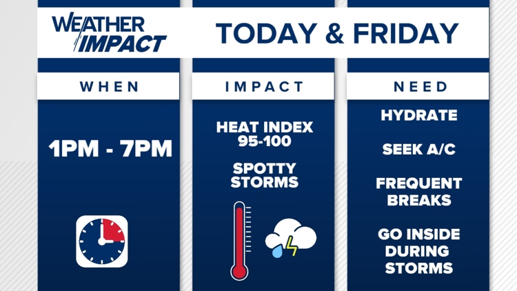
While Indy avoids the higher heat indices today, make no mistake — it's still going to be uncomfortably warm and humid. We'll be on radar watch the remainder of the day with the potential of a few potent pop-up storms. The atmosphere remains loaded with abundant moisture, so anything that develops will have 1"-2"+ per hour rain rates. Localized severe wind gusts are also possible in stronger cells, but the coverage of storms remains highly uncertain. There's a possibility of only isolated storms, but sometimes, it only takes one storm to create a domino effect and trigger additional storms. Stay tuned, and monitor radar.


Muggy Meter remains uncomfortable next 60 hours
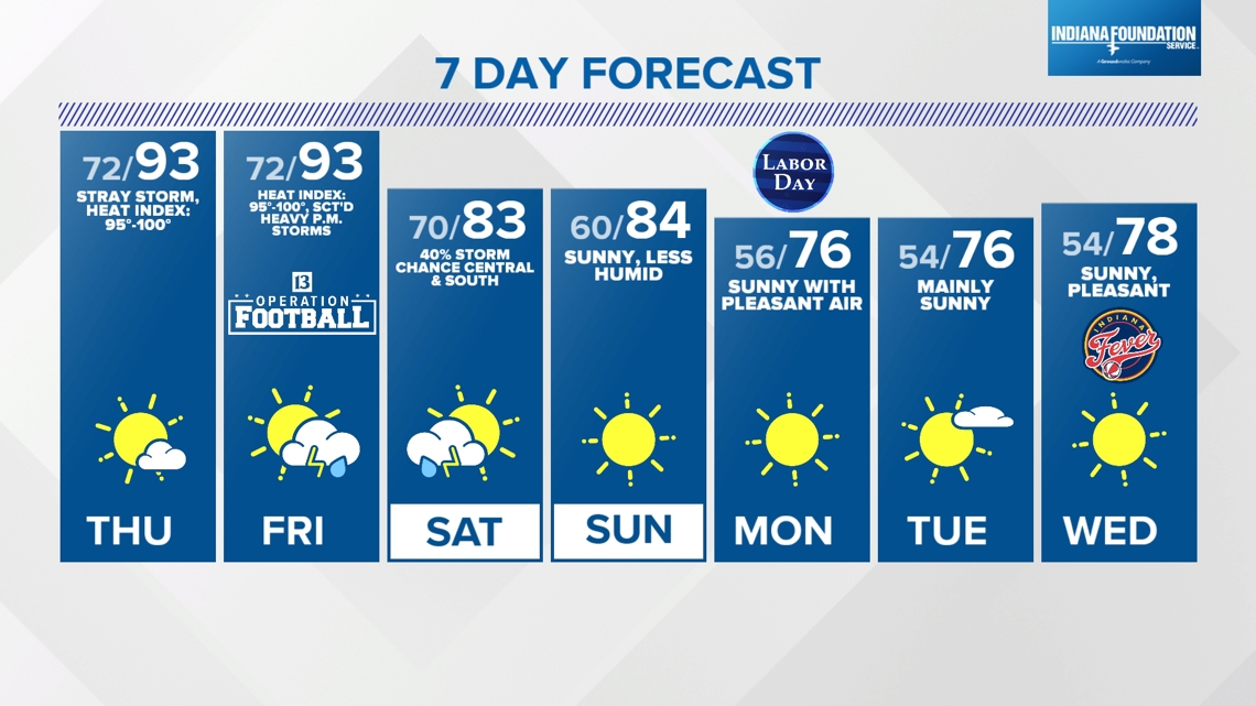
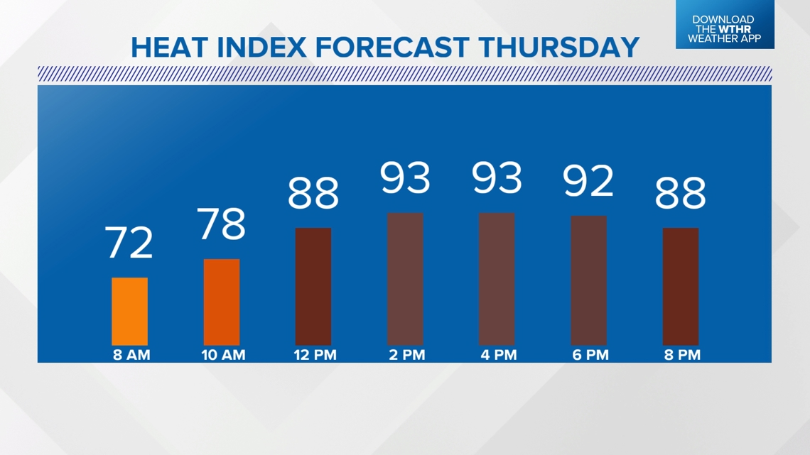
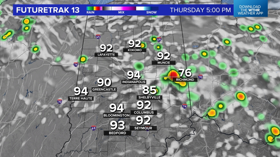
Thursday and Friday will both be hot and humid days. While Heat Advisory criteria may be avoided, please know we're expecting highs in the 90s, heat indices of 95°-100° and a Heat Stress Index in the caution to moderate zones. That requires frequent 15–30-minute hydration breaks for every hour outdoors.
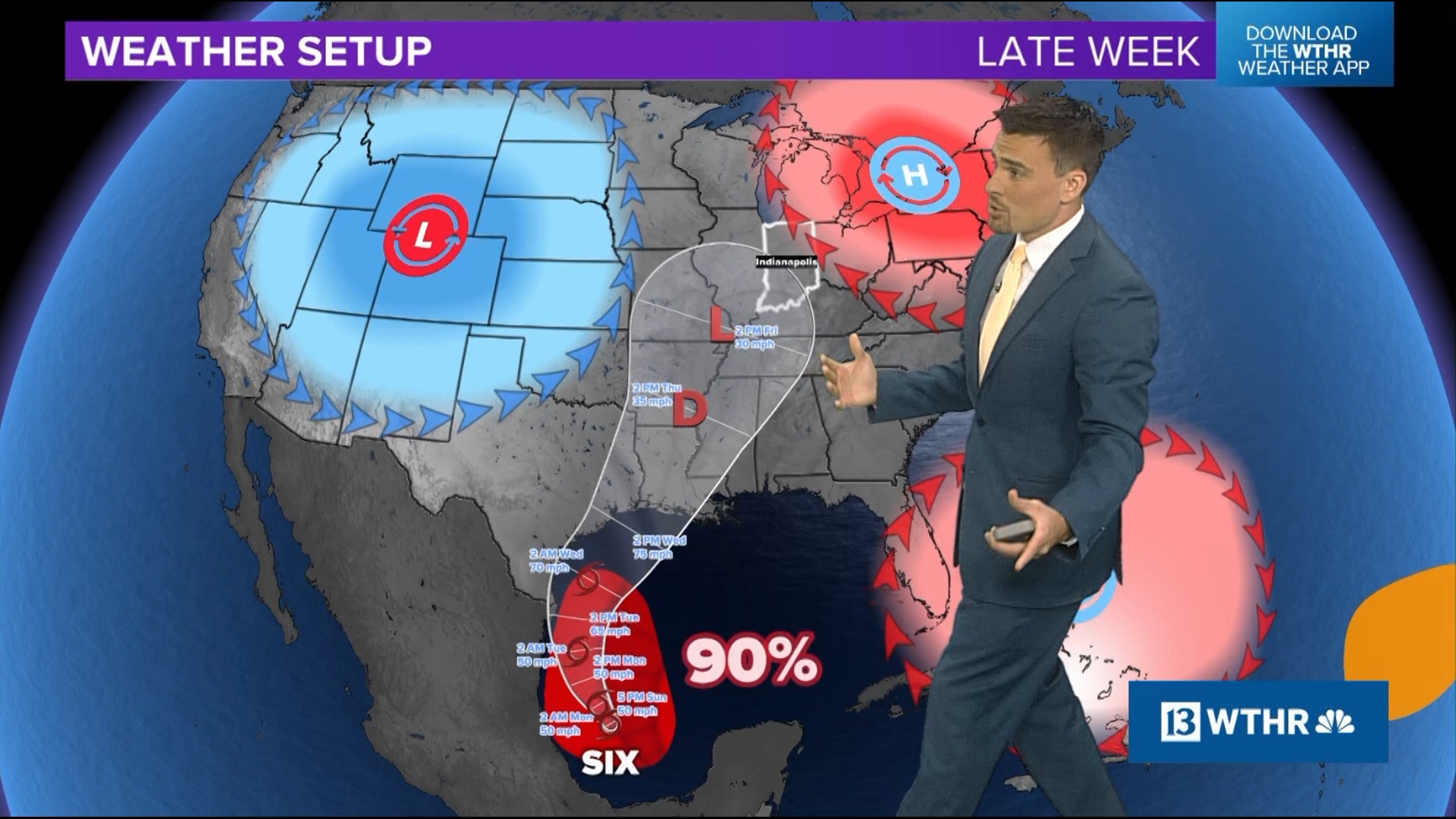
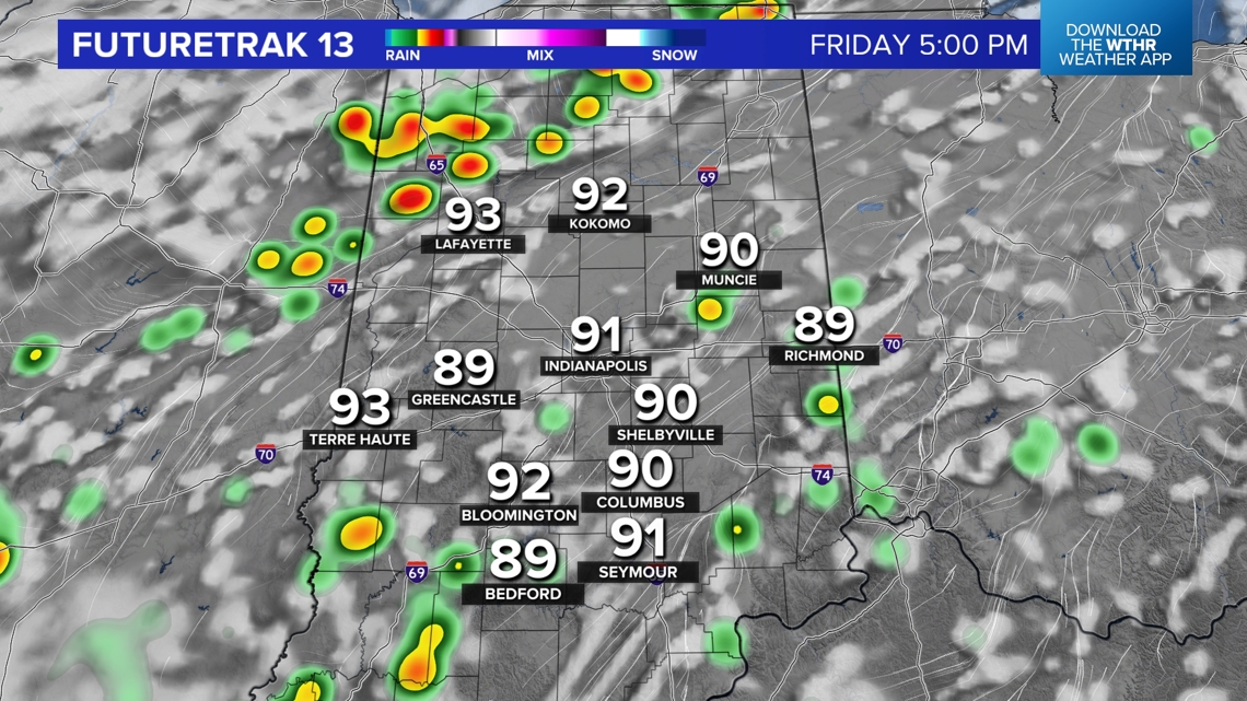
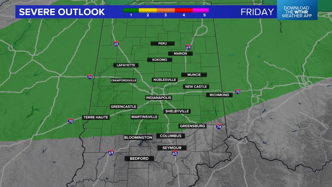
Only spotty storms are expected Thursday, but greater coverage of storms – possibly some severe – arrive Friday afternoon/evening along an approaching frontal boundary. There's a low risk (Level 1 out of 5) some of those storms could become severe. We'll adjust as needed for coverage and severity.


That front brings "cooler" temperatures this weekend but seasonably warm in the mid-80s. The Muggy Meter remains uncomfortable on Saturday before less humid air returns Sunday.
We're still on target for a refreshing streak of days next week beginning Labor Day morning with lows in the 50s. There will be plenty of sunshine and mild highs in the 70s for early next week.