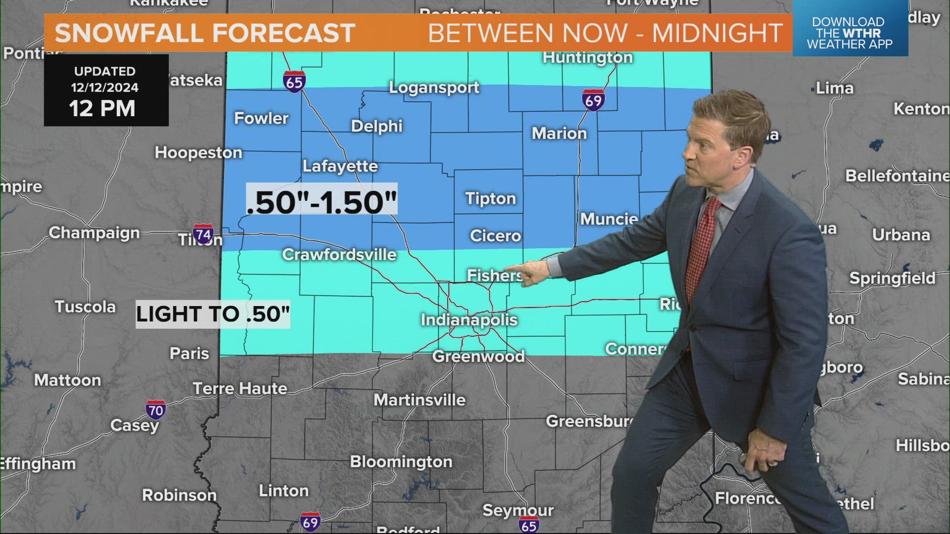
INDIANAPOLIS — While some areas are just cloudy and cold today, those within a narrow snow band will have to navigate slickening roads between now and 5 p.m.
The set-up is completely compared to 24 hours. It's due to temperatures being much colder and a steadier, slower-moving snowfall versus the showery, quicker nature that happened Wednesday.

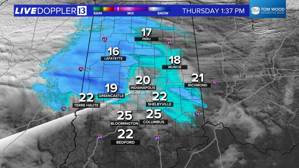

Where will the snow be?
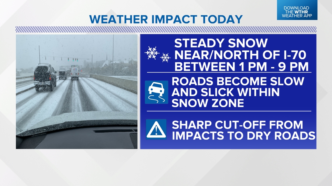
Temperatures remain in the teens for most and that will make for a more efficient, impactful snow within the expected narrow zone. While this isn't a winter storm, it will impact travel times and road conditions for those in the path due to the colder set-up and you should be prepared for that along and especially north of I-70 today and this evening.

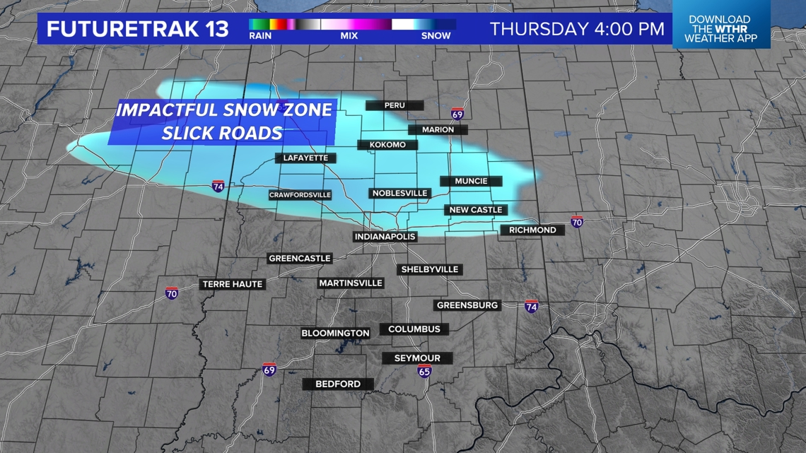

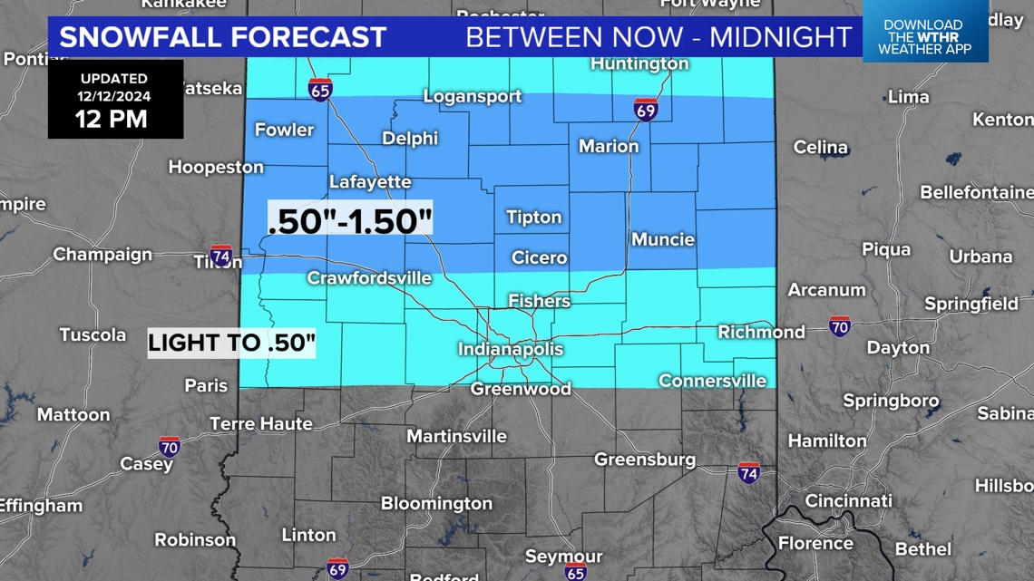

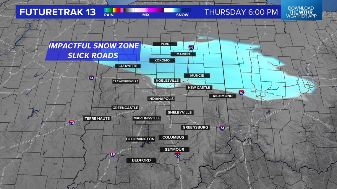
It's a tough call on Indianapolis with an expected sharp cut-off from those that get just some flurries to where it snows enough for a coating and impacts roads. That cut-off will be both on the northern and southern portion of that snow band.
For now, we're placing the steadier, slighter "heavier" snow band to occur north of Indy. But please know it won't take much to make roads messy for the evening commute.

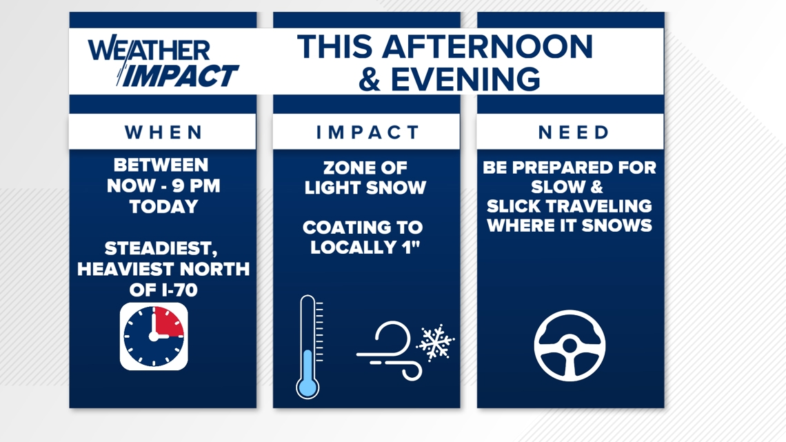
Unlike yesterday, it may snow steadily for several hours where this snow band sets-up. Even if it's snowing "lightly" that will be sufficient to coat roadways and increase the risk of accidents.
Please travel cautiously and monitor both radar and road conditions before leaving today.
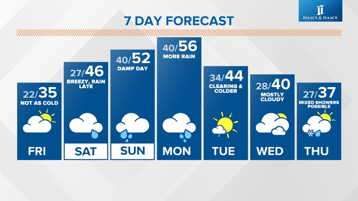
Snow ends by midnight and a quieter day is ahead Friday.

