

INDIANA, USA — Some cooler air may return to Indiana next week as a front tracks toward the Great Lakes. Anything would help.
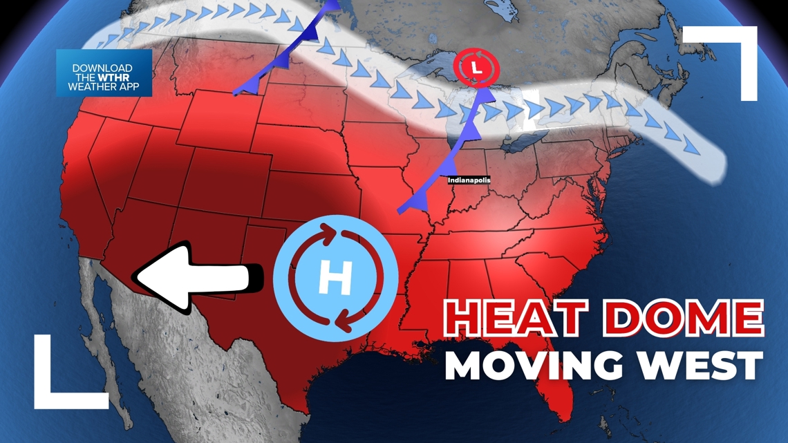
It's hot and it's humid, but it is summer. However this heat is ahead of schedule and has been very long-lasting for June's standards. The heat dome has been extremely strong over the eastern United States, while the west has enjoyed some cooler weather, plus some snow high up in the mountains for parts of the Rockies.
So when will the cooler air arrive and how long lasting will it be?
Tap HERE for our interactive radar to small cold fronts pushing toward Indiana.
Tracking the heat dome
A heat dome is a bubble of intense heat in the atmosphere due to higher pressure. They can help block cold fronts from arriving and knocking down temperatures. Isolated pop-ups are possible, while widespread rain chances get shut down.
The center of the high pressure dome will start to weaken by next week, and push west towards the desert southwest. This will start to flip-flop who gets the heat for the next several days. The west will bake while the east gets a mix of hot days and more comfortable days. Rain chances will also increase, but be limited.

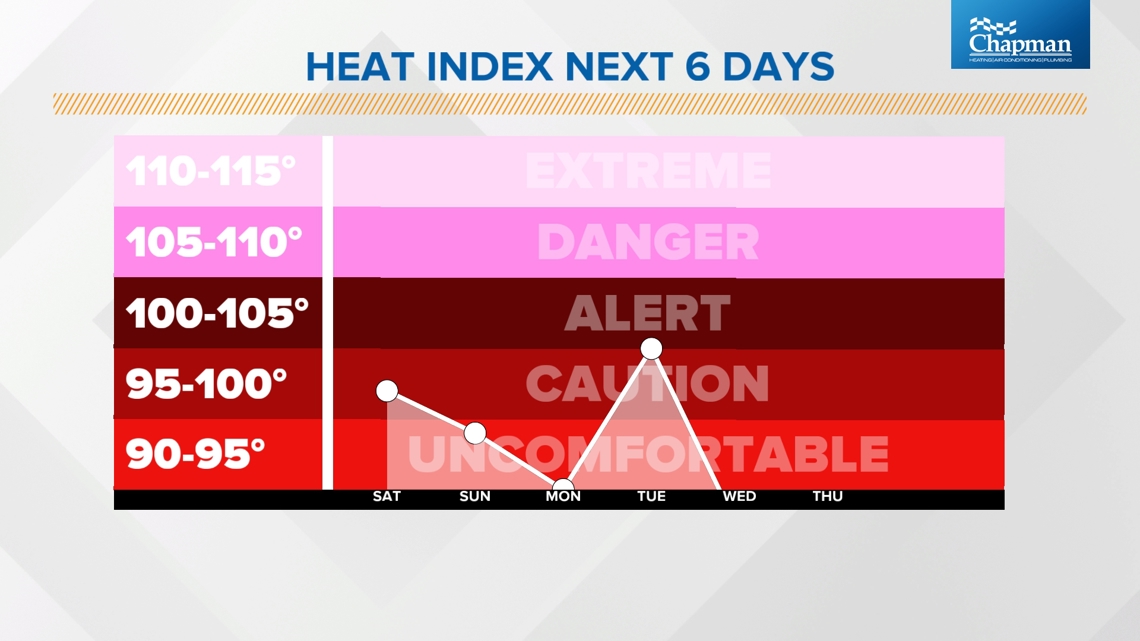
For much of the Ohio River Valley, the weekend looks incredibly hot, especially Saturday. However our first shot at some slightly cooler air will hit Sunday with a stronger push of cooler air arrives next week.
The heat index will remain high most days until the bigger cold front Wednesday. We are still working on the timing of this front and the strength of it, but generally mid-week is when we need to watch for slightly cooler air. Do not be surprised if the front gets pushed back until Thursday. Stay tuned for timing updates.

We have two main fronts to track. The first one is weaker and the second one is stronger.
Front #1
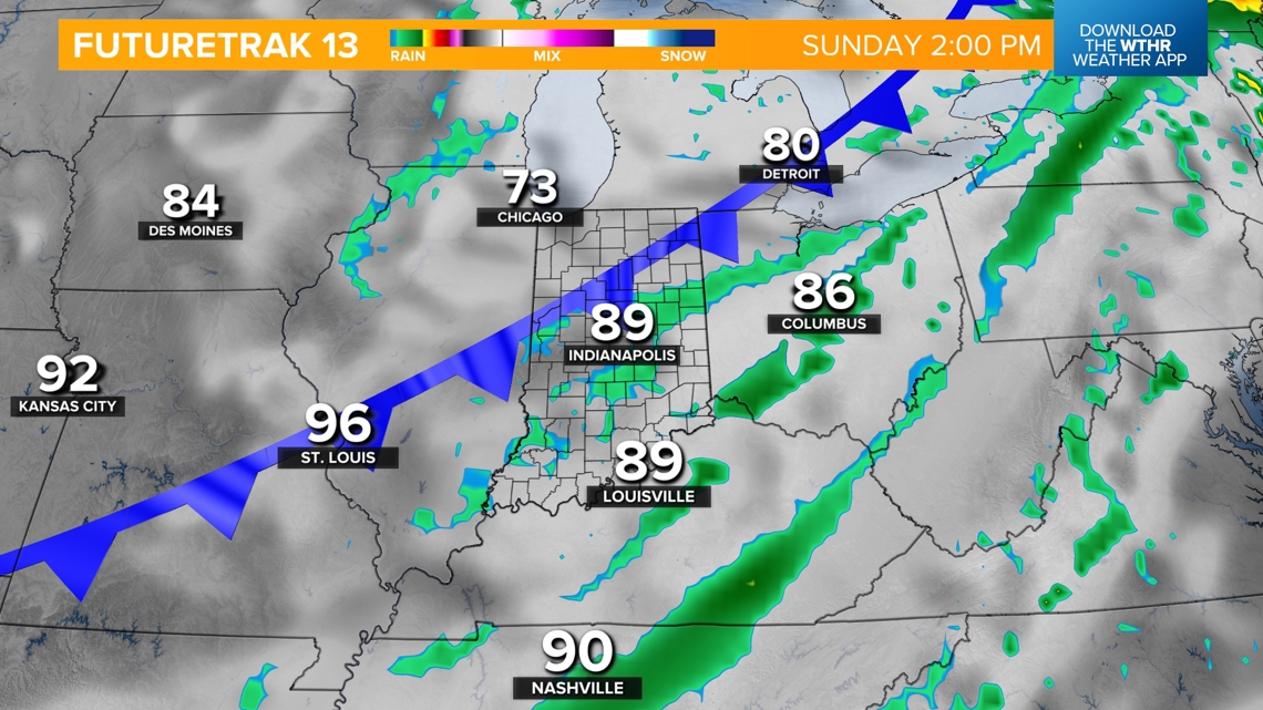
This cold front (maybe should be called a "cool" front) will arrive Sunday evening, gradually bringing some cooler air to start next week temporarily. Some rain chances are possible Sunday, but don't expect it to rain everywhere, nor for it to rain all day. Scattered showers and rumbles are possible across Indiana.

Front #2
This front is still out in the Gulf of Alaska. Once it arrives onto the North American continent where we can diagnose it more, we'll have more detailed timing.
Generally expect a big warm-up to return Tuesday of this coming week. By Wednesday or Thursday, this stronger front may arrive with some higher rain chances and some northwest winds. These cooler, refreshing winds may last for a few days.
Long-lasting cool air?
Highly unlikely. It's summer. We will get some shots of cooler air for a few days, plus lower humidity. However do not expect these cool downs to last very long.
— 13News Meteorologist Matt Standridge
