INDIANA, USA — After a stretch of sunny and warm weather, two cold fronts are on the way, bringing very brief cooldowns and the chance for frost in central Indiana.
Tap HERE to track the front pushing into Indiana with our interactive weather maps.
Overall, the weather looks near average or warmer than average when you look at the afternoons the rest of the month. Average highs should be in the low and mid 60s. However, the mornings will be chilly at times, bringing more frosty starts.
Most Hoosiers have already had their first frosts or freezes. If a sensitive plant hasn't been damaged, these next two rounds (Thursday morning and Sunday morning) probably will not be very impactful.
Let's walk through front by front.
Front #1: Wednesday into Thursday (Oct. 23-24)
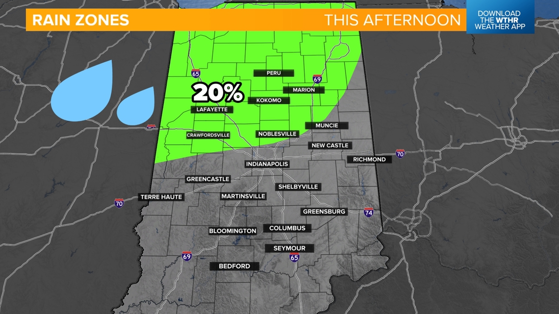
This first front is a drier cold front. There is a chance for a stray sprinkle in the afternoon across northern Indiana, but rain is not the weather story.
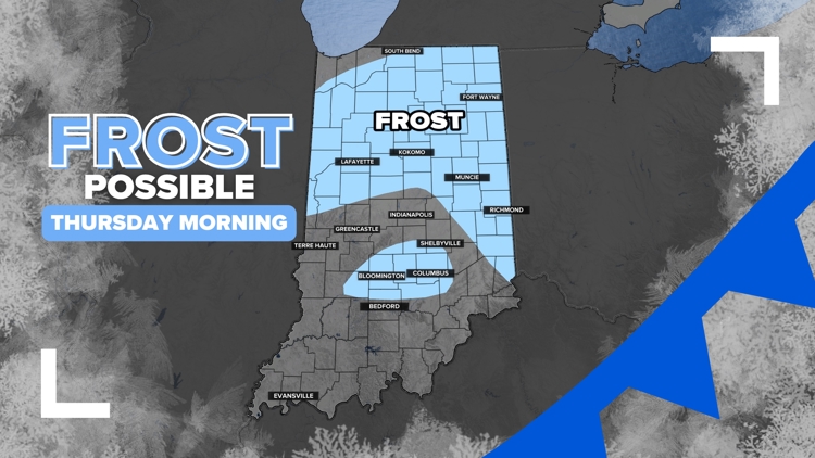
Northwest winds will pick up this afternoon 10-20 mph. It will be a cool evening, with a possibly frosty start by Thursday morning.

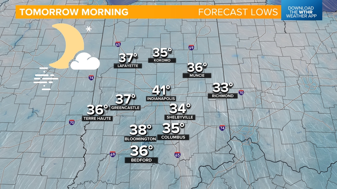
Temperatures Thursday morning will mostly be in the 30s across Indiana. Some spots in Marion County around Indianapolis may still stay in the 40s. This will be a 20-25 degree drop from the previous morning.

As temperatures drop, some patchy fog may develop in rural areas across Indiana.
(NOTE: Not a major part of the forecast, but there may be a brief touch of ice that develops on some handrails and mailboxes in rural Indiana in the coldest spots. There will be very isolated freezing fog. The roads should be fine.)

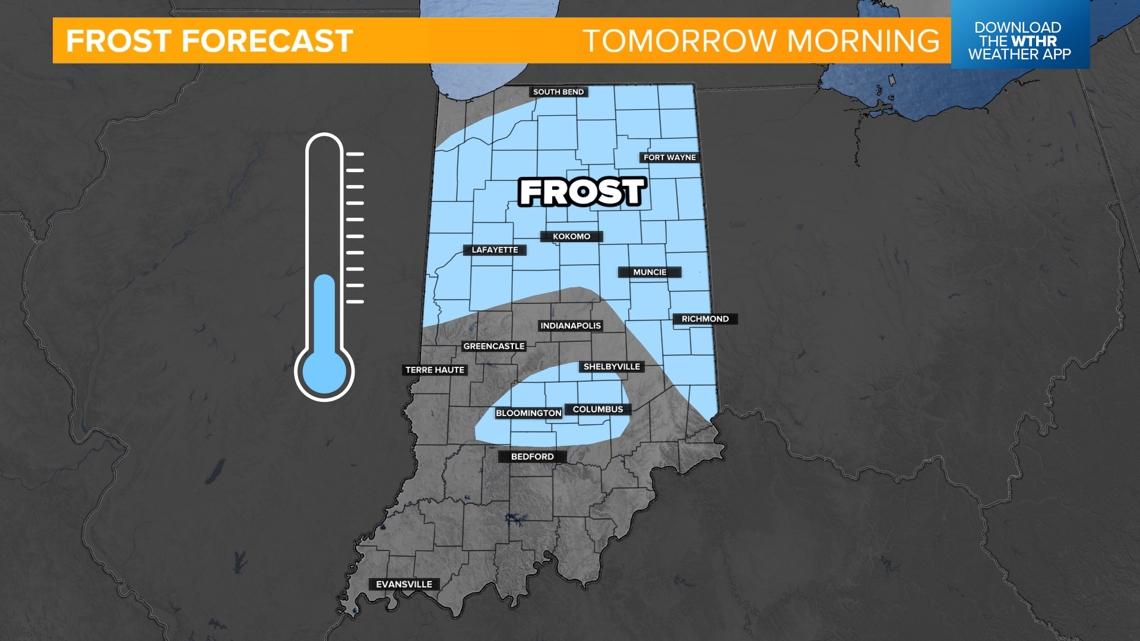
Areas highlighted in light blue may get some frost Thursday morning. The best chance will be north and east of Indianapolis. There may also be a little frost around Indiana University Bloomington, Brown County and Columbus.
Front # 2: Friday into the weekend (Oct. 25-27)
This front is a little stronger. It will bring some 20 mph northwest winds with some chances for scattered rain Friday morning and midday. A few rumbles of thunder are possible in northern Indiana.
After this front, Saturday morning may be cool in the 40s. Sunday morning may be colder in the 30s. This will be another decent chance for frost across the state.

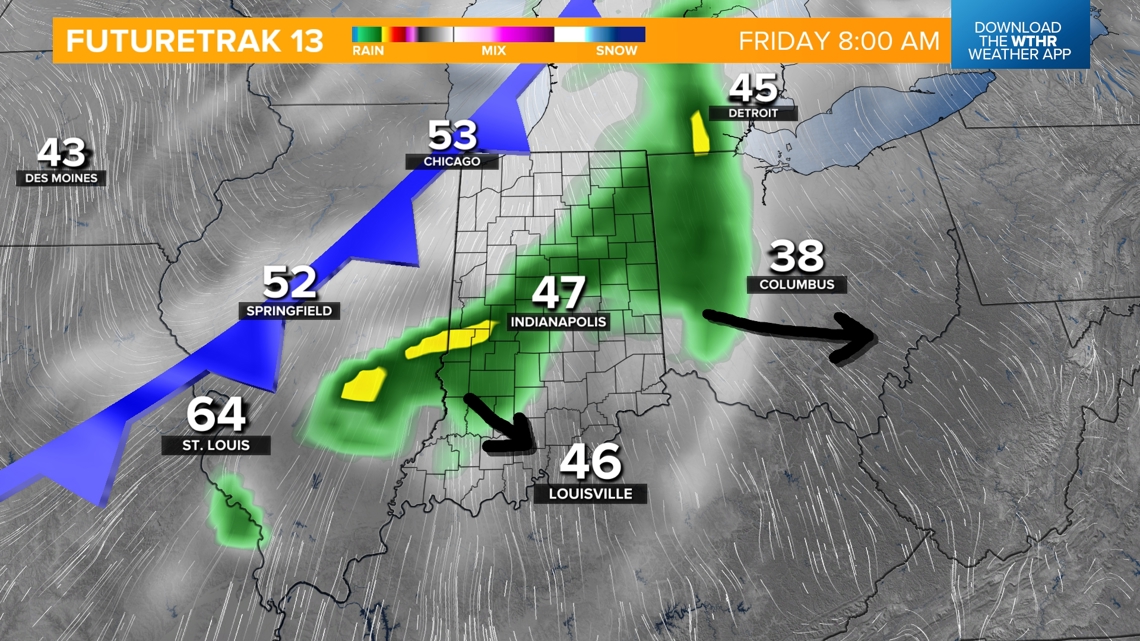
This won't be a huge rainmaker. Northern Indiana may pick up to a quarter inch of rain (0.25"), while central Indiana may max out around a tenth of an inch of rain (0.1").
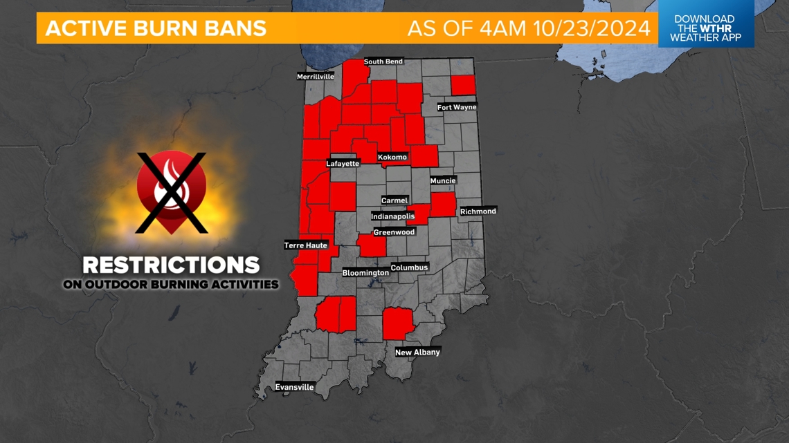
We need a couple inches of rain. Burn bans are being added daily across the state again as limited rain chances continue.
Counties in red have restrictions on outdoor open flames and burning.