INDIANA, USA — UPDATE: The tropical wave is now called "potential tropical cyclone eight."
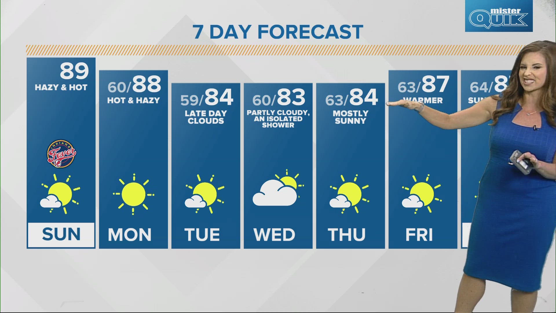
This week looks hot and dry across Indiana, however there is one catch: we are watching a tropical low develop off the Carolina coast. It will gradually move onshore bringing scattered showers and storms to the Mid-Atlantic and Appalachians. There's a small chance a shower or two tries to cross into Indiana on Wednesday.
But that's about it for rain chances...
Tap HERE to track the tropical rain develop with our interactive radar.
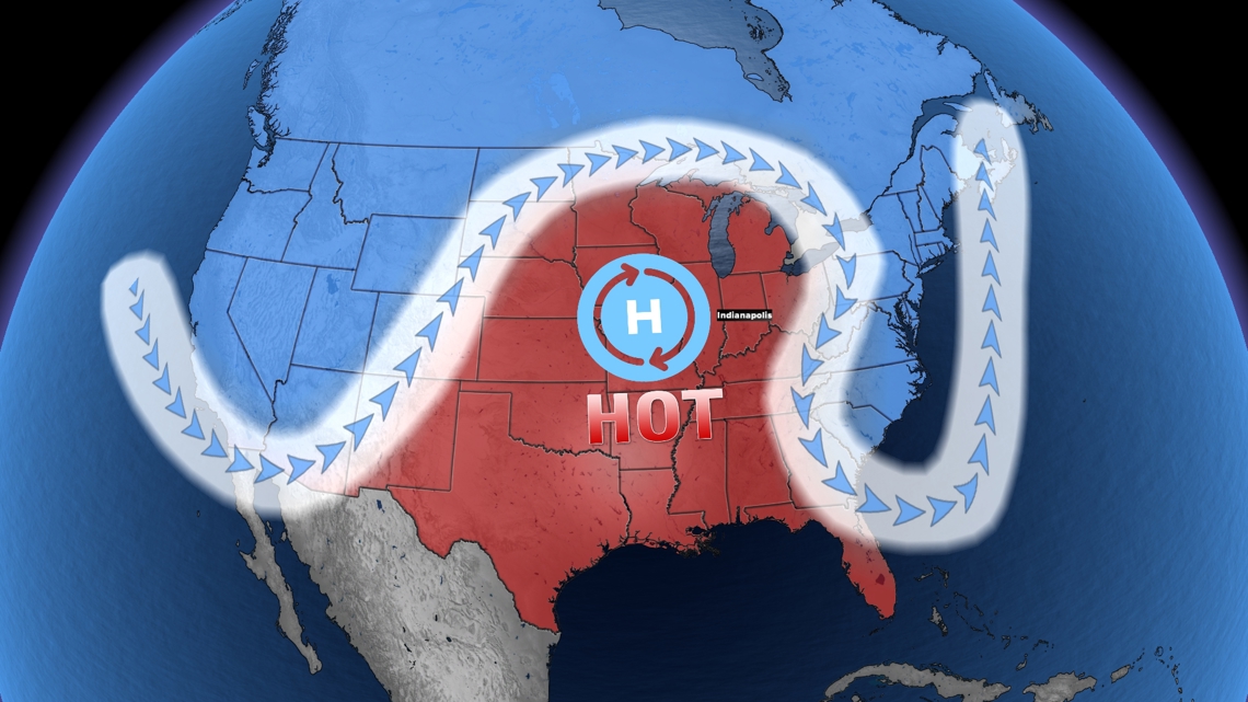
Higher pressure is sitting around the Great Lakes. That is keeping things hot and dry for Indiana. We have another week of sunshine ahead with many days in the 80s and 90s. Rain is being blocked from Indiana. However, tropical waves can still develop off the Atlantic and Gulf coasts. Then they can try to make runs at Indiana but the higher pressure around us will help rip them apart.
That is what we are watching this week.

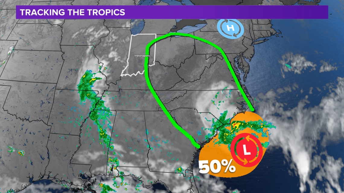
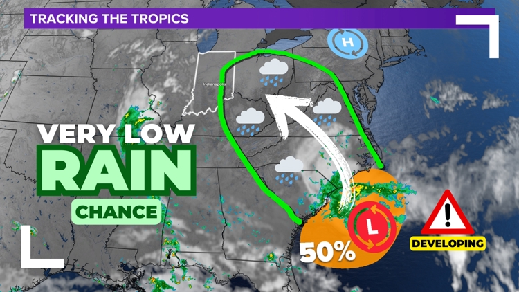
As of Sunday evening, potential tropical system 8 has a 50% chance of developing into a named storm. It would be named Helene (heh-LEEN). It will likely move northwest inside the outlined green zone, bringing scattered showers and storms.
The vast majority of the rain will stay outside of Indiana. However there is a chance of a stray shower on Wednesday in the Hoosier state, especially in eastern Indiana.

This is great news for drought-stricken areas around Virginia and West Virginia. Some of the showers could get close to Indiana. If something can pop up or move into the Hoosier state, it should be light and sparse. Most of the state should stay dry.

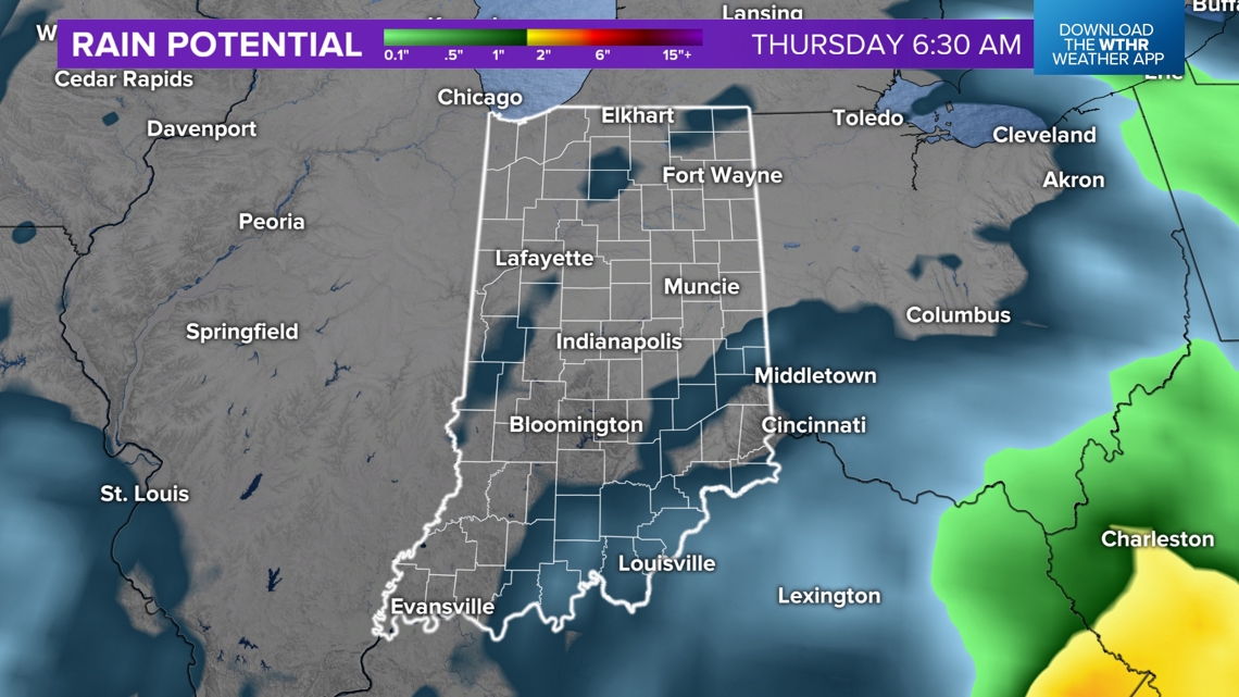
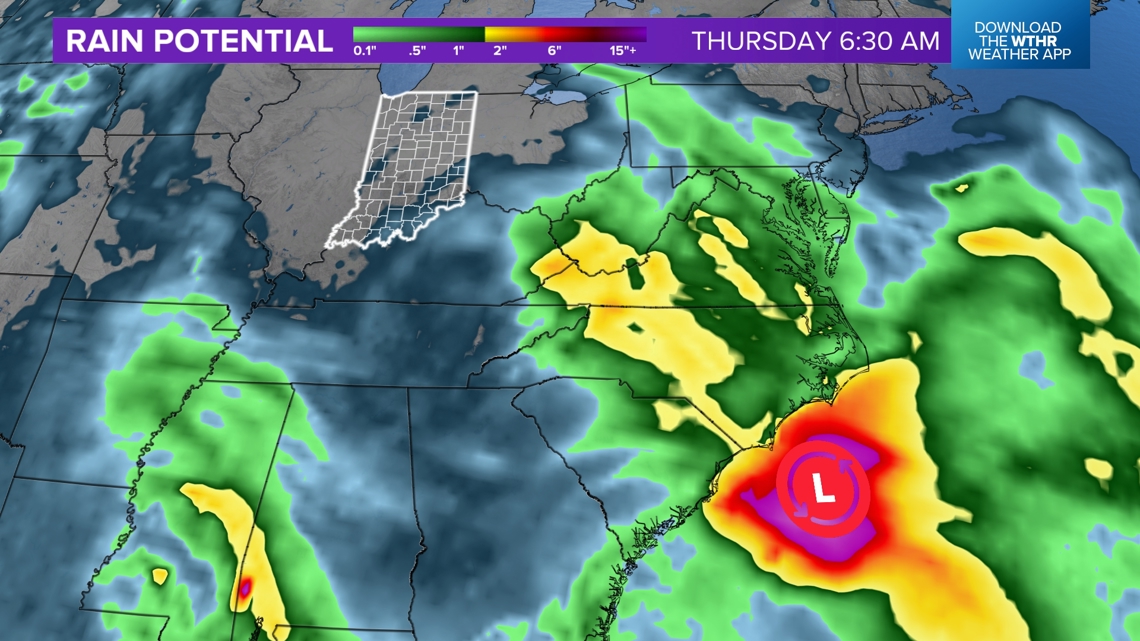
The green colors show rains above 0.1". That's a low threshold. The blue-ish color shows sprinkles or very minor accumulations. It's not enough rain to help the developing drought in Indiana.

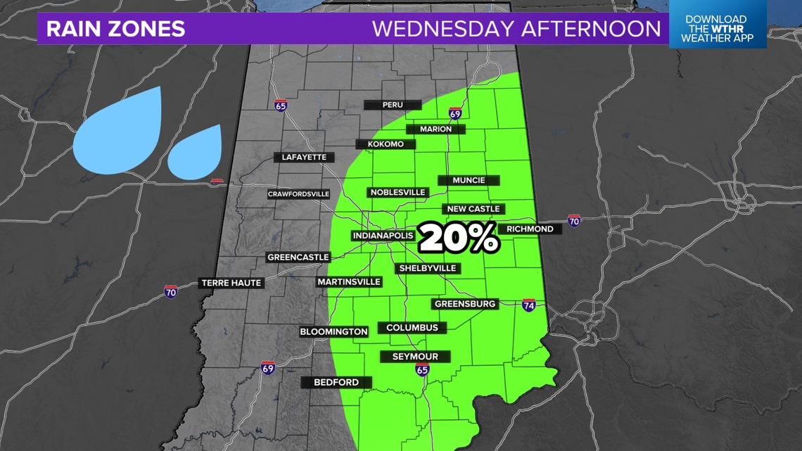
The highest rain chances will be closer to the center of the low pressure. That is why we have highlighted a 20% rain chance for parts of eastern and southern Indiana.
Blocking weather pattern
We are watching higher pressure over the central United States, keeping things quieter for Indiana. Systems can approach but many times they fall apart and dry out. This should be the case for the weak tropical system.

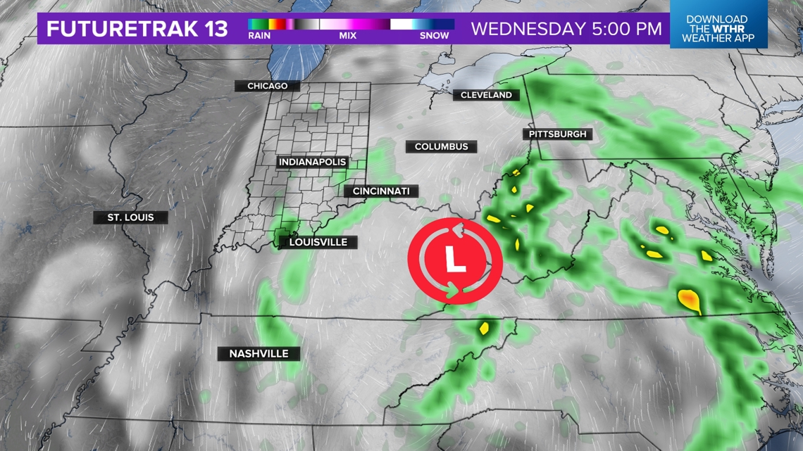
The rain will be very disorganized around the low pressure as it moves farther inland. We have only added a few extra clouds and very limited rain chances for Indiana on Wednesday. We should return to mostly sunny skies again on Thursday.

-13News Meteorologist Matt Standridge