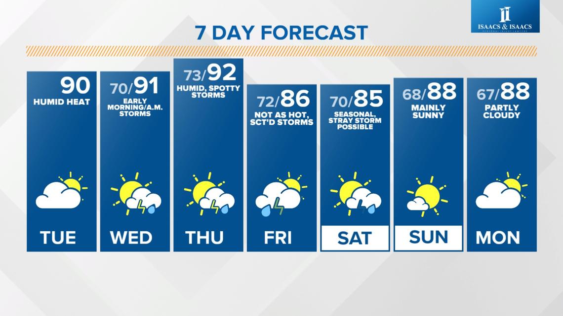
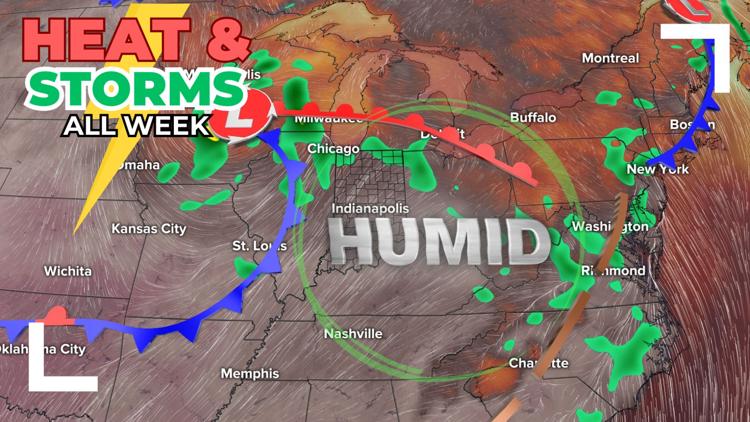
INDIANAPOLIS — Central Indiana will be stuck in a regime of high heat, humidity and daily storm chances through Friday.
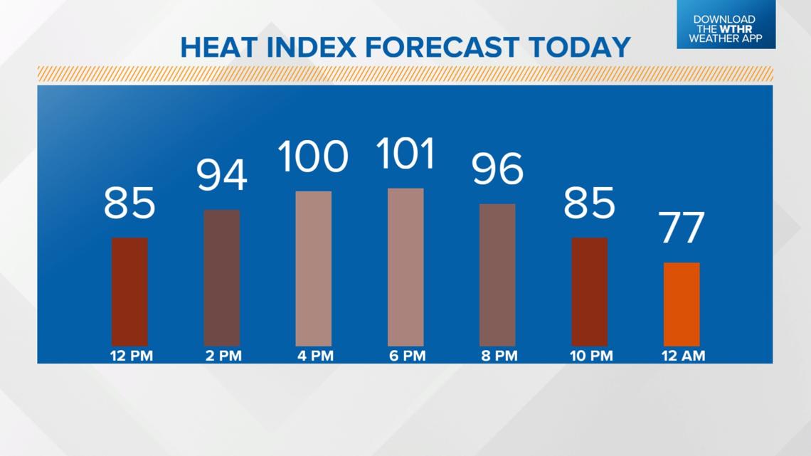
Heat index values will be at or above 100 degrees through Thursday this week. Remember to plan ahead to avoid being outside for prolonged periods during the peak afternoon heating hours.


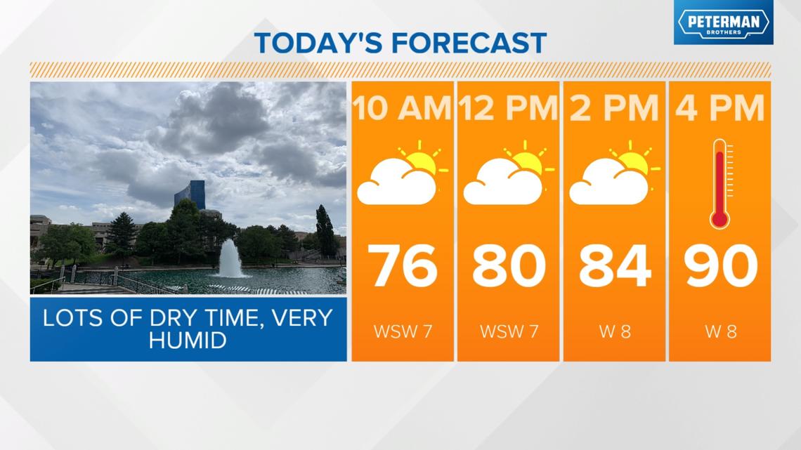
We'll have a lot of dry time today, but a saturated air mass brings miserably high dew points, heat indices in the 100-105 degree range and highs near 90 degrees in the afternoon.


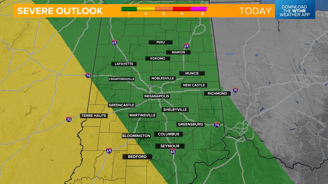
Severe risk across southwest Indiana Tuesday night
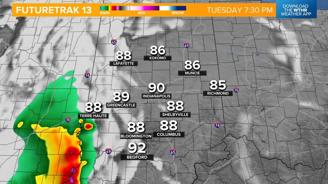
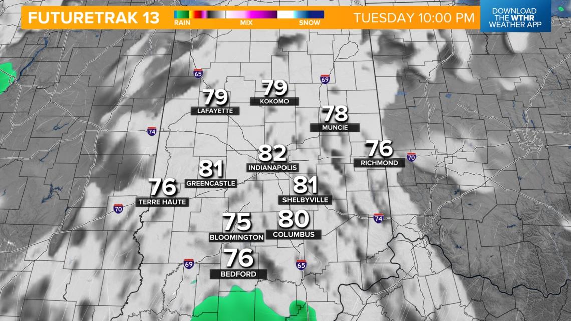
While all of Indiana remains under a low risk of severe weather, storms will again be possible mainly across southwestern Indiana where the Storm Prediction Center has a level 2 of 5 severe risk.
TIMING: After 7 p.m. - 12 a.m. Wednesday
RISK: Damaging wind threat



WEDNESDAY: A low-end threat of isolated strong to severe storms continues, especially in the morning and early afternoon.

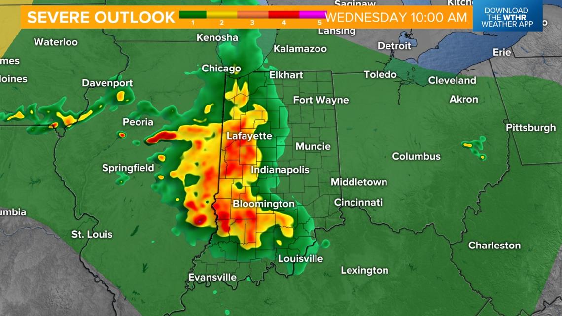
The primary focus of the forecast shifts to the high heat and humidity again tomorrow afternoon with highs again near 90 degrees, but heat indices will climb into the 100-110 degree range!

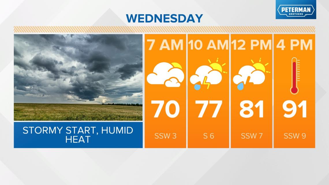

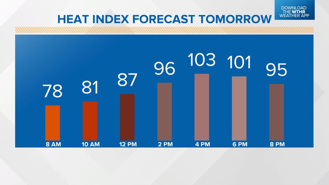
Hot, humid, stormy at times again Thursday
It'll be a mainly dry start to the day Thursday with temperatures quickly rising into the low 90s and heat indices in the 100-110 degree range.
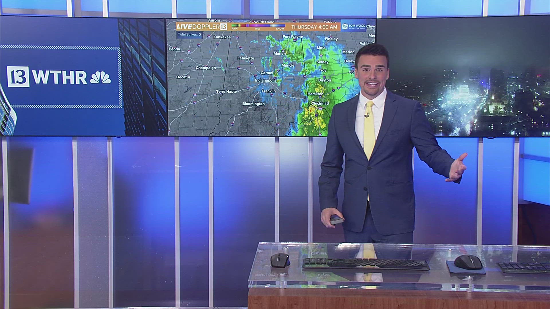
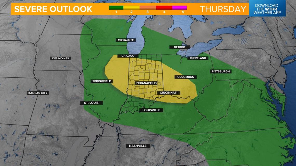
As a low pressure system begins to push into the area, storms will spark and some could be strong to severe.
The Storm Prediction Center has already placed most of the area under a level 2 of 5 with scattered severe storms.

The risk of scattered storms will remain in the forecast through the early weekend but temperatures become more seasonal starting Friday.

