INDIANA, USA — Grab the rain jacket and have it handy the next 24 hours. Our storm system has arrived and will give us times of clouds, times of showers and a few times for storms. We are unsettled. While most of the time you will be dry, watch for scattered rain. We look to be dodging on-and-off rain chances through Friday evening.
Tap HERE to track the rain and storms with our interactive radar.
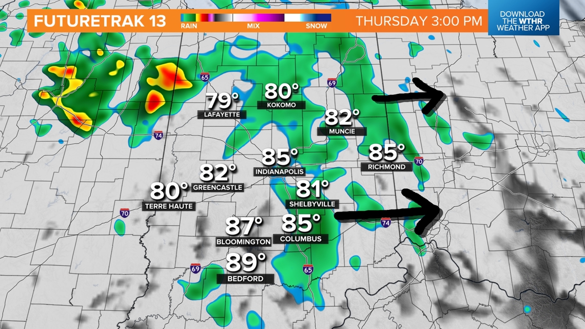
While a shower is possible at any time, the highest chances for rain for central Indiana will be Thursday from 1 p.m. to 8 p.m. and then Friday from midnight to 8 a.m. A few additional pop-up storms are possible later Friday afternoon and evening as well.
There are lots of time windows to watch for. Everyone in Indiana is going to get something a little different: varying amounts of water and varying times of rain. Generally expect about a quarter to half an inch of rain. A few spots may get close to an inch for the stronger downpours and storms.
(Scroll down for a more in-depth look at rain timing.)
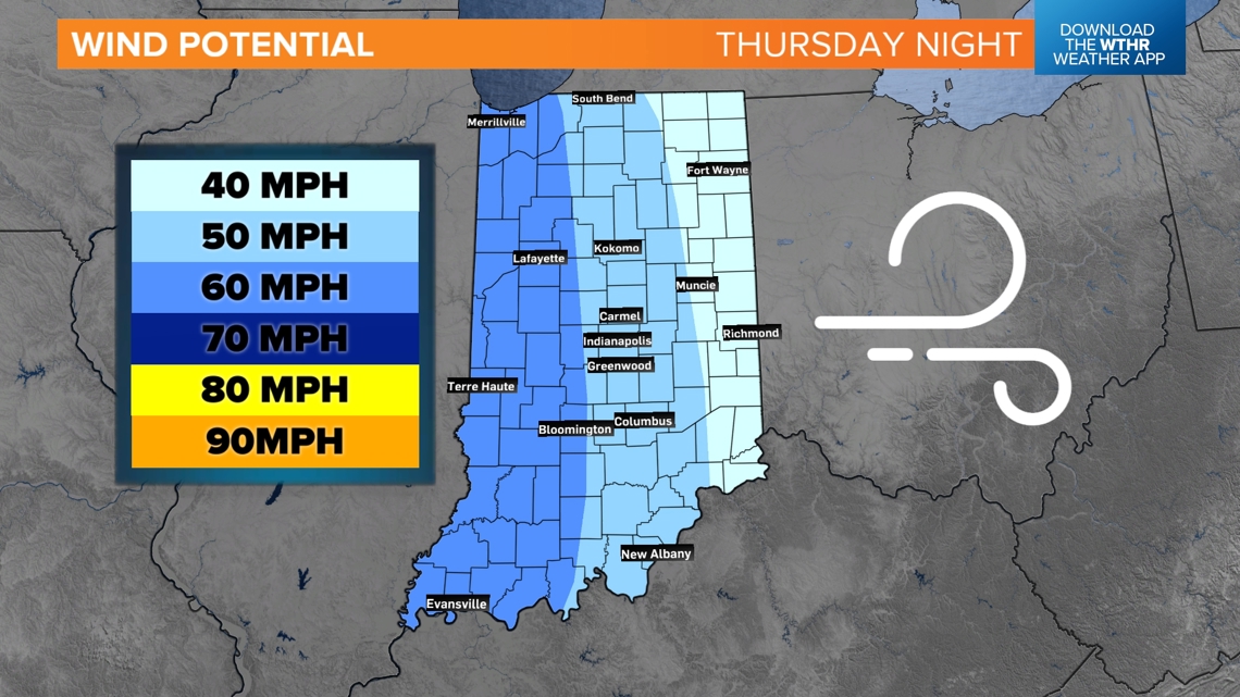
Severe chances
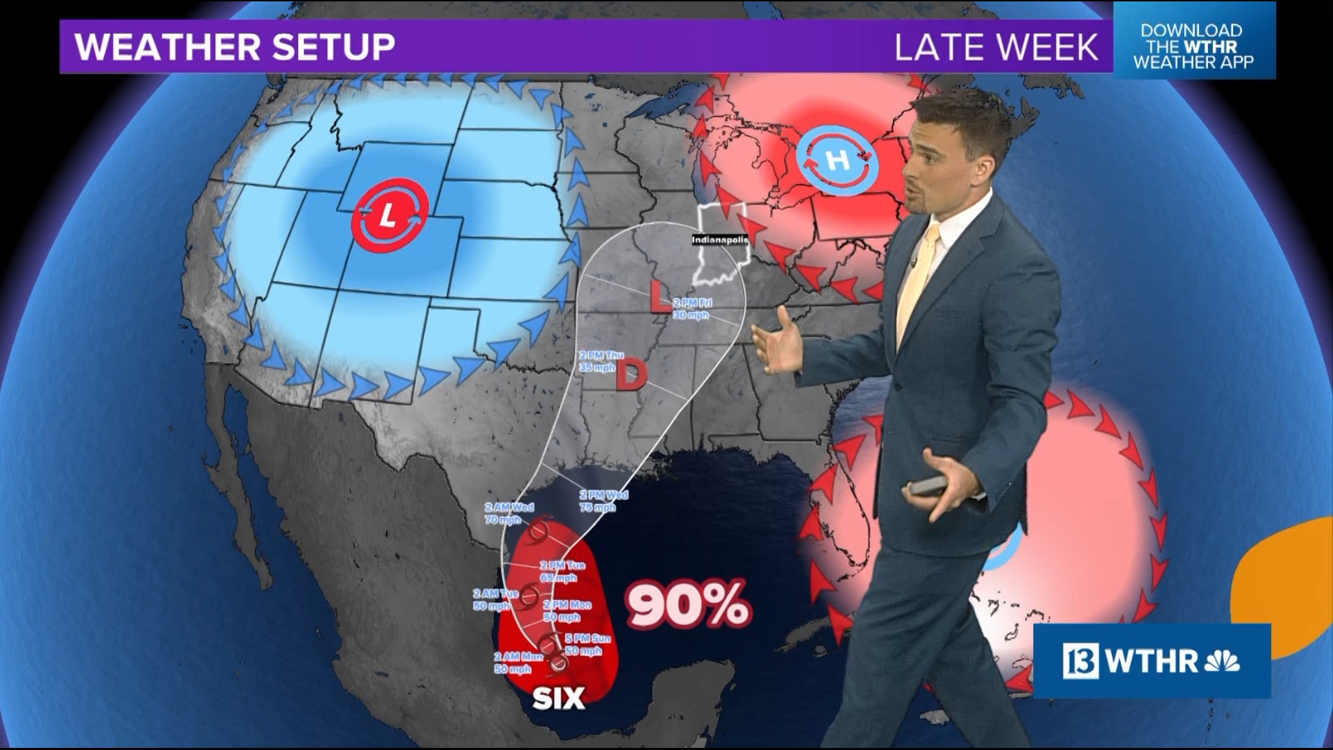
The storms are likely to be the strongest tonight in Missouri and Illinois. Eventually, they will push east into Indiana, but most of them won't arrive until after midnight. This will help storms to weaken a bit over time on their journey east, especially after all the clouds and showers earlier in the day.

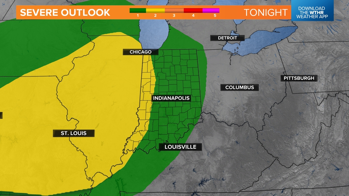
Wind is the primary threat for Indiana. The highest potential for 60 mph wind gusts will be west of Indianapolis.

Friday also has a severe chance. As pop-ups are possible later in the day, there may be a few cells that get some gusty winds. These storms will be isolated in nature. Many of us may stay dry with bits of sunshine.
Timing the rain
Thursday afternoon: Scattered showers are possible throughout the day on Thursday. Most of it will be light. There could be a downpour mixed in at times, but much of it should be pretty tame. We are not expecting severe weather during the day.

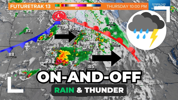
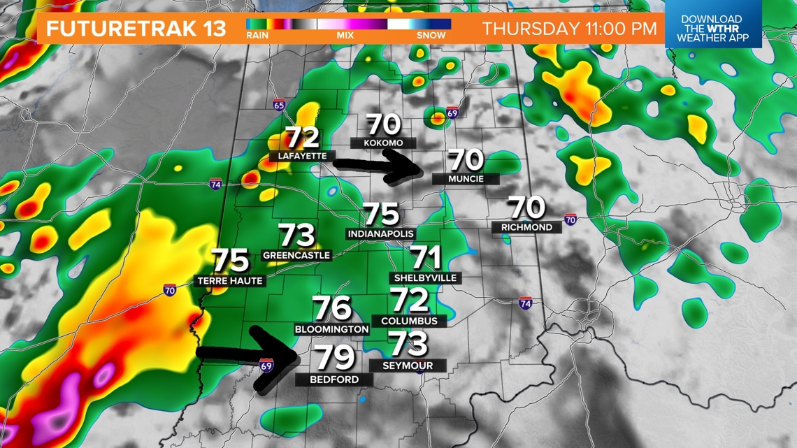
Thursday evening and night: While the early evening should be a little drier overall, save the chance for a spotty sprinkle, more showers and storms could ignite overnight into Tuesday morning. A few of these could be severe, especially west of Indianapolis. The storm coverage will be scattered, not everyone is guaranteed a storm.

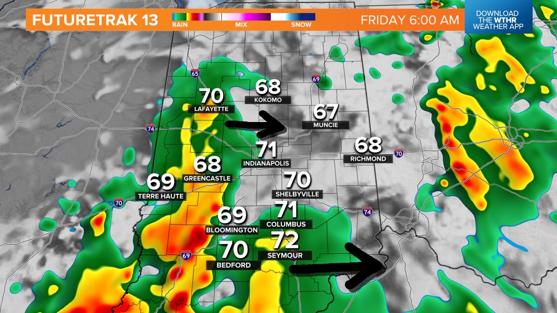
Friday morning: Leftover rain and thunder will be possible Friday morning, especially before 8 a.m. After 8 a.m., the rain chances should start to fade and maybe we can squeeze out a little sunshine midday. Additional pop-up storms are possible late in the afternoon and evening as we heat up. There is a level 1 severe risk for these storm chances. Wind is the primary threat to watch for. Not everyone will get a storm.

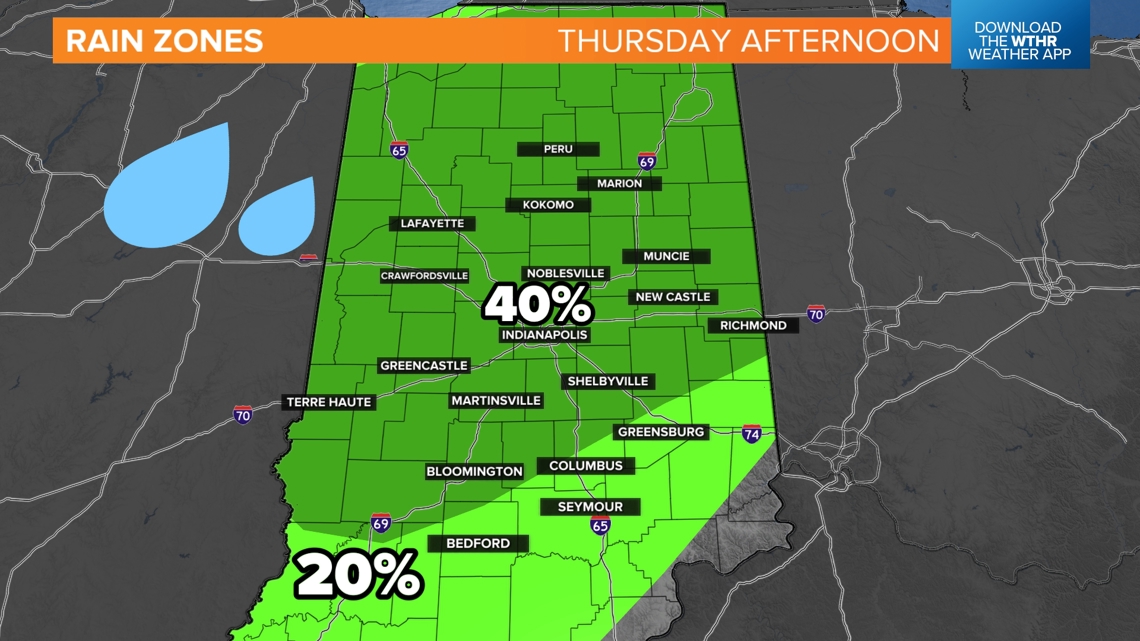
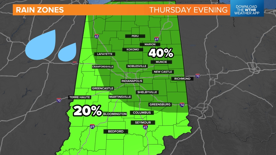
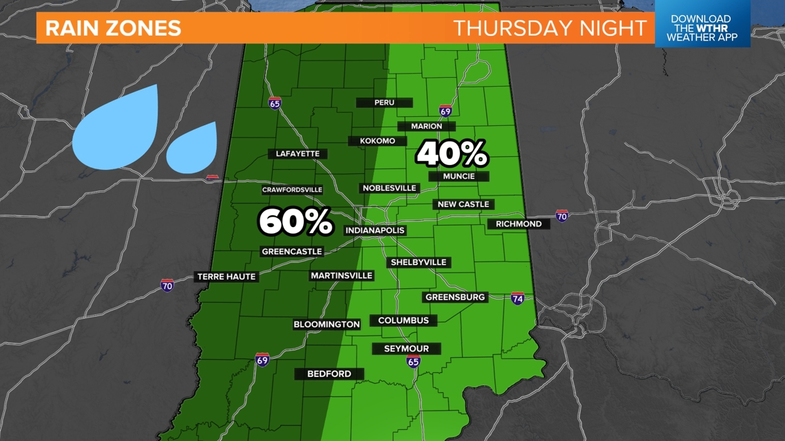
Rain zones
Futuretrak is one solution we can look at, showing snapshots of time. However, rain and storms will evolve over time. We have created some rain zone maps to help give you an idea on who has the highest chance for rain during varying windows throughout the day.
Thursday afternoon: The highest chance for rain will be in central and northern Indiana. Overall, rain looks to be on the lighter side.

Thursday evening: The highest chance for rain will shift to the east.

Thursday night: Highest chances for rain and storms will be west of Indianapolis, but everyone has a shot of some rain.

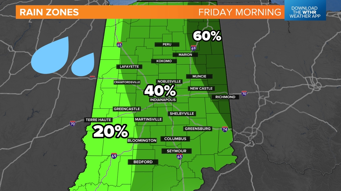
Friday morning: Rain will gradually wrap up and push east. Everyone has a chance for some lingering rain, but the highest will be out east toward Richmond, Winchester, Jay County and Muncie.