INDIANA, USA — More storms are on the way later today across parts of Indiana. We have the latest details on timing and location for rain chances.
We are stuck in an unsettled weather pattern. There is a higher level of incertainty in a volatile environment like this. Expect times of sun and times of rain. Speaking of rain, the chance goes up this evening, especially for southern Indiana.
Tap HERE to track the rain and storms with our live interactive radar.
The jet stream is pointing NW to SE. This is directing on-and-off waves of rain and storms to push into Indiana for the rest of the day.
AFTERNOON: Scattered storms south of I-70 (60% chance), isolated showers north of I-70 (40% chance)
EVENING: Scattered storms south of I-70 (60% chance), stray showers north of I-70 (20% chance)
TONIGHT: Few storms south of I-70 (40% chance), stray shower north of I-70 (20% chance)
Where will the highest storm potential be the rest of Wednesday?
The highest energy levels are in southern Indiana. This also where the southern edge of the jet stream is, which helps increase rain chances.

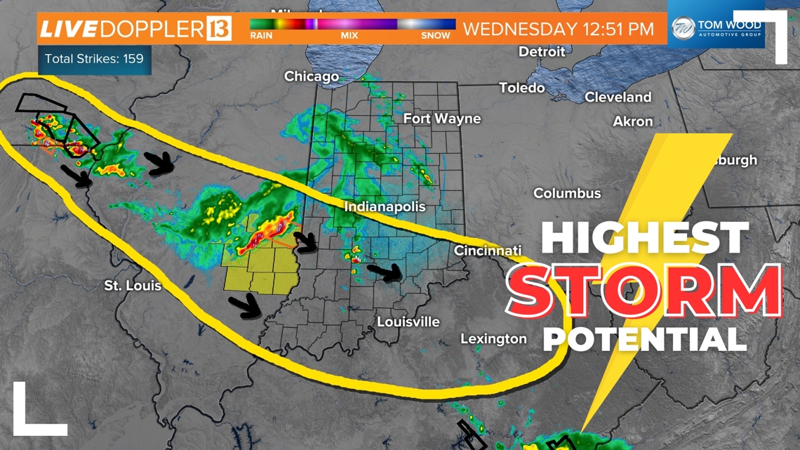
The yellow zone above highlights were we think the main activity will be the rest of Wednesday.
Timing rain chances
Exactly timing is difficult in this chaotic, hot, humid airmass over us right now, and for the rest of the week. However, expect on-and-off storm chances across Indiana for the rest of the day.
Watch for scattered storms until 4 p.m., with additional storms possible 6 p.m. - 11 p.m. This later timeframe will mainly be for the southern half of Indiana, or Highway 40 and south.

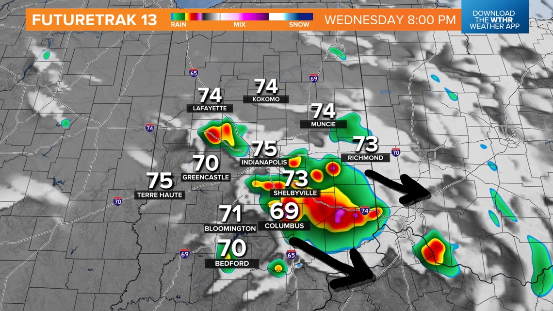
The coverage of these storm chances later this evening will be more scattered. Not everyone will get a storm later today.
We are constantly analyzing the atmosphere after earlier waves of rain. These have been trying to exhaust the atmosphere. If they are too successful, storm chances will drastically drop this evening. If we are able to hold onto unstable air with lots of warmth and humidity, expect more storms later today.
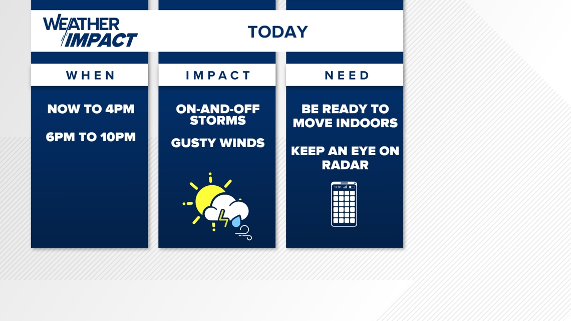
Stay weather aware
While not everyone gets rain and storms, watch for the potential of on-and-off storm chances with some gusty winds.

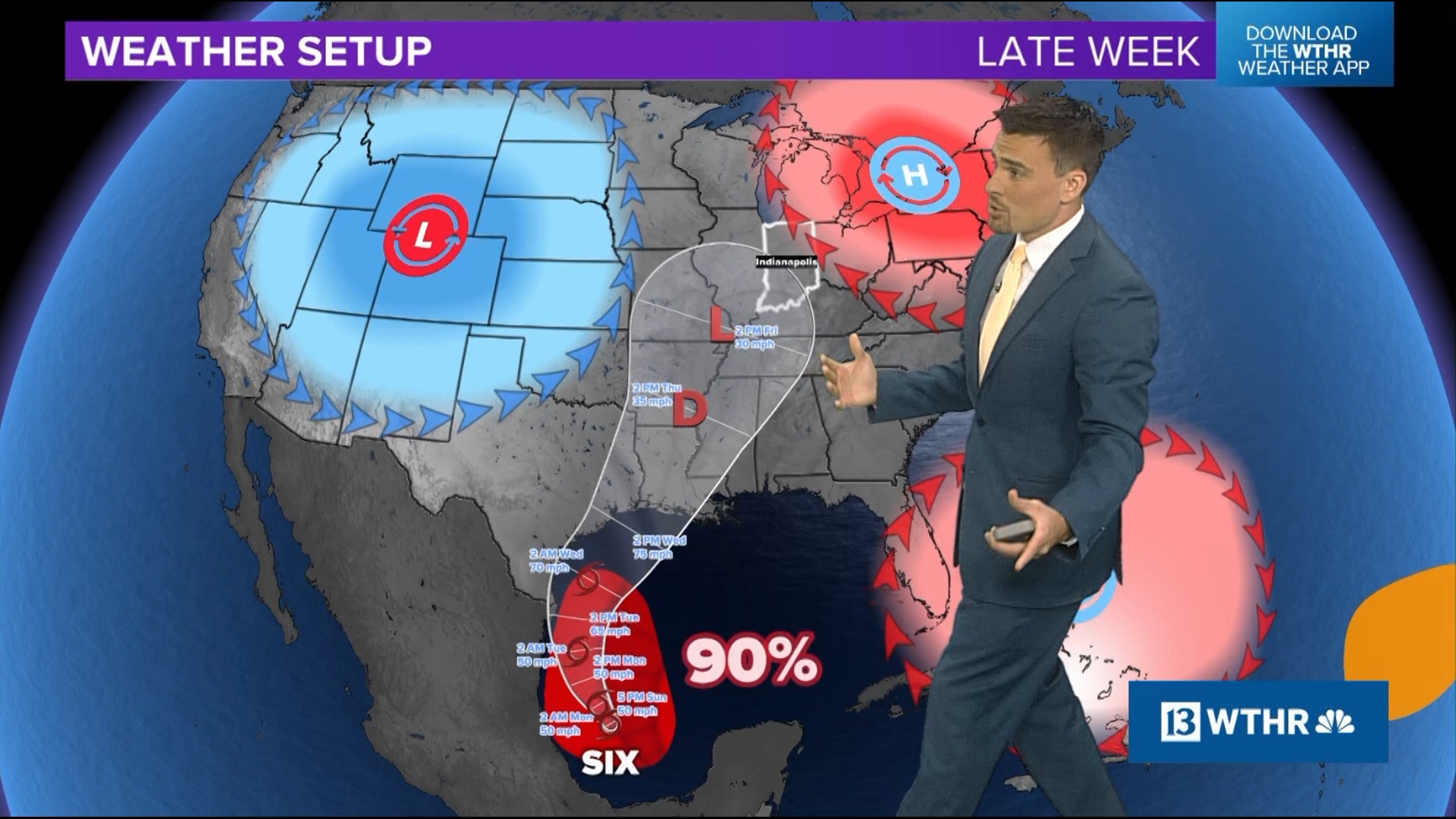
Weather setup
Why is this weather pattern so erratic? It seems like the forecast is constantly changing.
We agree. This pattern causes a lot of headaches in meteorology. There is even a phrase for it: "northwest flow, weatherman's woe."

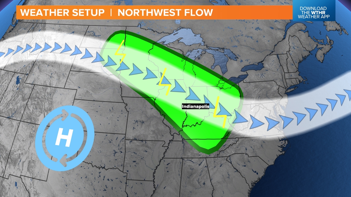
During the summer in a NW to SE flowing jet stream, scattered storm chances increase. This type of enhanced wind direction helps to create more tall clouds with separation between updrafts and downdrafts. Essentially, it helps the efficiency of storm development. Plus, during the summer the temperatures are lot hotter, so you add in more fuel for big storms with torrential rain and lots of lightning.
We will try to time out when storm chances are most likely, but at the same time you have to keep the idea in the back of your head that it could rain and storm at any time.
It's vague, but it's accurate. Expect times of rain and expect times of storms. Don't get used to one or the other because it will change.
Looking ahead
We should try breaking this pattern this weekend, lowering rain chances.