

INDIANA, USA — The weather for the last week of July is going to be a mess. The upper-level pattern, or jet stream, is sloppy. Fronts are slow and weak. Heat and humidity will be building. You put all this together, and you get a chaotic – and somewhat random – forecast. Scattered showers and storms can fire up at any time next week, especially in the afternoons and evenings.
Tap HERE for the latest daily forecast from the 13News Weather Team.
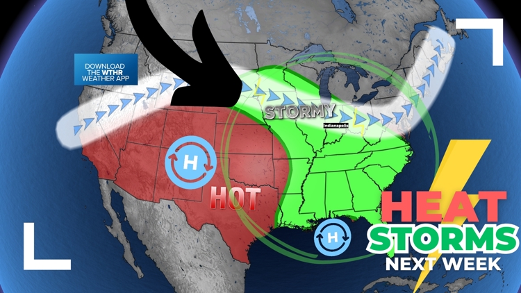
This stormy zone is very big. The unsettled weather will likely be the stormiest from Minnesota to Indiana to Florida. A wide arc of scattered showers and downpours will be possible across much of the Corn Belt, Ohio River Valley and Tennessee River Valley.
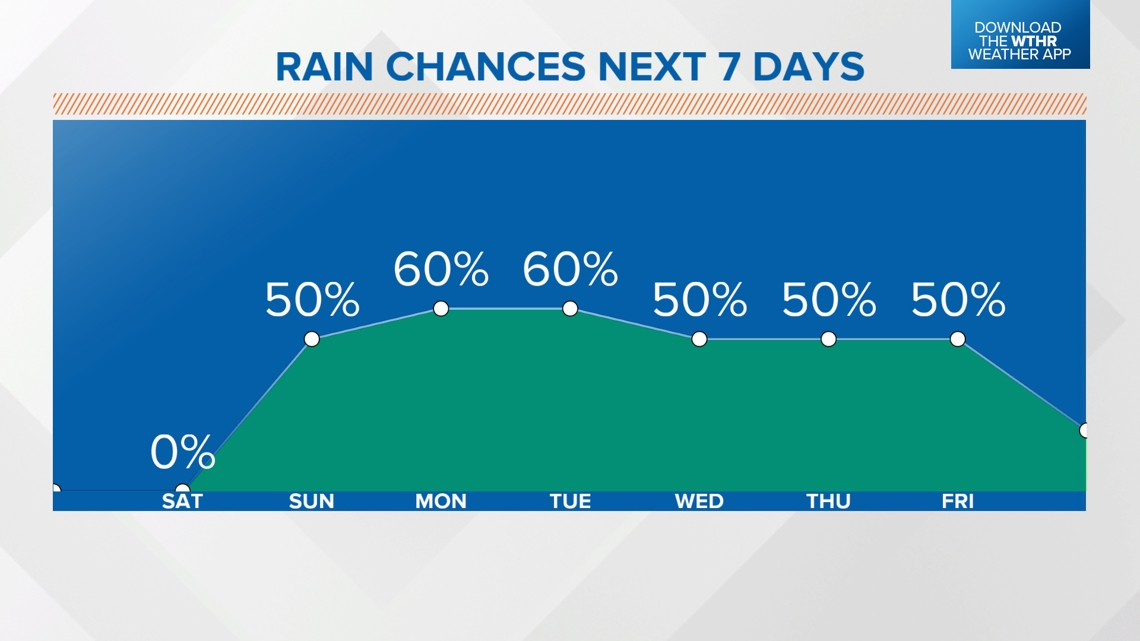
For Indiana, the rain chances will start on Sunday, lasting all through the coming week.
Weather setup | Why so messy?
We have an uneven, double barrel high pressure system. The winds flow clockwise around a low pressure. When there are two near each other, the winds get more jumbled up and can create convergence (winds coming together) to force scattered storms to pop up. Plus, the eastern high is weaker than the western high. This just further creates an unevenness to the atmosphere. It all adds to the chaotic factor with the forecast.
Our map of the jet stream bulges north in the western Plains. However, the interesting part is the NW flow slop from Iowa to West Virginia. This area helps create the most storms in a summer pattern like this, mainly because that NW flow really twists the atmosphere in the higher levels, which helps cloud development, which then leads to more rain and storm chances.

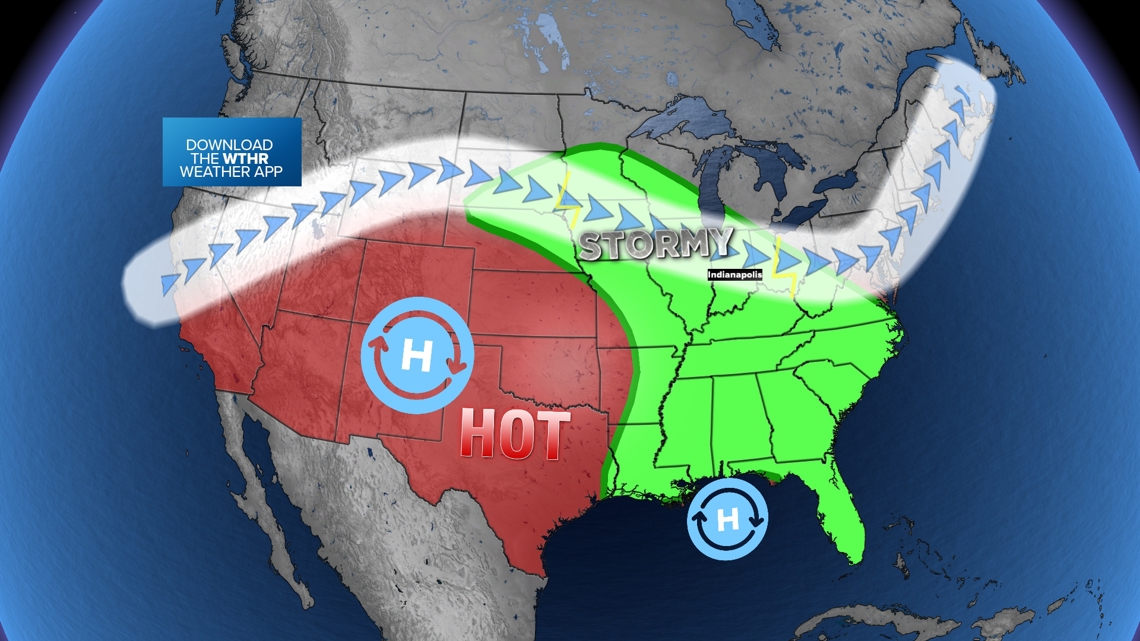
The green zone shows where we can expect elevated downpour chances. The zone then extends to the south. This is because as storms fire in the north, they can drop south toward the Gulf Coast. Storms like to head into areas with higher heat and humidity. The Deep South can provide this.
Building heat and humidity
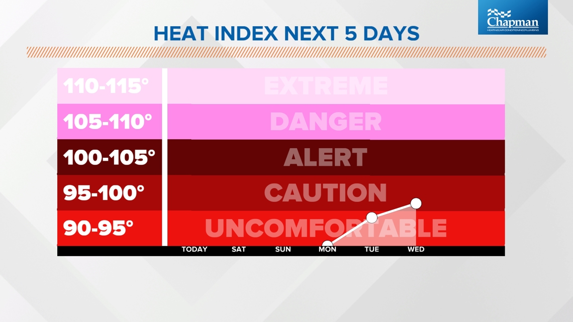
You need energy (heat) and you need water (humidity) to create storms. We will get both next week. Temperatures are already warm in late July, with lots of 80s and some 90s for Indiana. The humidity will be building over time, too. This will just help create more unsettled weather. The heat index will breach 90 degrees starting Monday.

The air will feel very tropical next week as we wrap up July. While it's not raining, expect sunshine and muggy air. It's a Florida-like air. This will aid in random storm development.
Which days will it rain?
Every day next week has a chance for scattered rain and storms. However, they are near to 50-50 shot range. Some will get rain, and some will not. Many towns in Indiana may not get much throughout the week, while other towns get soaked.

It is hard to focus on who has the highest rain chance when you're still a few days out. In this type of environment, we can only start getting more slightly specific 24 hours in advance. How rain and storms form one day will impact how they form the following day.
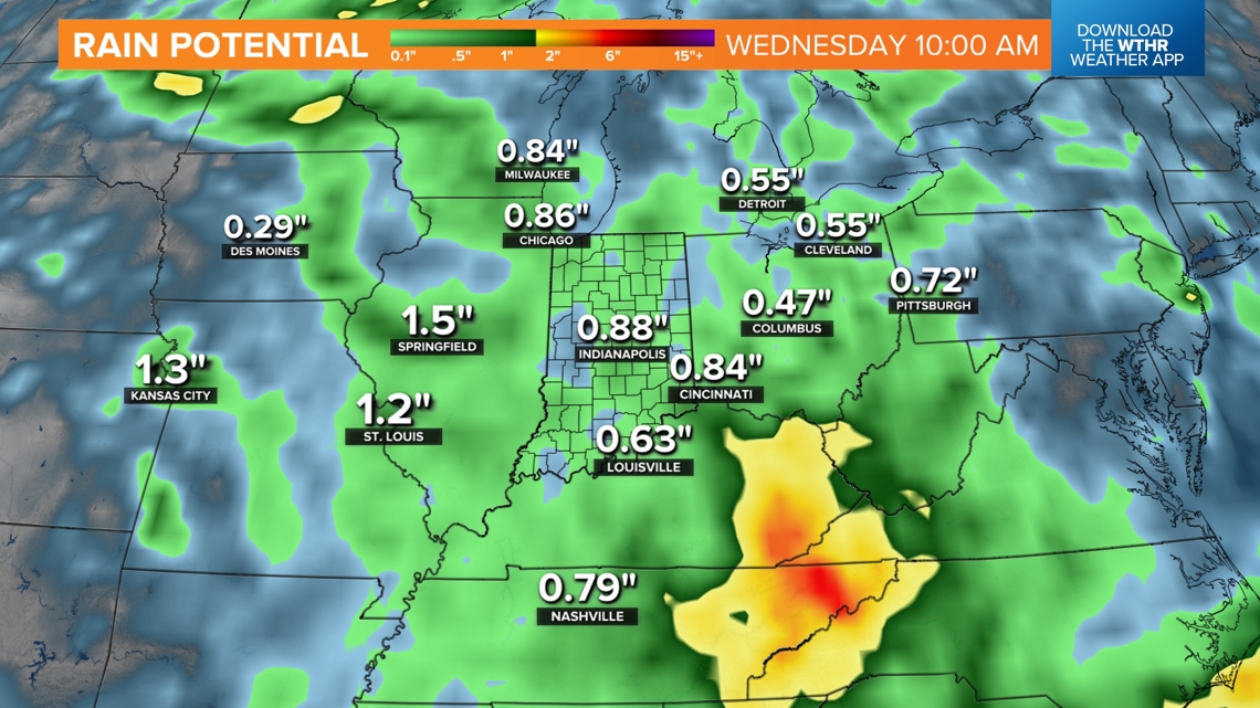
How much rain may we get?
Estimations are all over the place. Generally expect 0.5" to 2" of rain for next week. In some locations, we will get less, while others get more. It depends on where the individual downpours set up.

Check back daily for the rain chance for the next day. You can still have a great week outdoors! Just be ready to move indoors temporarily as storm chances increase, especially in the afternoons and evenings.
