

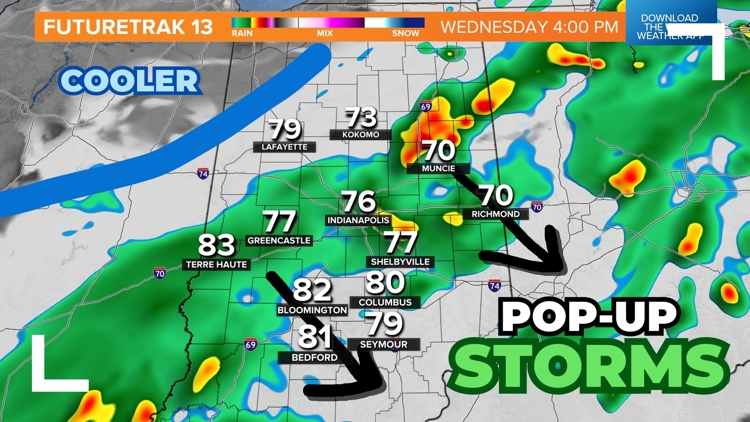
INDIANA, USA — Keep an eye out for heavy downpours and a few wind storms the rest of your Wednesday across Indiana. The highest wind chance will be east of Indianapolis.
Tap HERE to track the scattered rain and storms with our interactive radar.
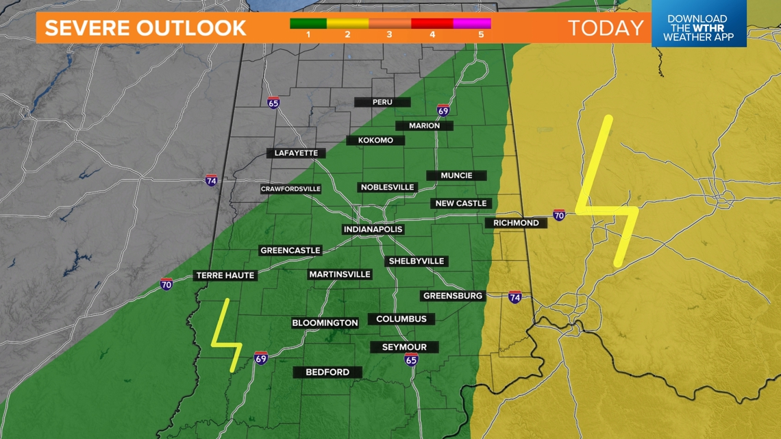
The air is soupy and humid. There is a cold front on the way to bring cooler, drier air to Indiana starting tomorrow, but in the meantime it is sparking rain chances. Some storms may turn severe, but overall widespread severe threats are low. If a storm gets cranky, it's likely it will produce some gusty winds, similar to the storms yesterday.
UPDATE
When will it rain?
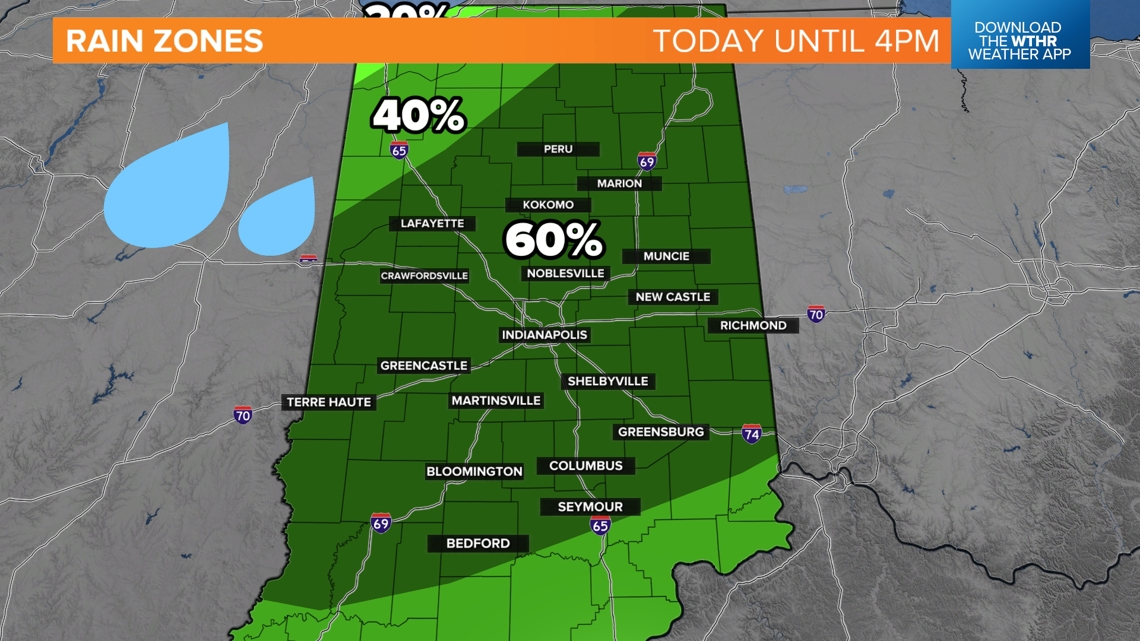
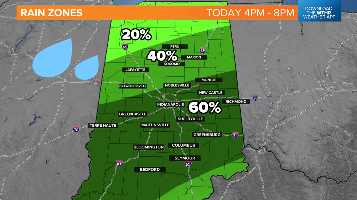
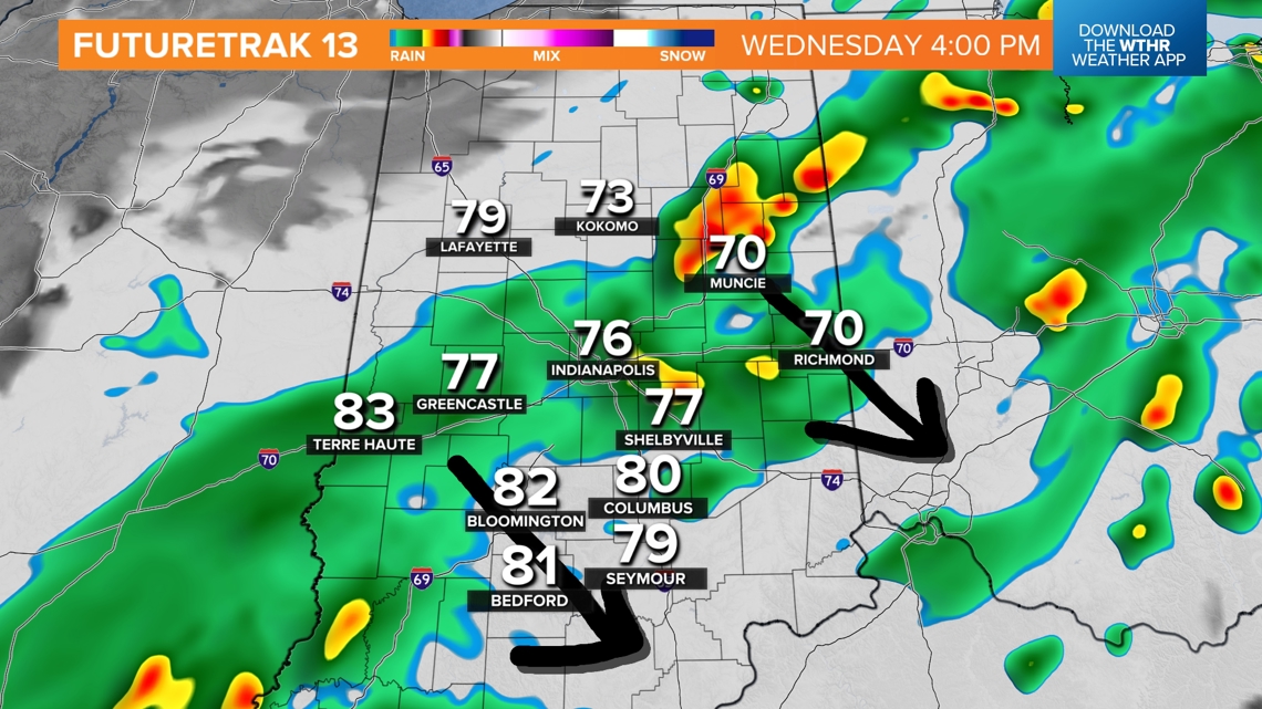
We have rain zones to show the general progression of storms. The rain will be a bit disorganized with weak upper-levels winds, but generally a group of showers and storms will slowly push southeast throughout the rest of the afternoon and early evening.
Until 4 p.m., watch for scattered rain across much of the state. The strongest storms will likely be east north and east of Indianapolis.

Between 4 p.m. and 8 p.m., expect the rain zones to shift south near Indianapolis. The southern half of the state will start to get higher rain chances. The strongest storms are during this time will likely be in eastern Indiana.

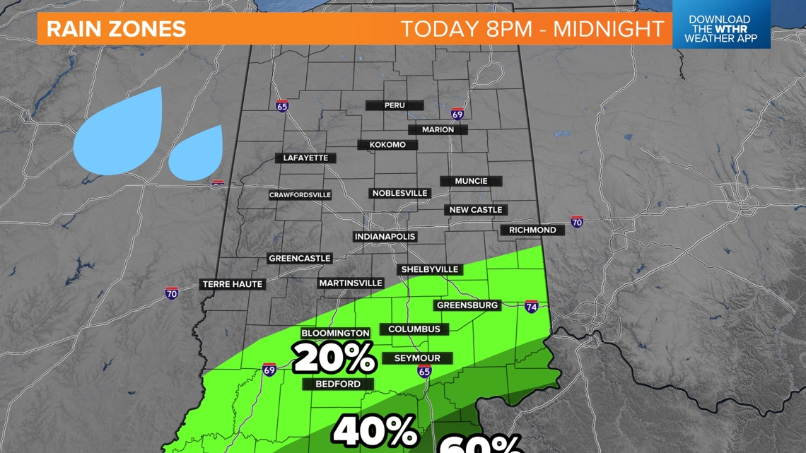
After 8 p.m., storms will push south toward the Ohio River, allowing the rest of Indiana to dry out and clear out. North winds will gradually move in this evening and tonight, breaking up the clouds and lowering the humidity.

How strong will the storms be?
While most of central Indiana has the chance for a severe wind storm, there is more instability in Ohio, or energy for these storms to fire up with and sustain more wind and hail. Eastern Indiana will have the highest threat for severe storms. However any cell will have the potential to bring some nasty wind. We'll be tracking them until they push into Kentucky or Ohio.

If you get hit by one downpour, they may not be the only rain you get. The storms are clustered up a bit. Expect scattered rain chances for the next several hours, especially east of Indianapolis.

Cooler air returns
After the rain ends this evening, quieter weather will return for the rest of the week. Enjoy lots of sunshine Thursday with seasonal temperatures in the low-mid 80s, plus lower humidity.
The next chance for scattered showers and storms will be Friday night into Saturday.
— 13News Meteorologist Matt Standridge
