INDIANA, USA — If you want cooler weather in Indiana during the month of July, you have to increase cloud and rain chances. That's what we are doing this week, including Monday.
We're tracking a few splash n' dash chances across Indiana for Monday, Tuesday, Wednesday, and Thursday of this week. Not everyone will get rain, but some pop-up showers and storms are possible here and there.
Tap HERE to track pop-up showers across Indiana with our interactive radar.
Where could it rain on Monday?
After a really nice weekend, rain chances will go up slightly this week across the Great Lakes and Midwest. Not everyone will get rain, but there will be more pop-up showers and storms this week. Temperatures are cooling above our heads, allowing clouds to get taller, helping them to create more rain chances.
But where will it rain?

In an unsettled weather environment like this, it is impossible to exactly know where individual showers will pop up at what times, however there are clues to areas that have the best chance of rain throughout the day. Let's walk through those.
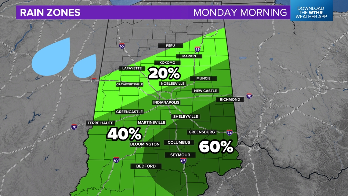
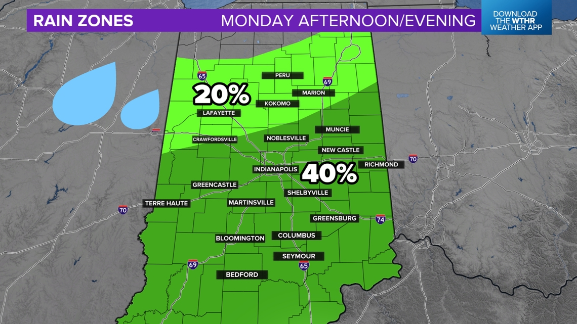
Monday morning: Mainly southern and eastern Indiana
A small upper-level wave in the atmosphere will help stir up some scattered shower chances Monday morning, especially from 6 a.m. to 10 a.m. This wave will create more rising motion in central and southern Indiana. Areas of southeastern Indiana have the highest chance for a few showers in the morning, although not guaranteed.

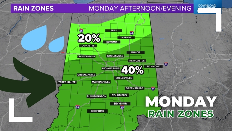
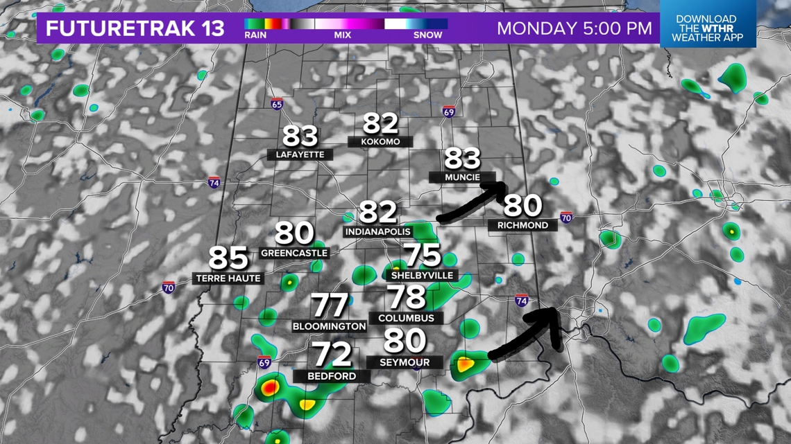
Monday afternoon/evening: Central and southern Indiana
After the morning wave, the atmosphere will become more unsettled and more unpredictable. Higher humidity and warmer temperatures will force a few pop-up showers and downpours, but they may be a bit more spotty in nature.
Where showers tracked earlier in the day may guide where the isolated splash n' dashes form later in the day. Much of central and southern Indiana is under a 40% chance. Individual cells are likely to be more sparse in northern Indiana.

Weather setup
Why so much unsettled weather?
There is an upper-level low coming into the southern Great Lakes the next few days. It helps clouds to form more easily. Random showers and downpours are possible near this low pressure, which includes Indiana.
However, notice how the jet stream slightly shows up in southern Indiana. This is another reason why our maps have a slight higher tendency to increase rain chances south of Indianapolis.

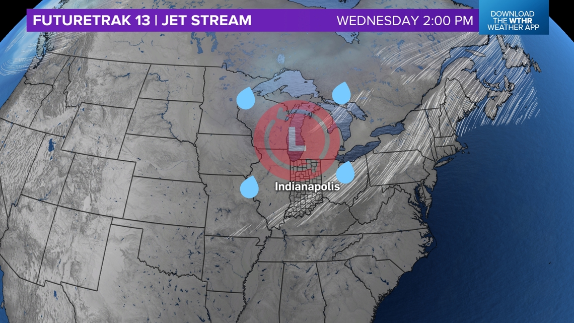
It won't rain every single day this week, but the highest chance for a few pop-up storms will likely be Monday and Wednesday. That's when parts of this upper level low will be colder across parts of Indiana.

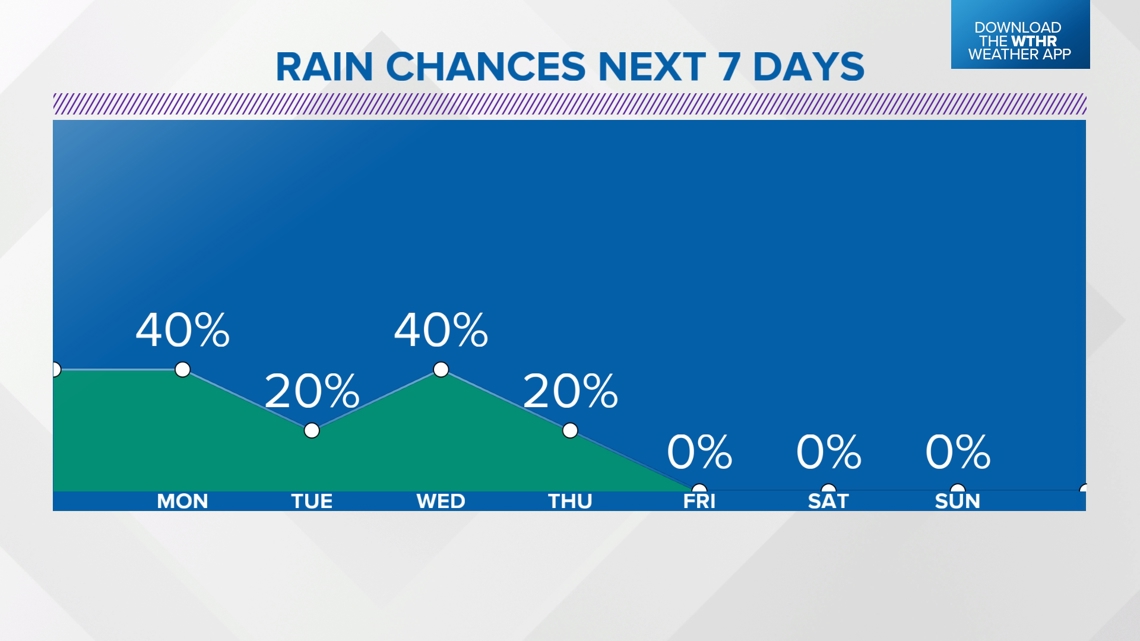
Later this week and into the weekend, higher pressure will return, bringing drier weather and more sunshine. Warmer weather may also come, too, with more sunshine expected.