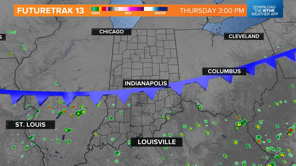
INDIANA, USA — One good push of scattered showers and storms hit central Indiana throughout Wednesday, but it will not last the rest of the week as a cold front swings south from Michigan. Expect pop-up storm chances to push south toward the Ohio River for the rest of the week, keeping most of Indiana drier.
Tap HERE to track pop-up showers and storms.
The front will bring slightly less humid air for the rest of the week. Dew points should fall to near 60 degrees instead of sitting in the mid-60s. It's a small difference but a noticeable one as you head outside.
Storms are likely to redevelop near Louisville on Thursday, but Indianapolis should be cooler. However, as the north winds move in, it may compress the air, and some thicker smoke from wildfires in Canada could temporarily stick in the skies above midday on Thursday, before finally being pushed south into Kentucky.
Tracking rain zones
We've made some maps highlighting which parts of Indiana have a higher chance to see a splash n' dash shower or storm the next 24 hours.
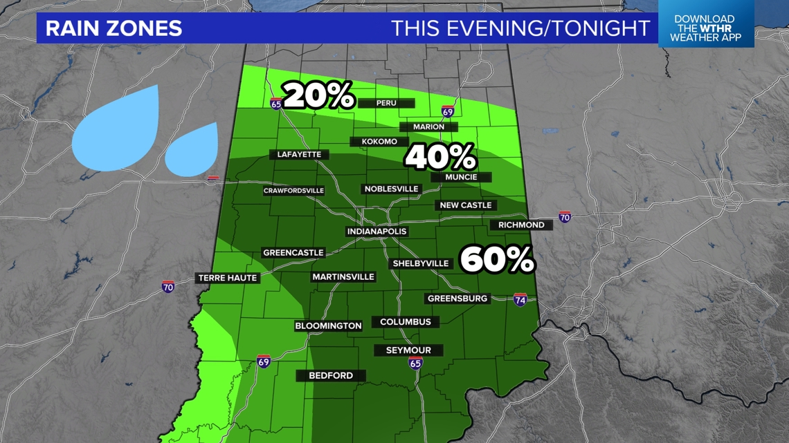
Wednesday night
After scattered storms Wednesday afternoon, there may still be some lingering rain chances into the evening and overnight hours. Not everyone will get one, but there is a decent shot of a few more downpours across central Indiana.

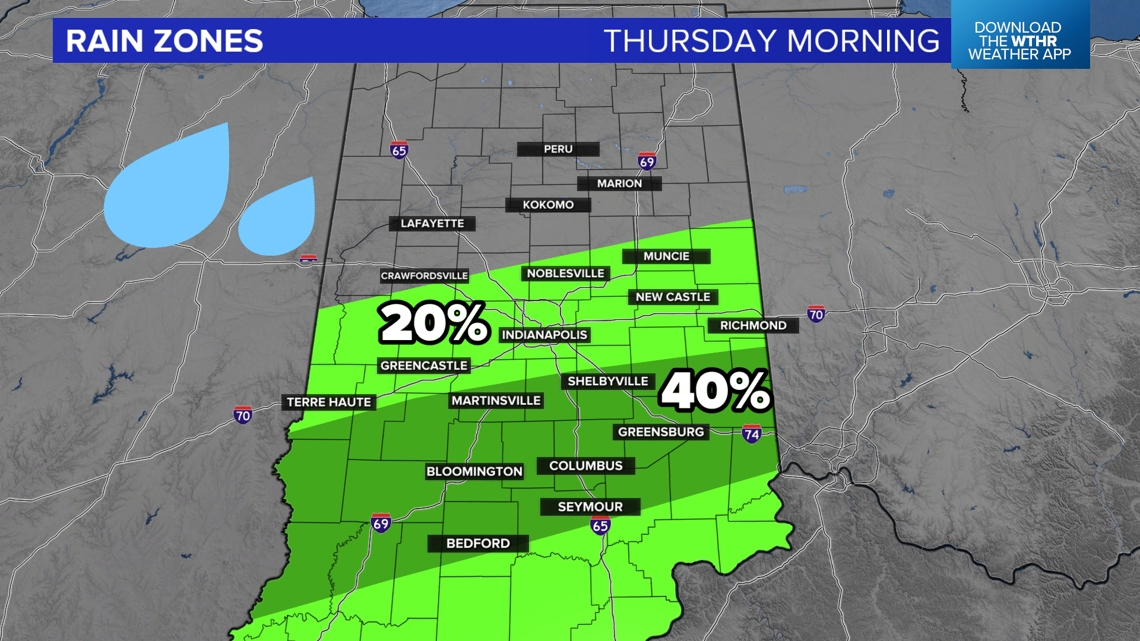
Thursday morning
Most of Thursday morning looks drier across Indiana. We can't completely get rid of a rain chance, but much of central Indiana will have a 20% chance of a shower. That's pretty low. However, there may be a small band of 40% rain chances from Bloomington to Greensburg.
This map, in particular, has a lower confidence level from the 13News weather team. The atmosphere is right on the edge of producing nothing or a couple small cells.
Don't be surprised if you are completely dry Thursday morning.

Thursday afternoon
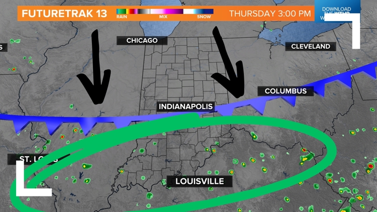
The rain chances push south! The exact cut-off is still TBD depending on the speed of the cold front. If you are north of the front, you will not get anything. For those still south of the front by the afternoon, watch for more showers and storms to redevelop.
Indianapolis has a 20% chance of rain. That's an 80% chance we don't get anything, too. Most rain chances will be south of Bloomington and Columbus.

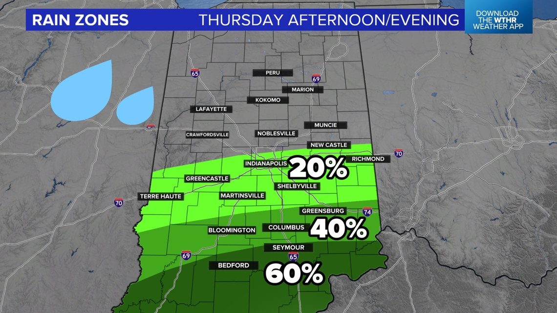
This front is helping to push the humidity back south. Locations near the Ohio River could be pretty unsettled Thursday afternoon and evening, while northern and central Indiana clear out.