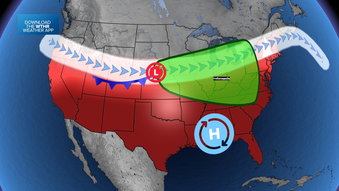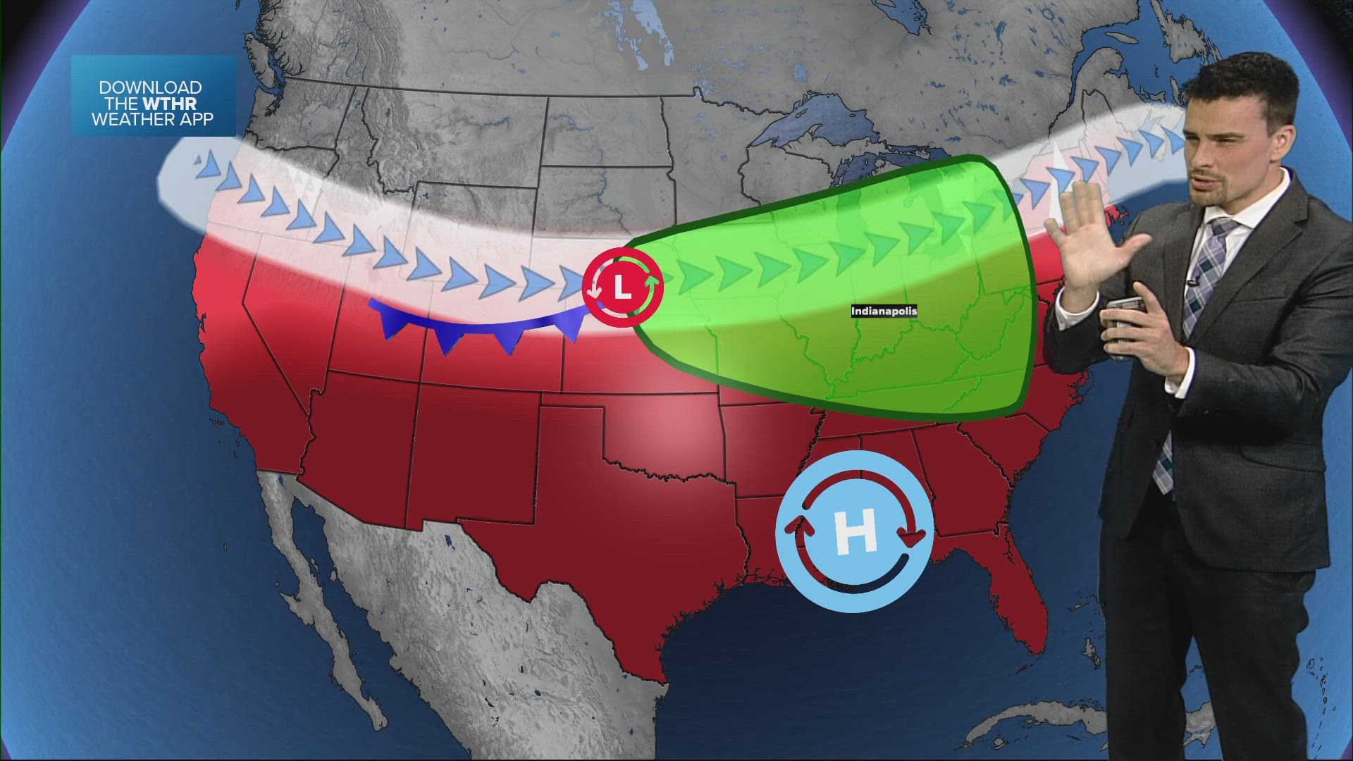
INDIANA, USA — After some showers and strong storms on Saturday, cooler air is on the way for Indiana. A cold front will bring north winds across the state, knocking out the heat and humidity for a couple days.
So, enjoy a refreshing Sunday and Monday!
South winds return by the middle of the first week of July, surging the humidity back just in time for the Fourth of July.
Tap HERE to track the front and the temperatures with our interactive weather maps.
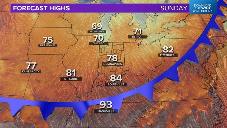
-Sunday: Highs in the 70s (north winds)
-Monday: Highs in the 70s (north winds)
-Tuesday: Highs in the 80s (south winds)
The air will feel much crisper starting Sunday. It will gradually get less humid throughout the day.


After 70s on Sunday, there may be a few 40s across northern Indiana by Monday morning.
Tracking lower humidity
The wind really helps either bring in muggy air, or it cuts it off dramatically. We will have much more comfortable air for the start of the first work week of July. It gets hotter by Independence Day.

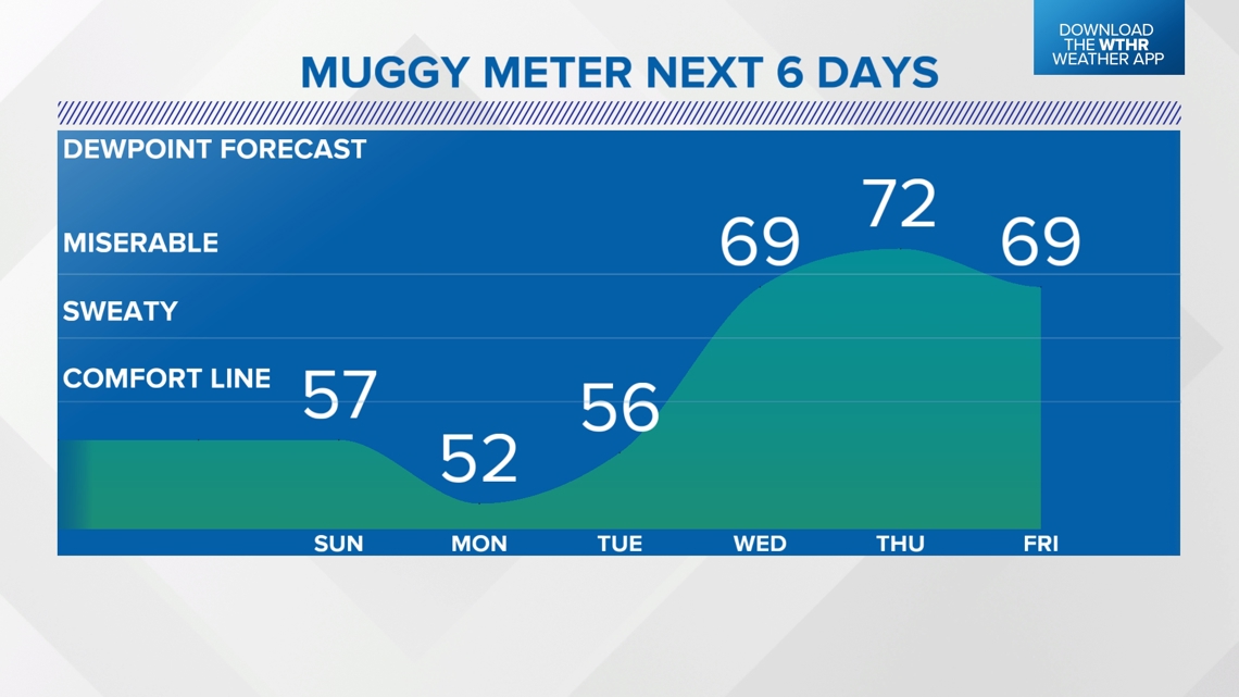
The jump in the humidity hits by Wednesday. Thursday will be the most humid day (Fourth of July).
Tracking more storm chances around the 4th
The jet stream will come back to Indiana by the middle of the week. That will create a more unsettled weather pattern. Plus as the humidity comes back, more water will be available to create scattered rain and storm chances.
Watch for on-and-off rain from Wednesday through Friday. There will be multiple clusters of rain likely over those days, but it won't rain the entire time. Expect lots of heat and high humidity in between rain chances.