
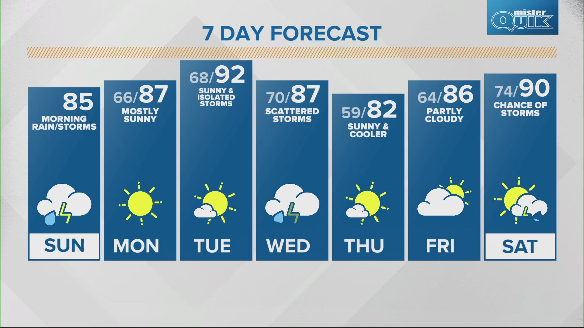
INDIANA, USA — More swings with heat and humidity will be likely across Indiana this week. Instead of high heat every single day, the heat dome is pushing west to allow some shots of cooler air to arrive. These fronts will bring storm chances. The highest storm chances for Indiana this week will likely be Tuesday night through Wednesday. Some storms may turn severe with wind and hail.
Tap HERE to track the incoming front with our interactive radar.
Weather setup
A lot of things are happening on this map. The "H" indicates the high pressure heat dome that has baked Indiana for the first half of June. The center of the highest pressure is moving west, bringing the most intense heat with it. It will still be hot at times in Indiana, but a jet stream will bring some occasional fronts with storm chances.

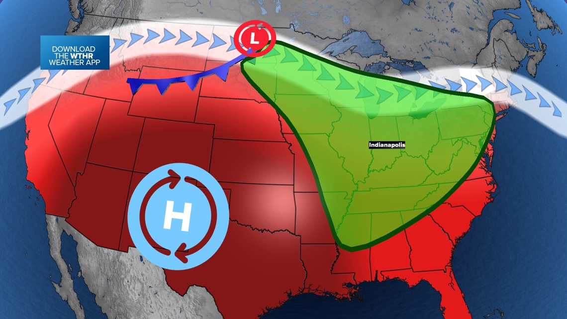
The green zone shows the areas for rain and storms to develop ahead of the cold front. This includes Indiana.
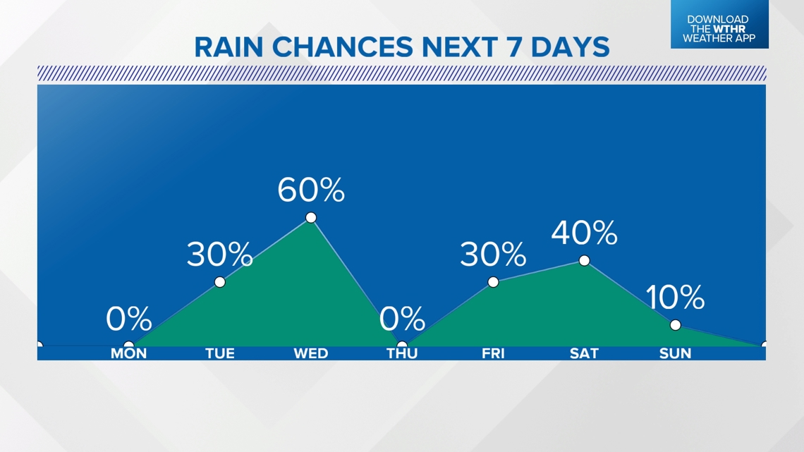
Expect the front to approach midweek. Rain chances (some severe) will arrive sometime Tuesday night into Wednesday for Indiana. Then the cooler air with the front will likely arrive Wednesday night, keeping the rest of the week slightly cooler and less humid.

As the higher pressure moves west, the jet stream will be able to get a bit closer to Indiana. Mini shots of cooler air will arrive at times lasting for a couple days before heat returns.
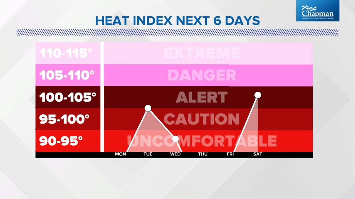
The heat index forecast is all over the place. Expect high heat and humidity Tuesday, and then again this coming weekend.
How bad will the storms be this week?
(Note: The timing of storms will be crucial in forecasting how strong the thunderstorms will be. If storm chances move into the middle of the afternoon or evening, the storms will have a higher severe possibility. If they arrive later at night or the morning, the storms will likely be weaker.)
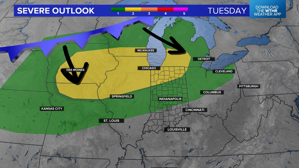
Scattered storms will develop over the northern Plains on Tuesday. The jet stream should help push storms southeast toward Indiana. Timing will adjust over time. The latest data suggest that an isolated storm or two may bubble up Tuesday, but more organized rain and storms may arrive early Wednesday morning. After these, storms may redevelop later Wednesday afternoon.

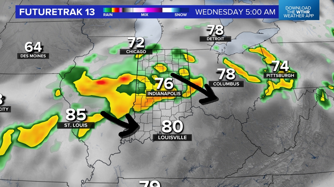
There is a severe zone posted for Tuesday night. Storms will start to the northwest in Illinois and push southeast into Indiana. They should slowly weaken over time into early Wednesday morning.
The strongest storms are likely to be in northern and western Indiana.

Rain chances are a little higher this week overall. That's great news as some dry conditions take over Indiana. NOAA hasn't put us under a drought yet, but we are one level underneath -- abnormally dry.
The best chance for rain will be Tuesday night, Wednesday on-and-off, Friday night, and Saturday.

— 13News Meteorologist Matt Standridge