INDIANAPOLIS — The primary forecast focus will be the risk of strong to severe storms tonight.
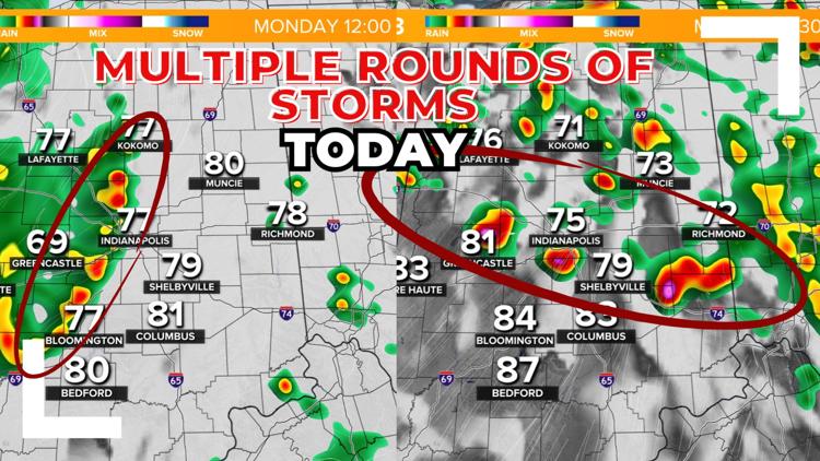
But first, a complex of storms has been tracking toward central Indiana so far today and will bring a few scattered storms through the area during the late morning and early afternoon. It's a low-end severe risk with this round, but gusty winds and heavy rain are likely.

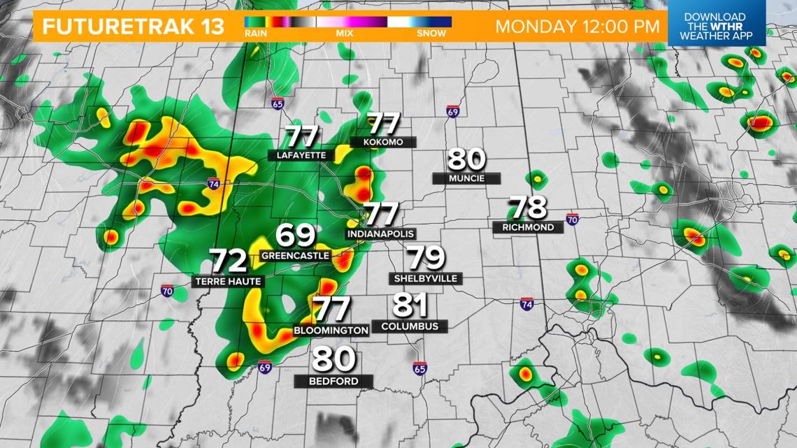
Temperatures recover through the 80s this afternoon with a brief break in rain/storm activity.
Severe risk tonight
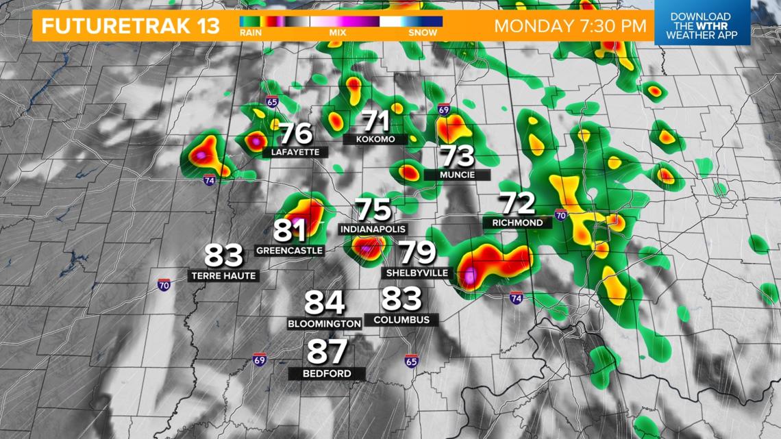
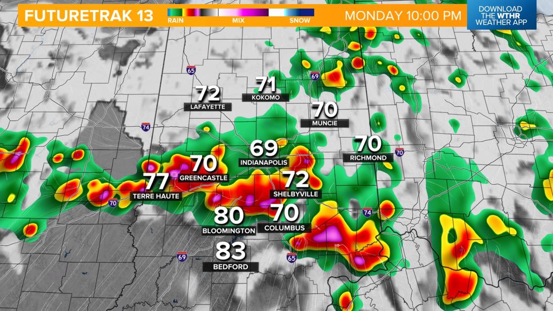
Depending on how well the atmosphere recovers from the earlier round of storms, we'll see another round fire up after 5 p.m. The Storm Prediction Center has placed the southwestern tier of central Indiana under a level 2 of 5 for the risk of scattered severe storms.

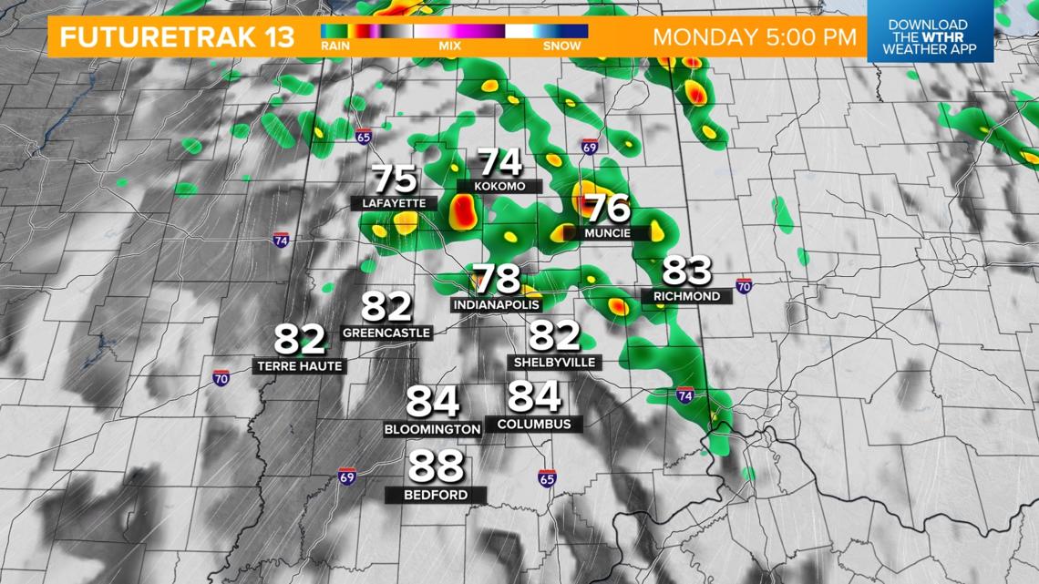

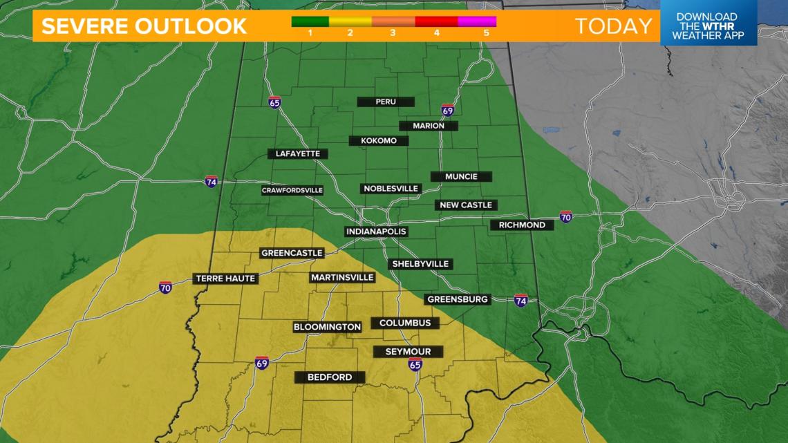
THREATS: Primarily damaging wind gusts leading to down trees/branches, localized power outages. Secondary threats include hail and isolated tornadoes.
Storms continue to strengthen this evening and will become more widespread. The threat of severe storms tapers off before 2 a.m. Tuesday.



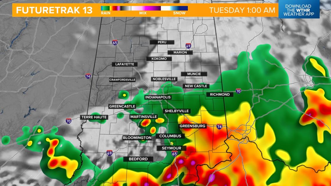
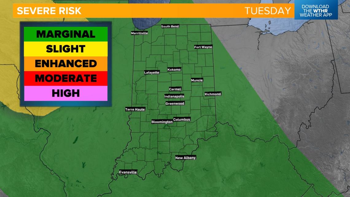
Tuesday severe risk
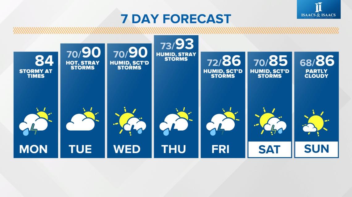
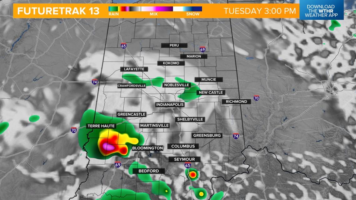
While all of Indiana remains under a low risk of severe weather, storms will again be possible mainly in the afternoon during the peak heating of the day. Highs will be near 90, with heat index levels approaching 100.


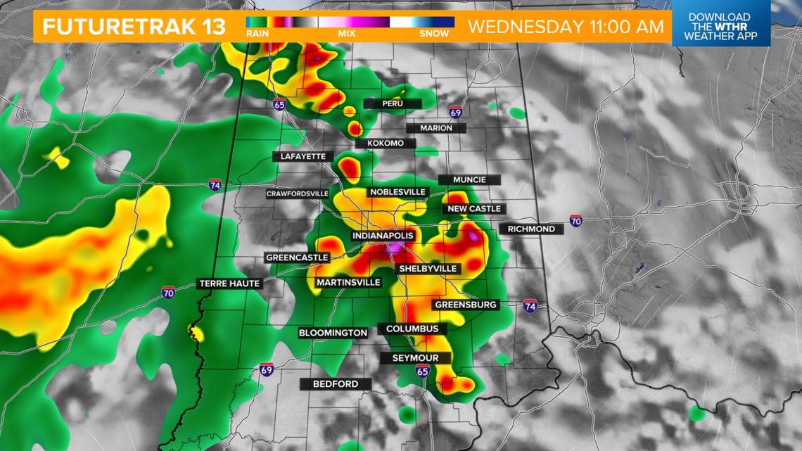
WEDNESDAY: A low-end threat of isolated strong to severe storms continues, especially in the late morning and afternoon, as the primary focus of the forecast shifts to the high heat and humidity. Highs on Wednesday will again be near 90, but heat indices climb into the 100-110 degree range.


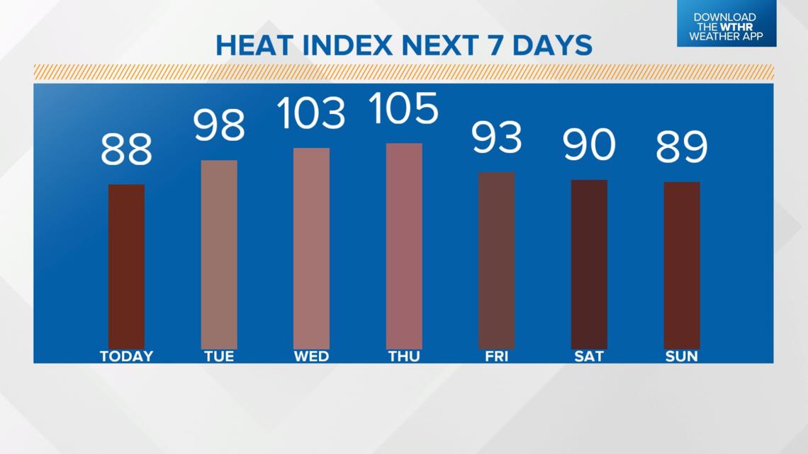
Stretch of dangerous heat this week
Heat index values will be at or above 100 degrees Tuesday through Thursday this week. Remember to plan ahead to avoid being outside for prolonged periods during the peak afternoon heating hours.
The risk of scattered storms will remain in the forecast through the early weekend, but temperatures will become more seasonal starting Friday.

