

INDIANA, USA — Finally, some rain chances and cooler air are in the forecast for Indiana! It will be quick.
Tap HERE to track the rain and cooling temperatures with our interactive weather maps.
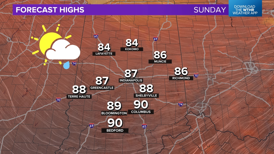
We are tracking a cold front moving into Indiana for Sunday, bringing some rain and high temperatures in the 80s. The humidity will also drop a little for the rest of the weekend and for the start of next week.
Thank you, heat dome, for moving away from Indiana (at least temporarily).
What is happening to the heat dome?
June 2024 has been warmer than average almost every single day. The heat dome that has locked in heat and humidity is starting to weaken and move back west. This pattern change will help bring a few days of cooler weather, mixed in with hot days. Long-lasting cool air is tough this time of year. We'll take it in short spurts at least!
Heat domes cannot last forever. During the summer they may not completely go away, but they do shift over time from west to east. Right now, we are seeing that shift to the west.

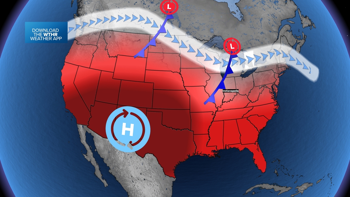
As the higher pressure moves west, some weak cold fronts will be able to sneak in from Canada to Indiana. They will not be long-lasting, but some days in the 80s sound great!
Tracking the cold front | When will it rain?
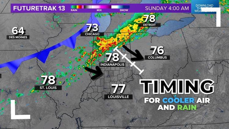
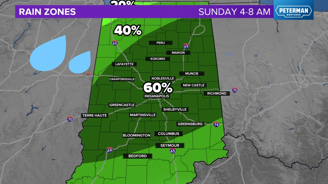
Scattered severe storms have been popping up over the northern Corn Belt in Illinois and Iowa. The leftovers of these storms will push southeast into Indiana early Sunday morning, weakening over time. The rain will arrive into central Indiana after 3 a.m.

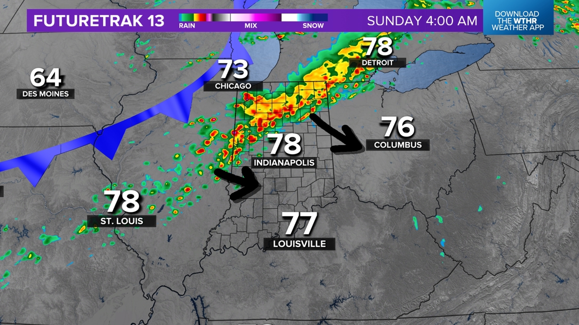
Severe threats are very low for Indiana. A severe warning could pop up for NW Indiana, but central Indiana should be good. We'll track the rain, so stay tuned for updates HERE.
Expect rain to move in before sunrise across much of central Indiana. It will only last for 2-3 hours. The heaviest will be north of Indianapolis. The band will continue to weaken and break apart on its journey southeast.

Let's chat rain zones.
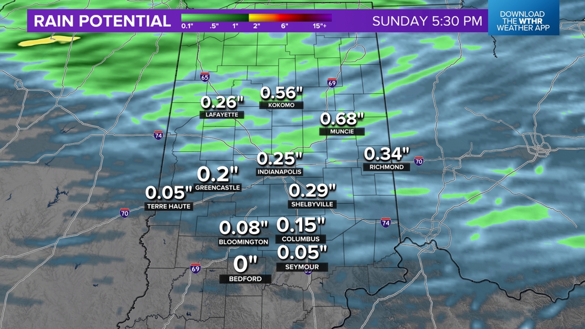
Most of Sunday will be dry. The heaviest rain chance will arrive before many Hoosiers are up on a Sunday morning. You may walk outside and see parts of the ground wet. After that, many of us may not see anymore rain the rest of the day, other than a stray, spotty shower.
The best chance for rain will be from 4 a.m. to 8 a.m.

After 8 a.m., the consistent rain should start to leave and push southeast toward Cincinnati.

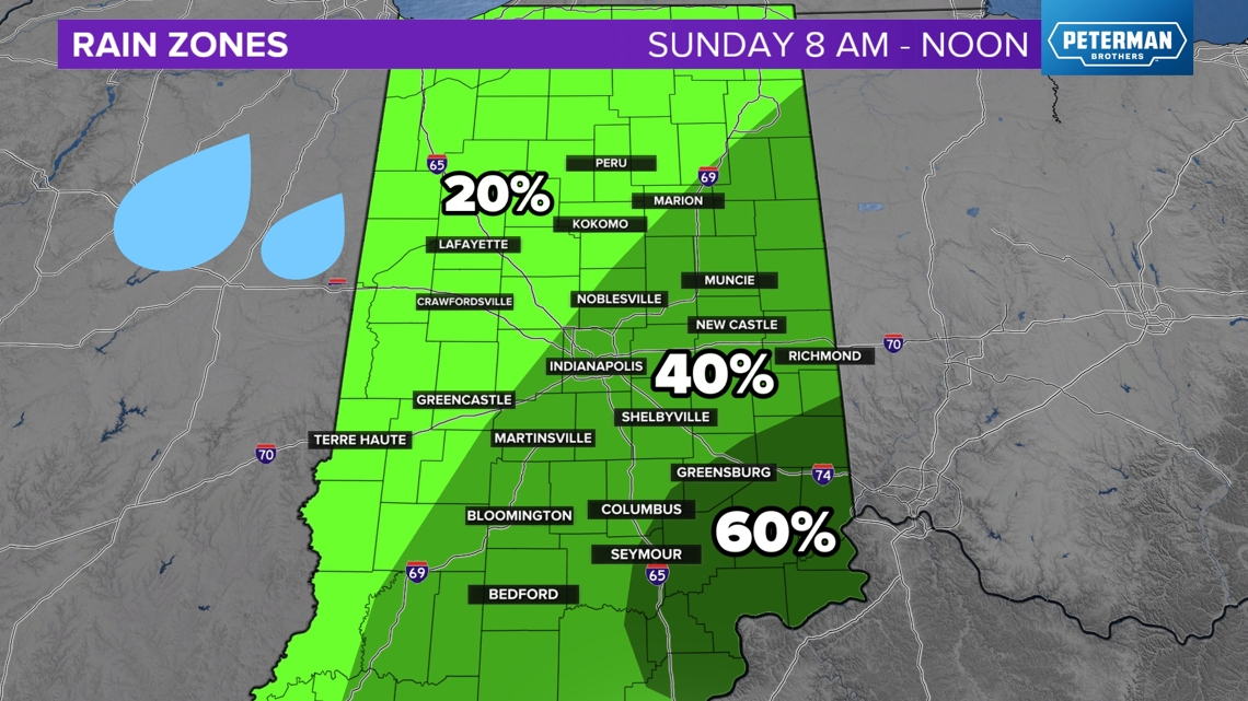
After lunch or noon, most of the rain will be done for the day. However, we may still have some lingering chances for a spotty shower. These will be random and moving from northwest to southeast with the new northwest wind. Rain chances drop to 20% until about 6 p.m.

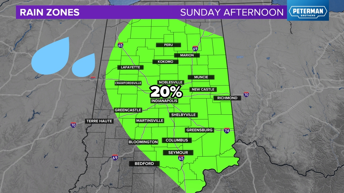
Many Hoosiers will not get any rain in the afternoon. However, still watch the chance for a spotty shower Sunday afternoon.
Cooler Sunday afternoon
Enjoy Sunday's weather! It will feel cooler, and gradually, the humidity will drop during the afternoon. It may still be very muggy in the morning, but then, the humidity should lower a bit after 2 p.m., thanks to northwest winds.
Overall, the day will still be above average for this time of year (average highs are around 83 degrees). But relatively, enjoy the slightly cool weather.

This cooler air will last Monday as well. There will be another spike in the heat and humidity on Tuesday and Wednesday.
-13News Meteorologist Matt Standridge
