INDIANAPOLIS — Today is the day central Indiana transitions out of a fall-like pattern as heat builds back into the region — and will likely continue through the extended forecast period.


WEEKEND WEATHER HEADLINES:
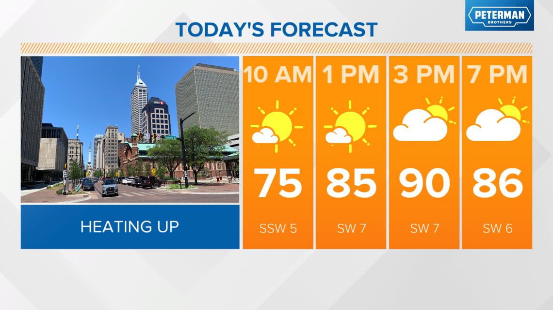
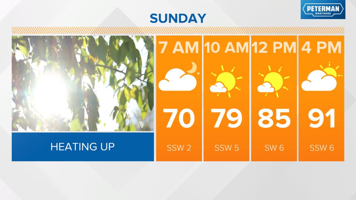
- Highs near 90 degrees today
- Fair weather clouds developing during the peak heating hours this afternoon
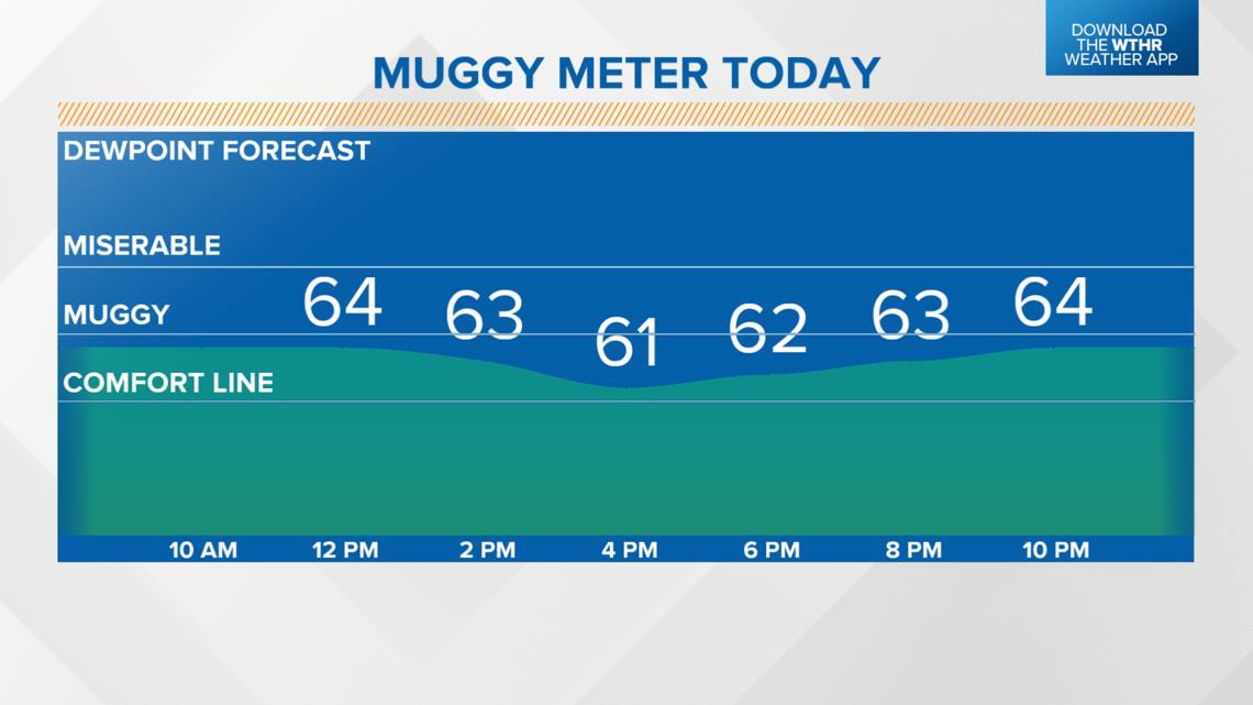
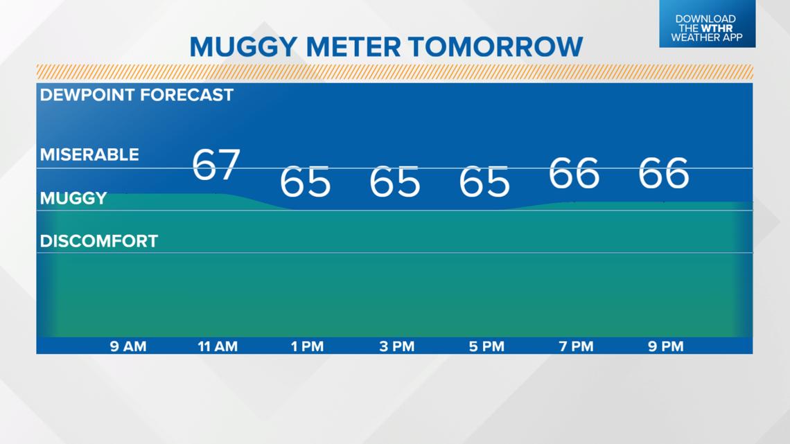
- Muggy, but dew points actually stay shy of the miserable zone


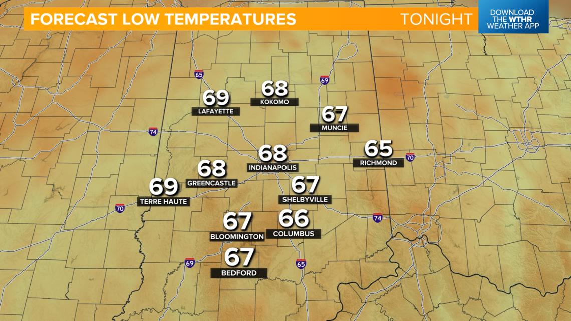
- After several days with low temperatures in the 50s (40s even in some outlying locations), we'll stay warmer in the upper 60s

- Highs in the low 90s
- Mostly to partly sunny sky
- Dew points will climb slightly so you may notice higher humidity


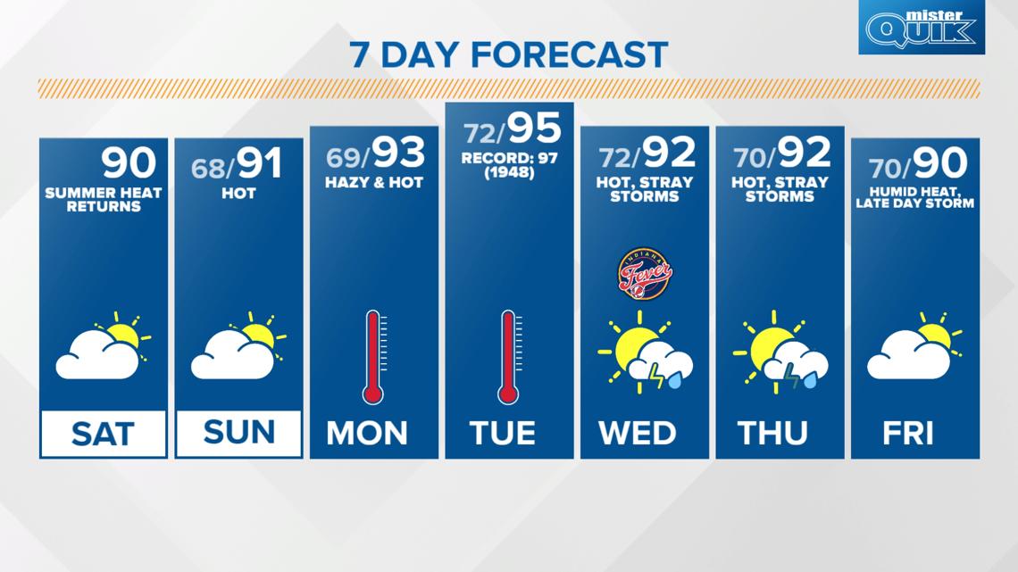
How long is this heat streak with highs in the 90s expected to last?
The heat streak is expected to last at least for the extended forecast (next 7 days).
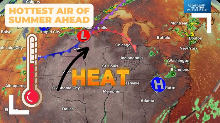
A heat dome that has been impacting the desert southwest will continue to push northeast shifting the core of the hotter air over our area.
Highs will likely be in the low 90s throughout the duration of the work week with the hottest day in the mid 90s on Tuesday (the standing record is 97 from 1948).

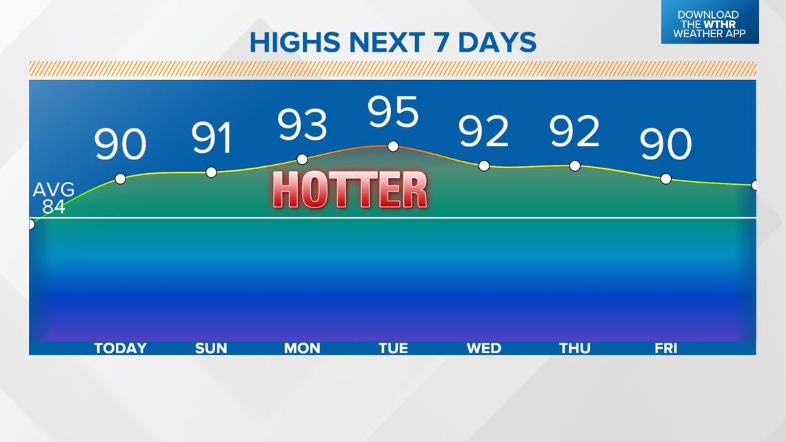
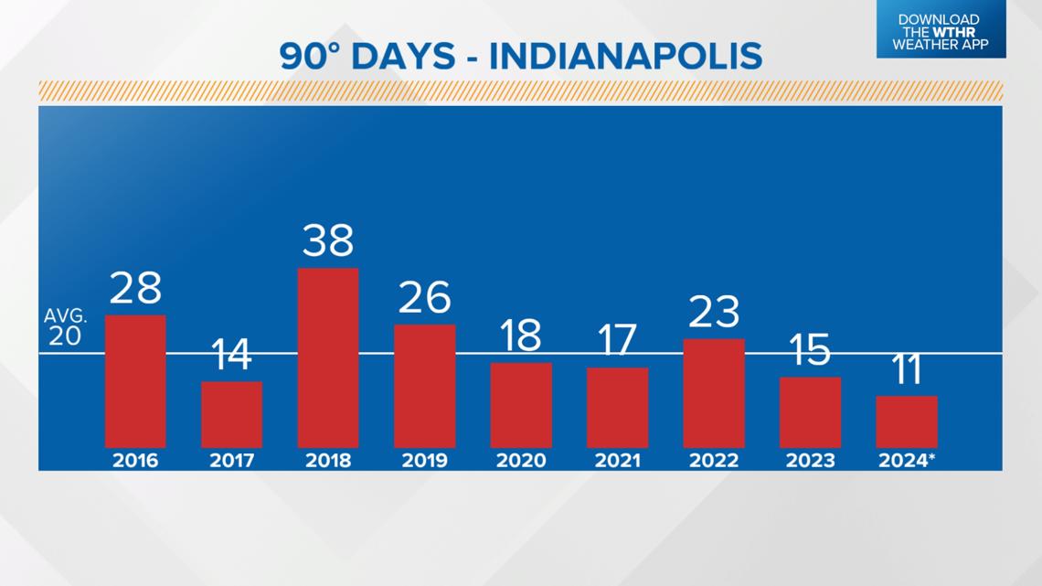
So far in 2024, Indianapolis has had a high temperature of 90+ degrees 11 times with the day to date hitting a high of 93 degrees on June 17.
On average, Indy sees around 20 days with highs at or above 90 degrees so we will likely get closer to that number after this week.

We'll also see limited rain chances to start the week with only a chance of stray storms for Wednesday and Thursday.
Long range models are hinting at this heat streak continuing through next weekend with highs pushing 90 degrees.