INDIANAPOLIS — For weather record-keeping sake, the "meteorological" summer season ended Aug. 31 and September officially begins the "meteorological" fall season.
Looking back at the past three months, Indianapolis averaged a temperature of 75.4° which is 1.5° above average — tying for the 29th-warmest summer on record. We finished with 11.43" of rainfall. That is -0.4" compared to normal, making this the 68th-wettest summer on record.
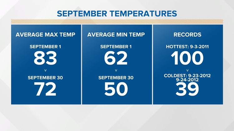
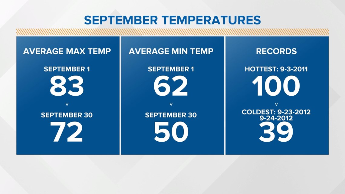
Looking ahead to the month of September, the average high will fall from 83° to 72° and the average low from 62° to 50° during the month. The hottest September day on record was back on Sept. 3, 2011 with a high of 100° . The record coldest temperature is 39°, which occurred on both Sept. 23 and 24 in 2012.

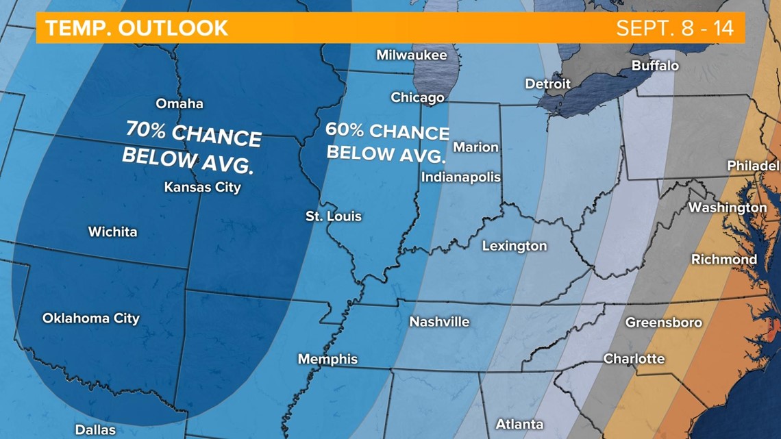
The forecast looks cool in the upcoming weeks. The Climate Prediction Center has most of the Great Plain states under a 70% chance of below-average temperatures and central Indiana under a 50-60% chance of cooler-than-average temps for Sept. 8-14.

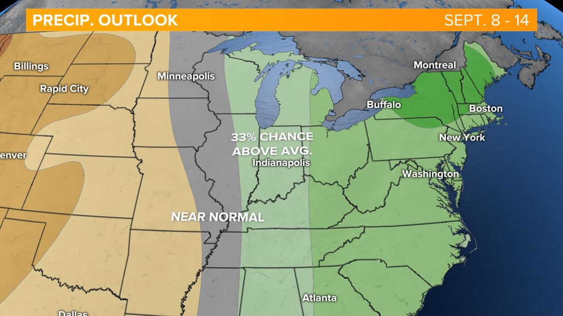
As far as rainfall, we're looking at slightly above-average precipitation in the 8-14 day outlook. The average rainfall for Indianapolis during the month of September is 3.12".

