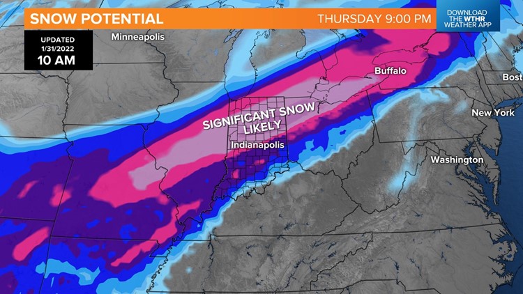
INDIANAPOLIS — Winter Storm Watches are now posted and will be in effect Wednesday night through Thursday night for central and northern Indiana. These will eventually become warnings and may expand as confidence continues to grow for a high-impact storm. Power outages and tree damage will be possible through the duration of the storm, along with very difficult travel.

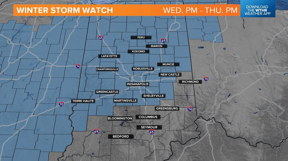
Latest timeline:
Tuesday night rain moves in after 5 p.m. and changes over to snow overnight for northern Indiana.

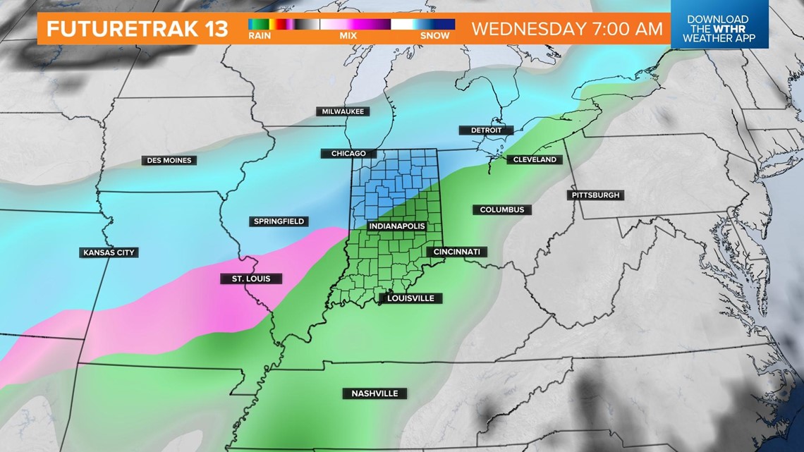
Rain will be the most likely precipitation type for southern Indiana through Wednesday afternoon, with snow continuing across the northern tier of the state. The Indianapolis metro area, including the I-70 corridor, will be in the transition zone with a mix of rain and freezing rain possible.

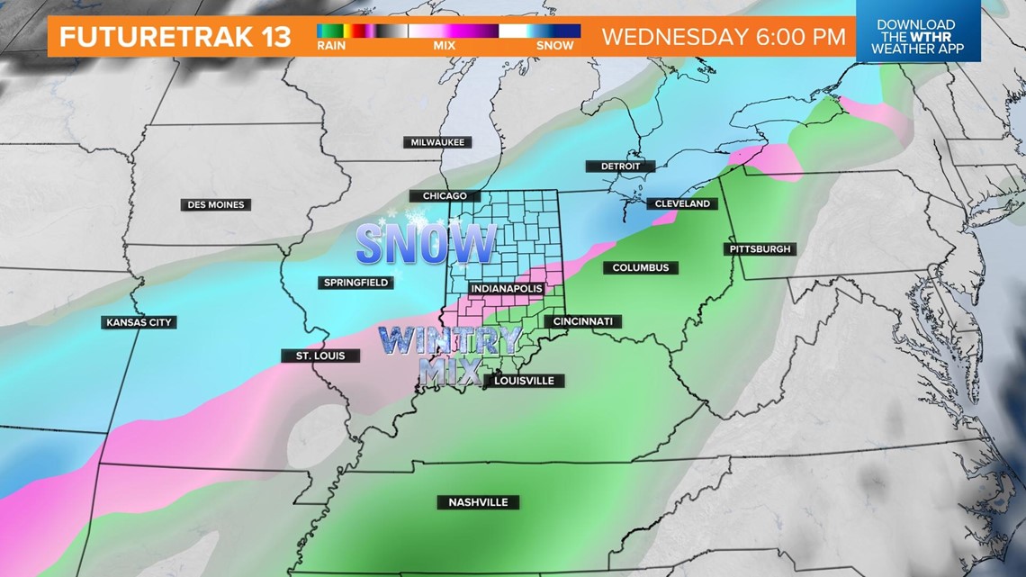
Colder air pushes farther south by Thursday morning. Freezing rain will be likely across the southern tier of the state, as the precipitation transitions to snow along the I-70 corridor. Ice accumulation is likely at this point, leading to downed trees, power outages, and dangerous road conditions.

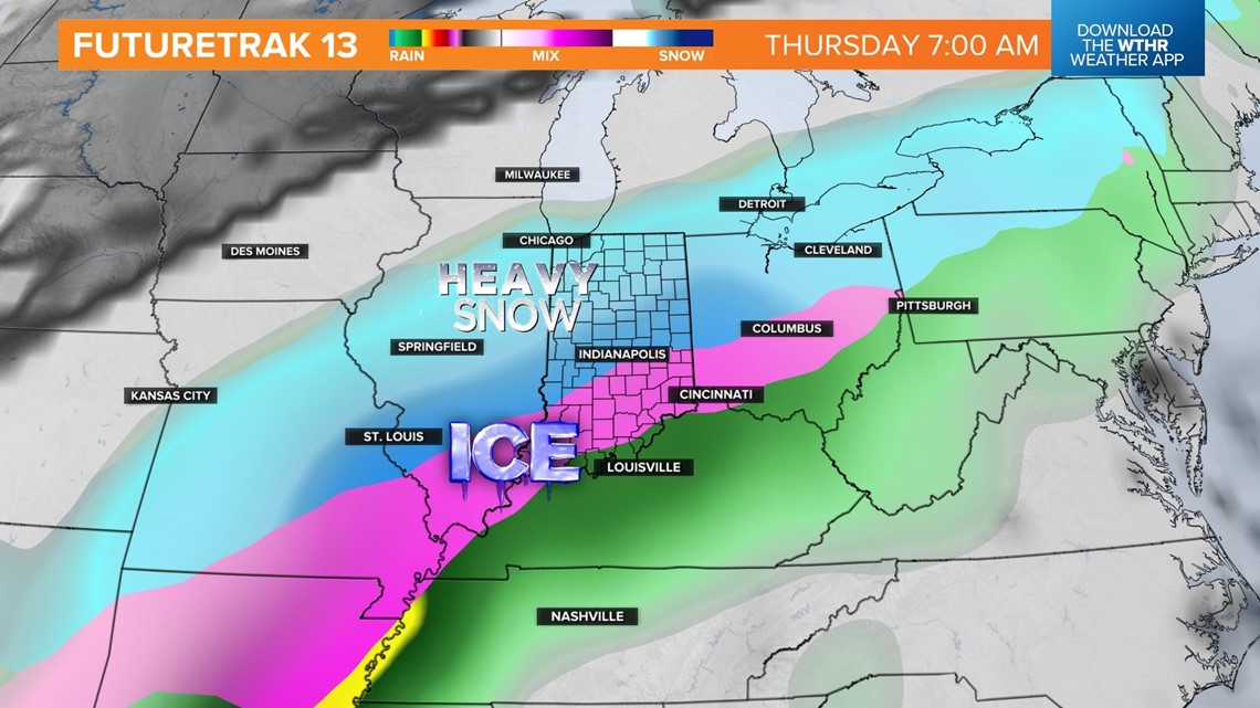
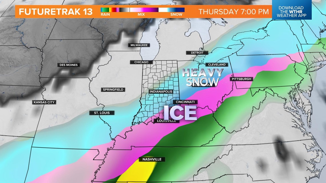
Snow will be the primary precipitation type by Thursday evening as the storm system begins to exit to the east.

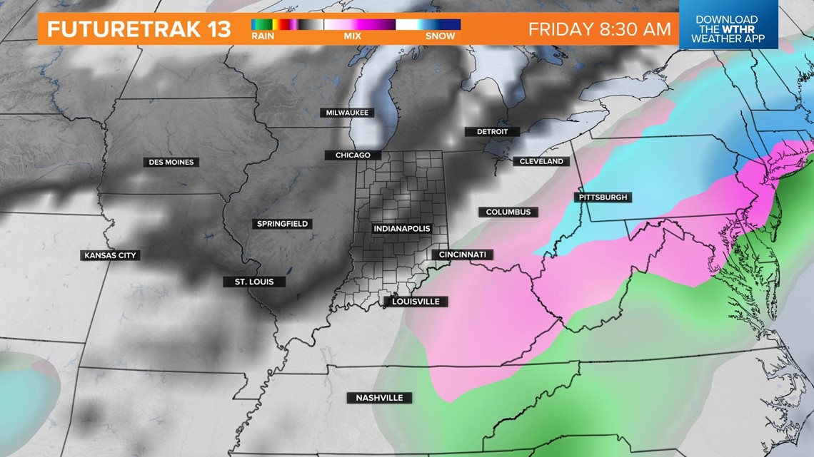
By Friday morning, we'll be on the backside of this system, but impacts will continue as temperatures drop into the single digits and highs only in the upper teens.

Forecasting snow/ice amounts will be more challenging around the Indy metro due to the potential of mixed precipitation types. Regardless, this will be highly disruptive, especially Wednesday night through Thursday.


The heaviest snow (10"+) is expected over the northern third of Indiana that comes from two waves of heavy snow — Wednesday 4 a.m. to 7 p.m. and Thursday 7 a.m. to 7 p.m.


