INDIANAPOLIS — Tonight is the quiet before our next severe weather outbreak.
Thankfully, there's a "lid" over central Indiana preventing storm development and it's due to significant warming in the mid-levels. That warming is reflected at the surface with our warmest temperatures since late September and the earliest 80° day in a year since 2012.
The 80° reading officially in Indianapolis ties the daily record high and is 20° above average for early April. Without the aforementioned "lid," storms would be more prevalent and likely be producing severe weather. But there's only a slim storm chance before 5 a.m. Wednesday.
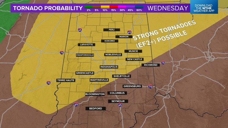
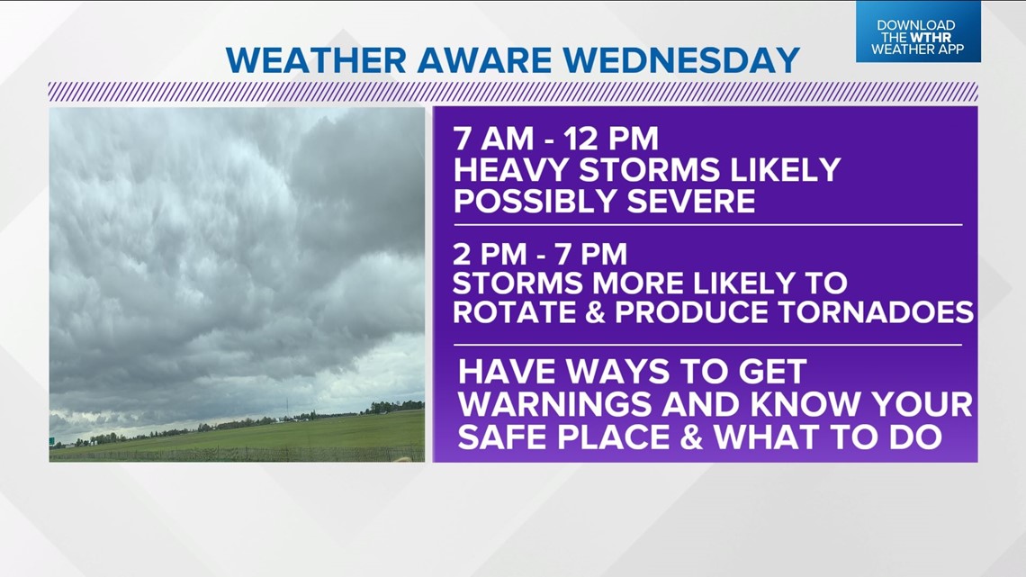
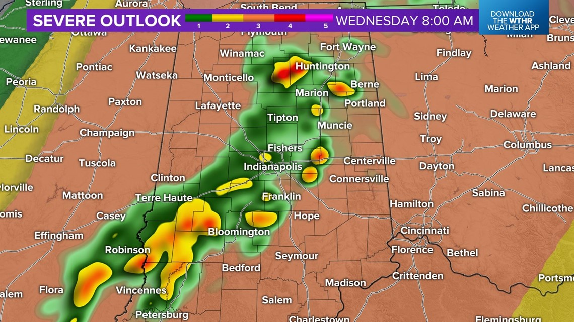
We can't stress enough the importance of being Weather Aware on Wednesday. The slower nature (afternoon/early evening) of an approaching cold front ups the ante for the atmosphere recharging quickly after expected morning downpours/storms. That first round - from 6/7 a.m. to 11 a.m. - will be mainly heavy rain, lightning, and possibly some hail. The more violent storms would come from round two in the 2 p.m. - 7 p.m. window.


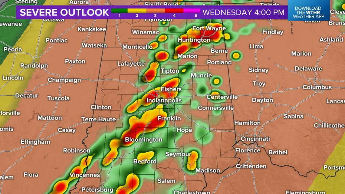
The modeled atmosphere over central Indiana during that time supports the idea of potentially long-track rotating thunderstorms (similar to Friday). While it's impossible to say exactly where they'll track ... we do know storm movement with cells in the afternoon will be rather quick east-northeast at over 60 mph.

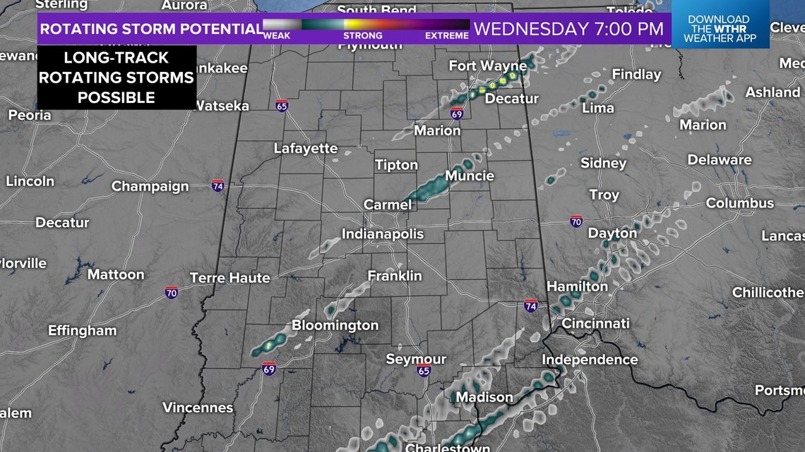
Modeling shows potential of long-track rotating storms around Wednesday ... especially within the 2 p.m.-8 p.m. timeframe. Don't focus on specific areas of modeled rotation tracks (it's impossible to say where they may ultimately go) but more on the idea that there could be multiple rotating storms over a long duration.
There are several potential scenarios of how Wednesday ultimately plays out, but we need to at least plan for and be prepared for multiple tornadic thunderstorms and storms with severe wind/hail. The threat of severe will be over by 9 p.m. Wednesday as cooler air arrives in the wake of a departing cold front.
This will be the second big severe weather day in central Indiana in a week with the tornado total continuing to climb from last Friday night.
At this time, NWS offices have confirmed 22 tornadoes now ... which is essentially the state's annual average of tornadoes in a mere four hours.

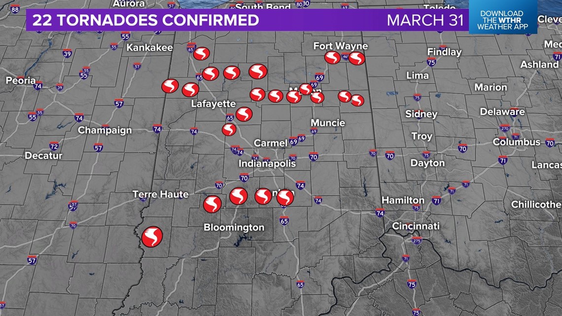

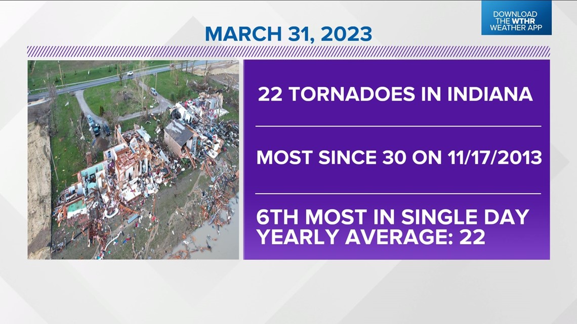
That's the most since the Nov. 17, 2013 outbreak and sixth most for a single day on record. But it's easily in the top tier for number of nocturnal tornadoes in a single event.
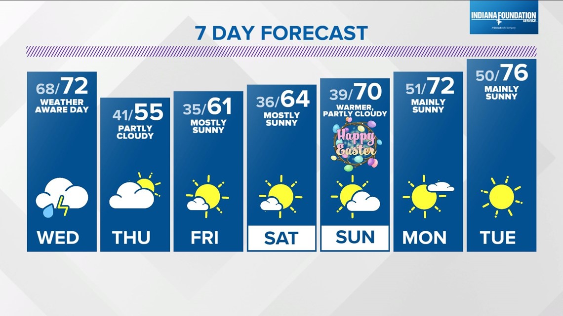
After Wednesday, tranquil weather for several days heading into Easter weekend ... which at this time looks rather pleasant with warming temperatures to near 70° Sunday afternoon.
Please follow the forecast closely the next 24 hours and be prepared to take action when/if needed. Thanks for trusting us to keep you safe and you count on us to be on top of the weather from start to finish Wednesday.