
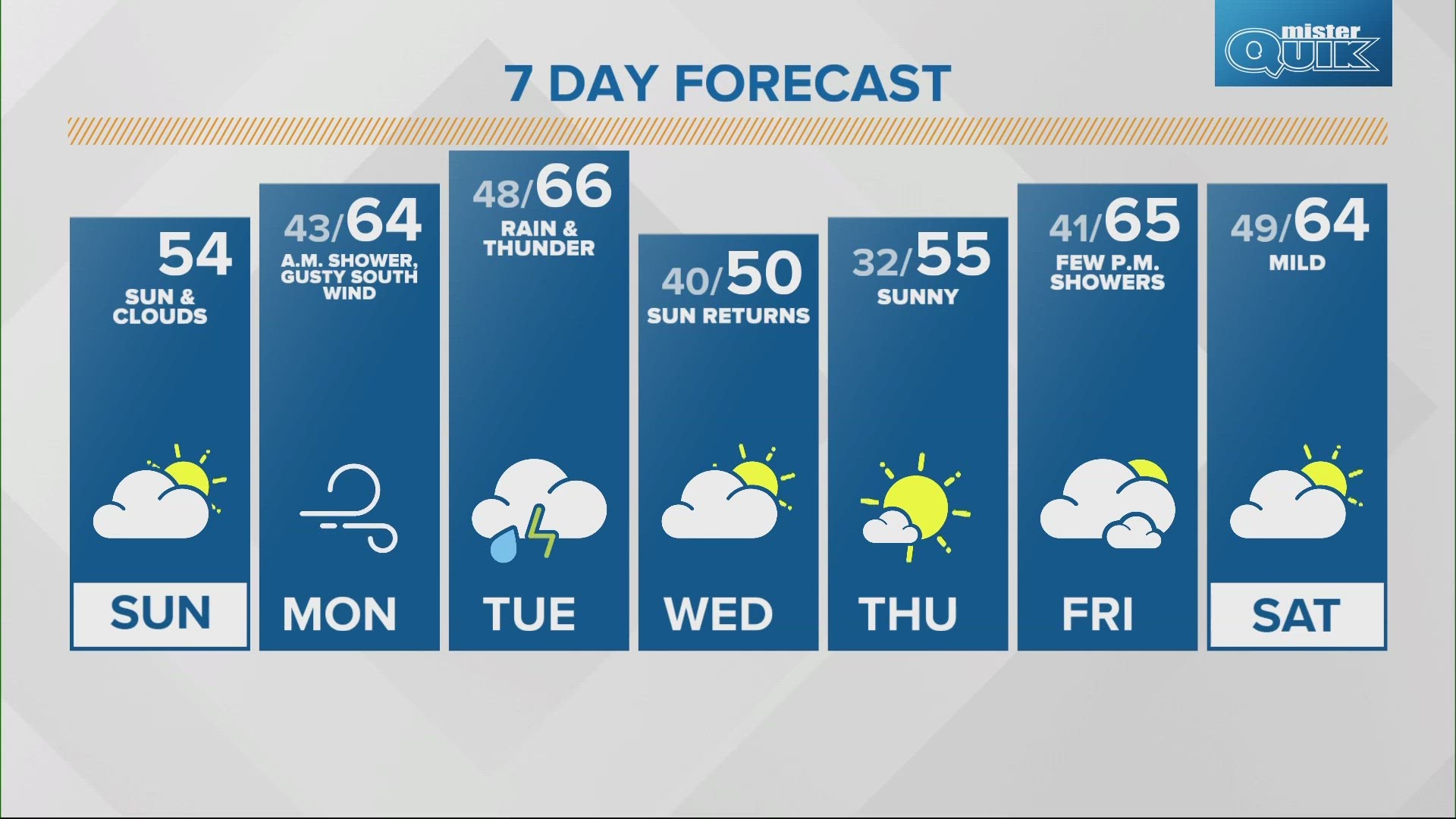
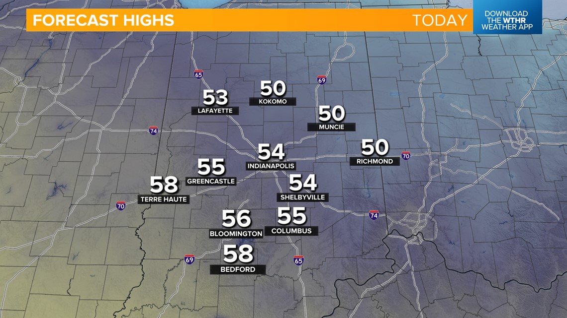
INDIANAPOLIS — Winds will shift from the southeast today, allowing temperatures to climb to more seasonal levels. Look for highs in the low to mid-50s this afternoon, with a mix of sun and clouds.


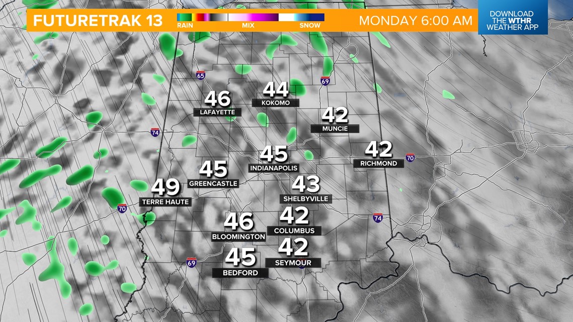
Clouds will increase overnight and bring a stray rain shower chance as a warm front lifts through. Temperatures will be more mild as well, with lows in the low 40s Monday morning.

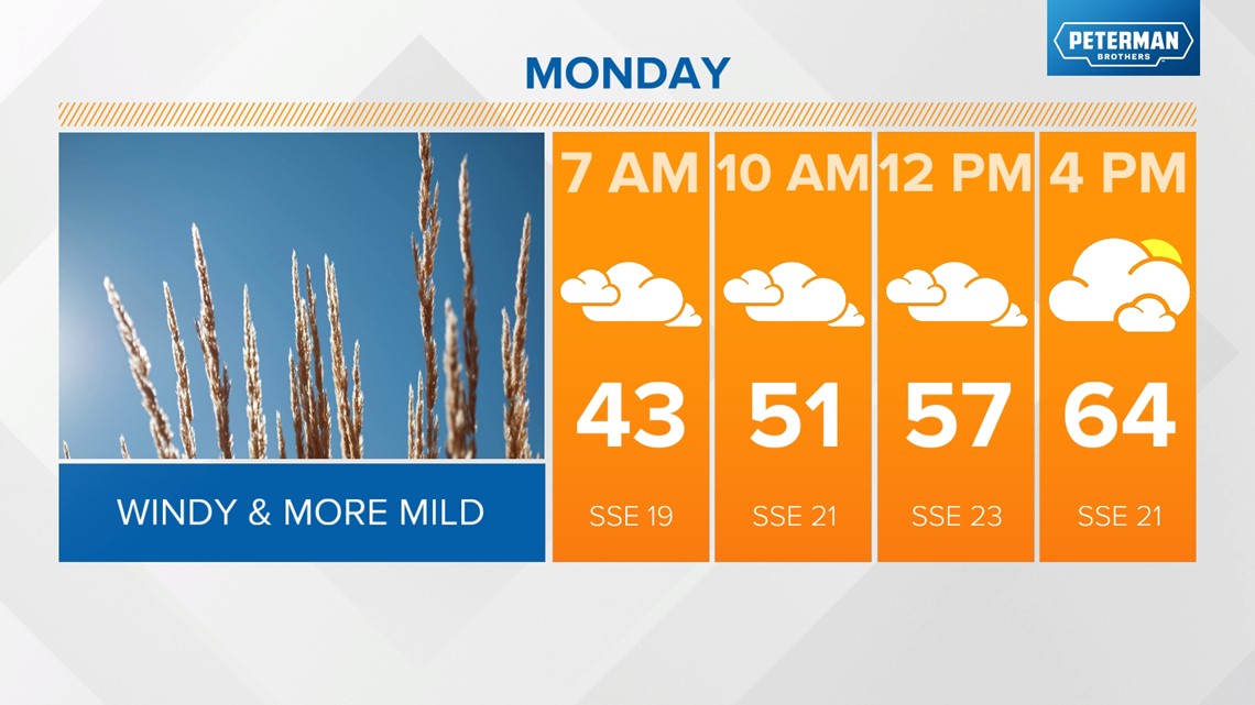

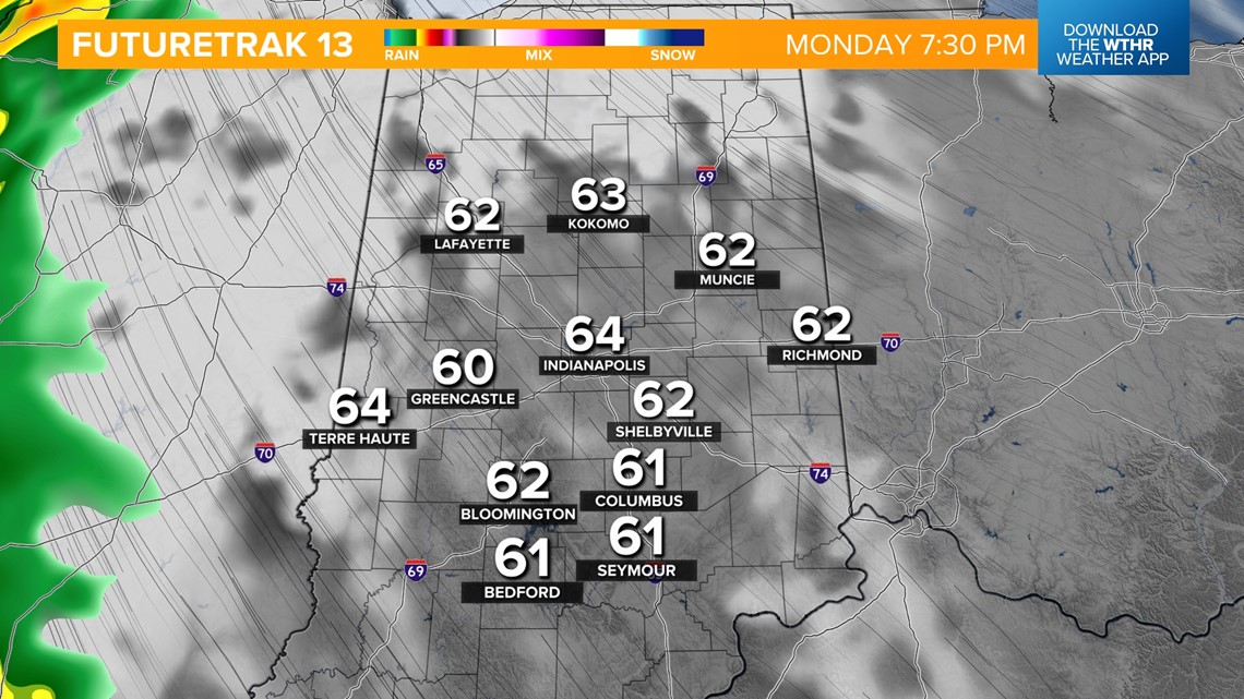
Central Indiana will sit on the warm side of this weather system through the day Monday, bringing strong southerly wind gusts, up to 40 mph at times. This pushes temperatures into the mid-60s. We'll be mainly dry Monday with partly sunny skies.

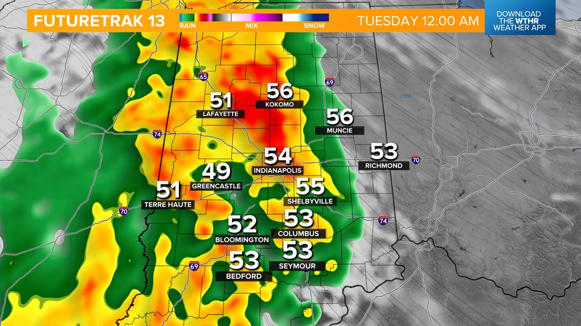
Monday night into Tuesday morning will be the timeframe widespread rain will be most likely.


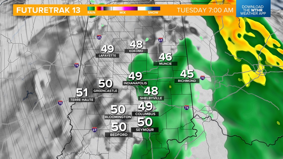
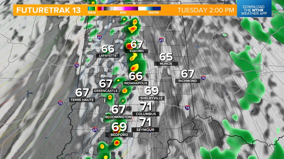
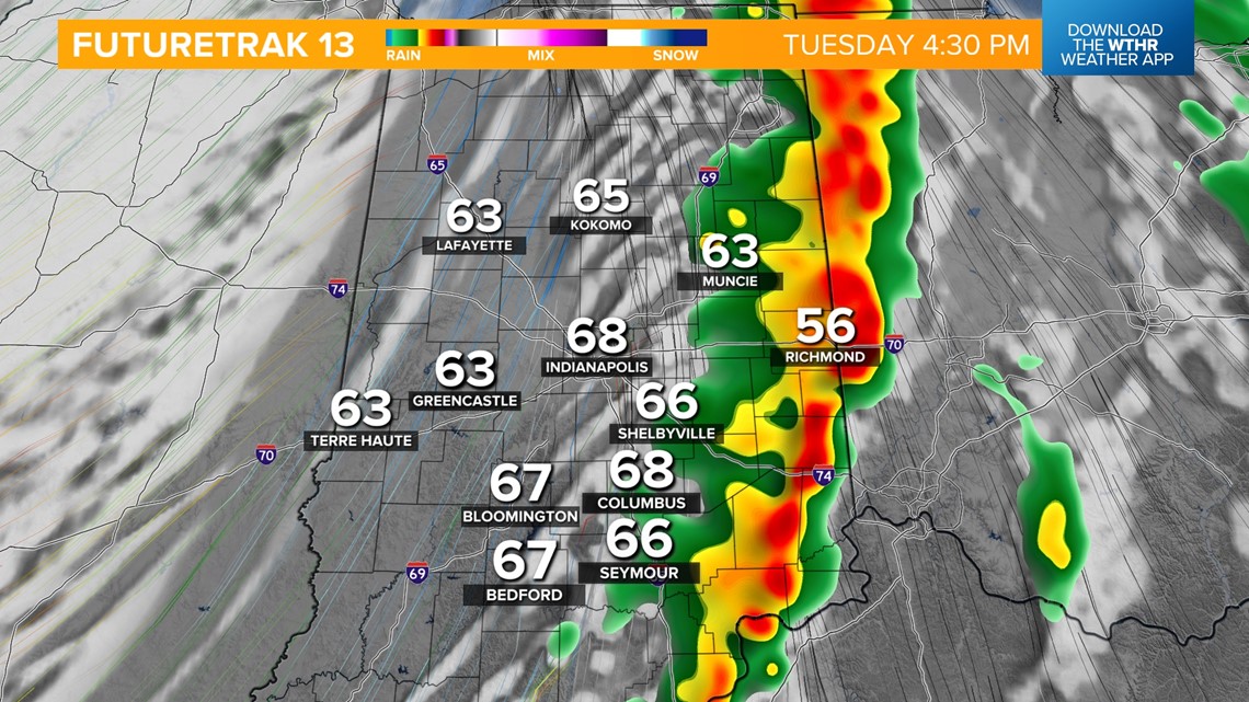
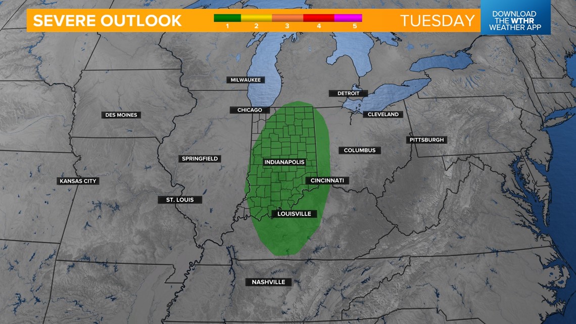
We'll then see a slight lull in rain through the late morning/early afternoon as temperatures recover into the mid-60s. The cold front then moves through in the late afternoon and brings a secondary round of steady rainfall and a few thunderstorms. The Storm Prediction Center has placed most of the state under a Level 1 of 5 for the threat of an isolated strong to severe storm along the frontal boundary Tuesday afternoon.


Rain will move out by Tuesday night as this system pulls east. Wednesday looks to be the coolest day next week with highs near 50. The pattern quiets down through the end of next week as temperatures start to trend upward. Highs rebound to the mid-50s Thursday and into the mid-60s for Friday and for the start of next weekend.

