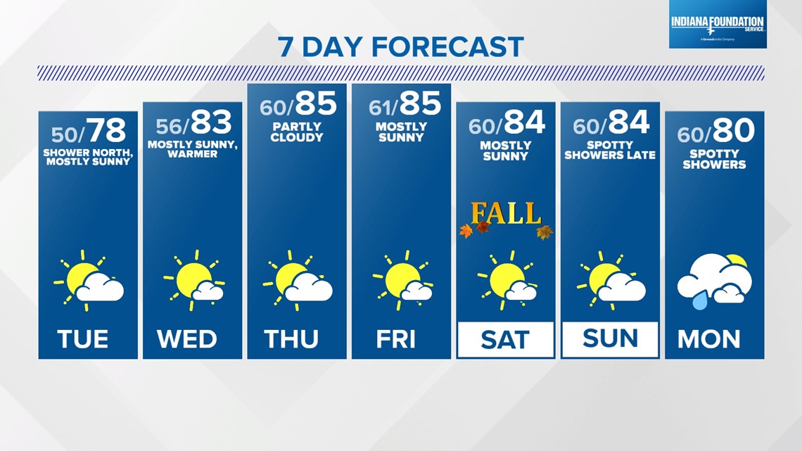
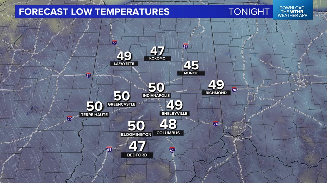
INDIANAPOLIS — Central Indiana remains a relatively quiet weather pattern for the remainder of the week. If you're a fan of seasonably cool temperatures then you'll want to take advantage of tonight and Tuesday night, when lows drop into the 40s and 50s.
Plenty of sunshine on deck Tuesday with the exception of mid-to-high level cloud blow off from upstream rain/storms. It's possible some of the showery remnants of this feature could hold together and move across far north-central Indiana, but the majority of our area stays dry.


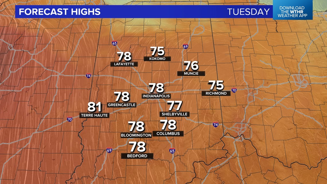
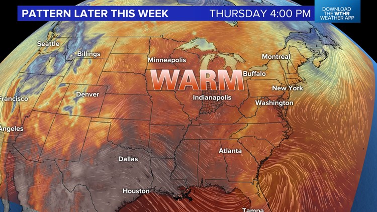
High pressure that's bringing the cool start in the morning moves east for the remainder of the week. This results in a wind-shift to the south-southwest in the coming days and a warmup of highs into the 80s. Tuesday highs range from mid-70s northeast to near 80 degrees central/southwest.

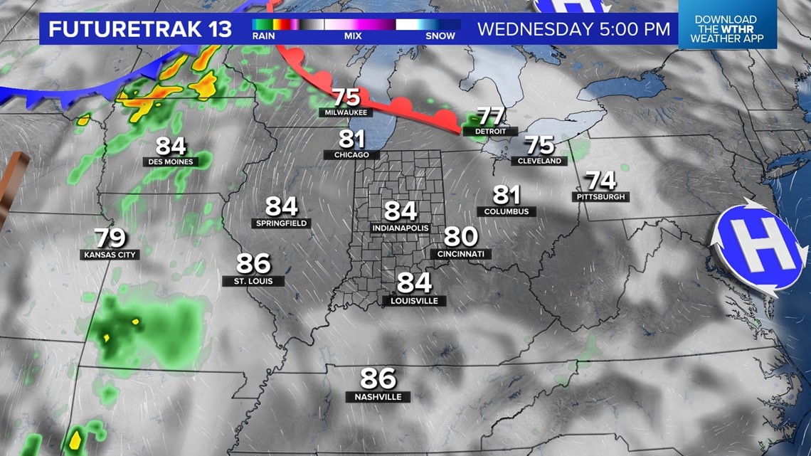

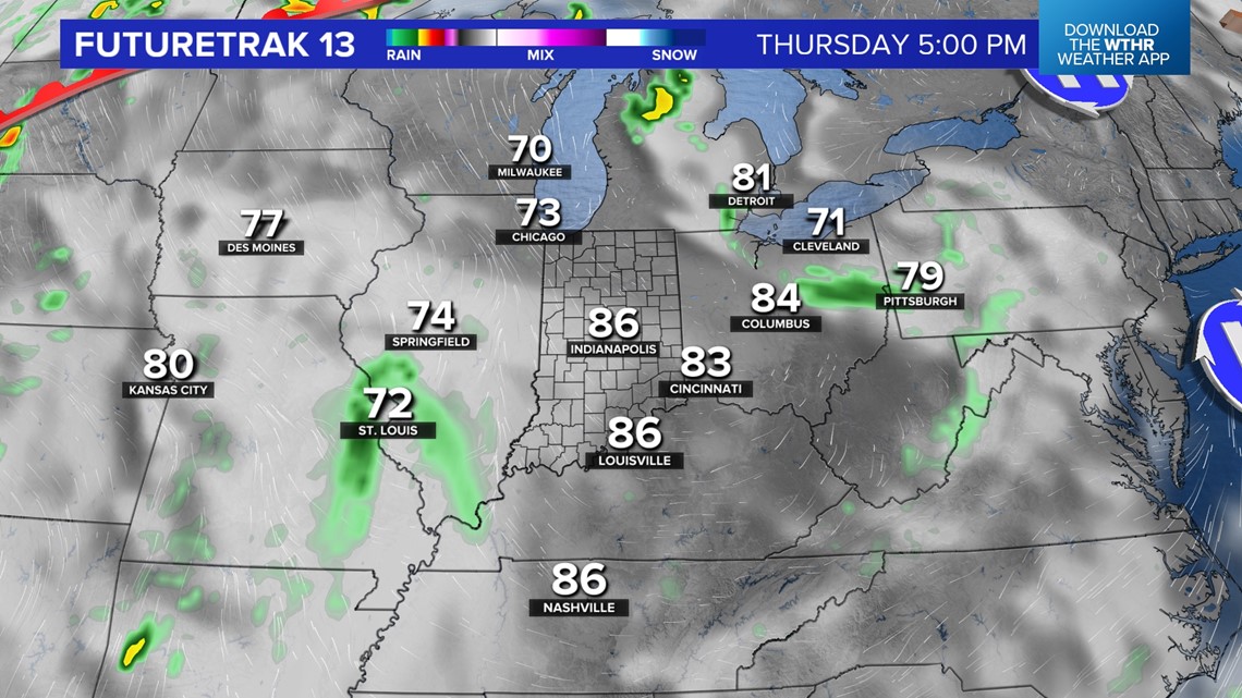
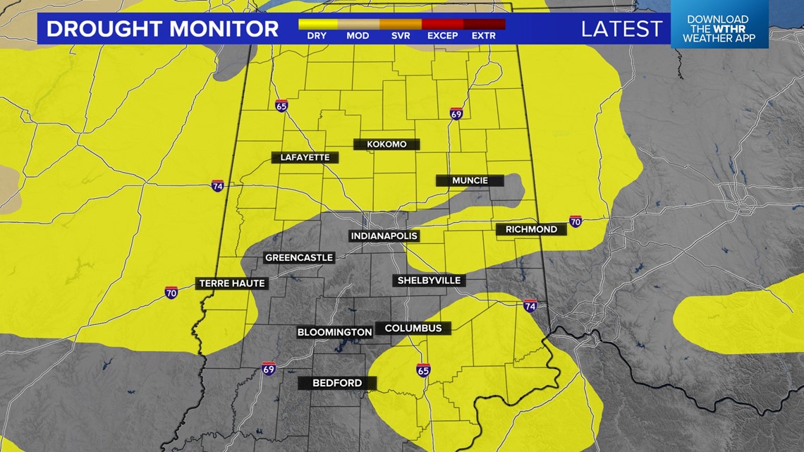
Area-wide soars into the 80s beginning Wednesday to mark a multi-day stretch of 80-plus degree days into this weekend. At the same time, prospects of rain remain low as central Indiana continues the abnormally dry stretch that began in the middle of August.

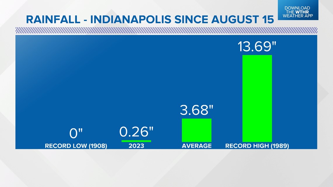

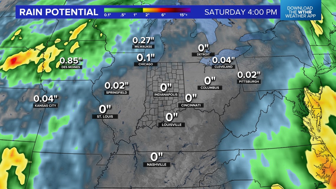
Since August 15th, Indianapolis is nearly 3.5 inches below average in rainfall and we're forecasting zero until possibly late Sunday into Monday. Even that may not deliver any widespread appreciable rain.
We fully expect an expansion of moderate drought conditions in the area when the Drought Monitor Index Map is released this Thursday. Stay tuned for updates.