Welcome to the month of April!
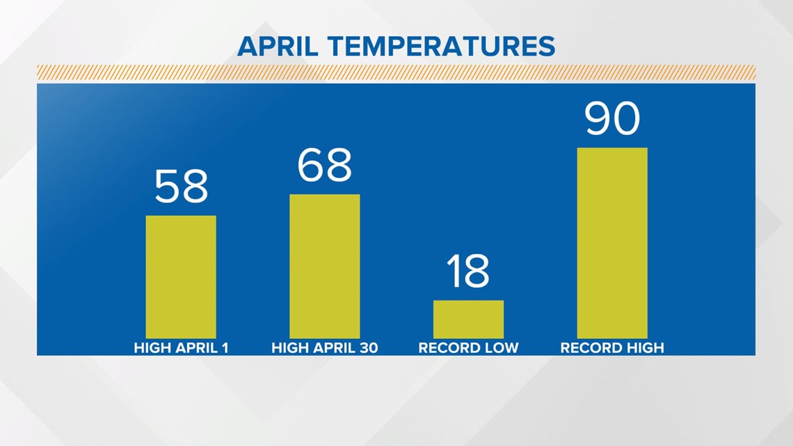
The average temperature will climb 10 degrees from today through April 30. The record coldest temperature is 18 for the month in Indianapolis and the record high temp is 90. Records date back to 1871.

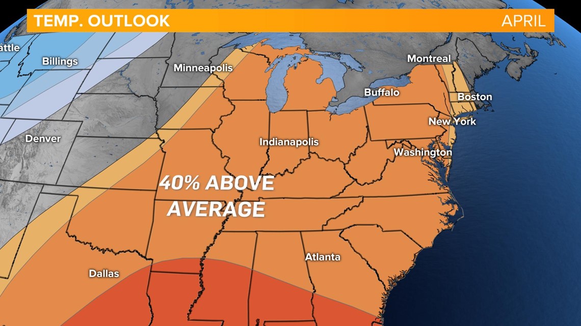
The Climate Prediction Center released their forecast for the month. The eastern US is under a 40% probability to see above average temperatures this month.

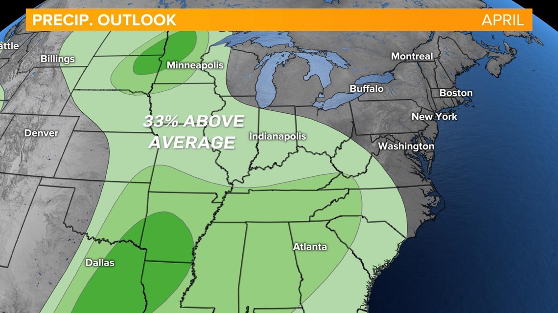
This month is also forecast to see above average precipitation.

Back to the forecast..
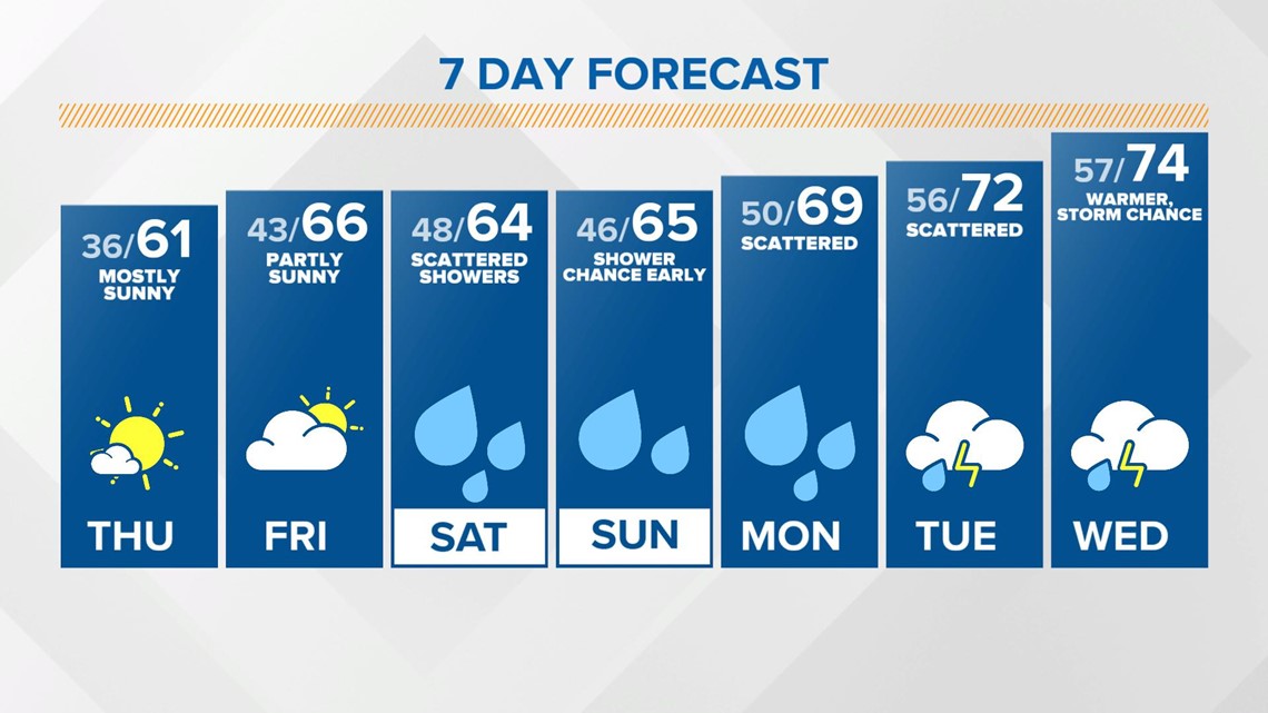
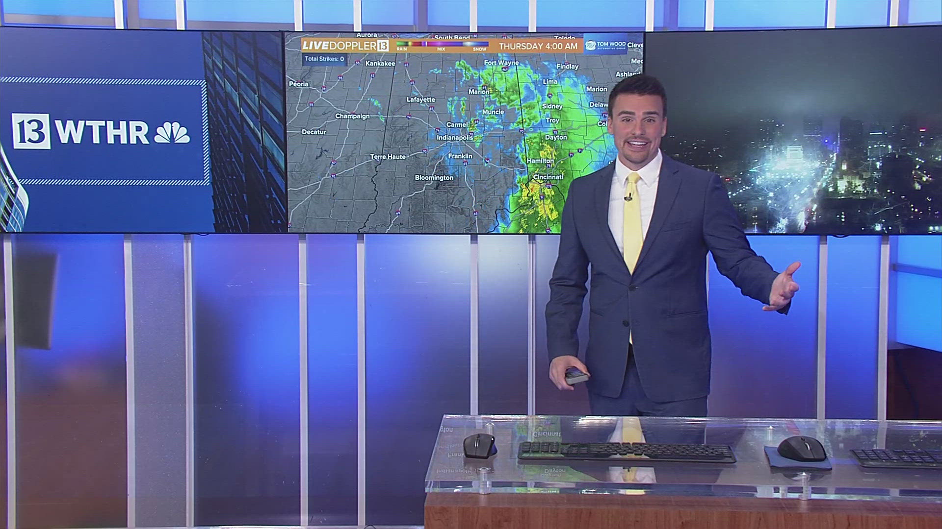
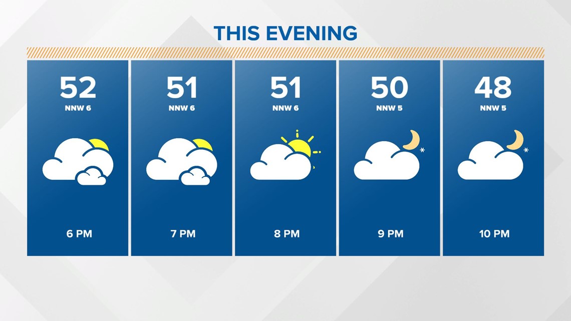
Temperatures will recover starting today for the rest of the week. Look for highs in the low 50s this afternoon with clouds gradually later in the day.

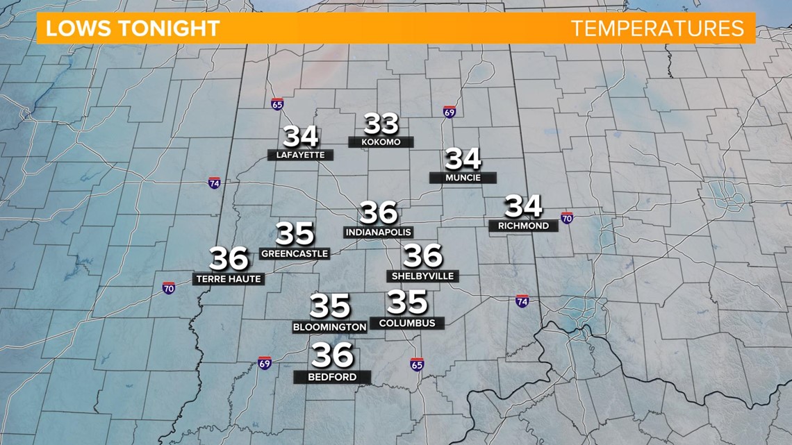
It'll be another chilly one overnight as the sky continues to clear. Temperatures fall back into the mid 30s by Thursday morning.

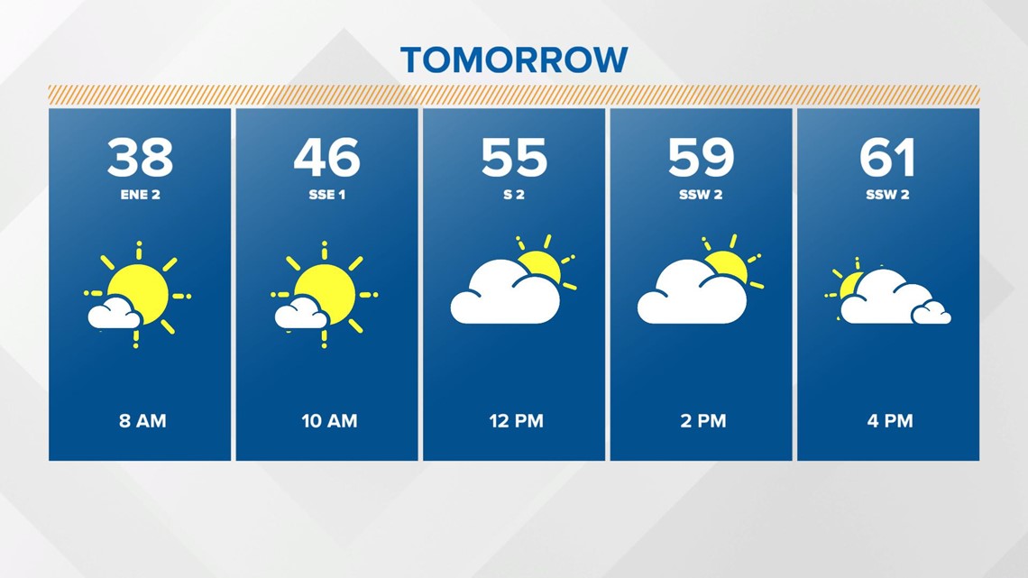
The wind will shift from the southeast tomorrow bringing back above average temperatures. Highs return to the low 60s. Mostly sunny early becoming partly cloudy in the late afternoon.


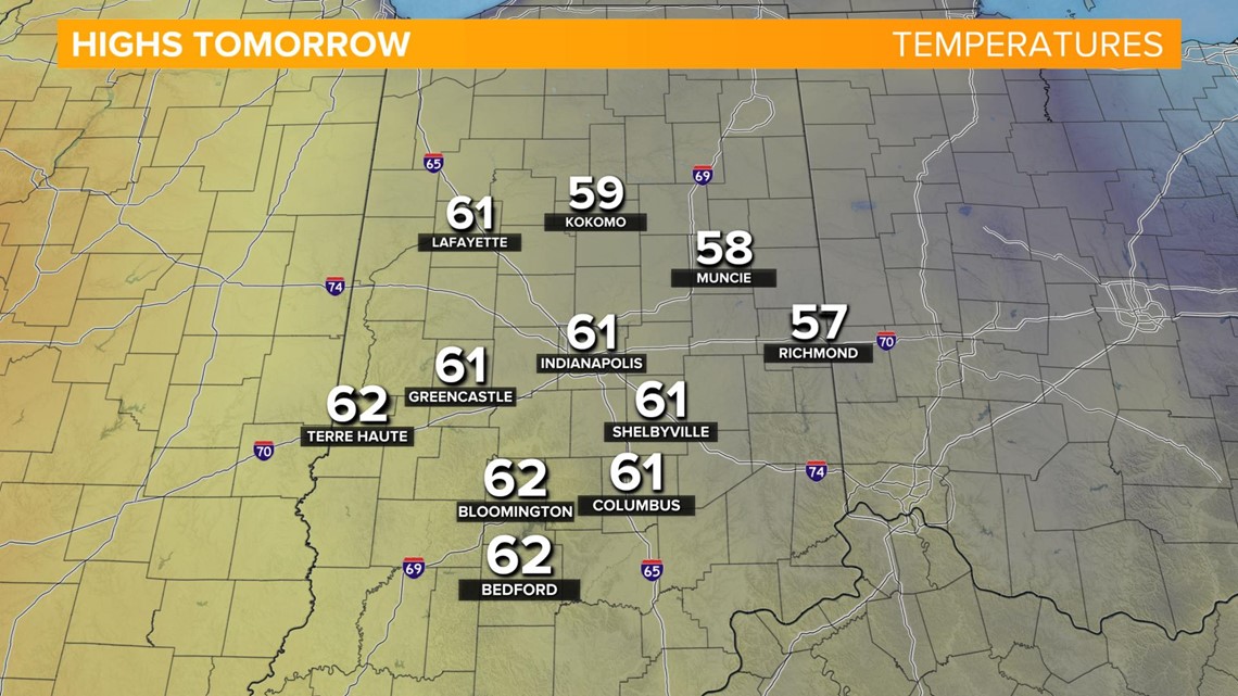
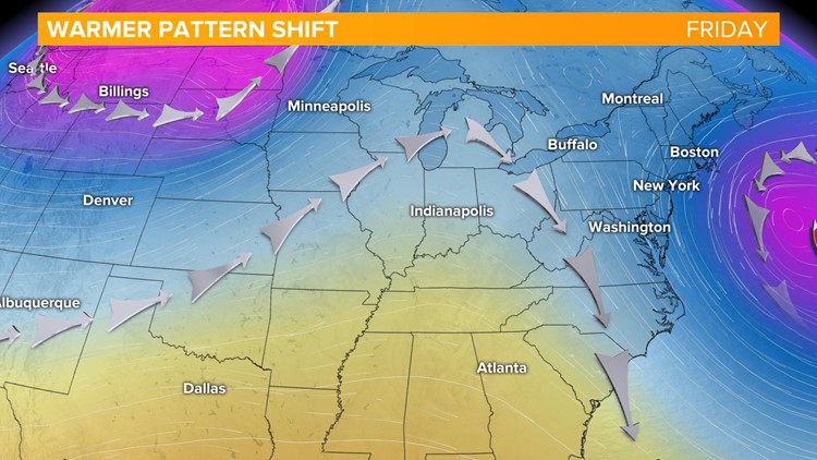
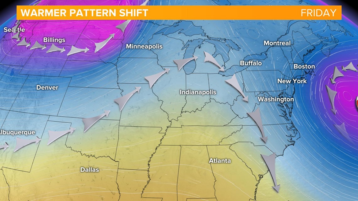
We'll wrap-up the work week on a dry and mild note with partly cloudy skies an highs in the mid 60s on Friday. We'l also see the overall pattern shifting to a warmer, springtime set-up with a ridge building in the eastner US bringing a surge of warmer air from the south.

The next best chance of rain moves in Saturday. Even with this system, it won't be an all day wash out with plenty of dry hours as well. Temperatures stay unseasonably warm with highs in the mid 60s both Saturday and Sunday. A few showers are possible through early Sunday with dry weather returning.
The long-range weather models are hinting at a warmer but wetter set-up next week. Highs recover to the upper 60s on Monday with stray rain showers possible and into the 70s on Tuesday.

