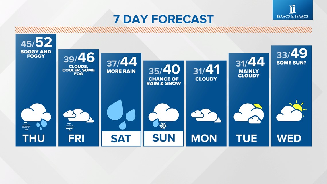
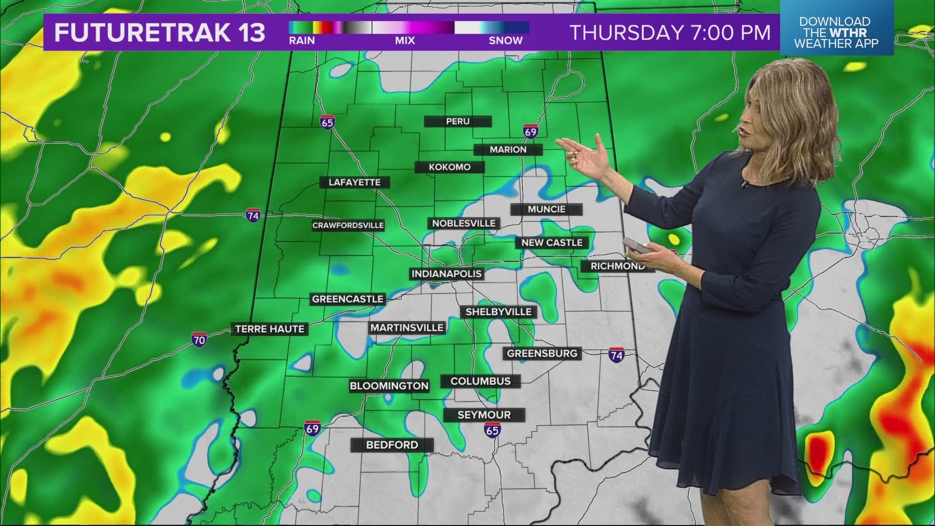
INDIANAPOLIS — Central Indiana remains in the "soupy" air with completely saturated conditions keeping it cloudy, misty and foggy between now Sunday morning. During that time there will also be intervals of heavier rain rates with at least another .25"-.75" of rainfall between now and Friday as well as the potential of another soaking system over the weekend. But there's much lower forecast confidence on the latter with model solutions diverging on a storm track from across central Indiana to near/south of the Ohio River.

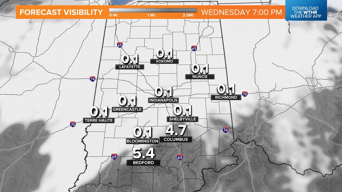
The gray set-up is coming from warmer air flowing over the colder ground that was frozen solid for nearly two weeks. That's causing the layer above ground to cool, condense and form a widespread deck of clouds and very low (300 feet and less) ceilings. Despite the rain, mist and fog, today is the warmest (50s) in central Indiana in nearly a month and this balmier January air lingers another 24 hours.

Visibilities this afternoon have been better compared to 24 hours ago and this is due to rainfall mixing the cloud layer near the surface. We're forecasting worsening visibility the remainder of the day and dense fog around again overnight into the Thursday morning commute. This likely means more school delays tomorrow.
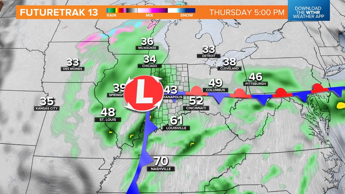
Misty, foggy conditions Thursday morning transition to heavier rain rates in the afternoon/evening as another wave of low pressure moves through the state. In its wake, cooler highs set for Friday and the weekend with continued cloud cover and areas of fog.

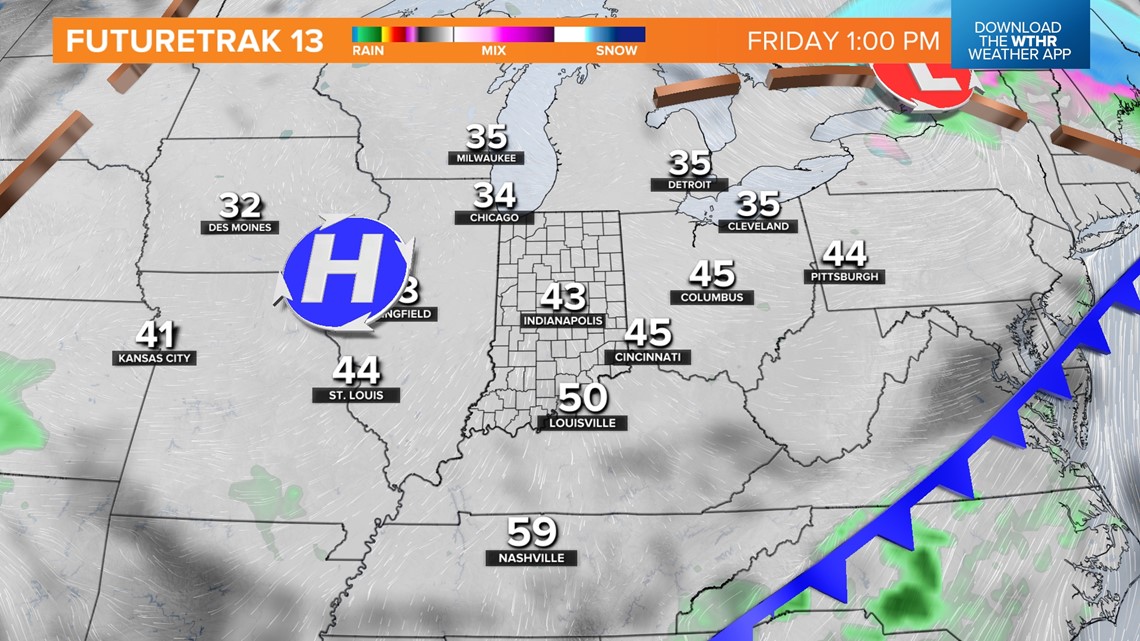
We'll update in the days ahead on the track of the aforementioned system for the weekend. It could be a soggy Saturday that finishes with period of wind-whipped rain/snow Saturday night into Sunday. Or it could be lighter rain with some snowflakes to finish Sunday. Stay tuned for updates.

