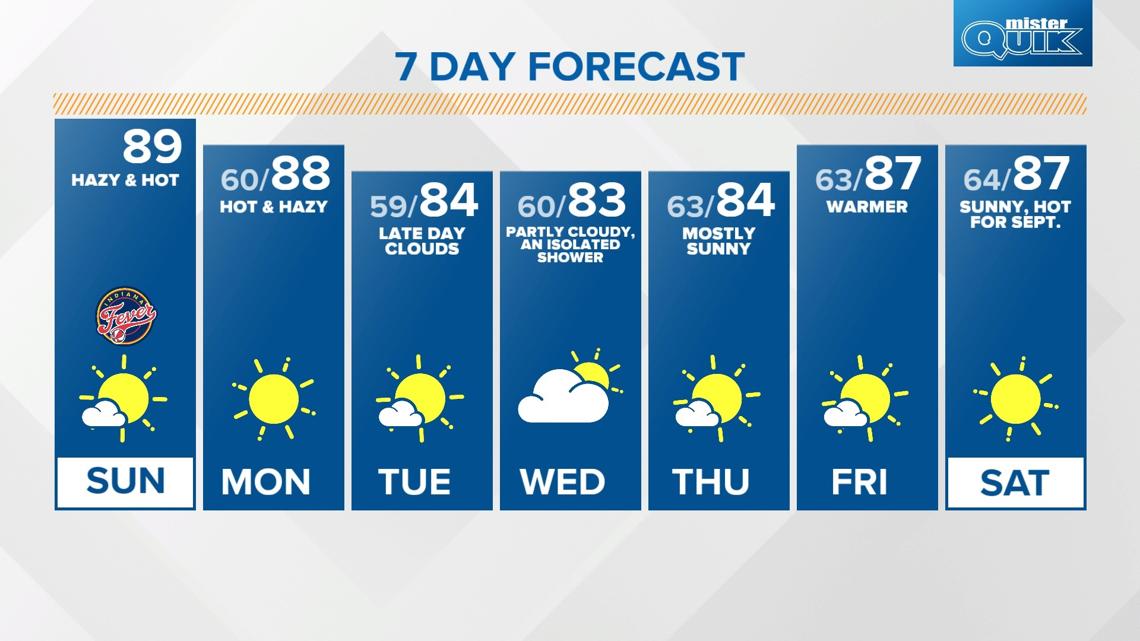
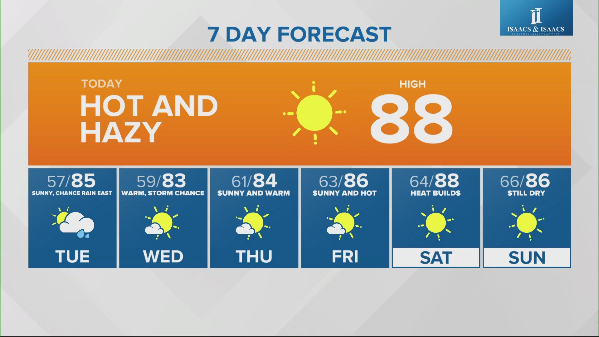
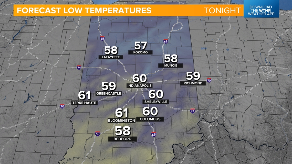
INDIANAPOLIS — Many spots in central Indiana hit the 90° mark yesterday, including Indianapolis, yet we've still had cool evenings and even chilly overnights in the 50s. Ever wonder how temperatures are able to swing so drastically in the same day? It's all associated with good radiational cooling.

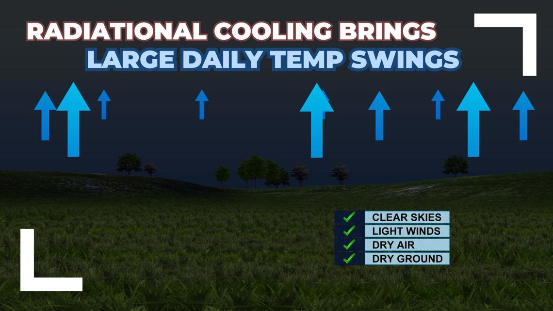
Why are conditions right for good radiational cooling right now?
Temperatures are already starting to climb since our air is so dry right now. Lower humidity values allow the air temperature to rise and fall more rapidly. We also have a dry ground and dry soil has a low heat capacity, meaning it will heat up or cool down quicker compared to damp soil. This all will help temperatures climb above average to the upper 80s for highs today.

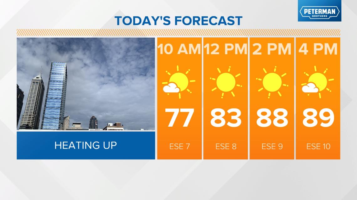

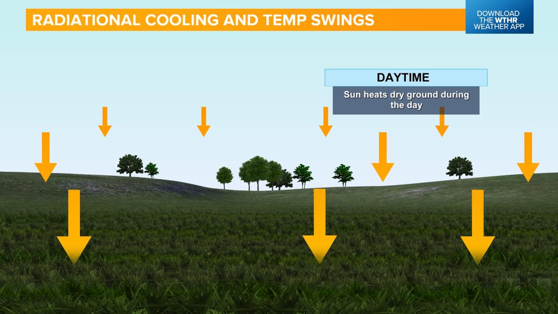
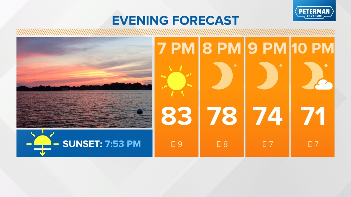
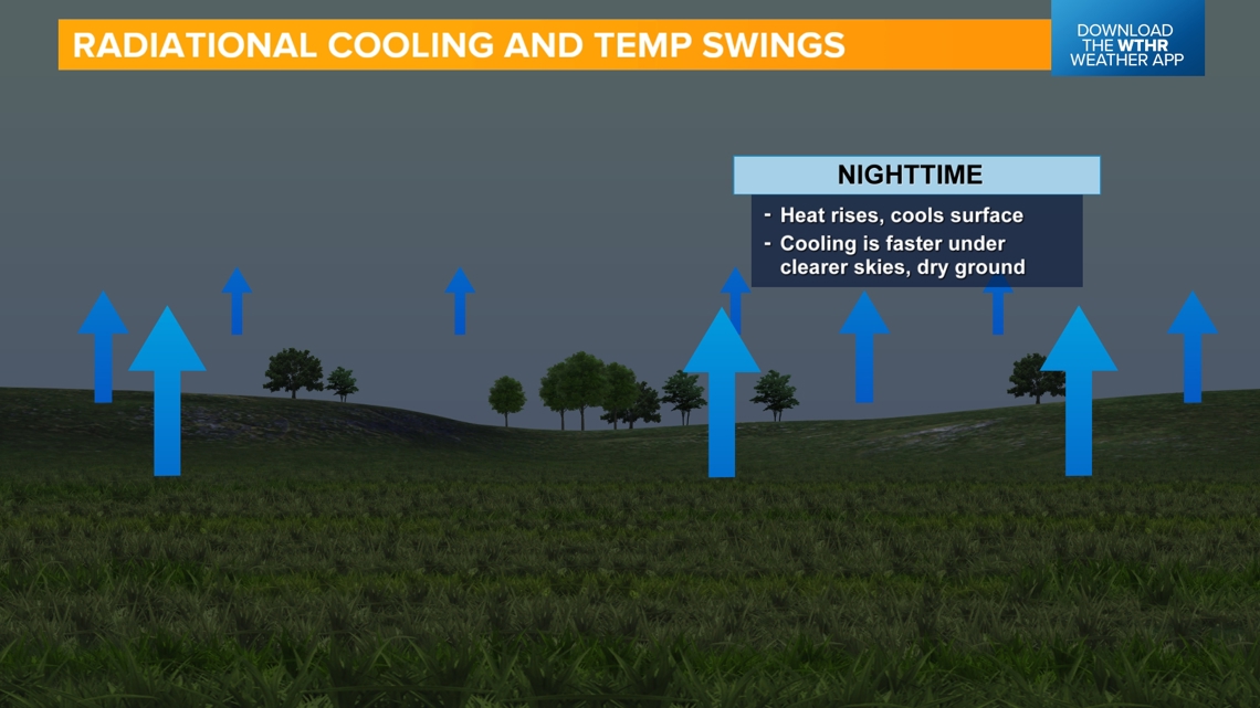
Temperatures will quickly cool this evening as the sun goes down just before 8 p.m. We have ideal conditions for good radiational cooling due to the clear skies, calm winds, dry air, and a dry ground.



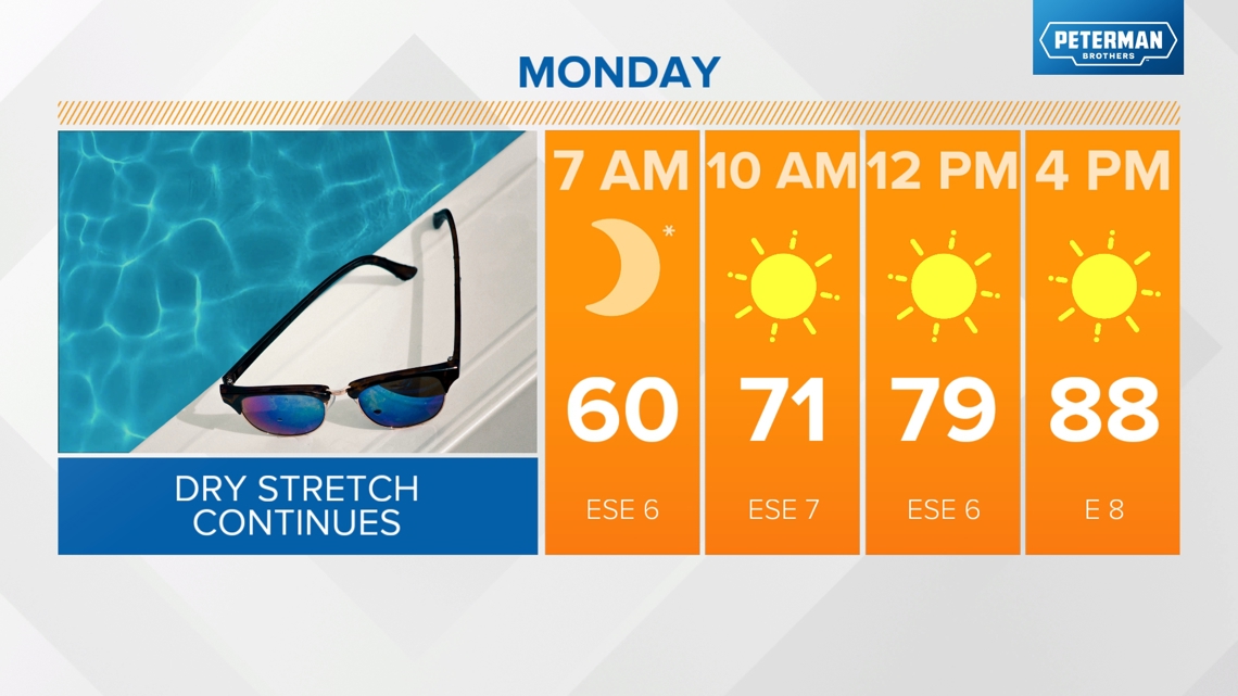
The pattern remains unchanged for Monday. A dry ground and sunny sky will combine to aid in above normal temperatures with highs again in the upper 80s. Mostly sunny, mid to upper 80s on Tuesday.

When will this dry pattern change?
The lone rain chance in the forecast (and it will be a very slight chance) will be on Wednesday as the remnants of a decaying tropical system move across the Appalachians. If moisture holds together, there may be a few showers in east and southeastern Indiana but this will be a tough battle against a very dry air mass that remains in place.

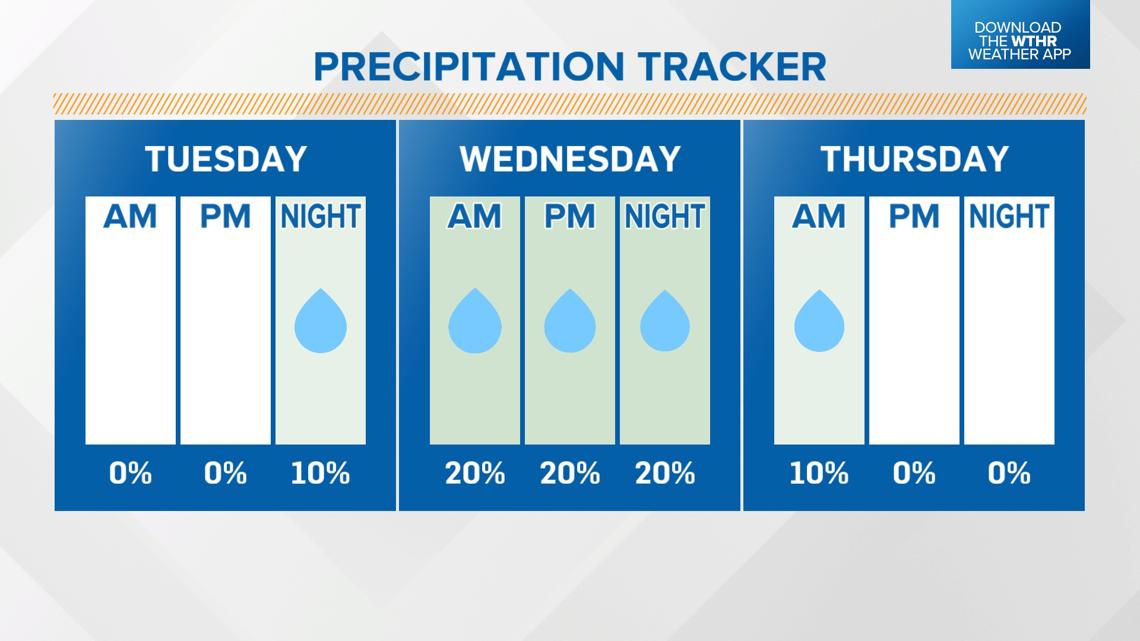
Temperatures will trend downward briefly due to the increased clouds on Wednesday with highs in the low to mid 80s. Skies clear back out on Thursday with highs in the mid 80s. We'll once again climb well above average by late week into the upper 80s by Friday into next weekend and dry air and sunshine returns.

