INDIANAPOLIS — Another unseasonably mild day is in progress for most of central Indiana. For the second straight day, it's 70°+ in Indianapolis. However, there is a subtle boundary across the WTHR viewing area that's dividing "cooler" air in the 50s to the north contrasted by mid/upper 70s to the south.
This front has some cloud cover associated with it, but your evening should be dry and balmy. Overnight into early Wednesday morning a warm front lifting through the area may squeeze some sprinkles or light showers from the clouds. But we're not expecting anything widespread and/or heavy.

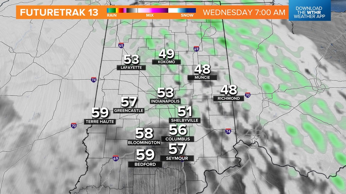

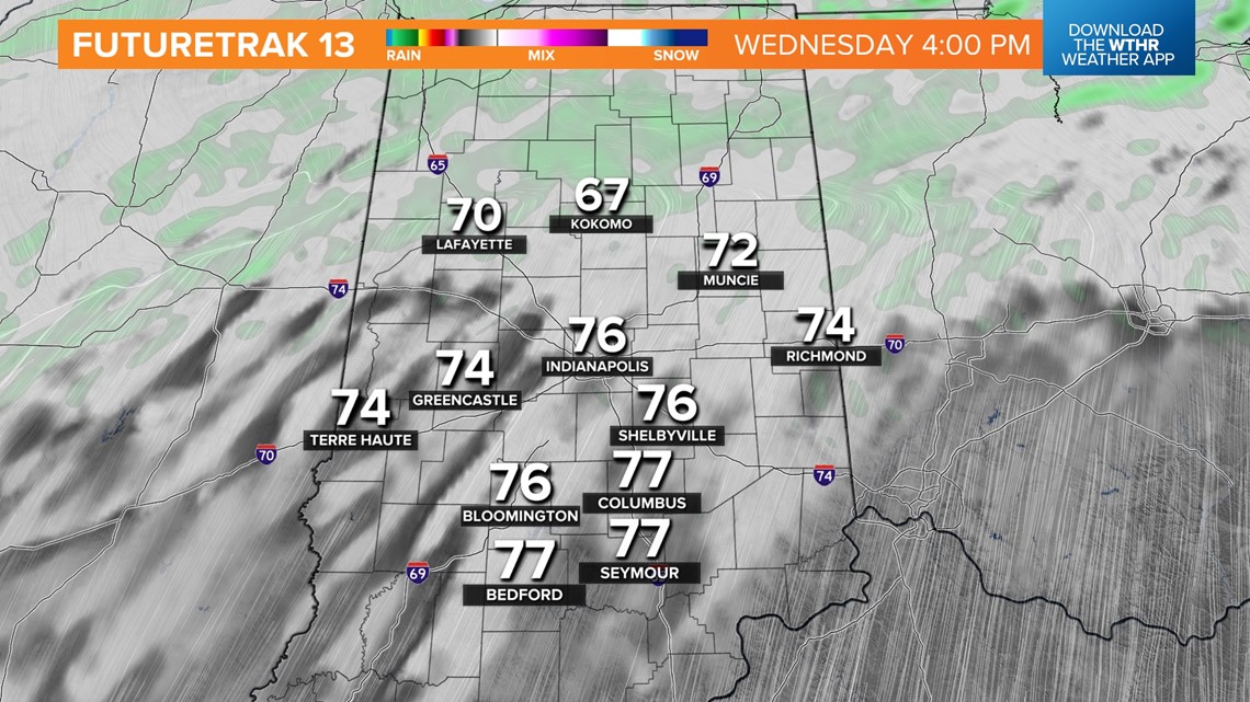
That warm front settles into the northern part of Indiana by Wednesday afternoon, allowing most areas to get firmly into the warm sector of an approaching low pressure system. Within that space will be a windy and September-like air mass that produces highs in the mid/upper 70s for most.
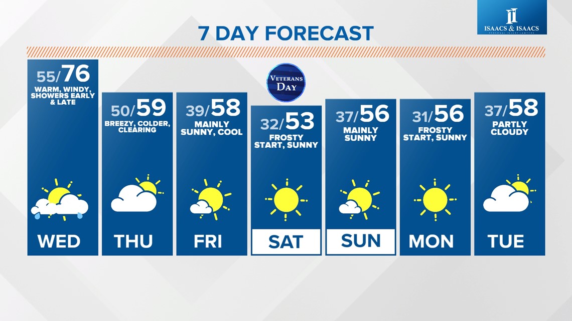
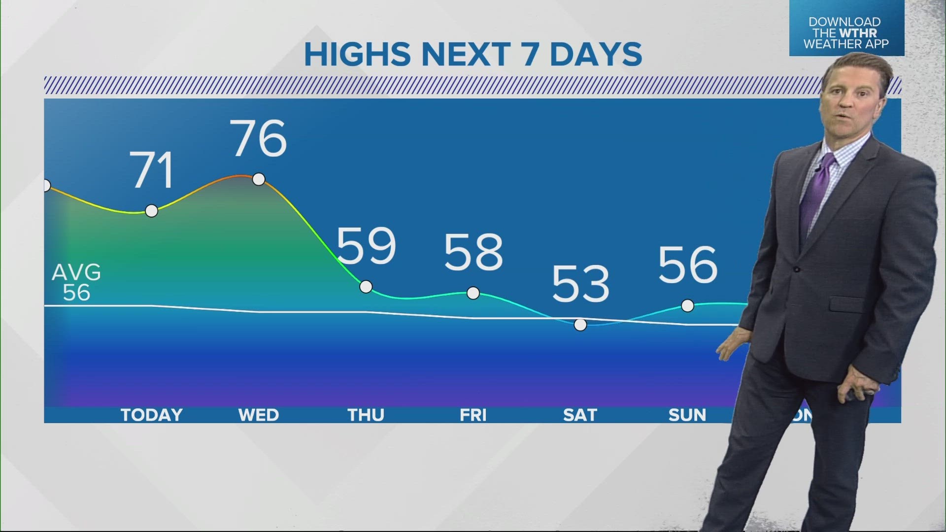
We're forecasting 76° for Indianapolis which would be just shy of the daily record high (79°/2020) and a good 20° above average for November 8th. It also marks the third straight 70°+ day in Indy in November to match the same feat from three years ago.

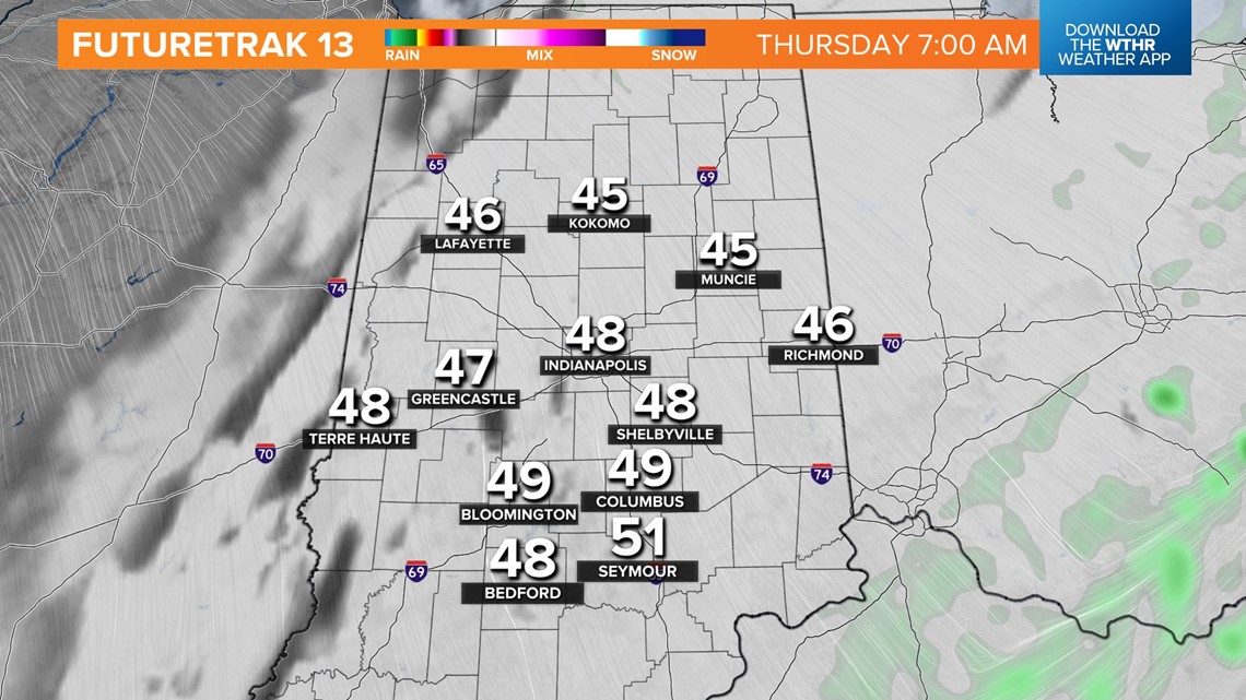

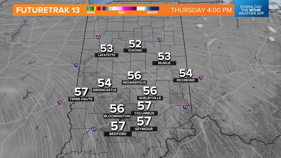
It will also be the last one for a little while at least. A stronger push of "cold" air arrives area-wide Thursday in the wake of a cold front passage through the state. This brings more numerous showers, though more light than heavy, Wednesday night/early Thursday morning. It also comes with breezy conditions and a clearing sky Thursday afternoon with much colder, but near-normal, highs in the 50s.
Plenty of sunshine into the weekend with seasonably cold mornings in the 30s and highs in the low to mid 50s.

