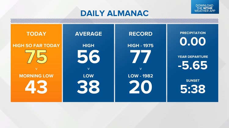
INDIANAPOLIS — Windy and warm are apt descriptions of our weather today. Frequent gusts over 30 mph from the southwest delivered near-record warmth in the mid-70s, which is some 20° above average and more typical of mid/late September versus early November.
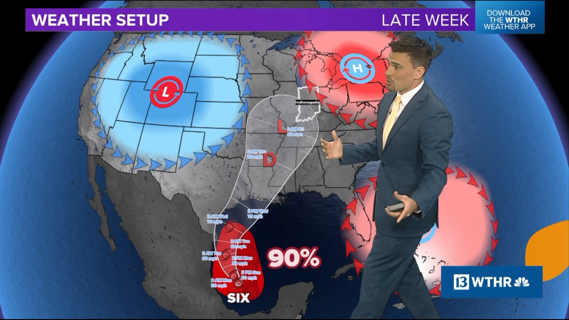
The balmy breeze continues this evening with increasing cloud cover that's pooling along a cool front that's slowly sagging southeastward. Though the front lacks low-level moisture, spotty sprinkles or light showers are possible overnight into early Tuesday morning.

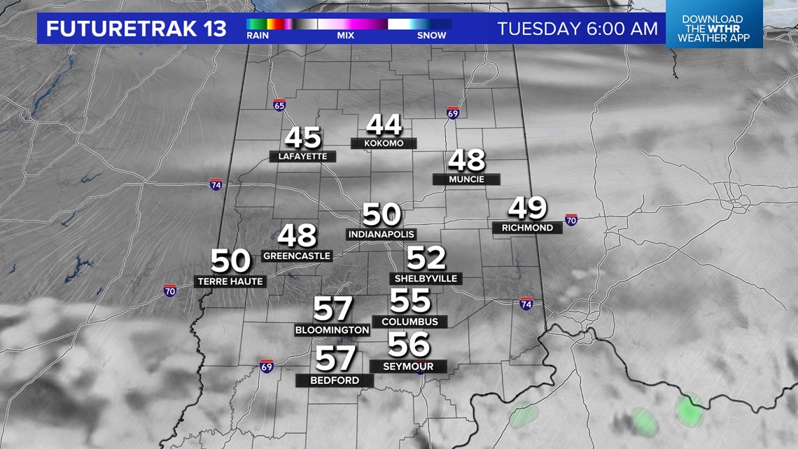

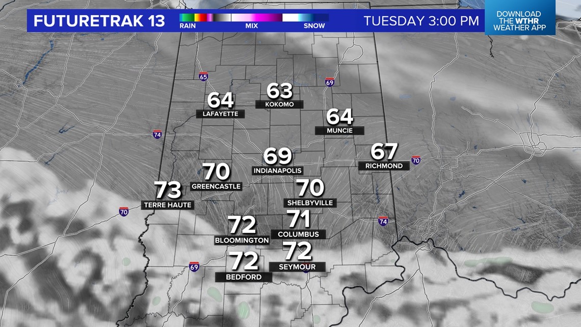
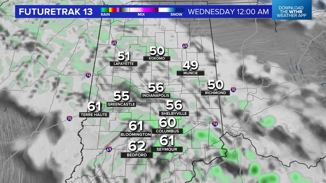
Low temperatures range from lower 40s north, upper 40s central, and mid/upper 50s south where the front stalls. There are just slight shower chances during the day Tuesday with another round of unseasonably mild highs near 70° central to mid 70s south.
That boundary lifting northward Tuesday night into Wednesday morning brings additional scattered showers.


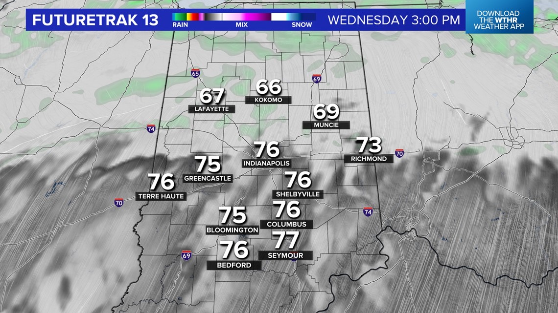

As the front lifts north Wednesday midday/early afternoon, high temperatures soar back into the mid-70s near and south of I-70, which will be closer to the daily record high (79°) versus the average (55°).
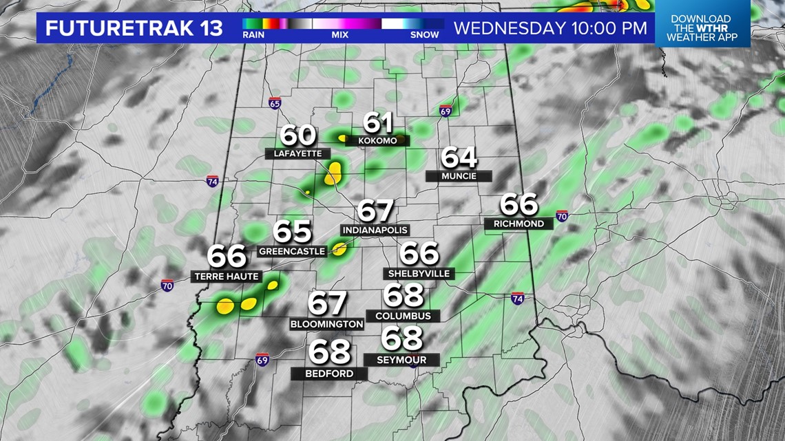
A stronger push of much colder, but near-normal, air arrives Thursday and the transition should squeeze out more numerous showers (possibly some thunder) Wednesday night into early Thursday morning.
We'll see highs in the 50s the rest of the week and weekend with much chillier lows in the 30s.