INDIANAPOLIS — Changes from prior forecast:
- Lower confidence on ice issues developing around Indy
- Warm/dry layer delayed start of precipitation
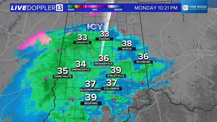
At 11 p.m., precipitation across much of central Indiana continues to fall as rain with the exception of north-central Indiana where freezing rain and slick driveways/sidewalks/roads have been reported around Lafayette.
Thankfully, a warmer (than anticipated) and drier layer near the surface delayed the onset of precipitation for the Indy metro area and points east. That layer may ultimately save areas along and certainly south of Interstate 70 from having massive ice issues on the roads. But it's too early to completely remove that threat and will require monitoring of temperature/dewpoints in the hours ahead.
Temperatures will continue to lower through evaporative cooling and eventually bottom out near freezing. There is always the wild card of the ground/subsoil remaining frozen from the nearly 10-day streak of subfreezing air.
Areas north of I-70/I-74 remain the more probable area to experience icy travel into Tuesday morning. Two points we want reiterate is that there will be a fine line between wet and icy surfaces tonight and some surfaces that may look wet could be icy.
RELATED: List of school closings and delays
It will be a good idea to wake up early and check with Chuck Lofton for the latest radar and road conditions on 13Sunrise starting at 4 a.m.
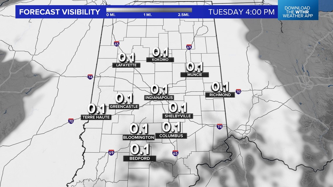
After a wet morning, fog becomes an issue on Tuesday with the potential of widespread dense fog. Stay tuned.