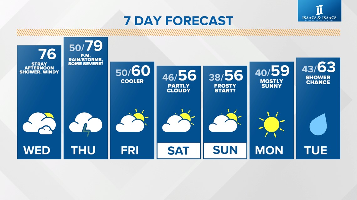
INDIANAPOLIS — Temperatures remain well above average today and tomorrow before a potent cold front sweeps through late Thursday night, bringing strong storms and a cooler air mass.

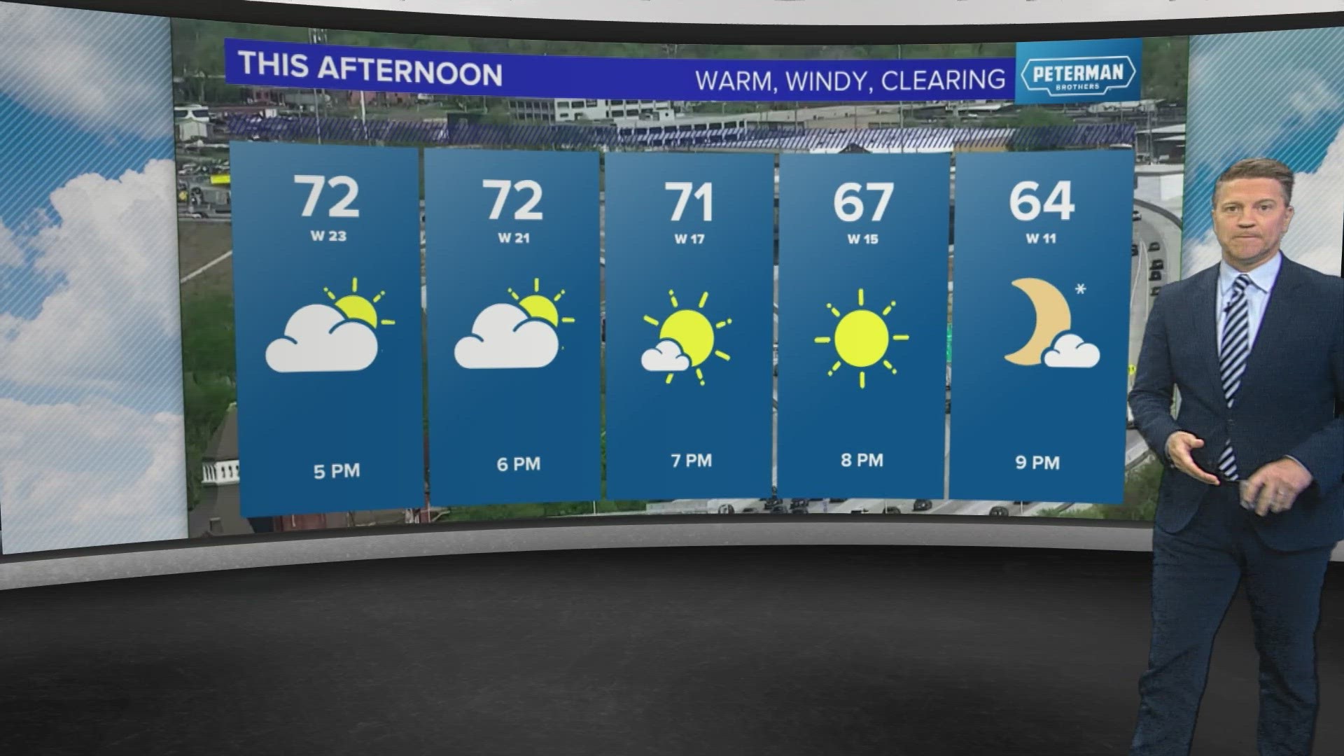
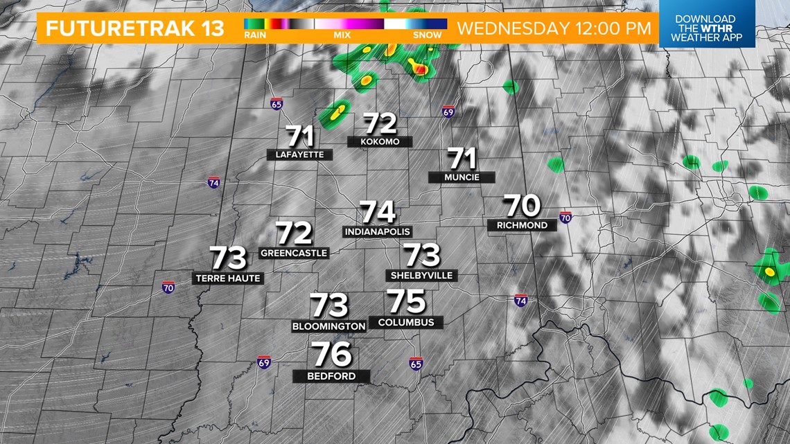
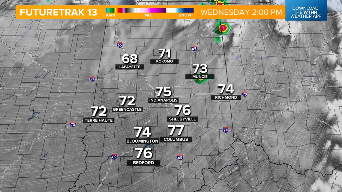
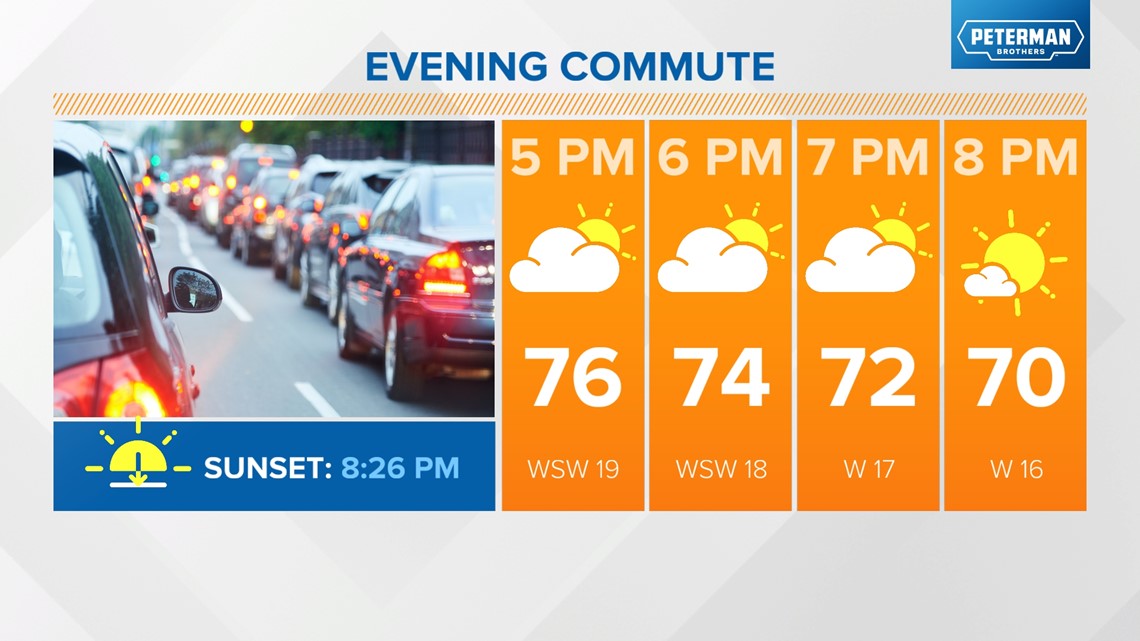
TODAY: Mainly dry with a stray storm, mainly north in the early afternoon. Highs in the mid-70s. Strong southerly wind gusts to 40 mph at times through the afternoon. Clearing skies this evening.



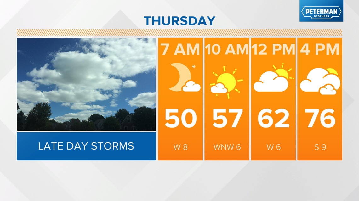
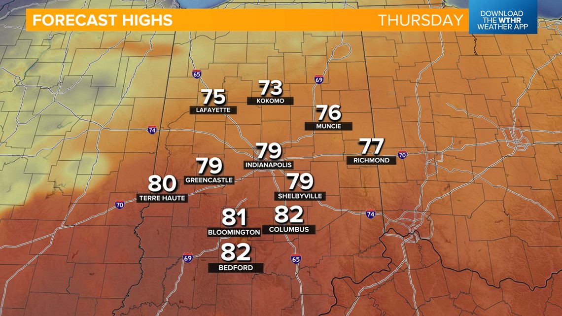
THURSDAY: Lots of dry time with warm highs in the upper 70s in the afternoon.


Are severe storms possible Thursday night?
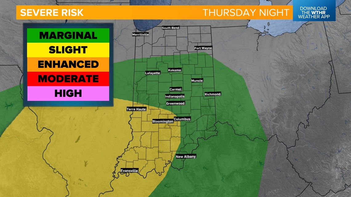
SEVERE THREAT: 8 p.m. Thursday - 2 a.m. Friday... The Storm Prediction Center has placed most of Indiana under a level 1 of 5 for isolated strong storms. Southwestern Indiana, including Bloomington, Bedford, and Terre Haute, is under a level 2 for the potential of more widespread storms. Damaging wind gusts and large hail are the primary threats, with rotating storms possible within the line.


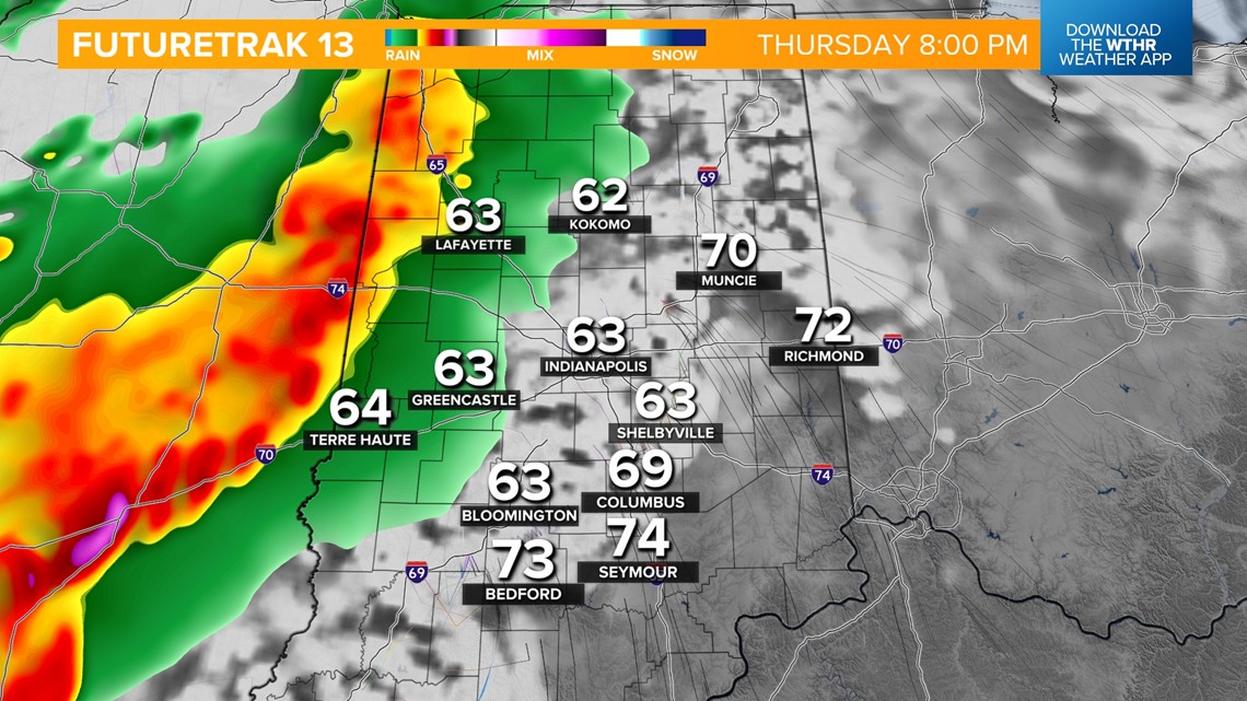

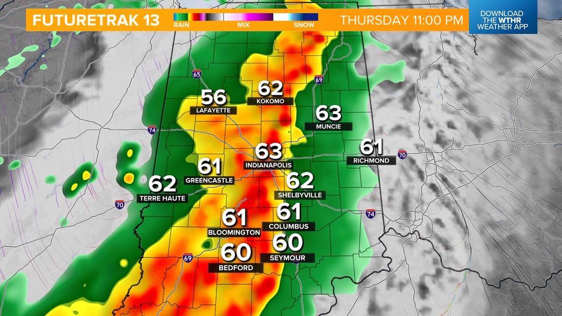

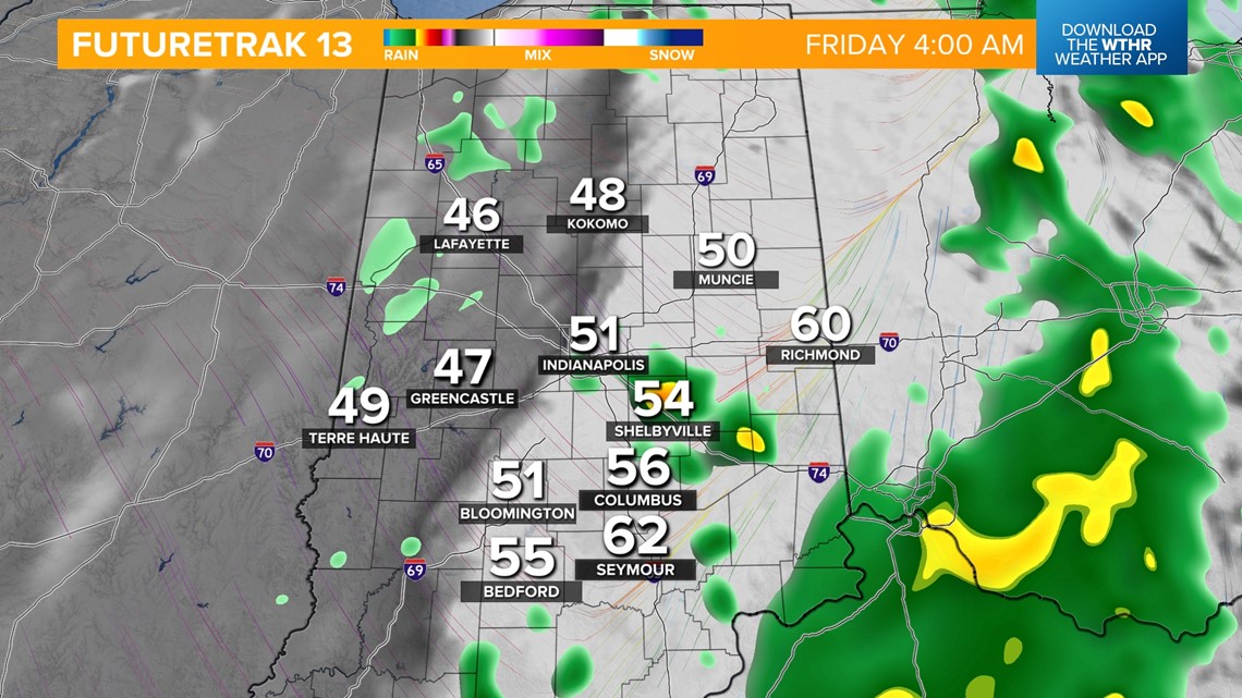
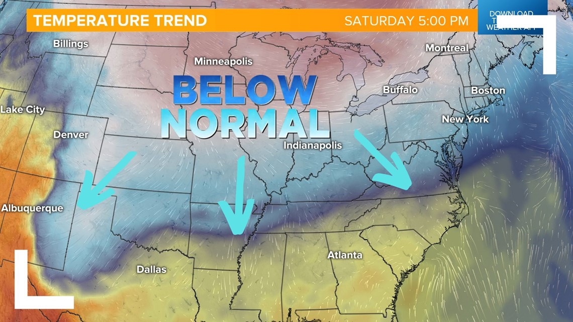
How much does it cool off behind the cold front?
FRIDAY: A stray shower will be possible early. Becoming partly cloudy with highs only near 60.
THIS WEEKEND: Highs run about 10° below average in the mid-50s for both Saturday and Sunday. Areas of frost will be possible Sunday morning with lows in the upper 30s. It will be dry, though, with mostly to partly sunny skies.

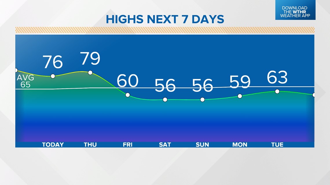
EXTENDED FORECAST: It'll be a cooler start to next week with highs in the upper 50s, near 60, before becoming more seasonal mid-week next week.

