INDIANAPOLIS — Our string of mainly overcast days continues as it's been since the January 20/21 since central Indiana enjoyed some blue and brighter sky.
In fact, according to National Weather Service Indianapolis this is the fifth cloudiest month in Indianapolis since record-keeping on that statistic began in 1951. The 72% rate of overcast this month is only behind January of 1999, 1998, 1992, and 1989 for cloudiest on record.
This afternoon clouds have more bark than bite.
Though this morning there was some light snow that accumulated to a dusting from west-central to south-central Indiana. Temperatures hover in the mid/upper 30s today with just the slightest hope of sun peeks in western Indiana before sunset. Most areas remain cloudy.
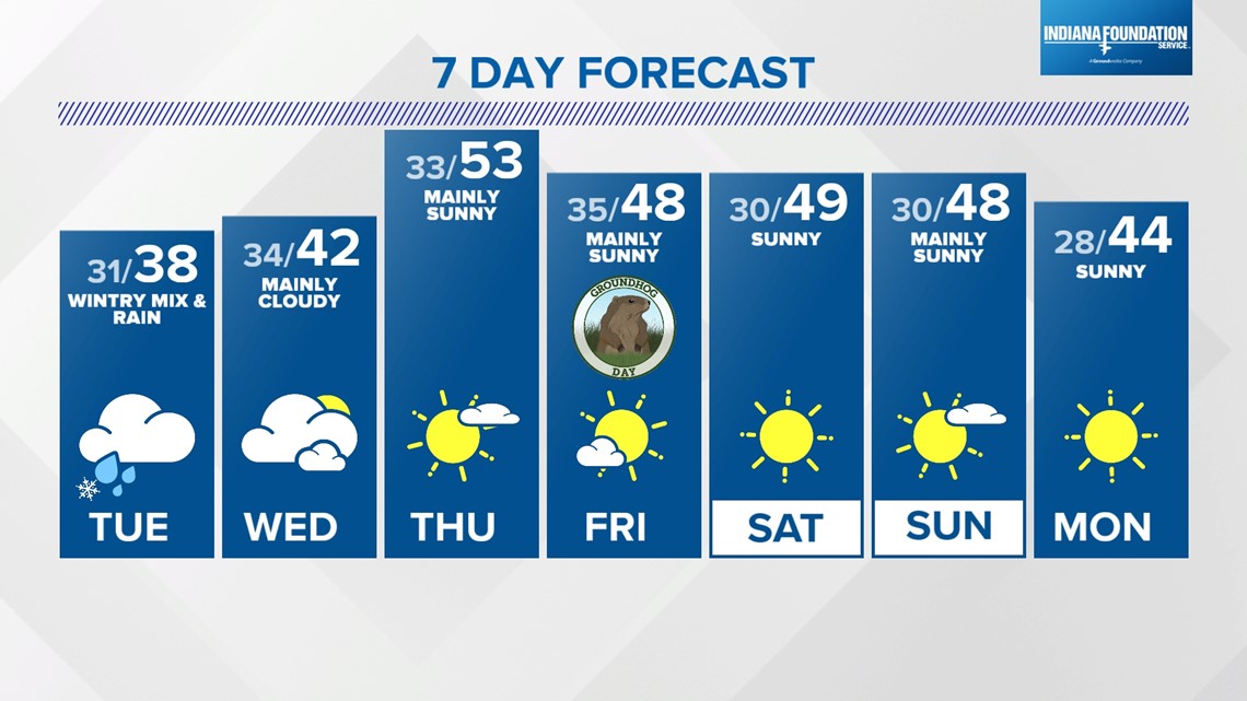
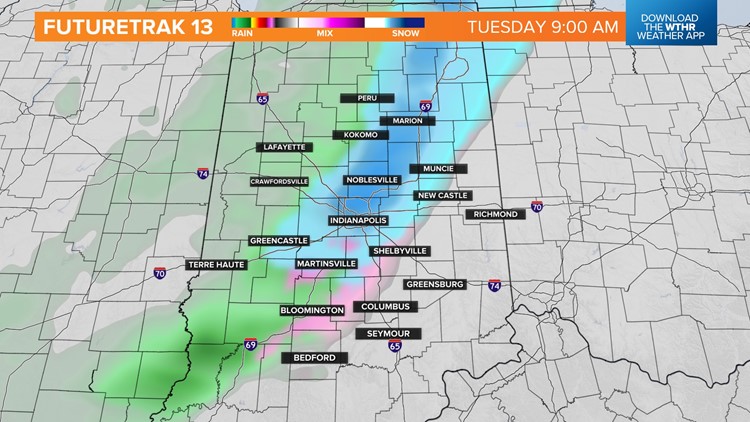
We'll be radar and temperatures closely Tuesday morning with the latest clipper system arriving just in time for the morning commute.
While this won't be a big system, it could make some slick travel with a dusting of snow and/or a glazing of freezing rain. Please follow the forecast closely with potential impacts to your commute Tuesday morning.
Otherwise, any wintry precipitation changes to rain showers in the afternoon with enough atmospheric warming. Clouds linger into Wednesday with a slight chance of showers.
There are some timing differences of a late-week cold front in modeling. For now, we're calling for a brighter sky Thursday and warmer highs in the 50s. But if the front arrives sooner, adjustments to sky conditions (cloudier) and temperatures (cooler) will be needed.
Long-range guidance shows a brighter set-up for a change Friday into the start of the weekend. We'll have to monitor the progression of a weather system that could at minimum bring clouds Sunday and at worst bring some rain. Our early call is for a southern track solution and dry weekend.


