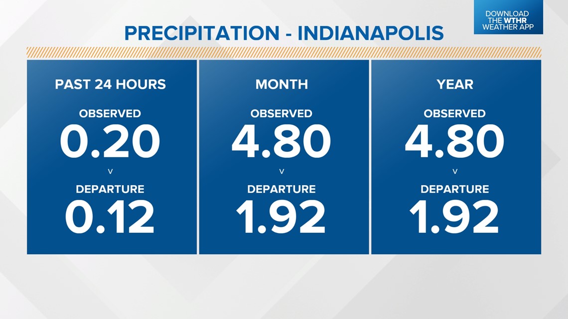
INDIANAPOLIS — A wet pattern this past weekend has put the Indy metro area in a rainfall surplus for the year so far. We've received just shy of 5 inches of rain so far this month, which is nearly 2 inches above normal.
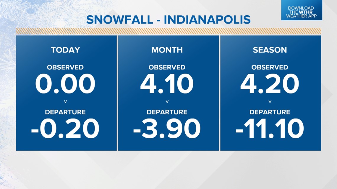
Snowfall is a different story, though. Indy is running nearly 4 inches below average for the month of January, and over an 11-inch deficit for the total snow season so far.


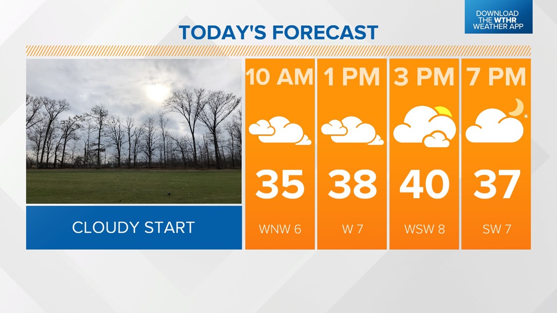
We get a break from all precipitation today, though. After a cloudy start with temperatures near freezing, we'll see a gradually clearing sky in the afternoon from west to east and temperatures topping out near 40.

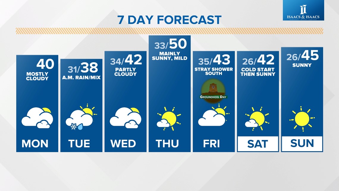
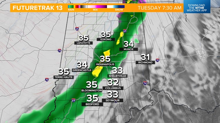
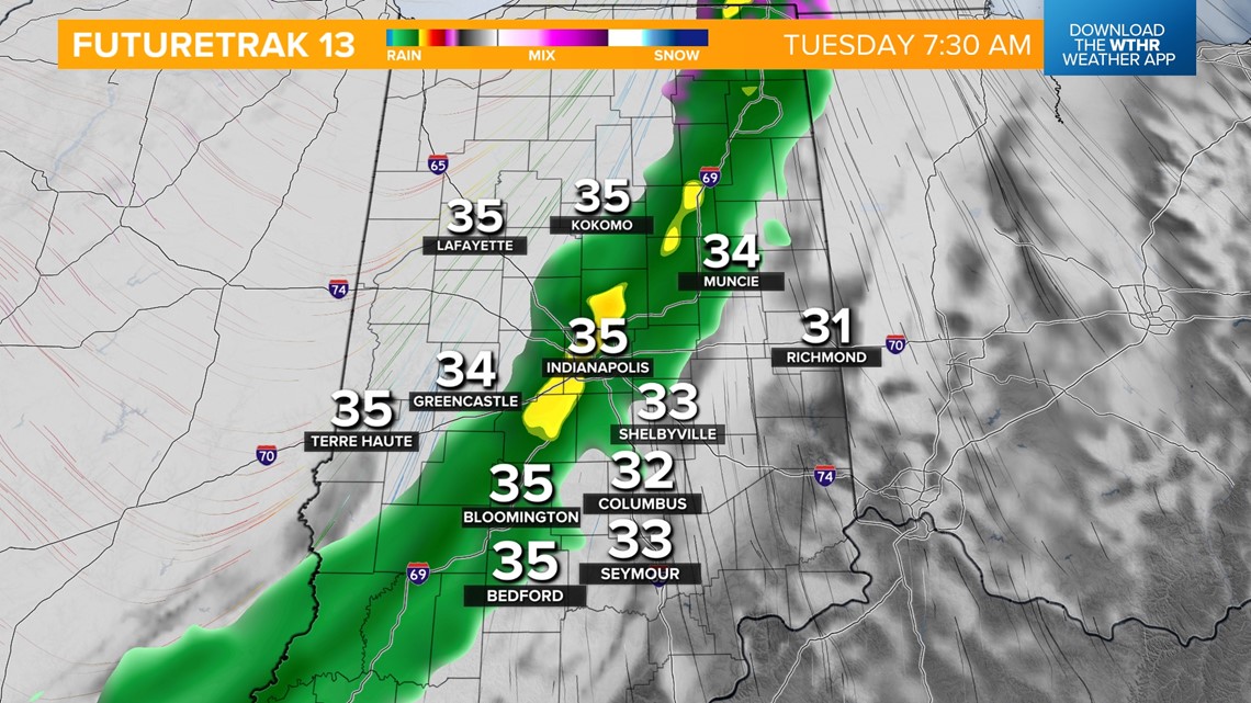
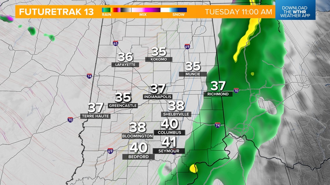
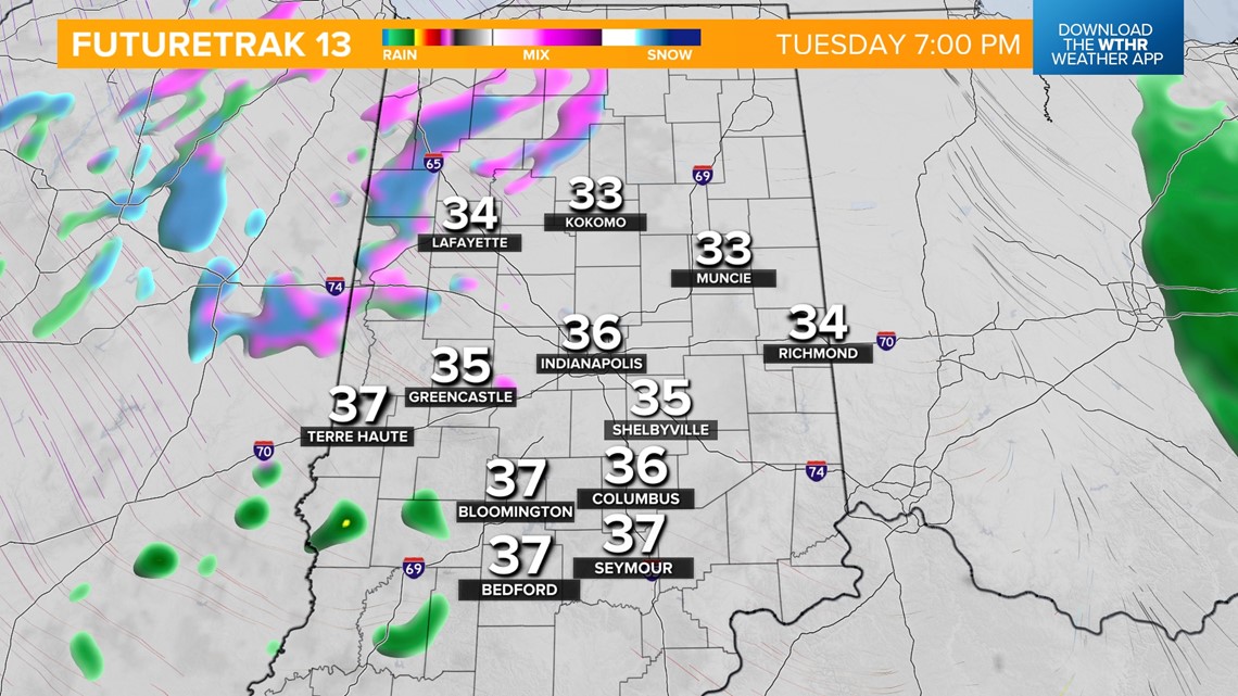
A quick clipper system will bring another chance of a wintry mix overnight into Tuesday morning. While temperatures will hold steady near the freezing mark, we'll see mainly rain around the Indy metro area with a better chance of snow/ice mixing in northeast. We'll still watch for impacts on the roads for the Tuesday morning commute before this clears out in the afternoon and temperatures recover to the upper 30s.


As the area of low pressure tracks south back into central Indiana, a few light mixed showers will be possible in the evening. No accumulation is expected, but slick spots on the roads continue to be possible through Wednesday morning with temperatures near freezing.


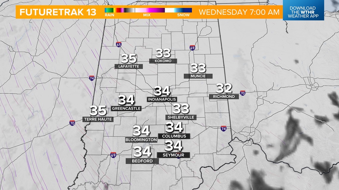
A more quiet setup begins Wednesday, with skies becoming partly cloudy and high temperatures in the low 40s. We'll see some sunshine and mild temperatures to kick off the month of February on Thursday, with highs near the 50-degree mark. That's about 15 degrees above average for this time of year!
We're looking cooler by late week with more clouds and a chance of stray showers, mainly south, on Friday for Groundhog Day. Highs fall back into the low 40s.
Temperatures remain slightly above average heading into next weekend, with highs in the low-to-mid-40s under sunny skies.

