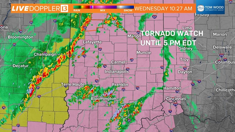
INDIANAPOLIS — We've got a stormy Wednesday in progress, and there's still another 4-5 hours to go. Not surprising, but a Tornado Watch is now in effect for all of central Indiana until technically 5 p.m. EDT today.
This is for the increasing threat of damaging wind and/or rotating storms both along a line that's now in western Indiana and for storms developing in advance of it.
There's a high level of spin in the atmosphere with ample low-level moisture so that any sustained updraft will have a higher probability to rotate, and possibly produce tornadoes.
Modeling continues to show several streaks of long-lived rotating updrafts and this ups the ante for Tornado Warnings between now and 4 p.m.
The main line of storms is expected to impact the Indy metro area from around noon to 3 p.m. with additional storms in progress before the line arrives.
Please have a way to get warnings and be prepared to take shelter if they're issued for your area.
The threat of severe weather will be over area-wide by 4-5 p.m. as a cold front pushes storms out of the WTHR viewing area. Remain Weather Aware until that happens.