INDIANA, USA — It was a crazy weather day with two tornadoes touching down in eastern Indiana. Scattered showers and downpours were able to develop some temporary shallow rotation near the ground Sunday after 7 p.m.
For rainfall totals across the state, tap HERE.
What happened: A weather look
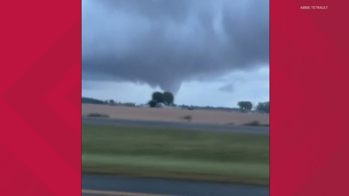
Reports on social media started being posted around 8 p.m. with pictures and videos of a tornado east of Interstate 69, heading toward Yorktown and Muncie. No tornado warning was issued because rotation was unclear thanks to the nature of these cells.
We usually call twisters like these "landspouts." They can easily create winds up to 100 mph right next to the ground, usually fairly brief, maybe only lasting a few seconds or a couple minutes. They form from sharp temperature differences on days with some buoyancy or energy to the atmosphere. What's weird about them is that they don't feed off much rotation from the thunderstorm above.
However, some very small rotation was able to form briefly, helping sustain these landspouts into tornadoes. All rotation was low-level based, so radar was unclear. There may have been one radar scan for each storm indicating something interesting, but then it was gone again.
This is why no tornado warnings were issued. Instead there were Special Weather Statements, calling for the potential of landspouts.
Because they did damage, we are definitely referring to them as tornadoes.
IMPORTANT: The classification doesn't really matter. Tornado... landspout... they did damage and that's what should be the focus.


For more about the damage: Storms damage buildings in east central Indiana
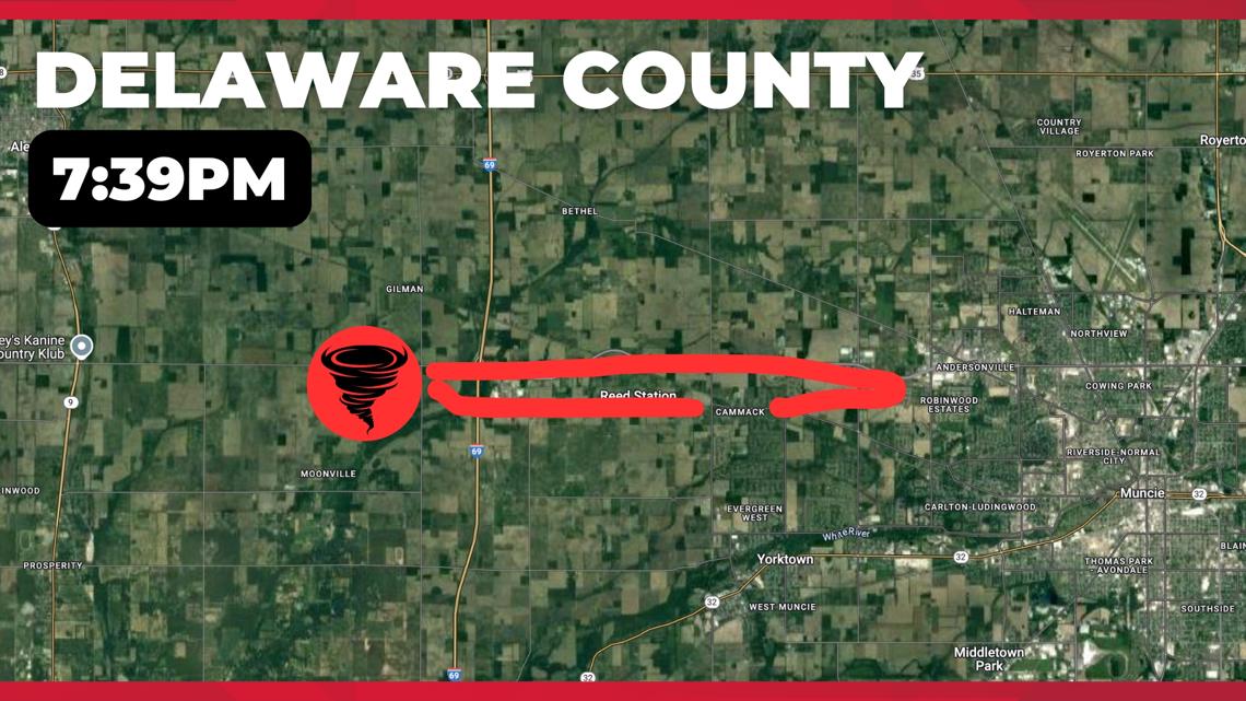
Delaware County Tornado
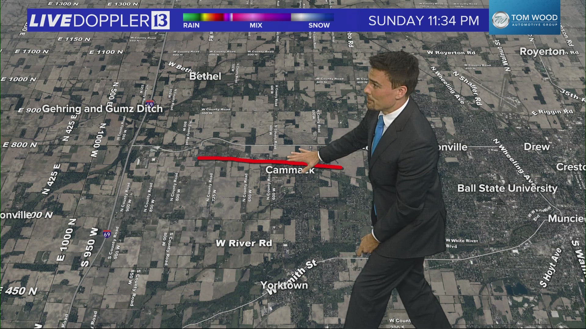
- Cammack (3 miles north of Yorktown)
- Estimated time — 7:39 p.m.
- Metal building damage at TK Constructors
- Possible damage around Cammack Station restaurant


The red circled area shows the potential touchdown(s) of this tornado in Delaware County. We believe it quit before getting into Muncie and Ball State. The Cammack (KAH-mack) area has the damage, which is just south of West McGalliard Road.
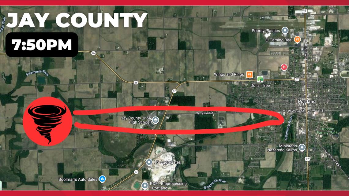
Jay County Tornado
- West side of Portland
- Estimated time — 7:50 p.m.
- Roof damage to the Jay County Jr./Sr. High School
- Tree damage to houses around the school
- Damage reported at the American Legion in Portland


The red circle area shows the potential touchdown(s) of this tornado in Jay County. Because of damage at American Legion, which is close to downtown Portland, the tornado may have had a longer path, or multiple touchdowns.
Update: Jay County School Corporation is closed for Monday, Sept. 23. No eLearning or remote learning. The school district is expecting to provide an update Monday afternoon.
What's next?
The National Weather Service will be conducting tornado surveys in both Delaware County and Jay County on Monday, Sept. 23.
Our news crews are also working to gather for information from residents impacted by the tornadoes and those who saw the twisters.
This story is developing. Check back for updates.
— 13News Meteorologist Matt Standridge

