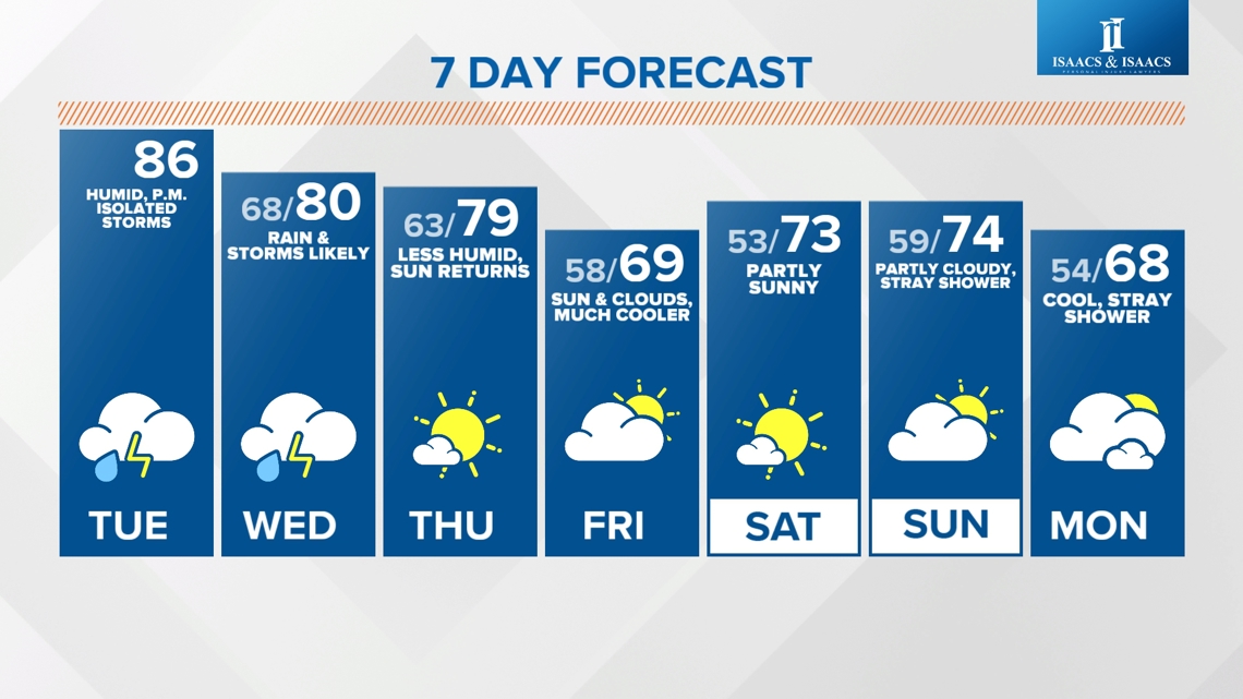
INDIANAPOLIS — Humid heat continues today with dew points climbing into the upper 60s this afternoon. Less humid air arrives behind the cold front by Thursday.
REST OF TODAY:
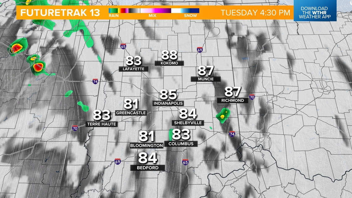
We'll see lots of dry time through the early afternoon as temperatures quickly warm up into the mid-80s.
STORM CHANCE:
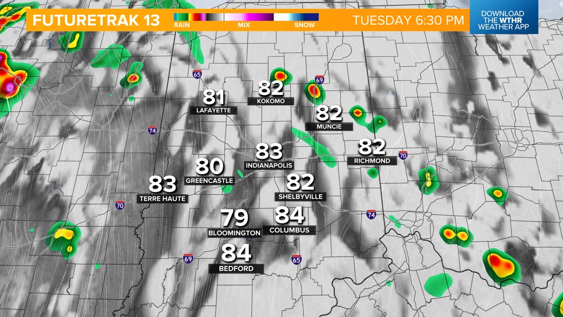
Hit-or-miss storms develop, especially after 4 p.m., during the heat of the day. Severe storms are not expected, but lightning is a threat in any storm and could impact evening outdoor activities.


OVERNIGHT:
Storm activity becomes more widespread during the overnight hours with steady temperatures in the upper 60s.

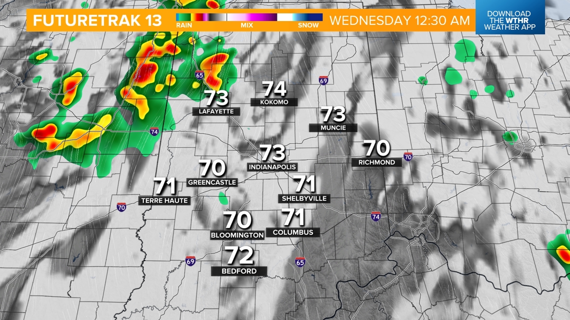

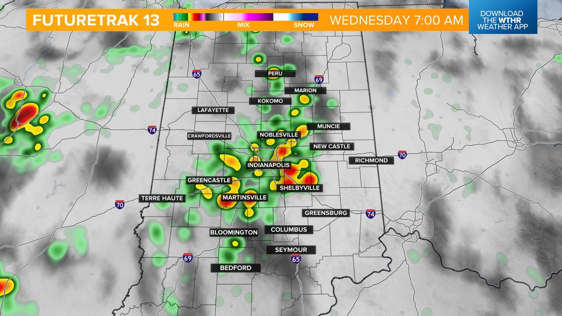
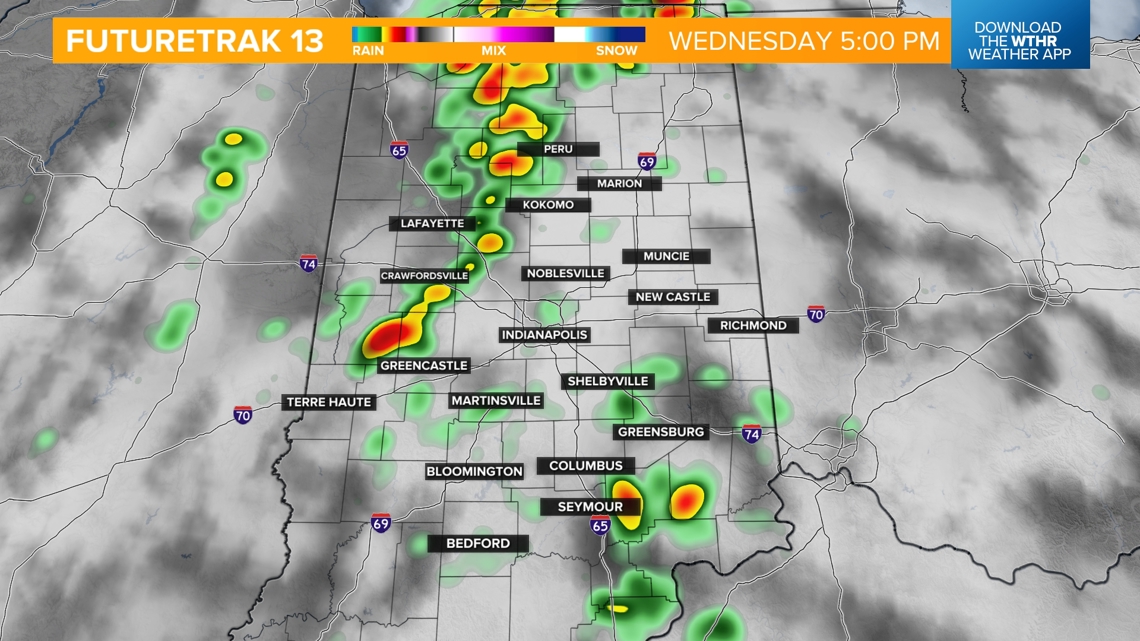
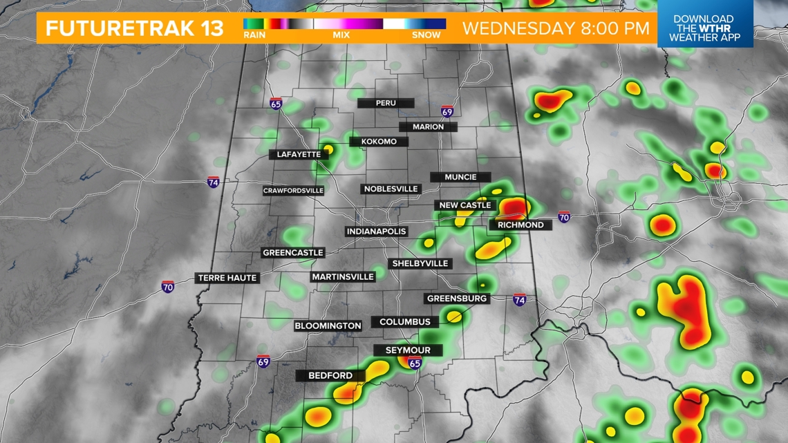
Storm timeline for Wednesday:
While it remains muggy ahead of the front, temperatures will be hindered a bit due to increased clouds and rain chances with highs near 80.

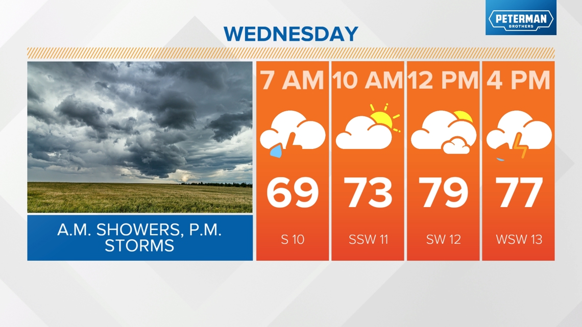
Morning:
Lingering showers from overnight.
Afternoon:
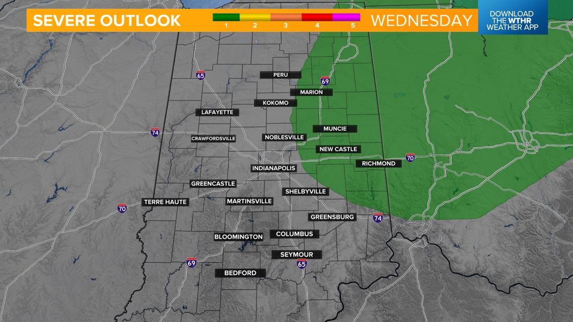
A cold front prompts scattered rain and storms, mainly from 2-8 p.m. The far eastern tier of the state has been placed under a level 1 of 5 for the chance of an isolated strong storm.


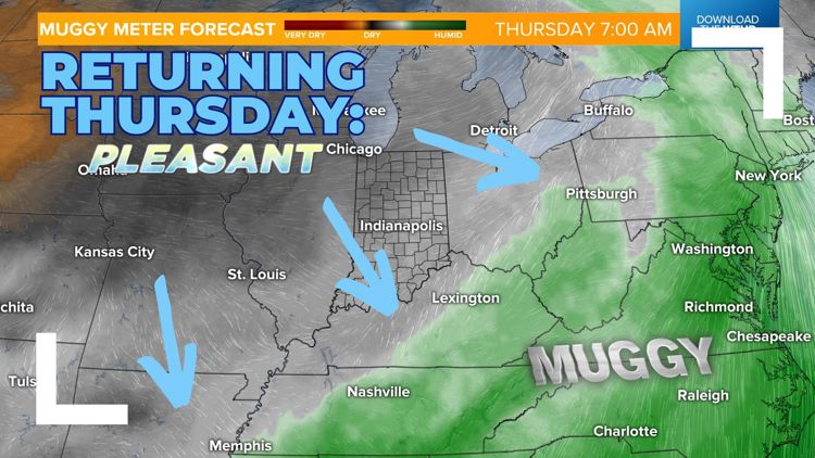
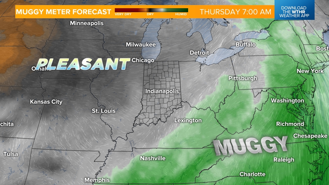
Less humid by Thursday, unseasonably cool stretch starting Friday
Skies clear late Wednesday evening and into the morning hours Thursday. Turning cooler with lows in the low 60s. Behind the front on Thursday, dew points will drop back into the 50s which is in the "comfortable" zone. We'll see sunshine returning with highs in the upper 70s.

Friday kicks off an unseasonably cool stretch with highs that will struggle to reach the 70-degree mark. Partly sunny skies for Friday.

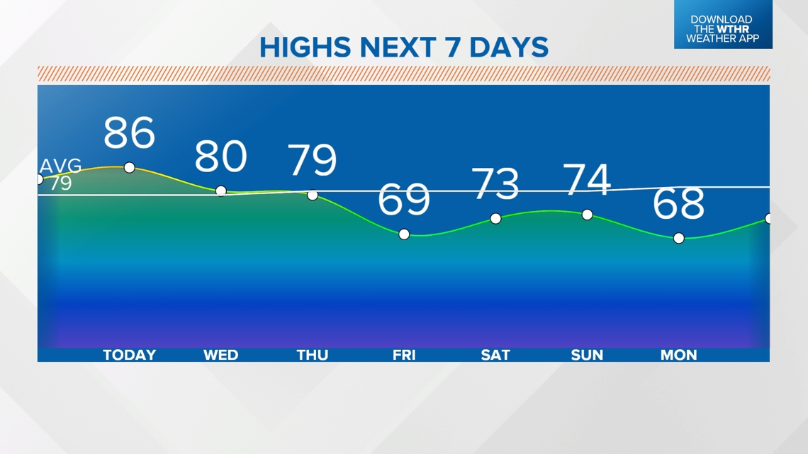
Pleasant high temperatures are expected through the weekend between 70-75 degree. Saturday looks mainly dry with only a stray shower possible on Sunday. Temperatures look to stay below average with highs in the upper 60s/low 70s through the first part of next week.