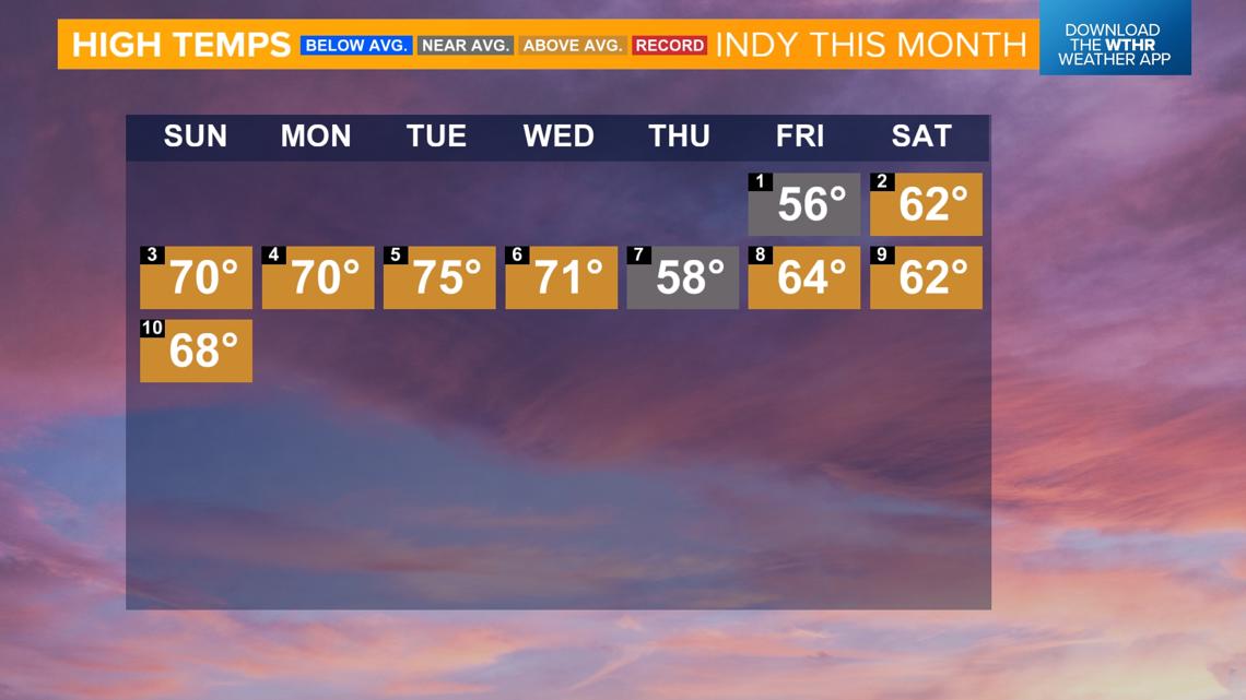
INDIANAPOLIS — Temperatures have been at or above average every day so far this month. The forecast for the next few weeks doesn't show a break in that trend either.


How warm has it been so far this November?
- The average "high" so far this month is 65.6 degrees, which is up 9.3 degrees from average, ranking it the 12th warmest on record.
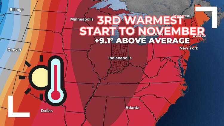
- Average daily mean temperature (temperature from throughout the day) is 47.3 degrees, which is up 9.1 degrees from average, which is a tie for the third warmest.

Above-average temperatures remain in the forecast
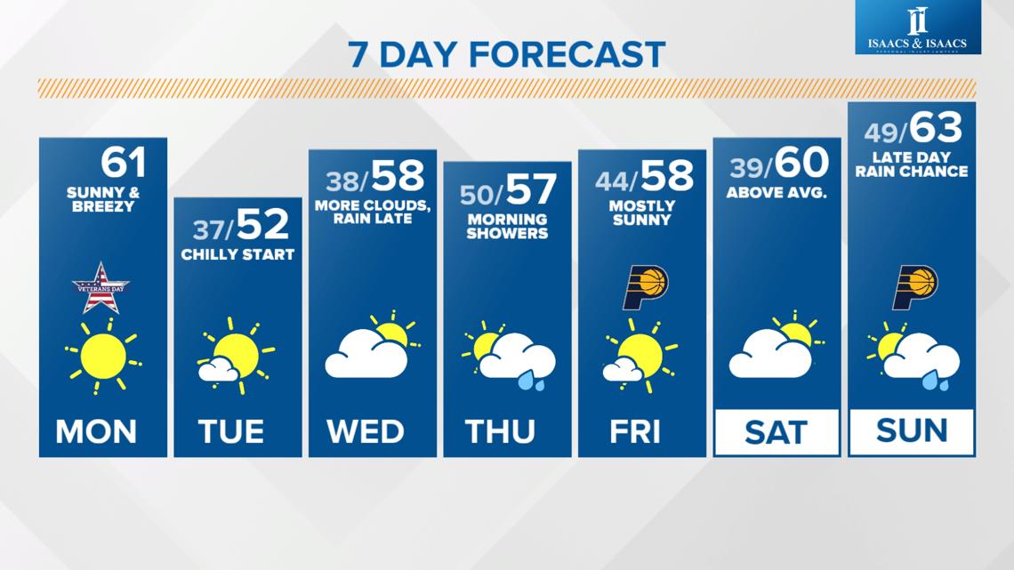
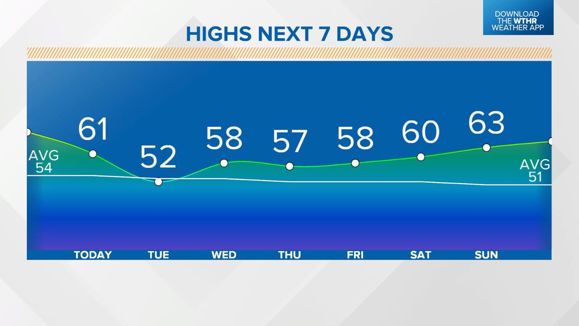
With the exception of tomorrow with a cool high forecast of 52 degrees, temperatures are forecast to climb back above average for the rest of the week. We are at a time of year where the average high temperature falls by a degree every few days, so our "average" high drops from 54 degrees today to 51 degrees this weekend.
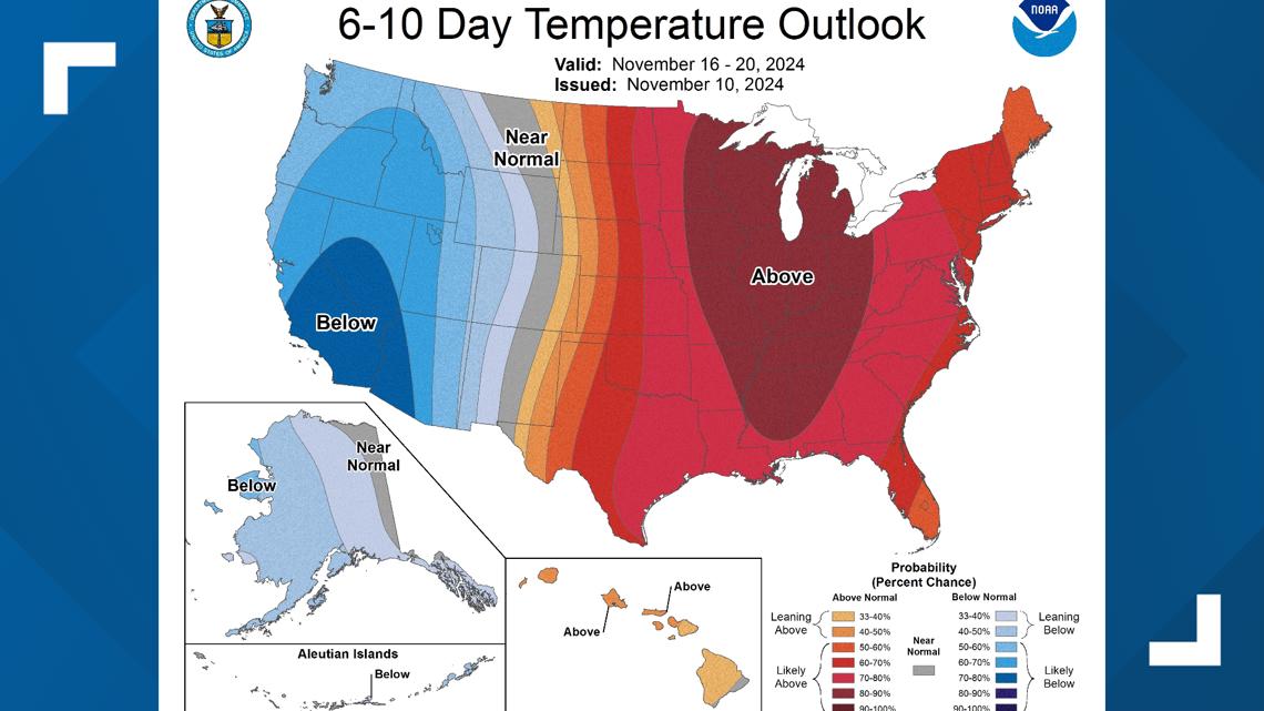
The Climate Prediction Center even has the entire state under a 80-90% chance of above-average temperatures through Nov. 20 in the 6-10 day outlook.


Above-average rainfall so far this month is helping drought conditions
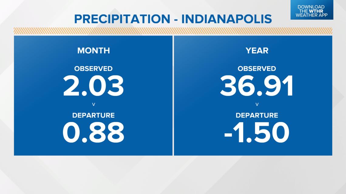
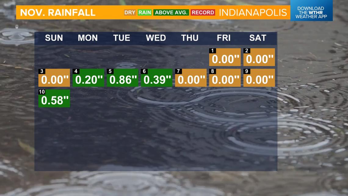
After another round of rain Sunday, Indianapolis is up to 2.03" for the month. That is a surplus of 0.9", which ranks this the 27th wettest start to November.
We could still use more rain though as we're down 1.5" on the year, and most of the state is still reporting abnormally dry to severe drought conditions.


Is there more rain in the forecast?
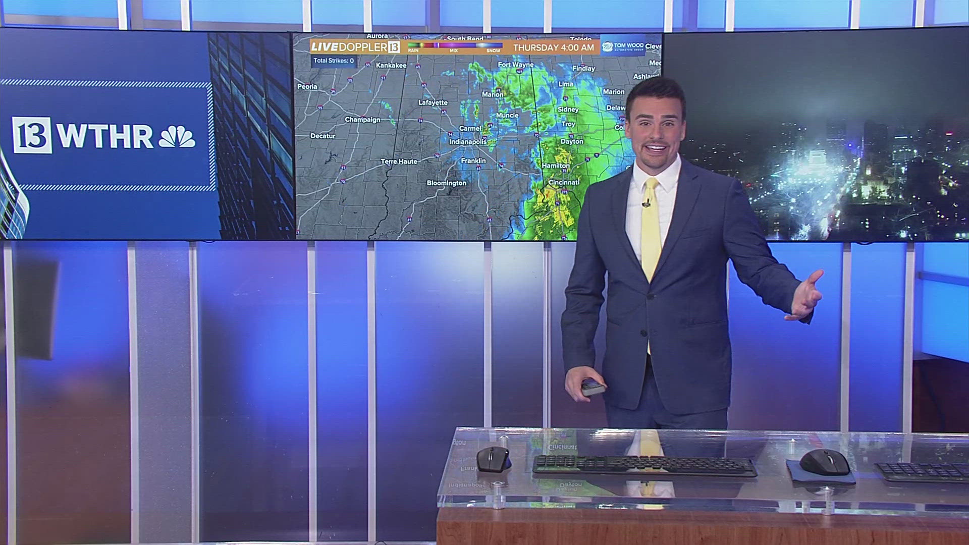
Another system comes in late Wednesday into Thursday morning and could bring an additional 0.25" to 0.75" to the state. Temperatures are forecast to warm back into the 60s this weekend.

