INDIANAPOLIS — It was a noisy overnight with multiple rain and hail storms. Plus, there was a brief rotation along the Wayne County/Union County line south of Richmond.
Now, temperatures are dropping quickly with a few snow flurries here and there, but they won't last long. We will stay near the freezing mark the rest of Wednesday with clearing skies. Expect northwest winds to blow between 15-25 mph with gusts near 35 mph.
TODAY
- Morning snow flurries
- Afternoon clearing skies
- Northwest winds 15-25 mph (gusts 30+ mph)
- Highs in the 30s
TONIGHT
- Clear skies
- Dropping to the low 20s (wind chills in the 10s)

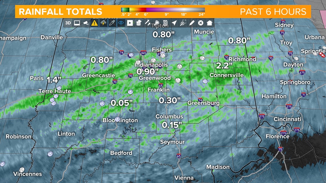
There were multiple small hail reports from pea-sized to ping pong ball-sized ice. There was a lot of wind across central Indiana with those storms. A gust of 59 mph was recorded at Indianapolis International Airport.
There were a few reports of small limbs down across the state. The heaviest rainfall fell near the center of the state, with generally a half-inch to a full inch of rain. Amounts were lower either 60 miles north of Indianapolis or 60 miles south.

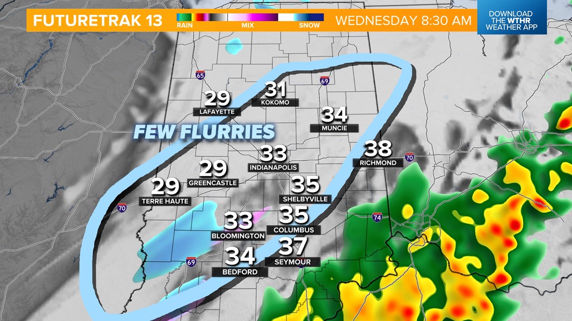
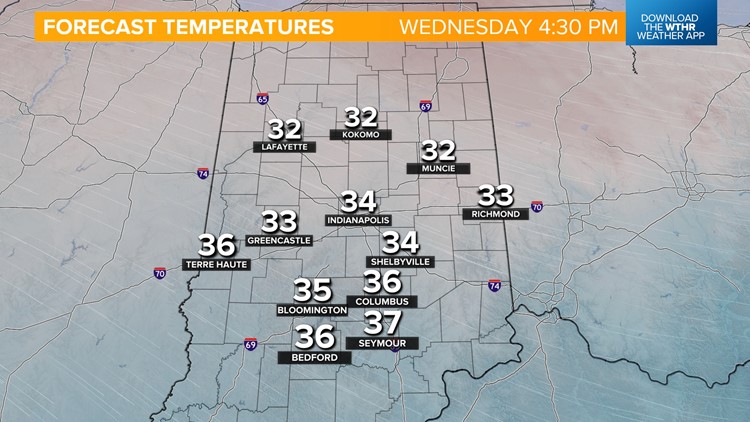
Watch for some scattered morning flurries across Indiana. As of now, no accumulations are expected, but don't be surprised to see some flurries blowing in the northwest winds for the rest of the morning.


Once we crash down to the low 30s, we are moving from there. Expect to stay in the 30s the rest of the day across Indiana. Wind chills will make it feel like the 20s. Skies will clear out with sunshine for the afternoon. It will be a very cold sunshine.

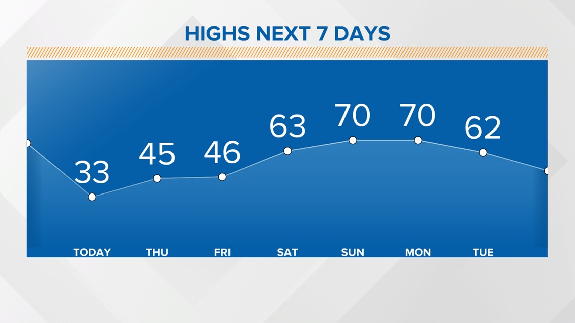
This cold front is strong, but it is not long-lasting. South winds will return by Thursday night, helping us to rebound to 60s and 70s this weekend.