
INDIANA, USA — We have enjoyed a stretch of cooler, pleasant weather for a couple days. Parts of Indiana have been running 5 to 10 degrees below average. Soak it in, because it's not lasting long. A burst of summer heat is coming this weekend and next week.
Tap HERE to track the heat moving in with our interactive weather maps.
A cold front hit Indiana and pushed south all the way to the Gulf Coast. It has brought beautiful weather and knocked out the humidity. Some mornings have started in the 40s.
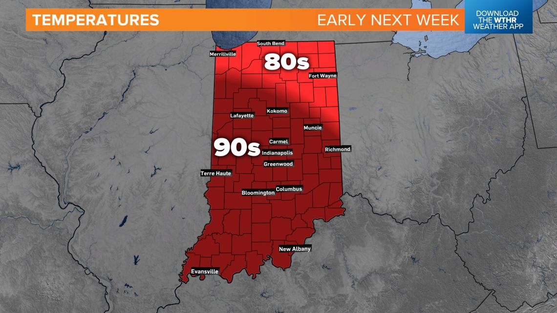
Get ready for highs in the 90s.
Weather pattern switch
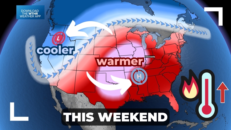
The upper level low (cooler air) has been sitting over the Great Lakes. The upper level high (warmer air) has been sitting over the west. It has also brought a higher fire threat for much of the Rockies. These two pressures are about to switch places.

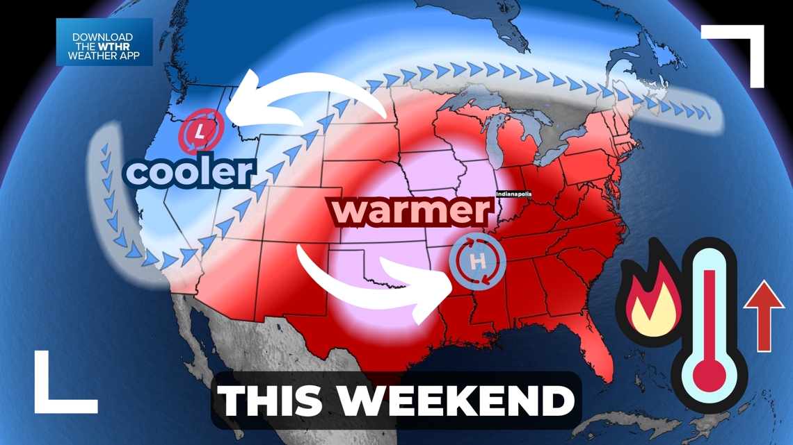
As lower pressure moves out west, the western states are about to cool down with some rain (and snow) chances.
Meanwhile, the higher pressure heat dome is moving east to sit over the central Plains.
This switch is about to bring a burst of hot weather and humidity to Great Lakes, including Indiana. Temperatures in the 90s are returning to the forecast.
Indiana heat
You'll notice the weather getting hotter day-by-day this weekend, but the hottest weather will not arrive until Monday and Tuesday. Expect many 90s across the state.

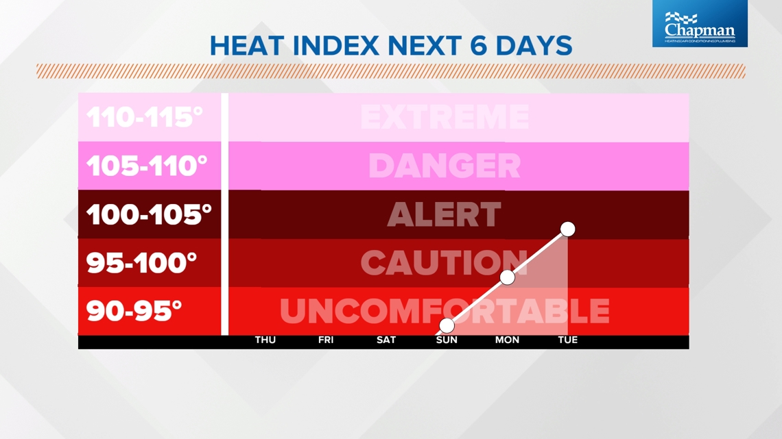
With the burst in humidity too, the heat index is about to soar. We haven't had a heat index in about a week. The lack of mugginess has made it feel chilly at times, especially in the mornings.
The heat index is likely to return to the 90s by Sunday. We'll be approaching the 100-degree mark with humidity by Tuesday.

Once the humidity goes up, some storm chances will also go up. Expect some pop-up storm chances at times next week.
First seasonal snowfall
The next snow season has started. As the west cools downs, and some moisture arrives, some snow will be possible in the highest elevations. If you look up, you may see some more white caps up on the tallest peaks. A few inches will be possible.

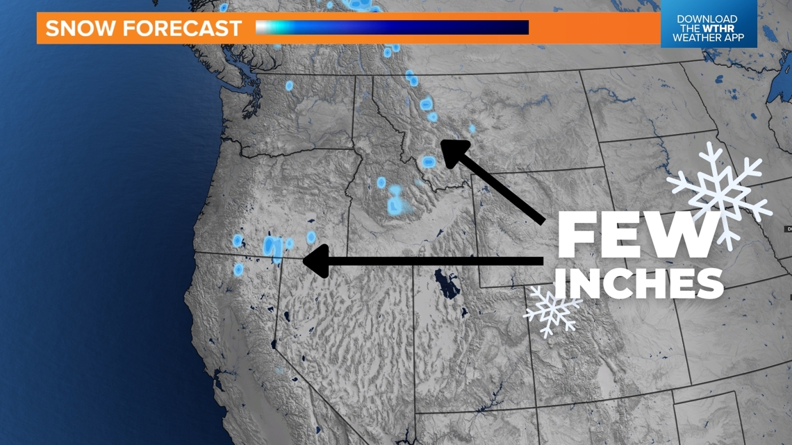
No snow will fall in any towns, just some rain. However, this is the first snowfall forecast we've had in a couple months.
Looking even further
After this burst of heat, we should have some fronts that take the slight edge off. However, expect warmer and more humid weather for the rest of the month.
We may have to wait for September to bring some morning 40s again.
