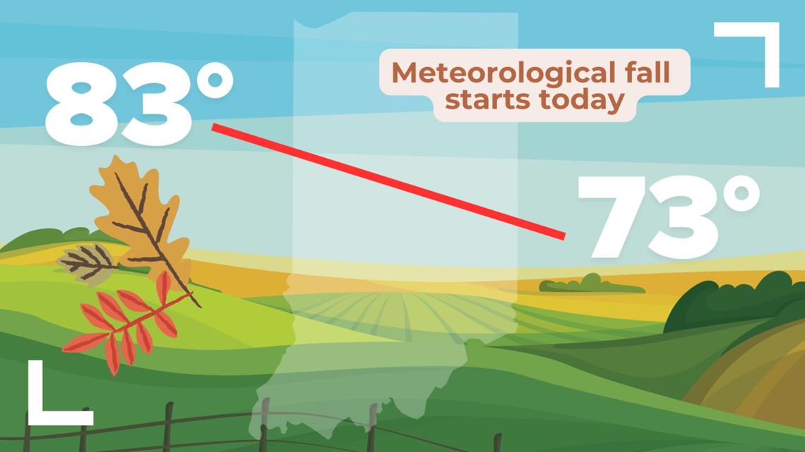
INDIANAPOLIS — It's officially September, which means the start of meteorological fall. This starts a new set of records that runs through Nov. 30.

So how did our summer pan out?
Indianapolis finished the meteorological summer season (June 1 - Aug. 31) with slightly average temperatures and below-average precipitation. Here's how the numbers rank us:
- Average high temp: 84.6 degrees = 0.7 degrees above average = T-55th warmest on record
- Average low temp: 65.3 degrees = 0.5 degrees above average = T-41st warmest
- Average mean temp: 74.9 degrees = 0.6 degrees above average = T-51st warmest
- Precipitation: 10.72" rainfall = 1.9" below average = 68th driest on record
Year to date (Jan. 1 - Aug. 31):
- Average high temp: 67.8 degrees = 2.9 degrees above average = T-3rd warmest on record
- Average low temp: 49.3 degrees = 3.0 degrees above average = 6th warmest
- Average mean temp: 58.5 degrees = 3 degrees above average = 4th warmest
- Precipitation: 32.76" = 1.9" above average = 32nd wettest on record
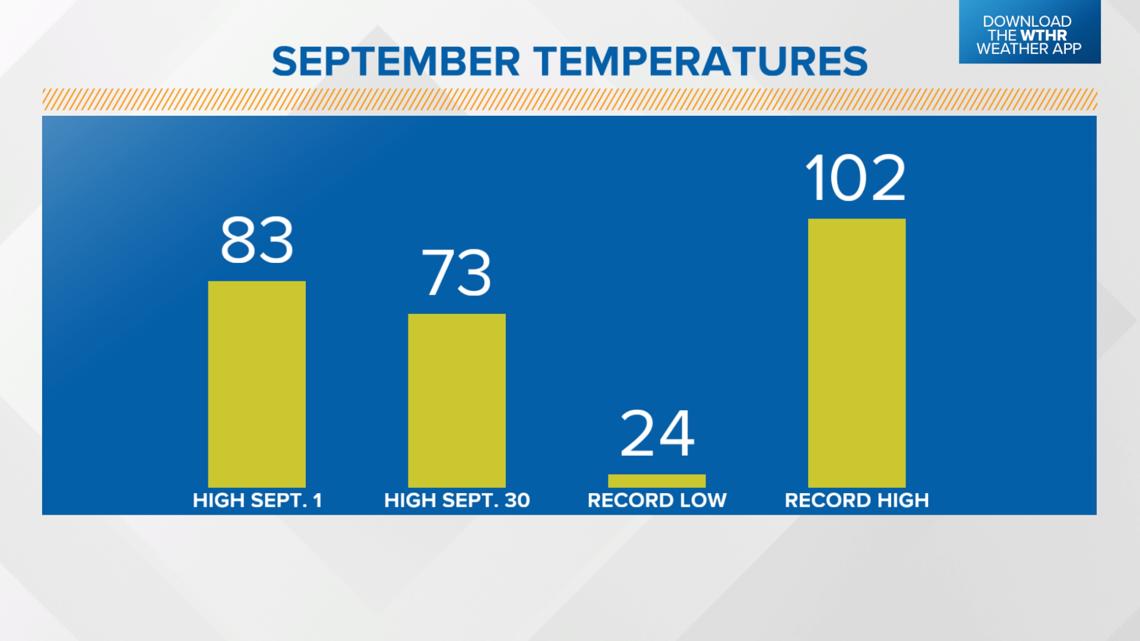
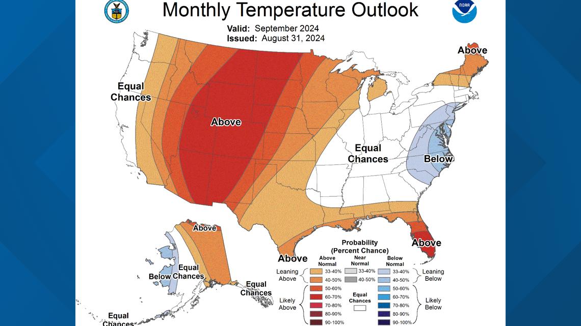
What can we expect for September?
On average, the high temperature drops from 83 degrees to 73 degrees during the month. The hottest temperature recorded in Indy in September was 102 degrees on Sept. 5, 1899, and the coldest was a low of 24 degrees on Sept. 30, 1899.

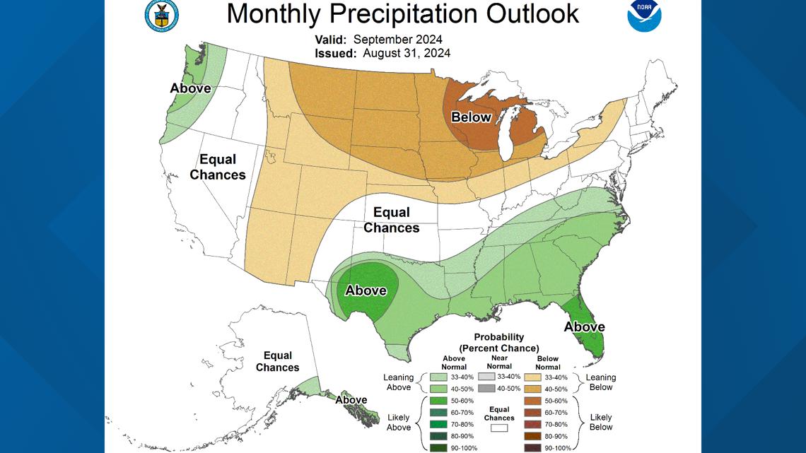
The Climate Prediction Center is looking at a fairly seasonal temperature setup for the month, with equal chances of above- and below-average temperatures and a signal of drier-than-normal precipitation chances. On average, Indy sees around 3" of rainfall during this month.


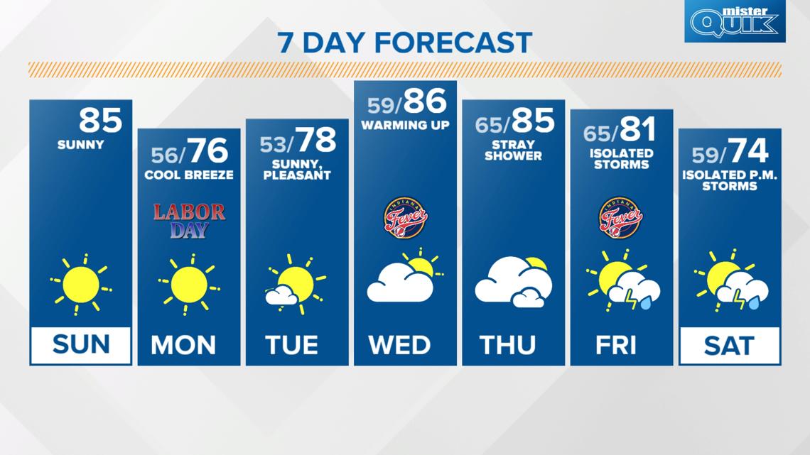
Unseasonably cool Labor Day with a wide range of temps this week
Look for seasonal highs in the mid-80s this afternoon but feeling less muggy as dew points drop below 60 degrees (comfortable zone!). We'll stay clear with a cool breeze tonight and overnight with lows dropping into the mid-50s.
Labor Day brings below-average temperatures with low humidity and lots of sunshine. Highs will be in the mid to upper 70s. After a chilly start with outlying locations dropping into the upper 40s Tuesday morning, we'll return to the upper 70s Tuesday afternoon.
Temperatures will trend warmer by mid-week with highs back in the mid-80s starting on Wednesday. Look for highs to stay in the 80s for the rest of the week as rain chances return to the forecast. A spotty storm is possible late Thursday with scattered storms possible again Friday and Saturday.
Long-range forecast models are bringing in much cooler air next weekend along a cold front. Below-normal temperatures could linger through the following week as well.