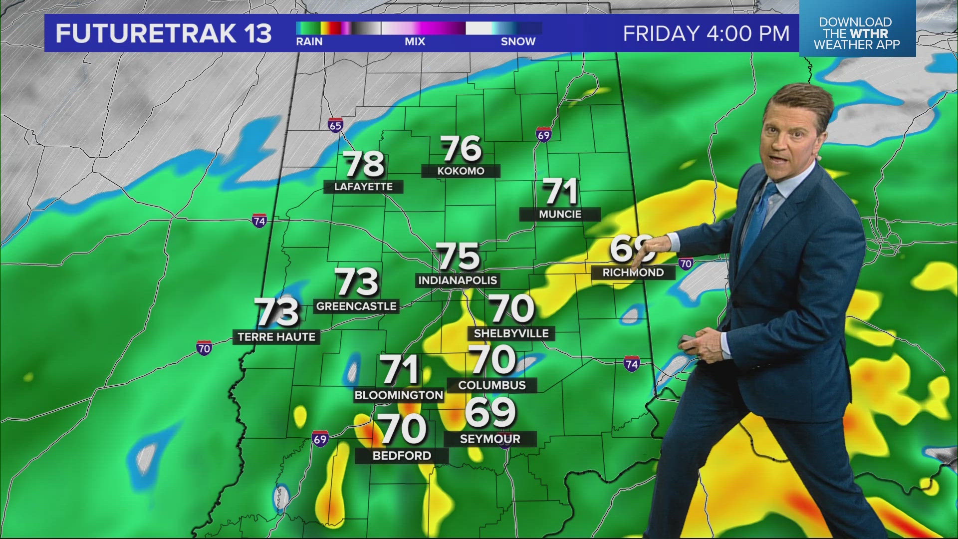
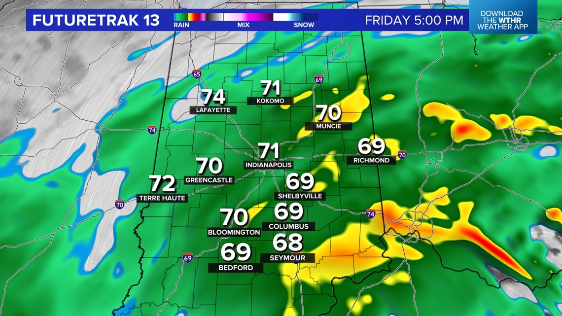
INDIANAPOLIS — Weather Impact Alert Day continues with the worst of the arriving between now and 8 p.m — as a surge of stronger gusts rotates through the state within heavier rain bands.
Those bands have already knocked out power to tens of thousands of customers in their path in Ohio and Kentucky — in addition to numerous downed trees. Please note that the tree damage around Louisville came from peak gusts (so far) less than 50 mph. Because soils are wetter due to non-stop rain today, trees will be more susceptible to come down with less wind.

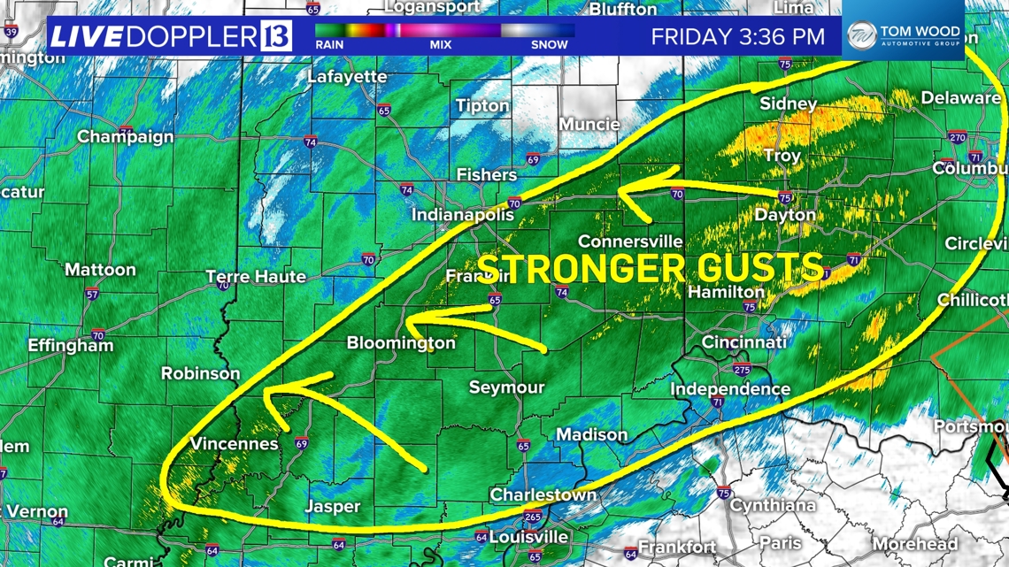
Peak gusts of 40-60 mph occur between now and 8 p.m. from east to west. Please use caution if traveling, have electronics charged and flashlights as power outages are expected to increase the next four hours.
In addition, rain becomes heavy at times, which will make driving difficult, flood some roads, and make for challenging conditions for power crews to restore power.


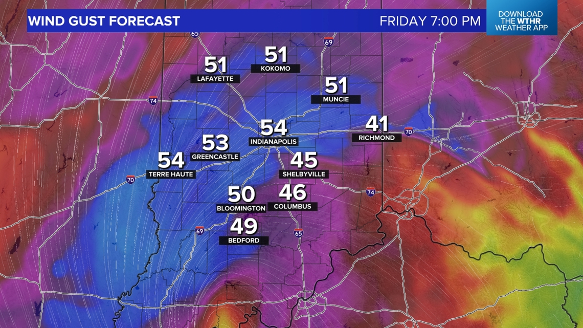
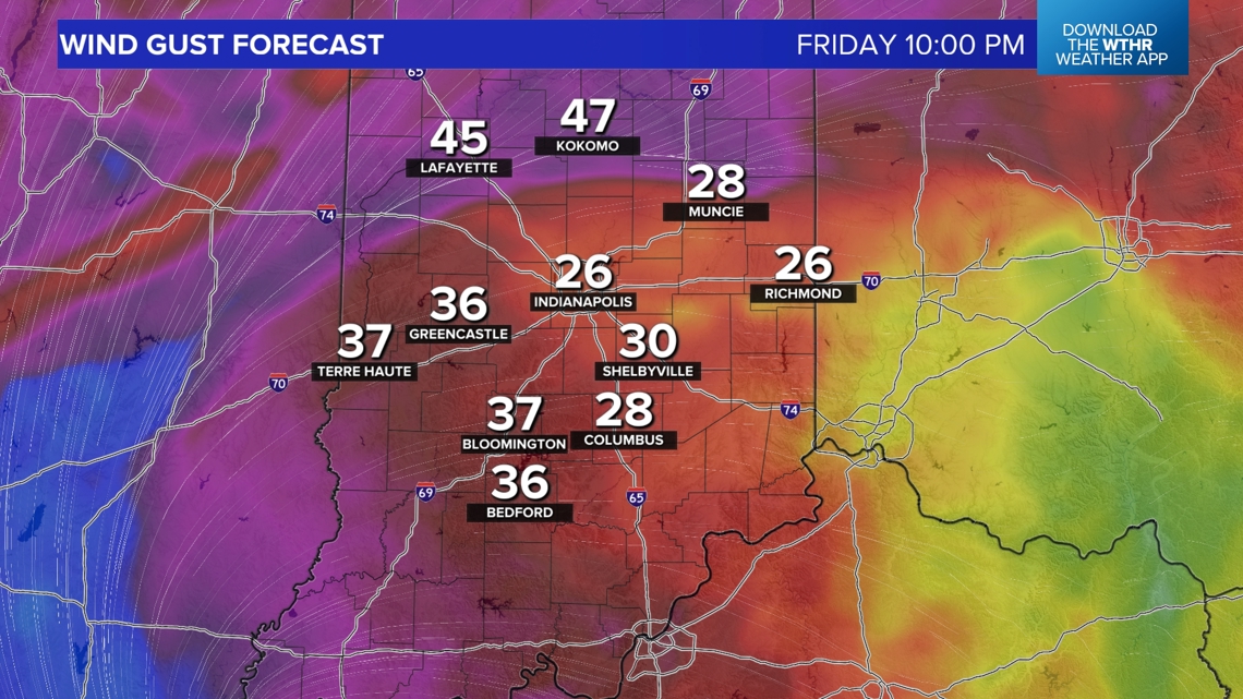
The High Wind Warning continues for most of the area until 11 p.m. The Wind Advisory (where peak gusts will be lower) continues until 1 a.m.
We'll need to monitor for potential embedded rotation as well on the southern edge of the rain shield, which is common with remnant tropical systems.

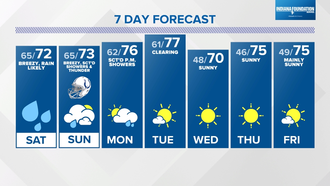
Weekend Impacts From Helene:

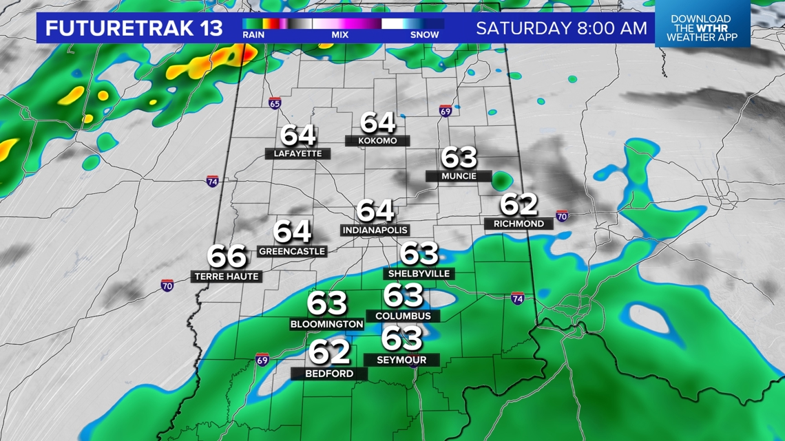
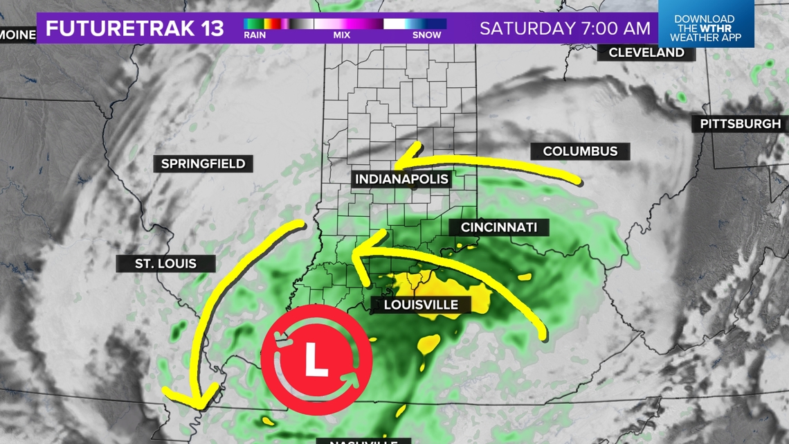
Rain scatters overnight and wind quickly eases by midnight. However, the new combined low pressure system (Helene merging with an upper low over southwestern KY/NW Tennessee) will meander around the Ohio River and Indiana for the entire weekend. That keeps us in steady rain Saturday with breezy conditions.

Rain will be likely from start-to-finish along and south of I-74...closer to the circulation center. The rain shield expands during the day and into the evening. Areas in north-central Indiana may actually get peeks of sun, but unfortunately that will allow scattered thunderstorms to develop.

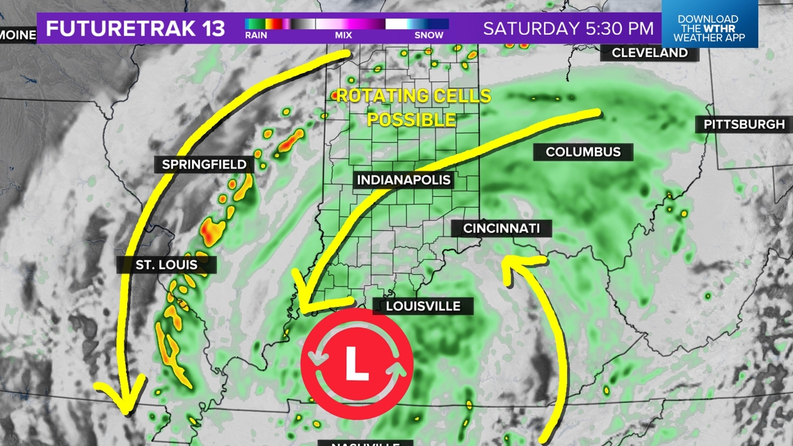

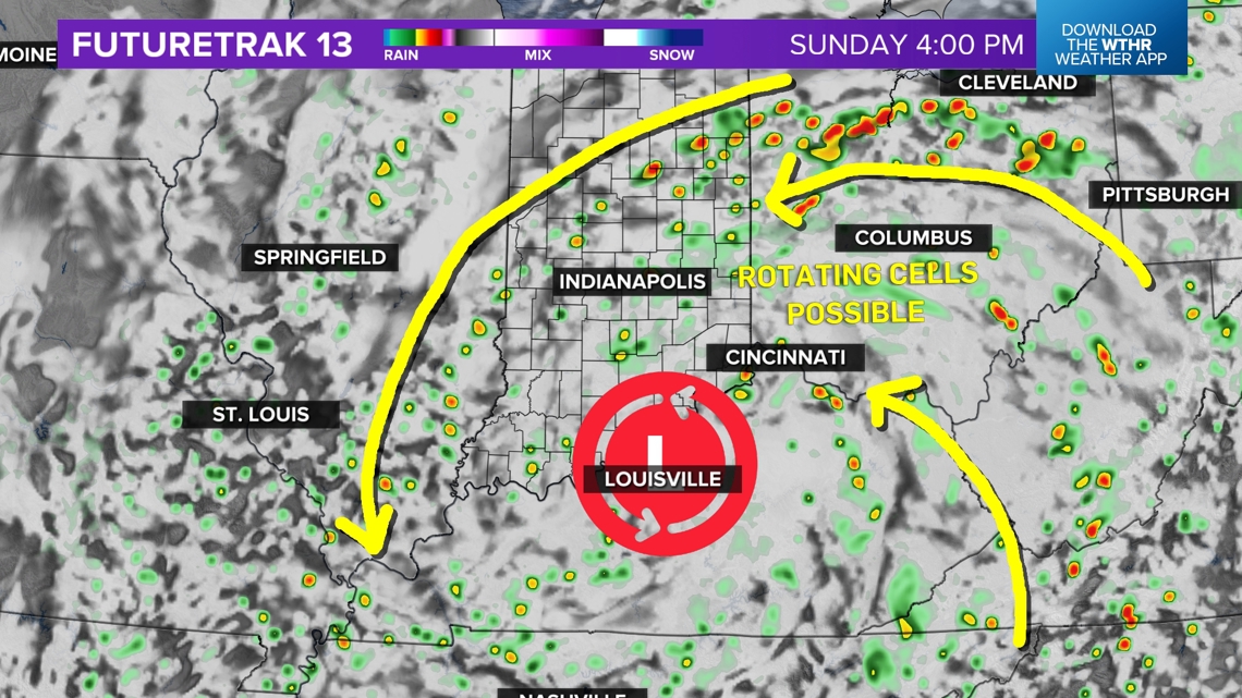
And we'll need to watch those closely with the broad circulation around what's left of Helene making cells more susceptible to rotate and/or produce brief tornadoes.
Be Weather Aware Saturday and Sunday afternoons with the potential of some Tornado Warnings both days.
Rain will be more scattered Sunday versus Saturday.
Showers continue Monday before a brighter, more pleasant pattern emerges during the middle and latter half of next week.