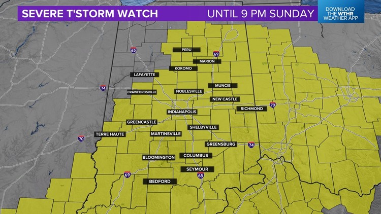
INDIANAPOLIS — For the fourth straight day central Indiana is dealing with weather watches and warnings.
Between now and sunset, there will be scattered to numerous thunderstorms across the viewing area. Any storm on radar today will possess very heavy rain rates, frequent lightning, gusty wind, some hail and the potential to produced localized flooding.
In stronger cells with persistent updrafts, locally severe hail and wind gusts over 60 mph will be possible.
You're advised to remain weather aware, follow radar closely and be prepared to seek shelter and get indoors if the storm is approaching your area and/or you hear thunder.

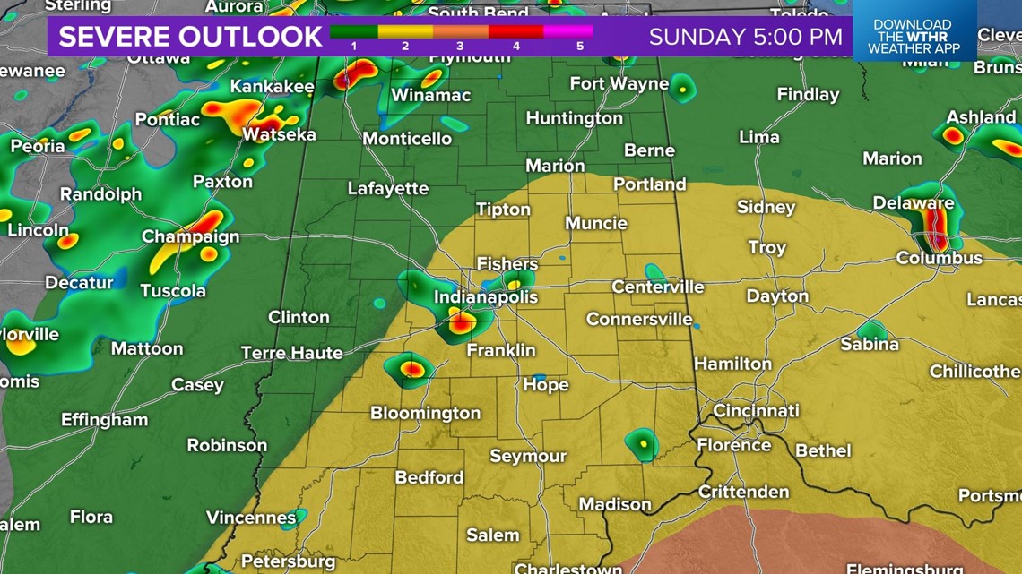

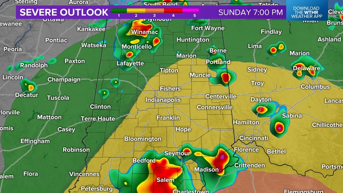

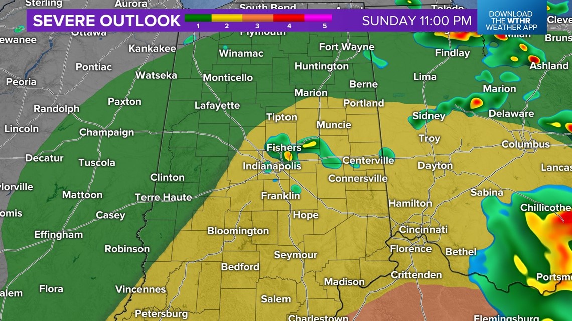
The severe threat ends around sunset with the passage of a "cool front" and its wind-shift which pushes the instability axis out of the state and sets the stage for quieter weather the remainder of the July 4th extended holiday weekend.
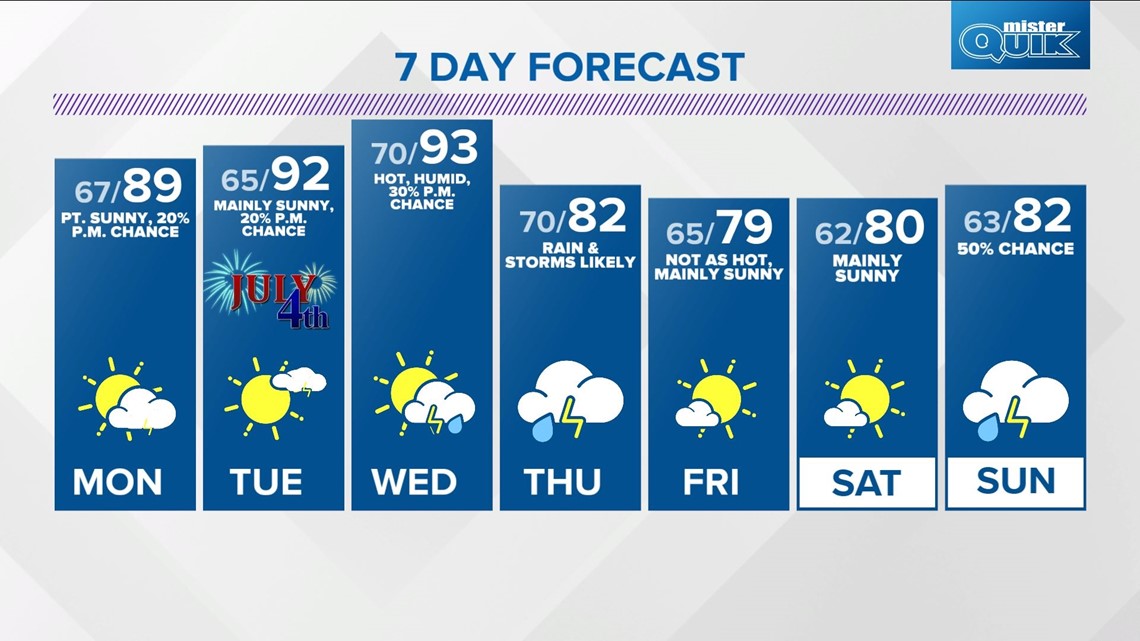
For those that now have fireworks festivities Monday and/or Tuesday, there will be a 20% chance of isolated downpours and/or thunderstorms both days. You'll be able to enjoy ample time on the lakes or your cookouts.

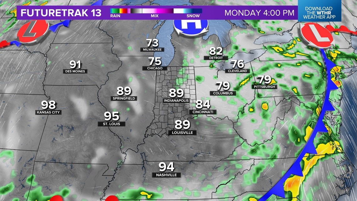

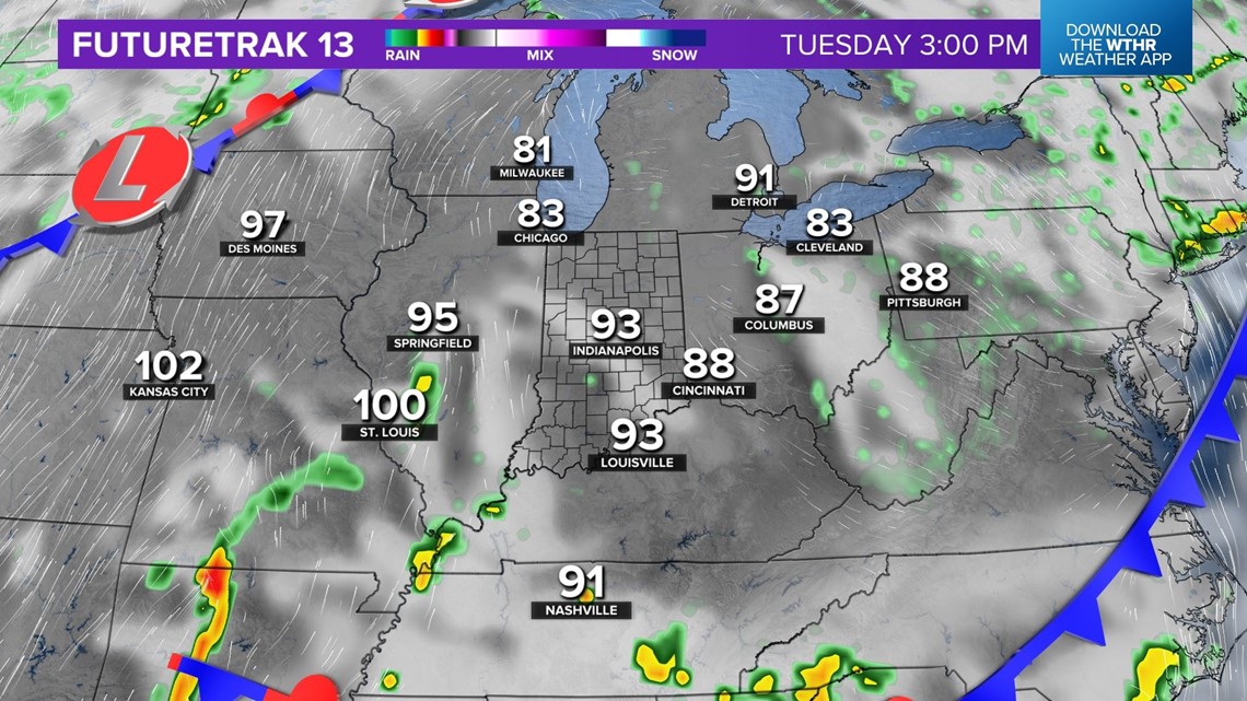
Plenty of sunshine, too, with seasonably hot highs near/above 90 degrees and a moderate muggy meter of dewpoints in the mid/upper 60s versus humid in the 70s.
A three-day streak of mainly quiet weather ends abruptly Wednesday night and Thursday with the approach of the cool front. We'll see scattered to numerous rain and storms Thursday before cooler air finishes the week and lingers into next weekend.