INDIANAPOLIS — Although the streets and sidewalks may be damp, we are finished with rain now for several days. Frankly, we do not need any more rain. For the past day, we have picked up .37" of rain. The monthly rain total is now 6.5", almost 4 inches above average.
The cold front that generated the rocking and rolling in the atmosphere overnight has moved east but is now causing a major weather change. Look for temperatures well below average the next few days, breaking a warm streak that gave us three days in the 80s this past week.
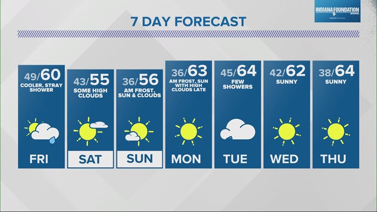
Today, we will struggle to get to 60 degrees as the winds shift to the north and northwest. Tomorrow and Sunday, highs will not get out of the 50s.
From a technical point, surface high pressure centered over Northern Montana tomorrow slides into the Southern Plains by Monday. For us, that means winds at the surface will be out of the northwest, and even though we will have drier air and sunshine, the cold snap is reinforced.
The wind speeds will be worth watching because if they die down, we may see some patchy frost both Sunday and Monday mornings. Again, this will be patchy and not widespread.
Next week marks a return to the 60s with a chance for showers Tuesday but lots of sunshine Monday, Wednesday and Thursday.


