INDIANA, USA — Storm chances for Easter Sunday across Indiana have been delayed until mainly after 10 p.m.
Good news! We are most likely squeezing out a few more hours of nice weather before storm chances pick up later. There is a chance for a rogue storm or shower popping up beforehand, but most of the rain, thunder, and hail possibilities will be near or after sunset. The warm front and the upper-level support will take a little longer to align that we originally thought.
Tap HERE to track storms coming into Indiana with our interactive radar.
(Note: With the delayed front, there is a chance these storms are overall a bit weaker. We'll see how they evolve through the evening.)
Why are storm chances being pushed back later?
Alignment. To get severe hail storms, you need the atmosphere to be working together near the ground and higher up. Right now we have some slight, upper-level enhancement across central Illinois and central Indiana. However you have nothing to really spark the storms in the first place. You need the warm front. The warm front was washed farther south early Sunday morning with some rain. It is taking the warm front longer to push back north into the firing zone.

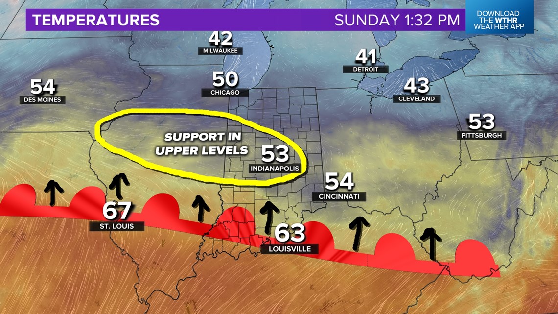
We are watching sunlight and winds to see how quickly we can push the warm front back north. A slight chance for a storm is possible after 6 p.m., but better chances for storms will come after 9 p.m.. Also, wherever the warm front ends up, that's where the hail storms will be, plus rain and thunder farther north of the front. Storms will be harder to form south of the front.
When will it storm Easter Sunday evening?
- SUNDAY AFTERNOON: For the rest of the afternoon, we are watching the warm front gradually move north into central Indiana. A stray shower or storm is possible, especially in western Indiana. Otherwise enjoy the nice weather!
- LATE SUNDAY EVENING AND NIGHT: Once the front gets farther north into the firing zone, more widespread rain and storms will be possible, especially near and north of the warm front. Many folks across central Indiana can expect some rain and thunder, especially after sunset. Those closer to where the front lies, that's where the hail storms are likely to be the strongest with up to quarter or golf ball-sized hail.

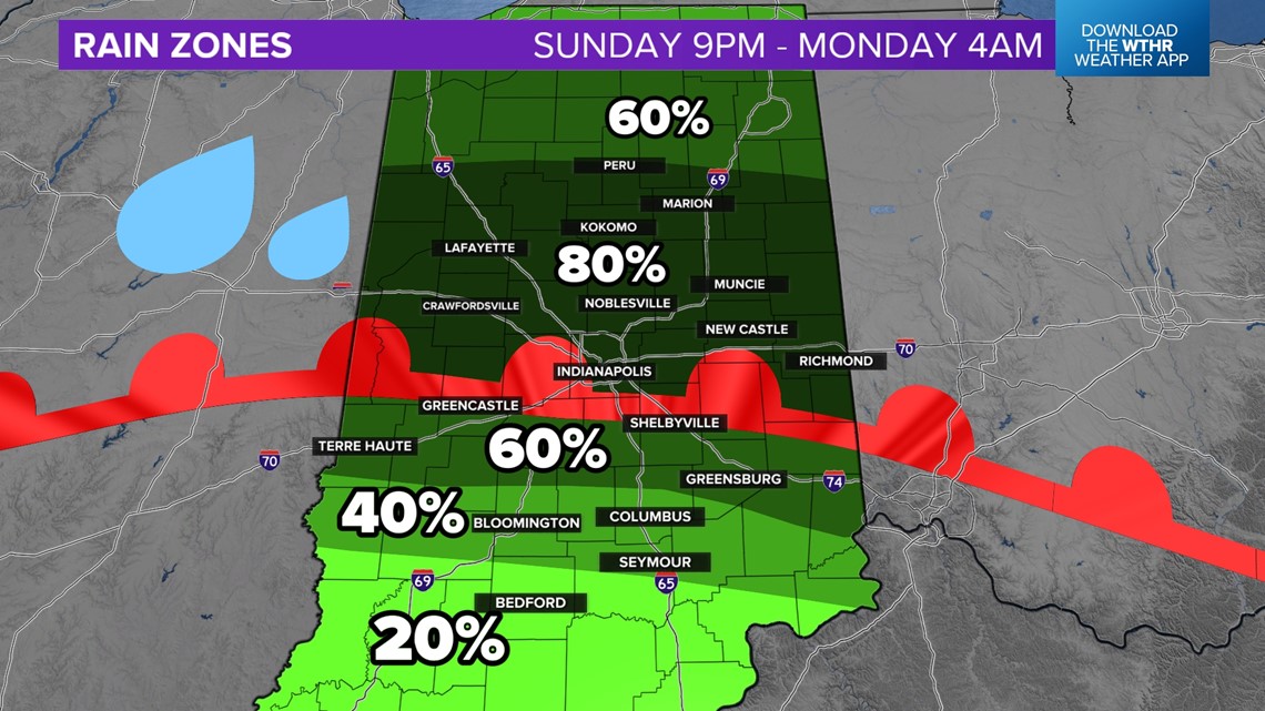
After first the storms are likely to be isolated and scattered. Over time as the front moves farther north and the low-level jet kicks in, expect the map to fill in with rain and thunder

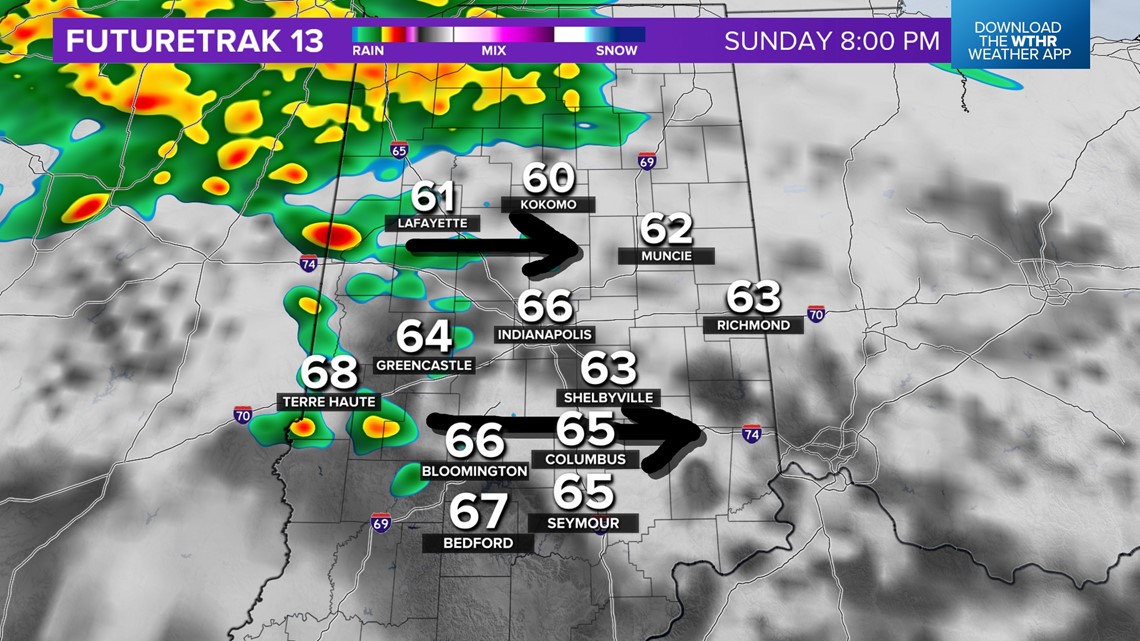
More widespread rain and thunder are likely after 10 p.m. and will last on-and-off through the rest of the night. Generally a half inch or so of rain is possible, with the highest totals north of I-70.

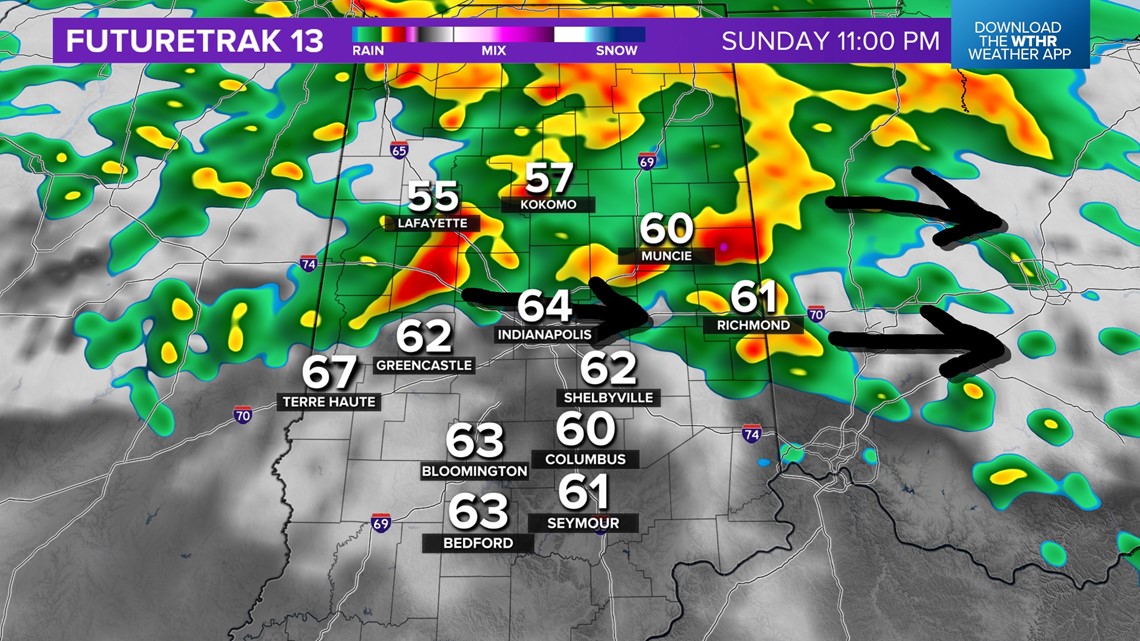
Storms are not impossible in southern Indiana, but there will be a capping mechanism in the atmosphere to help reduce storm chances. The best chance for rain and thunder will be north of Terre Haute, Bloomington, Shelbyville, and Rushville.
Who has the highest chance for hail Sunday night?
This zone may change over time, but generally the heart of central Indiana has the best chance for hail. This is where we could see up to golf ball sized hail.

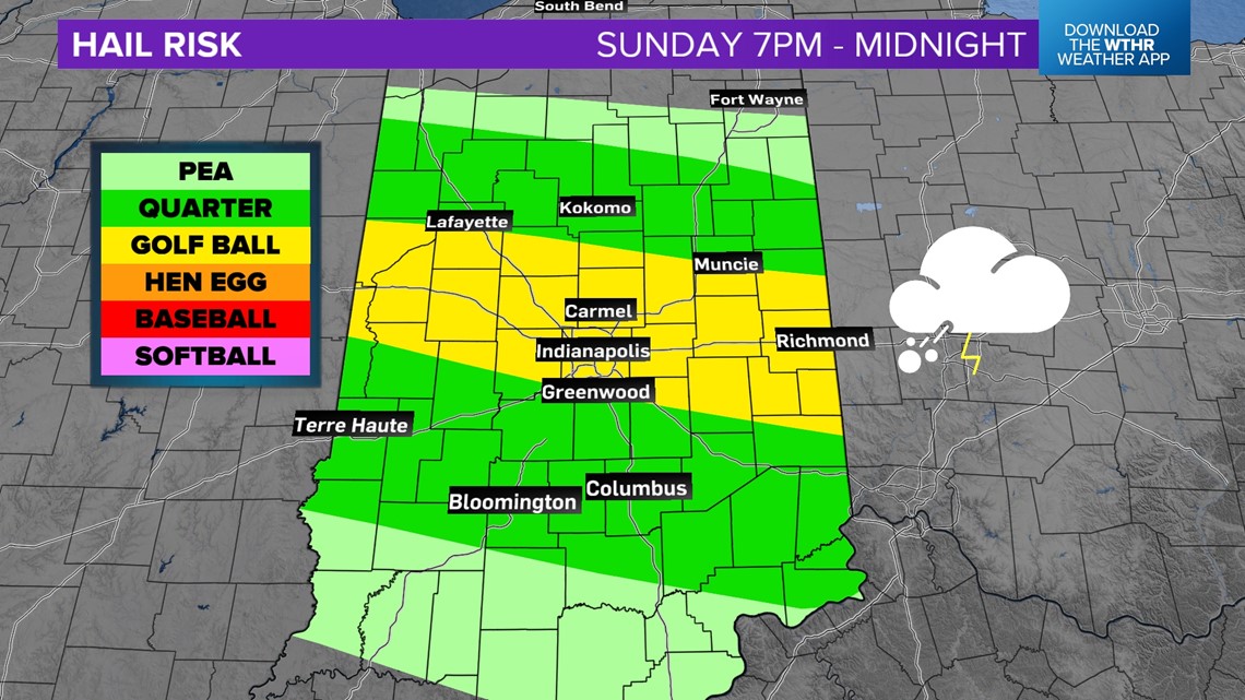
Not everyone will get hail, but the chance will be there. We have to see where individual storms track.
What about Monday's storm chances?
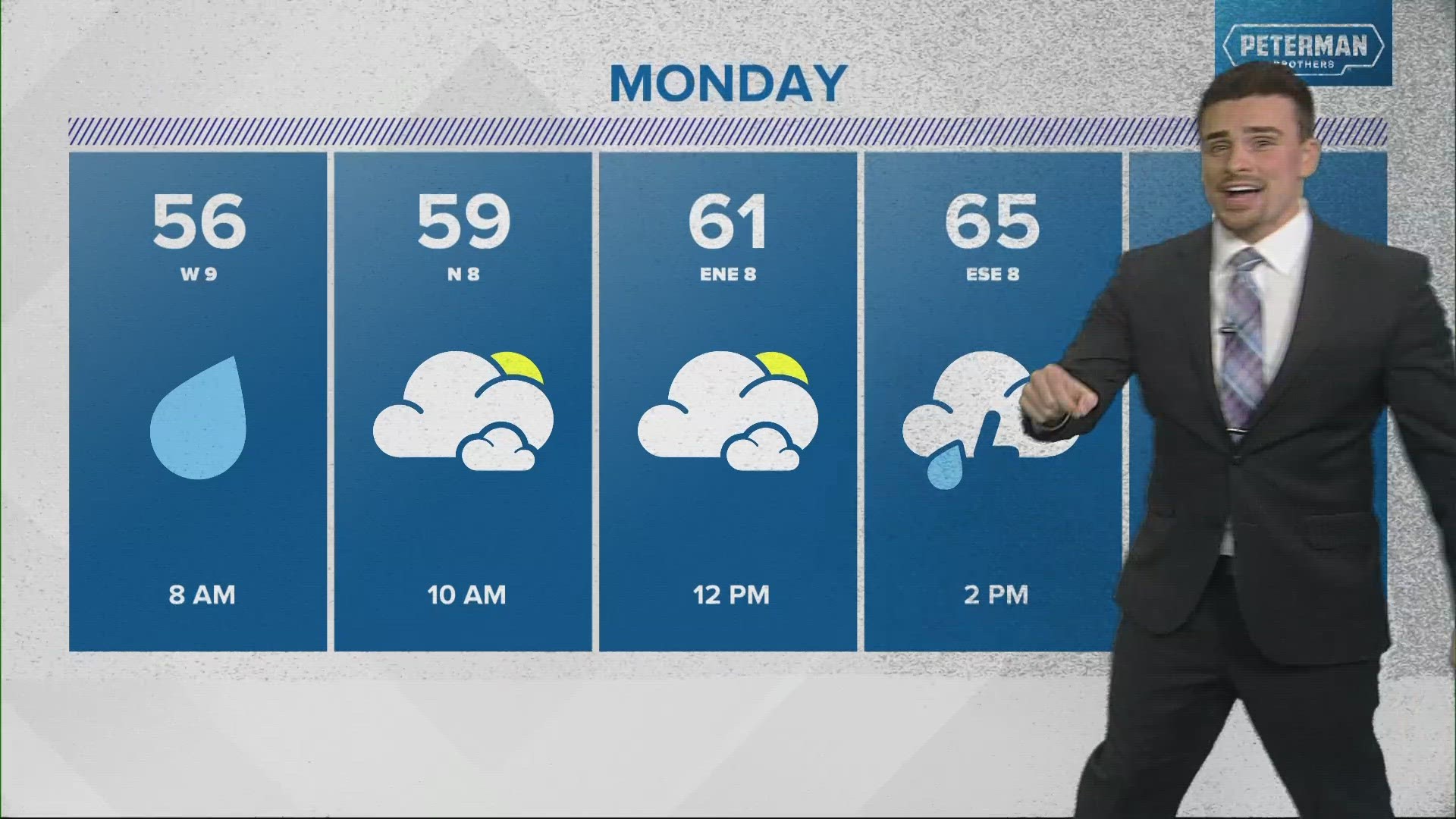
Sunday night is the weaker round. Once we dry out Monday morning, stronger storms are possible across the central U.S. Monday afternoon and evening. Heavy rain and thunderstorms will push into central Indiana with all threats, including hail, wind, and tornadoes.

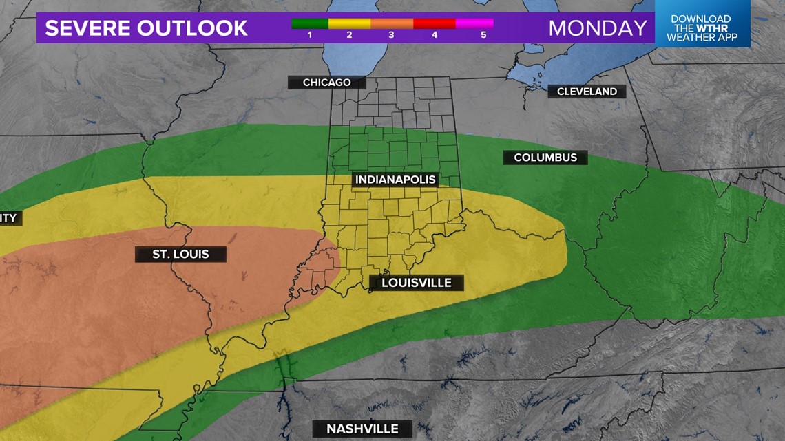
The worst of the storms will likely be south of Indianapolis where the warmer air lies. This is where we may be able to support stronger cells moving in from Illinois. A level 3 out of 5 severe threat is forecast for southwestern Indiana.

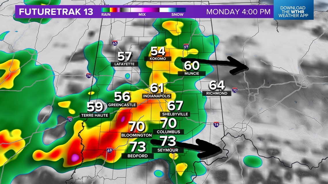
Stay tuned. Severe threats are always evolving as the atmosphere changes before a storm system arrives.
—13News Meteorologist Matt Standridge

