As expected, storms exploded over Central Indiana... producing very heavy rain, pockets of 55-60+ mph wind gusts, some treed damage, power outages, and small hail.

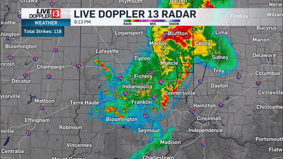
At this hour the storm complex continues to weaken in eastern Indiana, but areas of heavy rain continue.

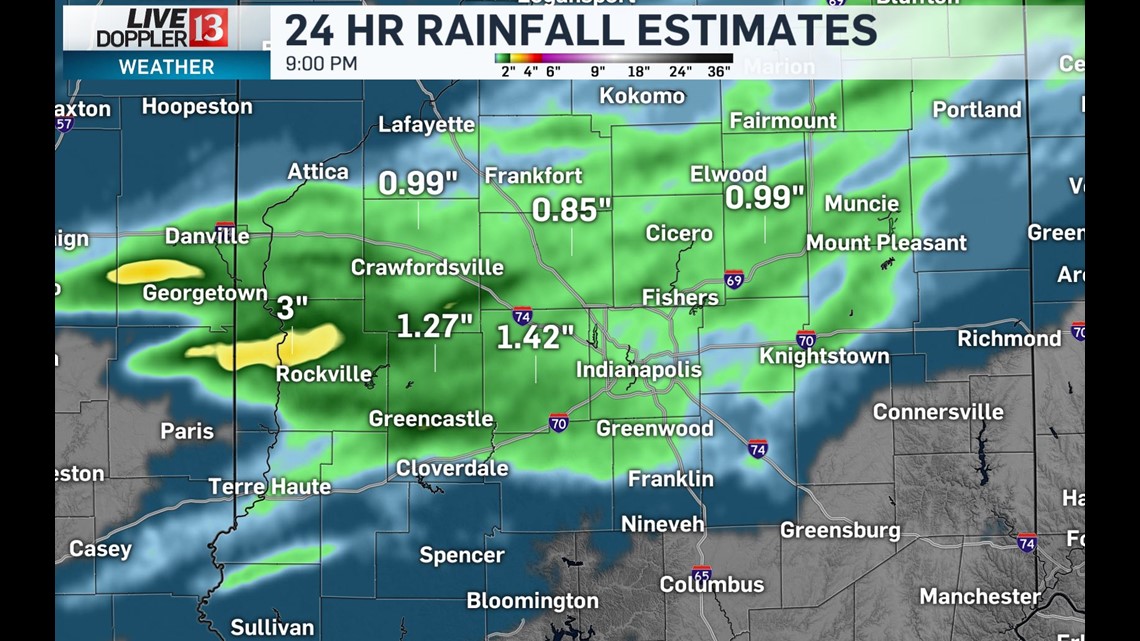
More much-needed rain fell for areas that have been very dry... with many locations along the I-74/70 corridors getting an inch or more. Thus far, southern cities have missed out but outflow boundary could spark storms before midnight.

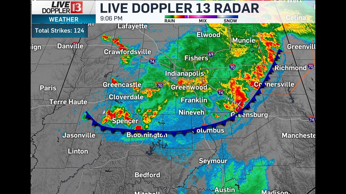
Be cautious of street flooding tonight. Storms will continue to weaken heading toward midnight, with only a slight chance of rain overnight into Monday morning.

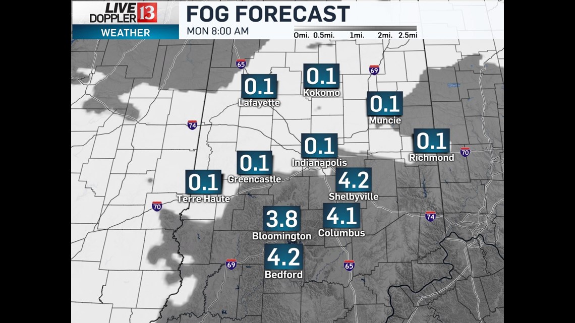
Areas of dense fog likely develop by sunrise Monday... and school delays are certainly possible given the rather humid and now saturated ground.

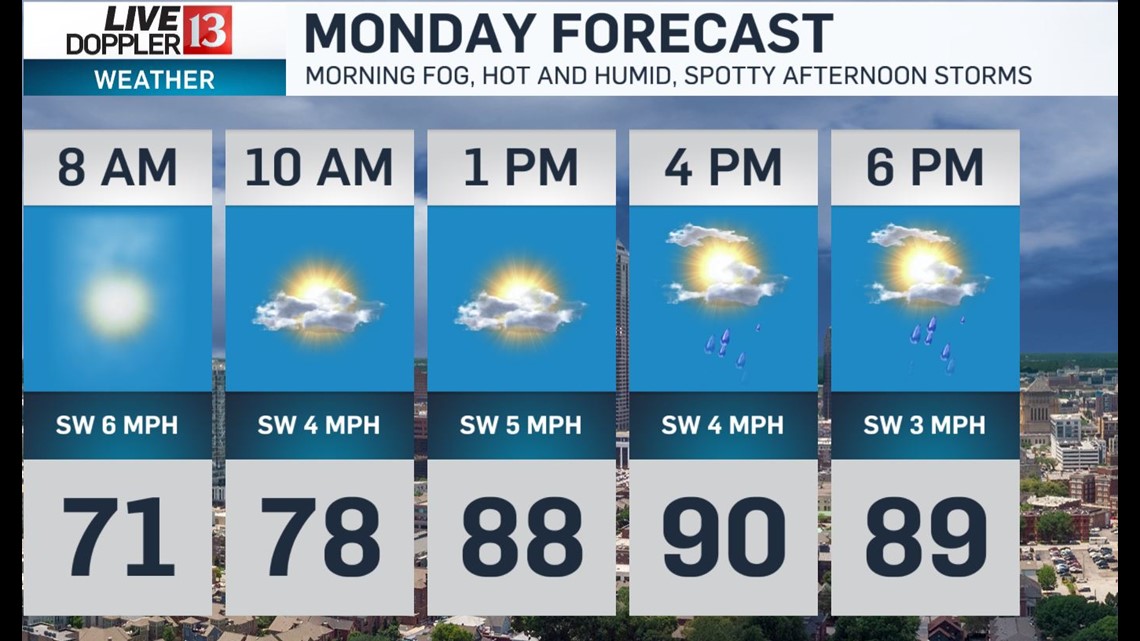

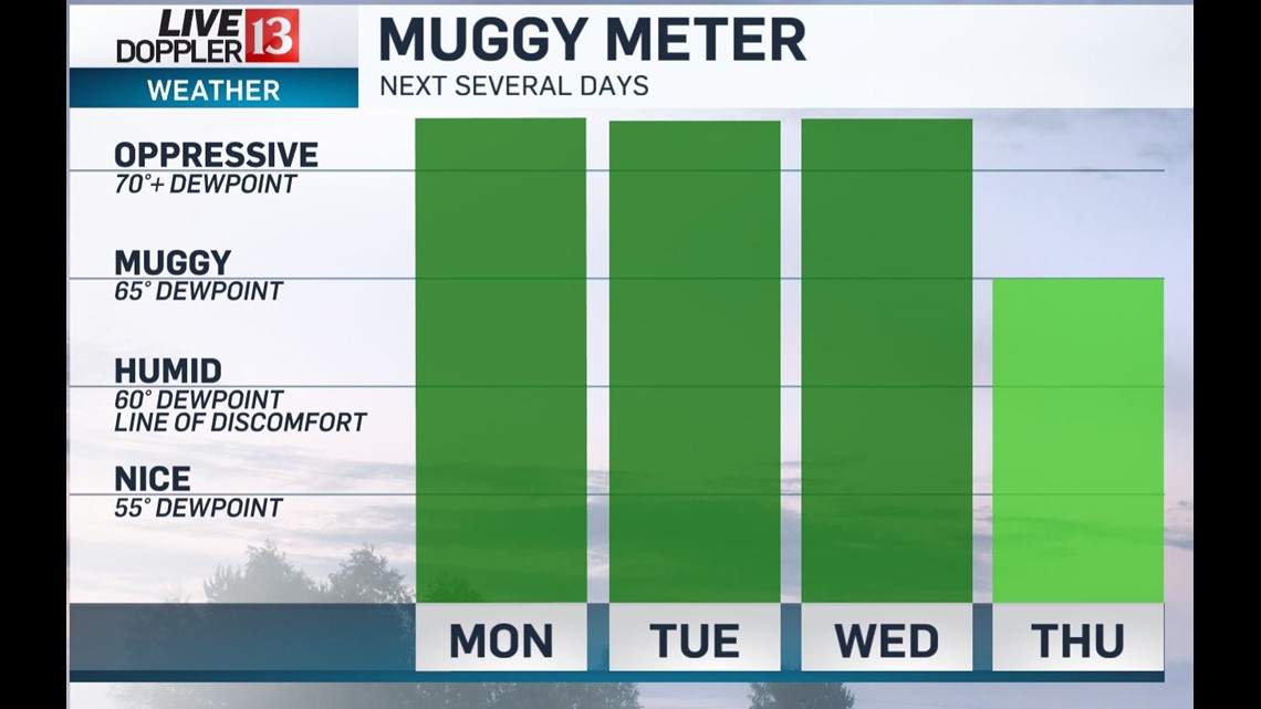
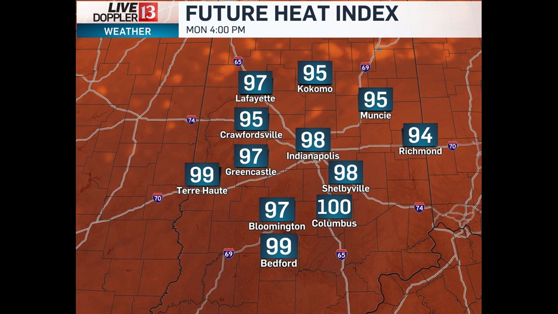
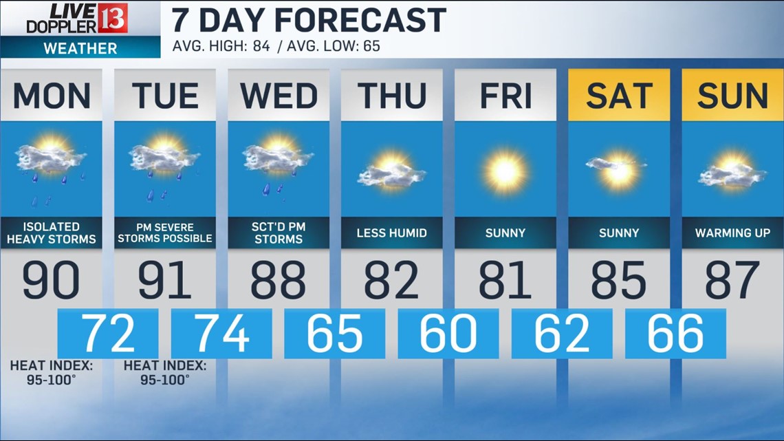
Miserably humid conditions Monday into Wednesday pushes peak heat indices into the 90s/near 100 each day.


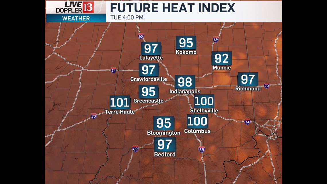
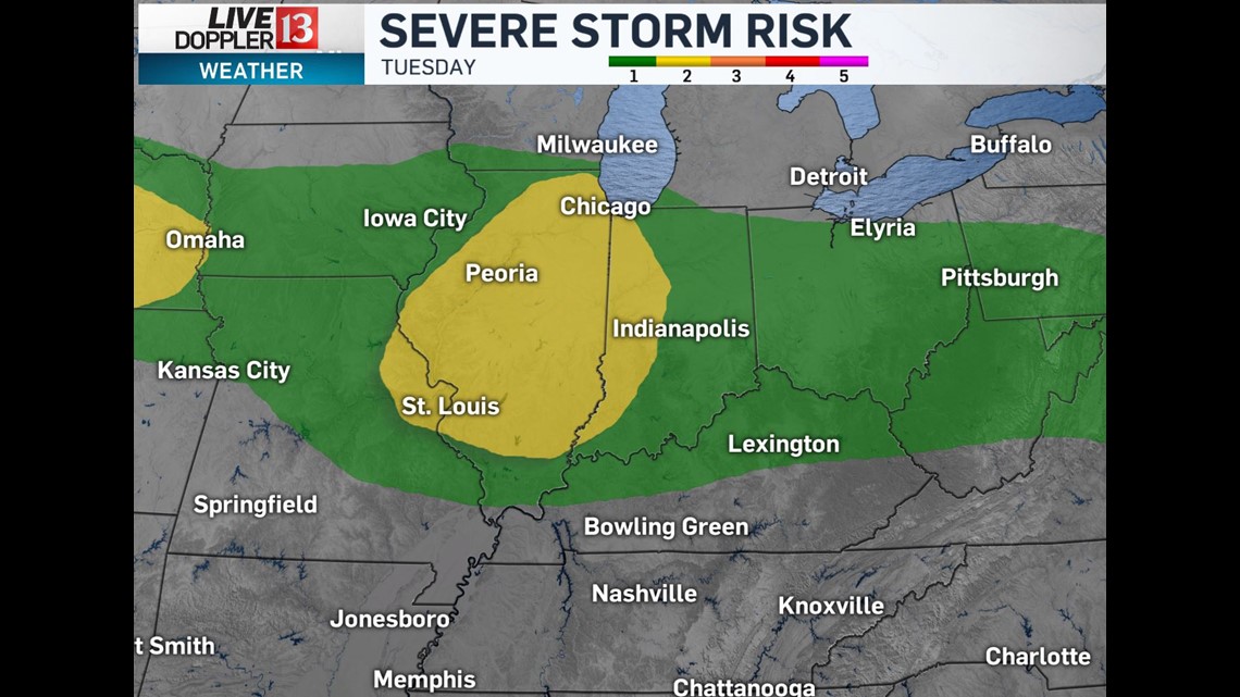
We're only expecting spotty storms Monday afternoon but we'll need to monitor conditions closely for a possible severe storm complex Tuesday afternoon into predawn Wednesday.

Less humid air returns Thursday evening and paves the way for quiet weather into next weekend.

The saturated ground, very humid air, and clouds clearing in western Indiana... sets the stage for areas of dense fog Monday morning. School delays very possible.


