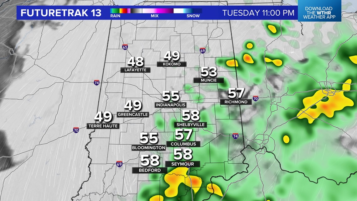
INDIANAPOLIS — An impressive cool front has now reached the I-70 corridor and continues to trigger areas of heavy rain and thunderstorms near/south of this boundary.
Storms have been slow-moving and producing localized flooding. That remains a possibility until the atmosphere stabilizes after 9 p.m.
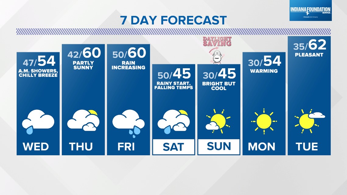
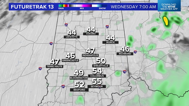
North of the front is in the cooler air, more stable and less humid with only spotty showers around. The front gradually drifts southward overnight into Wednesday morning, setting the stage for a chillier breeze and blustery day.


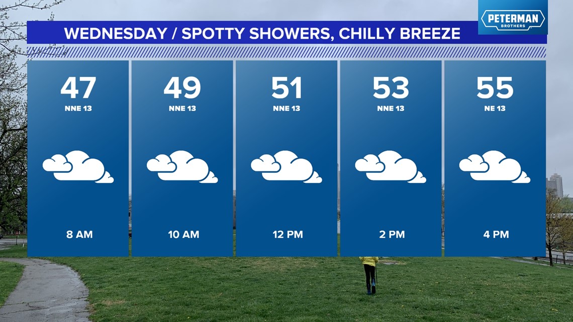
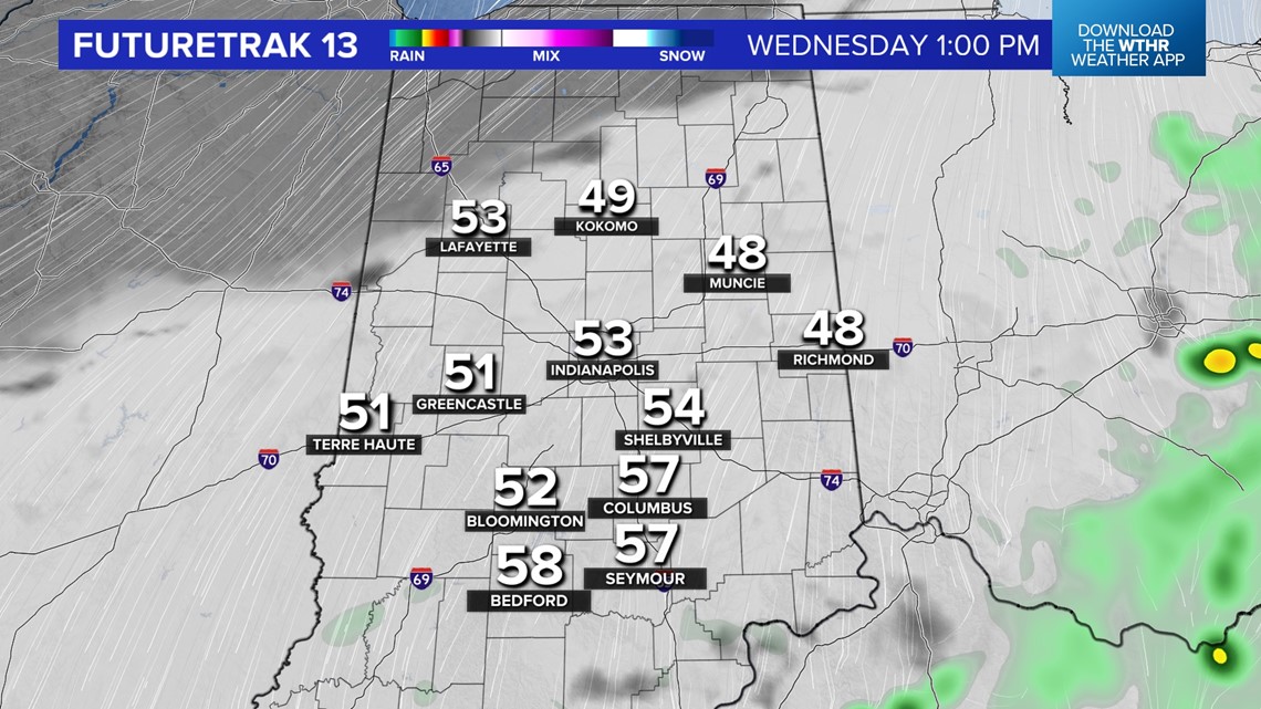
You'll need a heavier coat Wednesday with morning wind chills in the 30s and a steady northeasterly wind cranking much of the day. Clouds hang tough tomorrow too until some late-day peeks of sun and highs mainly in the lower/mid 50s.
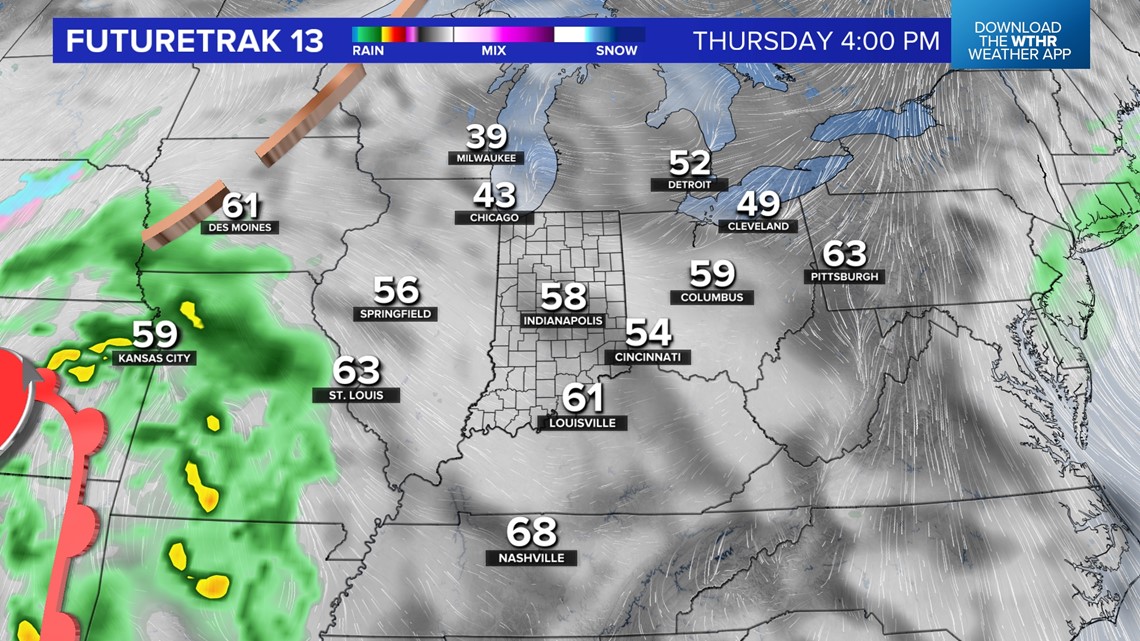
Thursday will be a relatively quiet weather day though some areas of fog will be possible in the morning. Otherwise, we're forecasting partial sun and highs in the upper 50s.


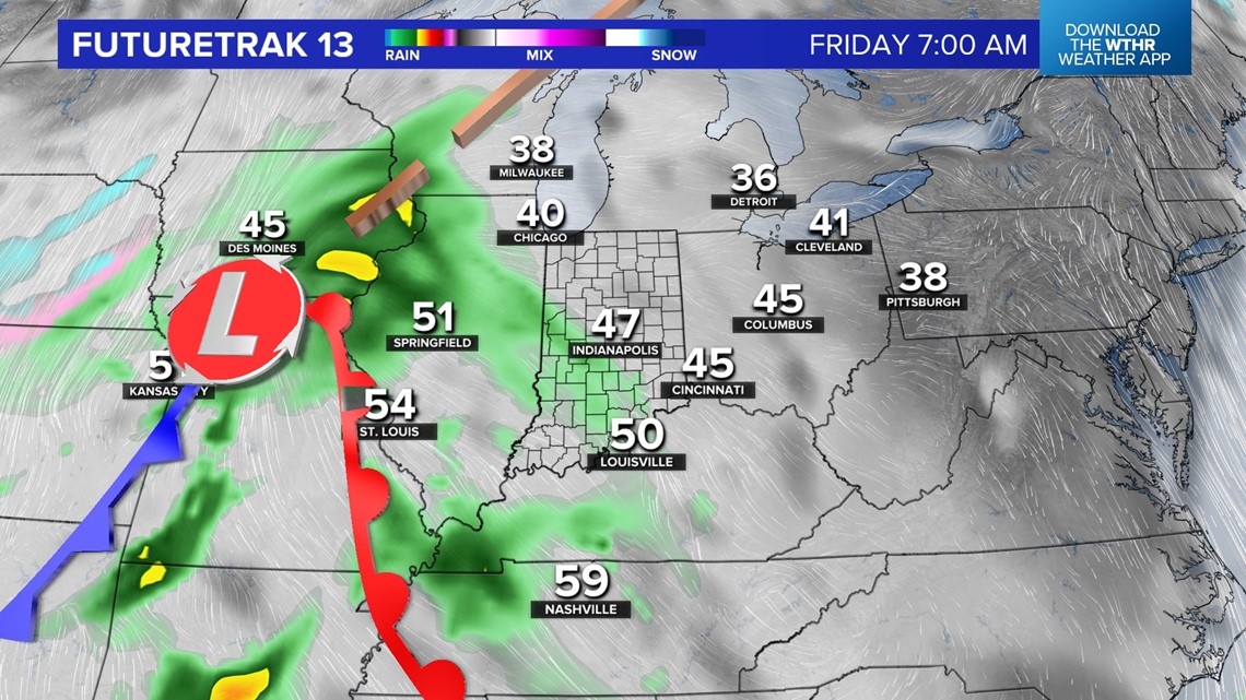
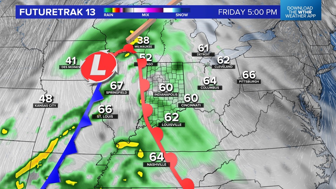
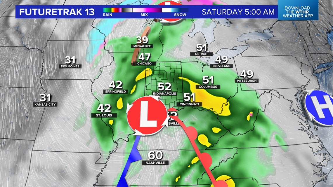
Guidance continues to remain bullish on another decent soaker moving through the Ohio Valley between Friday morning and Saturday afternoon. You should plan for wet conditions developing during the day Friday and for a wet start to Saturday.
We could salvage some dry time Saturday afternoon but there's too much uncertainty at this time. We're more confident on chillier, raw conditions Saturday with temperatures dropping into the lower 40s in the wake of a cold front.


We're back to bright to finish the weekend and sunshine continues into early next week.