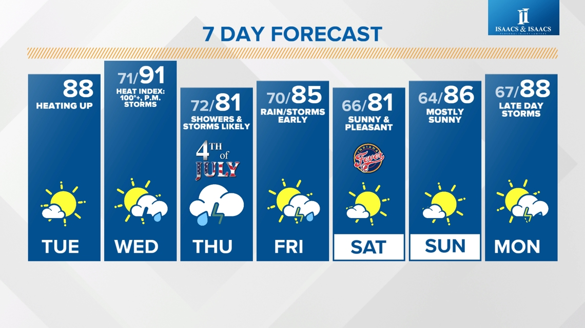
INDIANAPOLIS — Today kicks off a hotter trend with humidity and storms ramping up Wednesday, for the holiday Thursday, and into Friday.

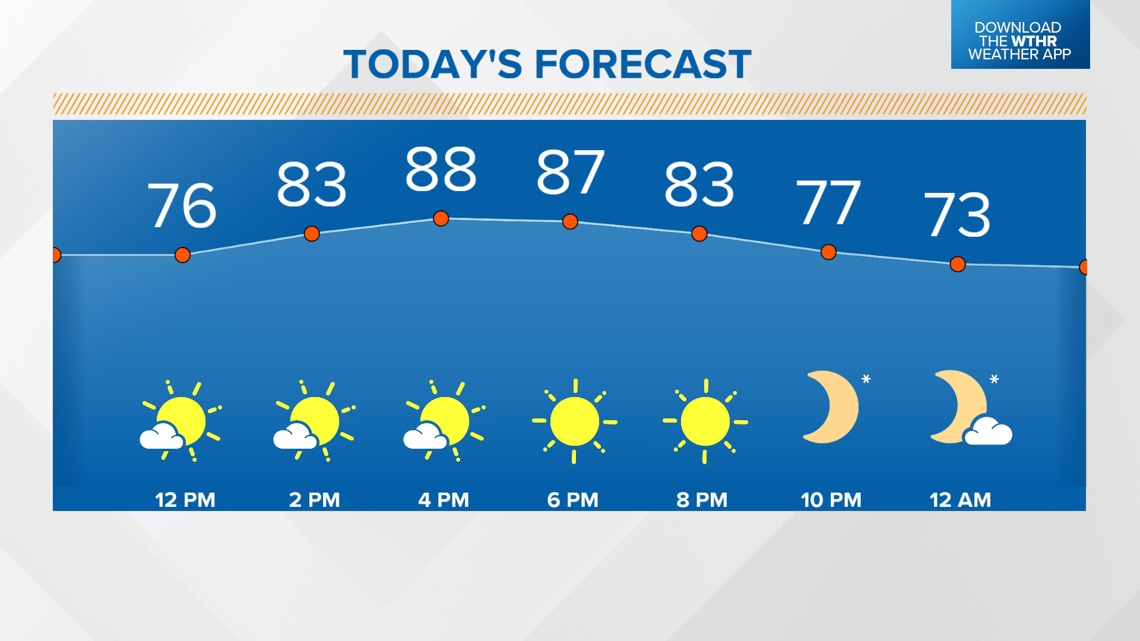
HIGH: 88°
FORECAST: Mainly sunny and becoming slightly more humid this afternoon.

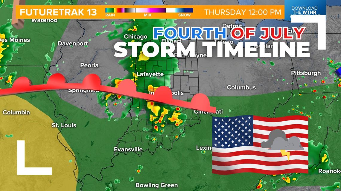
Will my Fourth of July plans get rained out?
We're starting to see a more defined setup for rain and storm development starting Wednesday afternoon and concluding with a passing cold front during the first part of the day on Friday. With a clearer timeline beginning to take place, there are some windows of opportunity we're watching. Here's how it breaks down hour-by-hour as well as across different parts of the state:

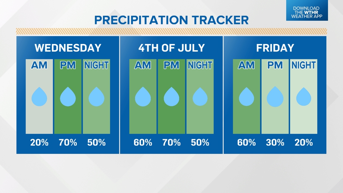
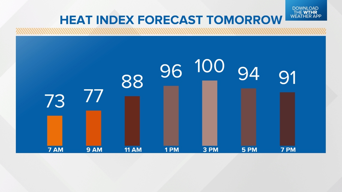
WEDNESDAY: Hotter, more humid with highs in the low 90s and heat indices approaching 100 degrees. Storms develop after 3 p.m.

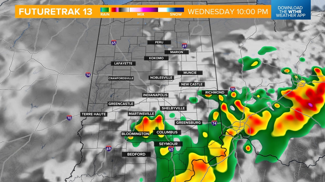
Wednesday storm timeline
A frontal boundary will move into northern Indiana in the morning and continue to track south through the state throughout the day.
Scattered storms will fire along this boundary, especially after 3 p.m. in central Indiana, and continue to develop through the evening to areas south.
Some storms could be severe with damaging wind gusts possible, especially across the southern tier of the state Wednesday evening. The Storm Prediction Center has placed central and southern Indiana under a level 2 of 5 for this risk.

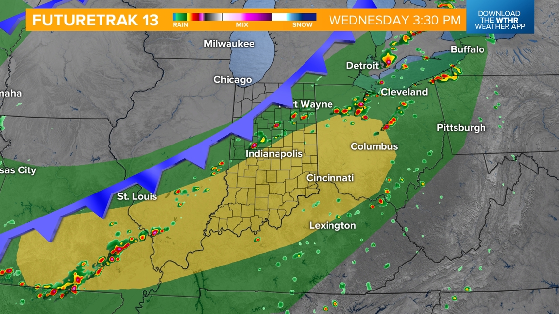

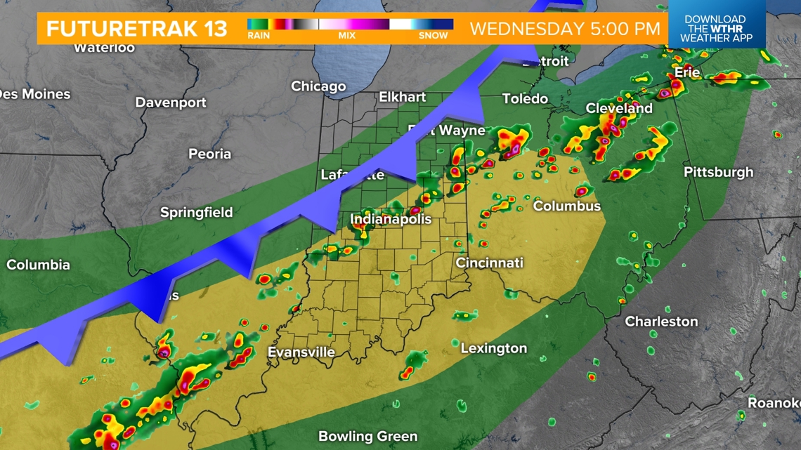

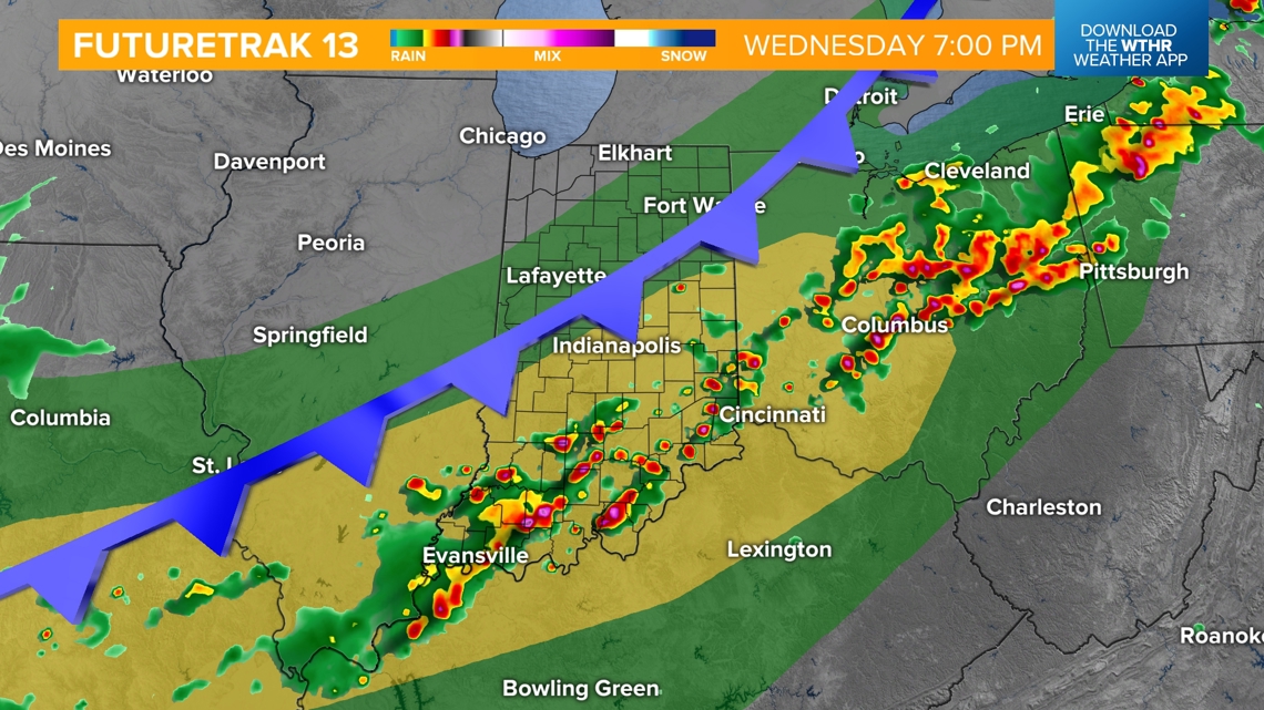
Outdoor events around the Indy metro could see a window of opportunity for some dry time around dusk as the better chance of storms will likely be hindered to farther southern Indiana.

Is Thursday looking any better than Wednesday?
While the severe risk is lower, the storm coverage area may be more widespread and lightning/gusty winds are a threat in any thunderstorm. While it won't be an all-day washout, it does look like storms will be possible on Thursday late morning into the early evening.

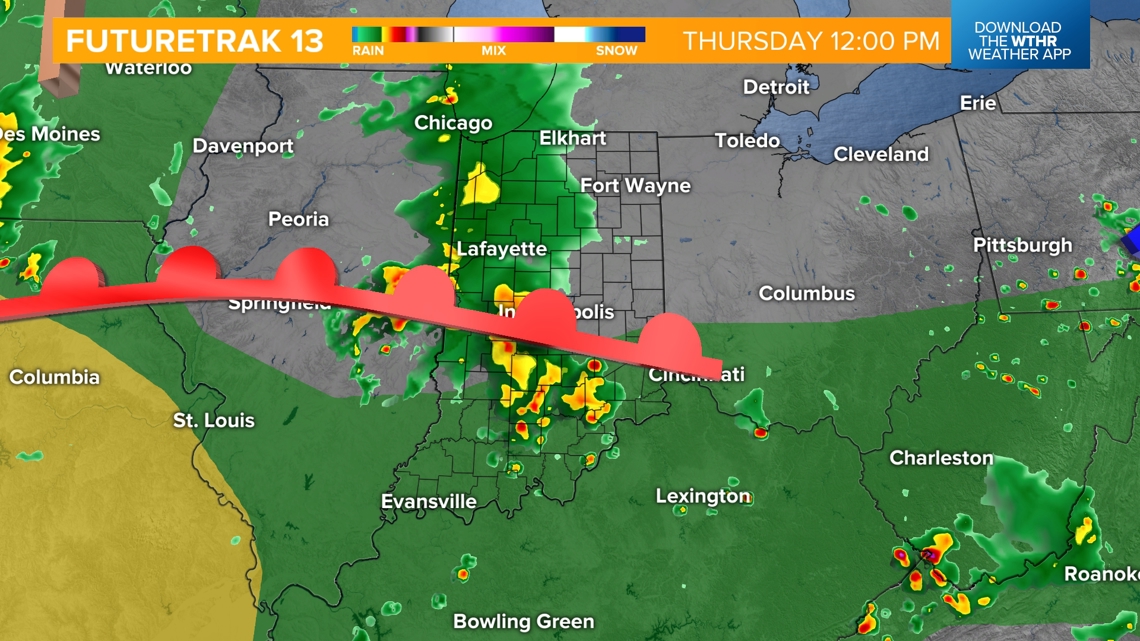

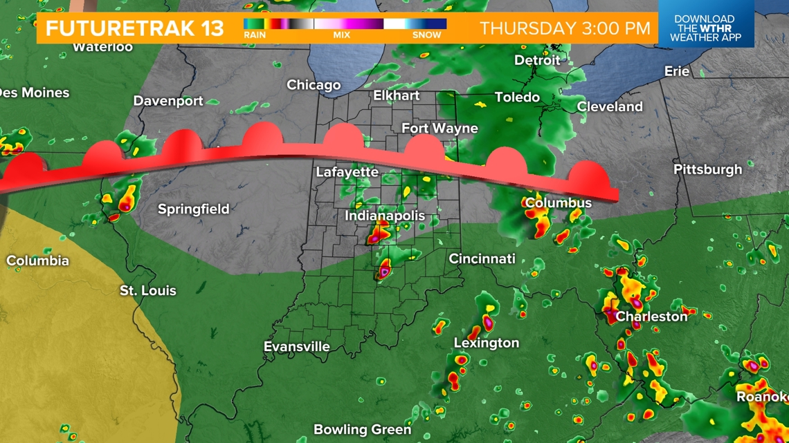
Those planning outdoor activities should be prepared for a rather active weather day during the day, but the latest trend is most storm activity will be contained to southern Indiana closer to dusk.

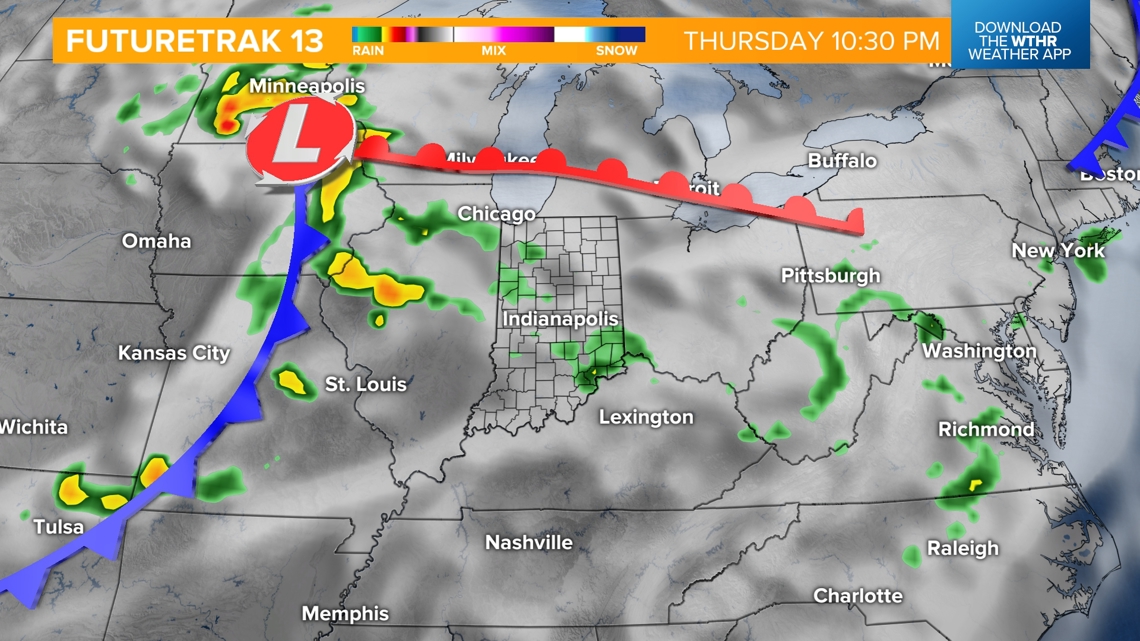
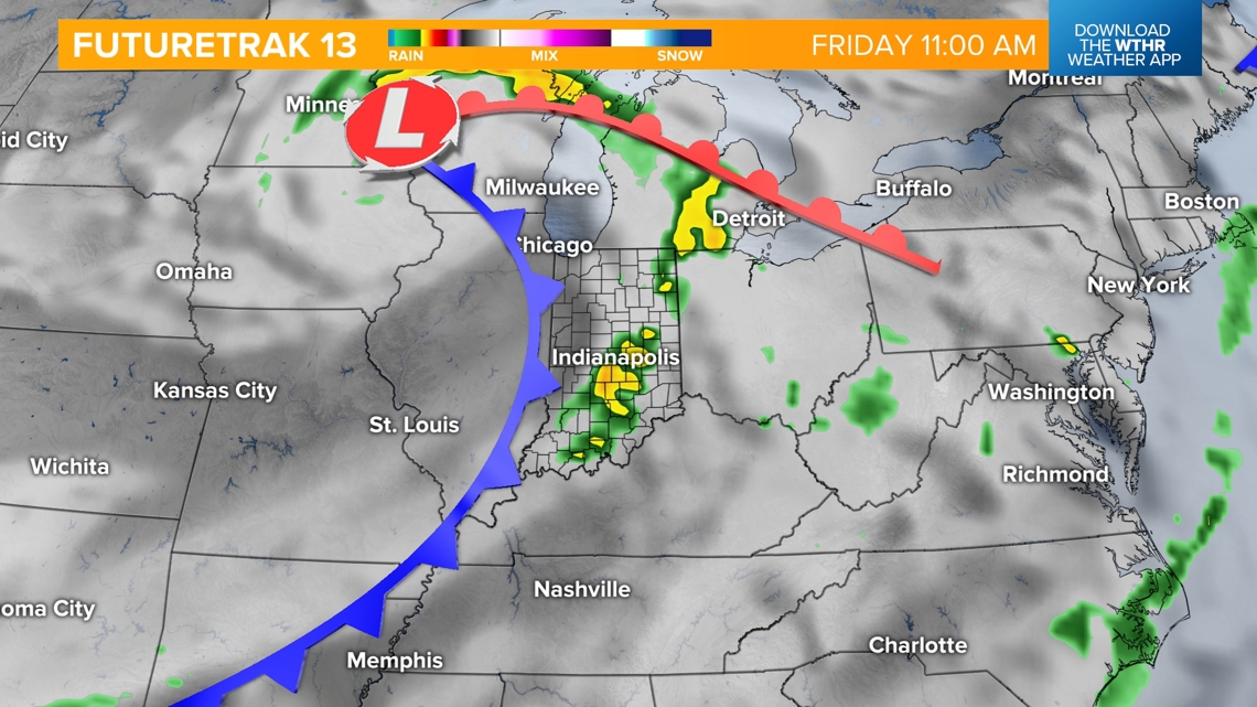
We're not quite done with the storms just yet. Another frontal boundary moves through Friday morning and brings one more round of scattered storms. This will likely move out later in the afternoon and we'll see more dry time in the evening.

Behind the front, sunshine returns to start next weekend with seasonal highs in the low-to-mid-80s.